4
More Annotations


6


2
Favourite Annotations


3


2
Text
PARADISE CREEK TRAIL, SEQUOIA NATIONAL PARK The Paradise Creek Trail is an excellent introduction to the extraordinary biodiversity of the Sierra Nevada foothills. It is also one of the most pleasant all-season hikes in the park. When most of the park’s trails remain buried deep in snow, this trail dazzles with arrays of beautiful wildflowers growing next to a tumbling Facebook
Instagram
stream.
KERN RIVER RANGER DISTRICT OFFICE / VISITOR CENTER The Kern River Ranger District Office is located in Kernville, California. We offer visitors information on hiking, biking, rafting, camping and other recreational opportunities in the Sequoia National Forest and surrounding areas of the southern Sierra Nevada. We provide visitors with various passes and permits. YUBA-DONNER SCENIC BYWAY The loop follows portions of State Highways 20, 49 and 89, historic U.S. 40, and Interstate 80. It is located in Nevada, Yuba, Sierra and Placer counties. It crosses historic Donner Pass and Yuba Pass. Much of the byway is over curving, 2-lane highways. Expect winter driving conditions along higher elevation stretches. CEDAR PASS SNOW PARK The Snow Park is open weekends and holidays during the winter months. Hours of operation are 10:00 a.m. to 4:00 p.m. From the Junction of Hwy 395 and Hwy 299 in Alturas, go north on Hwy 299 towards Cedarville approximately 17 miles. Look for the Cedar Pass Ski Hill sign on the right side of the highway, turn right and go down the hill and you MODOC COUNTY HISTORICAL MUSEUM Welcome to our home. Explore 25 million acres of timeless traditions, local culture, events, and world-class adventures from Lava Beds National Monument to Sequoia and Kings Canyon National Parks. Use our Sierra Nevada travel planning map and the Free Mobile App to guide you through a breathtaking landscape that shapes our lives and unforgettable vacations. Get off the beaten path and find our MT. ROSE HIGHWAY SCENIC OVERLOOK This scenic overlook on Nevada Highway 431 at 7,562 feet provides one of the best photo opportunities of this striking alpine lake located in the Sierra Nevada. Lake Tahoe, which is 21.2 miles long, 11.9 miles wide with an average surface elevation of 6,225 ft above sea level, is the highest lake of its size in the United States. Lake Tahoe is MCKINLEY GROVE GIANT SEQUOIAS McKinley Grove – Gail Overstreet. Located in the Sierra National Forest, McKinley Grove is a secluded and uncrowded Giant Sequoia grove near Shaver Lake, California. While California’s Coastal Redwoods are the world’s tallest trees, Giant Sequoias are the world’slargest, with
DOWNIEVILLE MUSEUM
It has been the county seat of Sierra County since the county's creation in 1852. One of the more interesting displays in the museum is a scale model of the turn-of-the-century Downieville business district. Meticulously designed and built by local historian Len Kinzler, the model gives a 3-D view of historic Downieville. NUUI CUNNI NATIVE AMERICAN INTERTRIBAL CULTURAL CENTER The stairway from the parking lot is equipped with handrails and is a gentle slope making for easy walking. The “Nuui Cunni” Native American Intertribal Cultural Center is located on Lake Isabella in the southern Sierra Nevada mountains. The center's location on Lake Isabella is beautiful and breathtaking, and radiates a spiritual FREEMAN CREEK GROVE AND THE GEORGE BUSH TREE The Freeman Creek Grove is the largest unlogged grove outside of a national park. There are a couple trees with a diameter of 20 feet, more than 100 with 15-foot diameters, and over 800 with 10-foot diameters. There are estimated to be over 2,000 sequoias with a diameter of over 5 feet in the grove. The largest tree in the grovemeasures 255
PARADISE CREEK TRAIL, SEQUOIA NATIONAL PARK The Paradise Creek Trail is an excellent introduction to the extraordinary biodiversity of the Sierra Nevada foothills. It is also one of the most pleasant all-season hikes in the park. When most of the park’s trails remain buried deep in snow, this trail dazzles with arrays of beautiful wildflowers growing next to a tumblingstream.
KERN RIVER RANGER DISTRICT OFFICE / VISITOR CENTER The Kern River Ranger District Office is located in Kernville, California. We offer visitors information on hiking, biking, rafting, camping and other recreational opportunities in the Sequoia National Forest and surrounding areas of the southern Sierra Nevada. We provide visitors with various passes and permits. YUBA-DONNER SCENIC BYWAY The loop follows portions of State Highways 20, 49 and 89, historic U.S. 40, and Interstate 80. It is located in Nevada, Yuba, Sierra and Placer counties. It crosses historic Donner Pass and Yuba Pass. Much of the byway is over curving, 2-lane highways. Expect winter driving conditions along higher elevation stretches. CEDAR PASS SNOW PARK The Snow Park is open weekends and holidays during the winter months. Hours of operation are 10:00 a.m. to 4:00 p.m. From the Junction of Hwy 395 and Hwy 299 in Alturas, go north on Hwy 299 towards Cedarville approximately 17 miles. Look for the Cedar Pass Ski Hill sign on the right side of the highway, turn right and go down the hill and you MODOC COUNTY HISTORICAL MUSEUM Welcome to our home. Explore 25 million acres of timeless traditions, local culture, events, and world-class adventures from Lava Beds National Monument to Sequoia and Kings Canyon National Parks. Use our Sierra Nevada travel planning map and the Free Mobile App to guide you through a breathtaking landscape that shapes our lives and unforgettable vacations. Get off the beaten path and find our MT. ROSE HIGHWAY SCENIC OVERLOOK This scenic overlook on Nevada Highway 431 at 7,562 feet provides one of the best photo opportunities of this striking alpine lake located in the Sierra Nevada. Lake Tahoe, which is 21.2 miles long, 11.9 miles wide with an average surface elevation of 6,225 ft above sea level, is the highest lake of its size in the United States. Lake Tahoe is MCKINLEY GROVE GIANT SEQUOIAS McKinley Grove – Gail Overstreet. Located in the Sierra National Forest, McKinley Grove is a secluded and uncrowded Giant Sequoia grove near Shaver Lake, California. While California’s Coastal Redwoods are the world’s tallest trees, Giant Sequoias are the world’slargest, with
DOWNIEVILLE MUSEUM
It has been the county seat of Sierra County since the county's creation in 1852. One of the more interesting displays in the museum is a scale model of the turn-of-the-century Downieville business district. Meticulously designed and built by local historian Len Kinzler, the model gives a 3-D view of historic Downieville. NUUI CUNNI NATIVE AMERICAN INTERTRIBAL CULTURAL CENTER The stairway from the parking lot is equipped with handrails and is a gentle slope making for easy walking. The “Nuui Cunni” Native American Intertribal Cultural Center is located on Lake Isabella in the southern Sierra Nevada mountains. The center's location on Lake Isabella is beautiful and breathtaking, and radiates a spiritual FREEMAN CREEK GROVE AND THE GEORGE BUSH TREE The Freeman Creek Grove is the largest unlogged grove outside of a national park. There are a couple trees with a diameter of 20 feet, more than 100 with 15-foot diameters, and over 800 with 10-foot diameters. There are estimated to be over 2,000 sequoias with a diameter of over 5 feet in the grove. The largest tree in the grovemeasures 255
SPICER'S MEADOW CAMPGROUND AND RESERVOIR The Spicer's Meadow Reservoir Rd is about 35 to 40 miles east of Angels Camp and a well marked right turn off of Hwy 4. The road in to the reservoir is about 12 miles, mostly paved, but the last couple miles are gravel. If approaching from the East you drive east from Hwy 395 over several high passes, including Pacific Grade and Meadows and SIERRA HERITAGE SCENIC BYWAY The Sierra Heritage Scenic Byway begins in the town of Clovis, a suburb of Fresno. All the excitement of a city vacation is offered in Clovis, where you can go antiquing, shopping, and take historic walking tours. Continue your journey on Highway 168 to the border of the Sierra National Forest. Explore Shaver Lake, and enjoy the greatoutdoors.
49 MILES ALONG HIGHWAY 49 The 49 Miles Along Highway 49 Historic Driving Tour guides you along one of the most scenic and historically rich sections of beautiful Highway 49 from Yuba Pass to Oregon Creek. You'll drive through quaint, small towns, historic mining areas, along one of the most beautiful rivers of Northern California and shows you some of the rich history contained within the hills and mountains of rural IRON POINT-EUCHRE BAR TRAIL The trail to Euchre Bar starts at Iron Point and drops 1780 feet in 1.5 miles to the North Fork American River, a designated Wild and Scenic River. While steep, the trail is in very good shape with lots of shade. The trail dates back to the California Gold Rush. Euchre was a card game popular with the early miners. FREEMAN CREEK GROVE AND THE GEORGE BUSH TREE The Freeman Creek Grove is the largest unlogged grove outside of a national park. There are a couple trees with a diameter of 20 feet, more than 100 with 15-foot diameters, and over 800 with 10-foot diameters. There are estimated to be over 2,000 sequoias with a diameter of over 5 feet in the grove. The largest tree in the grovemeasures 255
LAKE ENGLEBRIGHT AND SKIPPERS COVE MARINA Welcome to our home. Explore 25 million acres of timeless traditions, local culture, events, and world-class adventures from Lava Beds National Monument to Sequoia and Kings Canyon National Parks. Use our Sierra Nevada travel planning map and the Free Mobile App to guide you through a breathtaking landscape that shapes our lives and unforgettable vacations. HUNTINGTON LAKE STORE The Huntington Lake Store is a meeting place on Thursday and Sunday for nature hikes. Our interpretive program offers a guided nature hike to Rancheria Falls and Indian Pools. The Rancheria Falls Trailhead is at 7,200 feet and ends at 8,120 feet. The falls are approximately 150 feet high and 50 feet wide. This is a gentle two mile round trip hike. BASIN & RANGE BIRDING TRAIL, MODOC COUNTY Welcome to our home. Explore 25 million acres of timeless traditions, local culture, events, and world-class adventures from Lava Beds National Monument to Sequoia and Kings Canyon National Parks. Use our Sierra Nevada travel planning map and the Free Mobile App to guide you through a breathtaking landscape that shapes our lives and unforgettable vacations. TRUCKEE RIVER LEGACY TRAIL The Truckee River Legacy Trail honors our lifeblood with a paved Class 1 trail that runs along the beautiful Truckee River, allowing residents and visitors to safely ride their bikes, walk, or roll safely along one of the town's most beautiful natural features. The number of users on this trail depends on the time of day and day ofthe week.
HANGMAN'S TREE (NO. 141 CALIFORNIA HISTORICAL LANDMARK Hangman's Tree once stood in Elstner's Hay Yard next to the Jackass Inn; today the stump is in the cellar of The Hangman's Tree tavern on Historic Main Street. A plaque has been placed on the tavern to commemorate the tree. The plaque is located at 305 Main Street in Placerville. El Dorado County. Stretching from oak-studded foothillsand the
PARADISE CREEK TRAIL, SEQUOIA NATIONAL PARK The Paradise Creek Trail is an excellent introduction to the extraordinary biodiversity of the Sierra Nevada foothills. It is also one of the most pleasant all-season hikes in the park. When most of the park’s trails remain buried deep in snow, this trail dazzles with arrays of beautiful wildflowers growing next to a tumblingstream.
KERN RIVER RANGER DISTRICT OFFICE / VISITOR CENTER The Kern River Ranger District Office is located in Kernville, California. We offer visitors information on hiking, biking, rafting, camping and other recreational opportunities in the Sequoia National Forest and surrounding areas of the southern Sierra Nevada. We provide visitors with various passes and permits. YUBA-DONNER SCENIC BYWAY The loop follows portions of State Highways 20, 49 and 89, historic U.S. 40, and Interstate 80. It is located in Nevada, Yuba, Sierra and Placer counties. It crosses historic Donner Pass and Yuba Pass. Much of the byway is over curving, 2-lane highways. Expect winter driving conditions along higher elevation stretches. CEDAR PASS SNOW PARK The Snow Park is open weekends and holidays during the winter months. Hours of operation are 10:00 a.m. to 4:00 p.m. From the Junction of Hwy 395 and Hwy 299 in Alturas, go north on Hwy 299 towards Cedarville approximately 17 miles. Look for the Cedar Pass Ski Hill sign on the right side of the highway, turn right and go down the hill and you MODOC COUNTY HISTORICAL MUSEUM Welcome to our home. Explore 25 million acres of timeless traditions, local culture, events, and world-class adventures from Lava Beds National Monument to Sequoia and Kings Canyon National Parks. Use our Sierra Nevada travel planning map and the Free Mobile App to guide you through a breathtaking landscape that shapes our lives and unforgettable vacations. Get off the beaten path and find our MT. ROSE HIGHWAY SCENIC OVERLOOK This scenic overlook on Nevada Highway 431 at 7,562 feet provides one of the best photo opportunities of this striking alpine lake located in the Sierra Nevada. Lake Tahoe, which is 21.2 miles long, 11.9 miles wide with an average surface elevation of 6,225 ft above sea level, is the highest lake of its size in the United States. Lake Tahoe is MCKINLEY GROVE GIANT SEQUOIAS McKinley Grove – Gail Overstreet. Located in the Sierra National Forest, McKinley Grove is a secluded and uncrowded Giant Sequoia grove near Shaver Lake, California. While California’s Coastal Redwoods are the world’s tallest trees, Giant Sequoias are the world’slargest, with
DOWNIEVILLE MUSEUM
It has been the county seat of Sierra County since the county's creation in 1852. One of the more interesting displays in the museum is a scale model of the turn-of-the-century Downieville business district. Meticulously designed and built by local historian Len Kinzler, the model gives a 3-D view of historic Downieville. NUUI CUNNI NATIVE AMERICAN INTERTRIBAL CULTURAL CENTER The stairway from the parking lot is equipped with handrails and is a gentle slope making for easy walking. The “Nuui Cunni” Native American Intertribal Cultural Center is located on Lake Isabella in the southern Sierra Nevada mountains. The center's location on Lake Isabella is beautiful and breathtaking, and radiates a spiritual FREEMAN CREEK GROVE AND THE GEORGE BUSH TREE The Freeman Creek Grove is the largest unlogged grove outside of a national park. There are a couple trees with a diameter of 20 feet, more than 100 with 15-foot diameters, and over 800 with 10-foot diameters. There are estimated to be over 2,000 sequoias with a diameter of over 5 feet in the grove. The largest tree in the grovemeasures 255
SPICER'S MEADOW CAMPGROUND AND RESERVOIR The Spicer's Meadow Reservoir Rd is about 35 to 40 miles east of Angels Camp and a well marked right turn off of Hwy 4. The road in to the reservoir is about 12 miles, mostly paved, but the last couple miles are gravel. If approaching from the East you drive east from Hwy 395 over several high passes, including Pacific Grade and Meadows and SIERRA HERITAGE SCENIC BYWAY The Sierra Heritage Scenic Byway begins in the town of Clovis, a suburb of Fresno. All the excitement of a city vacation is offered in Clovis, where you can go antiquing, shopping, and take historic walking tours. Continue your journey on Highway 168 to the border of the Sierra National Forest. Explore Shaver Lake, and enjoy the greatoutdoors.
49 MILES ALONG HIGHWAY 49 The 49 Miles Along Highway 49 Historic Driving Tour guides you along one of the most scenic and historically rich sections of beautiful Highway 49 from Yuba Pass to Oregon Creek. You'll drive through quaint, small towns, historic mining areas, along one of the most beautiful rivers of Northern California and shows you some of the rich history contained within the hills and mountains of rural IRON POINT-EUCHRE BAR TRAIL The trail to Euchre Bar starts at Iron Point and drops 1780 feet in 1.5 miles to the North Fork American River, a designated Wild and Scenic River. While steep, the trail is in very good shape with lots of shade. The trail dates back to the California Gold Rush. Euchre was a card game popular with the early miners. LAKE ENGLEBRIGHT AND SKIPPERS COVE MARINA Welcome to our home. Explore 25 million acres of timeless traditions, local culture, events, and world-class adventures from Lava Beds National Monument to Sequoia and Kings Canyon National Parks. Use our Sierra Nevada travel planning map and the Free Mobile App to guide you through a breathtaking landscape that shapes our lives and unforgettable vacations. FREEMAN CREEK GROVE AND THE GEORGE BUSH TREE The Freeman Creek Grove is the largest unlogged grove outside of a national park. There are a couple trees with a diameter of 20 feet, more than 100 with 15-foot diameters, and over 800 with 10-foot diameters. There are estimated to be over 2,000 sequoias with a diameter of over 5 feet in the grove. The largest tree in the grovemeasures 255
HUNTINGTON LAKE STORE The Huntington Lake Store is a meeting place on Thursday and Sunday for nature hikes. Our interpretive program offers a guided nature hike to Rancheria Falls and Indian Pools. The Rancheria Falls Trailhead is at 7,200 feet and ends at 8,120 feet. The falls are approximately 150 feet high and 50 feet wide. This is a gentle two mile round trip hike. BASIN & RANGE BIRDING TRAIL, MODOC COUNTY Welcome to our home. Explore 25 million acres of timeless traditions, local culture, events, and world-class adventures from Lava Beds National Monument to Sequoia and Kings Canyon National Parks. Use our Sierra Nevada travel planning map and the Free Mobile App to guide you through a breathtaking landscape that shapes our lives and unforgettable vacations. TRUCKEE RIVER LEGACY TRAIL The Truckee River Legacy Trail honors our lifeblood with a paved Class 1 trail that runs along the beautiful Truckee River, allowing residents and visitors to safely ride their bikes, walk, or roll safely along one of the town's most beautiful natural features. The number of users on this trail depends on the time of day and day ofthe week.
HANGMAN'S TREE (NO. 141 CALIFORNIA HISTORICAL LANDMARK Hangman's Tree once stood in Elstner's Hay Yard next to the Jackass Inn; today the stump is in the cellar of The Hangman's Tree tavern on Historic Main Street. A plaque has been placed on the tavern to commemorate the tree. The plaque is located at 305 Main Street in Placerville. El Dorado County. Stretching from oak-studded foothillsand the
PARADISE CREEK TRAIL, SEQUOIA NATIONAL PARK Welcome to our home. Explore 25 million acres of timeless traditions, local culture, events, and world-class adventures from Lava Beds National Monument to Sequoia and Kings Canyon National Parks. Use our Sierra Nevada travel planning map and the Free Mobile App to guide you through a breathtaking landscape that shapes our lives and unforgettable vacations. Get off the beaten path and find our SIERRA HERITAGE SCENIC BYWAY Welcome to our home. Explore 25 million acres of timeless traditions, local culture, events, and world-class adventures from Lava Beds National Monument to Sequoia and Kings Canyon National Parks. Use our Sierra Nevada travel planning map and the Free Mobile App to guide you through a breathtaking landscape that shapes our lives and unforgettable vacations. Get off the beaten path and find our YUBA-DONNER SCENIC BYWAY Welcome to our home. Explore 25 million acres of timeless traditions, local culture, events, and world-class adventures from Lava Beds National Monument to Sequoia and Kings Canyon National Parks. Use our Sierra Nevada travel planning map and the Free Mobile App to guide you through a breathtaking landscape that shapes our lives and unforgettable vacations. Get off the beaten path and find our KERN RIVER RANGER DISTRICT OFFICE / VISITOR CENTER ADA Accessibility Notes. Our site is fully Accessible. The Kern River Ranger District Office is located in Kernville, California. We offer visitors information on hiking, biking, rafting, camping and other recreational opportunities in the Sequoia National Forest and surrounding areas of the southern Sierra Nevada.DOWNIEVILLE MUSEUM
Welcome to our home. Explore 25 million acres of timeless traditions, local culture, events, and world-class adventures from Lava Beds National Monument to Sequoia and Kings Canyon National Parks. Use our Sierra Nevada travel planning map and the Free Mobile App to guide you through a breathtaking landscape that shapes our lives and unforgettable vacations. Get off the beaten path and find our CEDAR PASS SNOW PARK Welcome to our home. Explore 25 million acres of timeless traditions, local culture, events, and world-class adventures from Lava Beds National Monument to Sequoia and Kings Canyon National Parks. Use our Sierra Nevada travel planning map and the Free Mobile App to guide you through a breathtaking landscape that shapes our lives and unforgettable vacations. Get off the beaten path and find ourJACKASS MAIL RUN
Welcome to our home. Explore 25 million acres of timeless traditions, local culture, events, and world-class adventures from Lava Beds National Monument to Sequoia and Kings Canyon National Parks. Use our Sierra Nevada travel planning map and the Free Mobile App to guide you through a breathtaking landscape that shapes our lives and unforgettable vacations. Get off the beaten path and find our FREEMAN CREEK GROVE AND THE GEORGE BUSH TREE Welcome to our home. Explore 25 million acres of timeless traditions, local culture, events, and world-class adventures from Lava Beds National Monument to Sequoia and Kings Canyon National Parks. Use our Sierra Nevada travel planning map and the Free Mobile App to guide you through a breathtaking landscape that shapes our lives and unforgettable vacations. Get off the beaten path and find our MCKINLEY GROVE GIANT SEQUOIAS Located in the Sierra National Forest, McKinley Grove is a secluded and uncrowded Giant Sequoia grove near Shaver Lake, California. While California’s Coastal Redwoods are the world’s tallest trees, Giant Sequoias are the world’s largest, with trees averaging 15 feet in diameter and 250 feet tall. NUUI CUNNI NATIVE AMERICAN INTERTRIBAL CULTURAL CENTER Welcome to our home. Explore 25 million acres of timeless traditions, local culture, events, and world-class adventures from Lava Beds National Monument to Sequoia and Kings Canyon National Parks. Use our Sierra Nevada travel planning map and the Free Mobile App to guide you through a breathtaking landscape that shapes our lives and unforgettable vacations. Get off the beaten path and find our PARADISE CREEK TRAIL, SEQUOIA NATIONAL PARK Welcome to our home. Explore 25 million acres of timeless traditions, local culture, events, and world-class adventures from Lava Beds National Monument to Sequoia and Kings Canyon National Parks. Use our Sierra Nevada travel planning map and the Free Mobile App to guide you through a breathtaking landscape that shapes our lives and unforgettable vacations. Get off the beaten path and find our SIERRA HERITAGE SCENIC BYWAY Welcome to our home. Explore 25 million acres of timeless traditions, local culture, events, and world-class adventures from Lava Beds National Monument to Sequoia and Kings Canyon National Parks. Use our Sierra Nevada travel planning map and the Free Mobile App to guide you through a breathtaking landscape that shapes our lives and unforgettable vacations. Get off the beaten path and find our YUBA-DONNER SCENIC BYWAY Welcome to our home. Explore 25 million acres of timeless traditions, local culture, events, and world-class adventures from Lava Beds National Monument to Sequoia and Kings Canyon National Parks. Use our Sierra Nevada travel planning map and the Free Mobile App to guide you through a breathtaking landscape that shapes our lives and unforgettable vacations. Get off the beaten path and find our KERN RIVER RANGER DISTRICT OFFICE / VISITOR CENTER ADA Accessibility Notes. Our site is fully Accessible. The Kern River Ranger District Office is located in Kernville, California. We offer visitors information on hiking, biking, rafting, camping and other recreational opportunities in the Sequoia National Forest and surrounding areas of the southern Sierra Nevada.DOWNIEVILLE MUSEUM
Welcome to our home. Explore 25 million acres of timeless traditions, local culture, events, and world-class adventures from Lava Beds National Monument to Sequoia and Kings Canyon National Parks. Use our Sierra Nevada travel planning map and the Free Mobile App to guide you through a breathtaking landscape that shapes our lives and unforgettable vacations. Get off the beaten path and find our CEDAR PASS SNOW PARK Welcome to our home. Explore 25 million acres of timeless traditions, local culture, events, and world-class adventures from Lava Beds National Monument to Sequoia and Kings Canyon National Parks. Use our Sierra Nevada travel planning map and the Free Mobile App to guide you through a breathtaking landscape that shapes our lives and unforgettable vacations. Get off the beaten path and find ourJACKASS MAIL RUN
Welcome to our home. Explore 25 million acres of timeless traditions, local culture, events, and world-class adventures from Lava Beds National Monument to Sequoia and Kings Canyon National Parks. Use our Sierra Nevada travel planning map and the Free Mobile App to guide you through a breathtaking landscape that shapes our lives and unforgettable vacations. Get off the beaten path and find our FREEMAN CREEK GROVE AND THE GEORGE BUSH TREE Welcome to our home. Explore 25 million acres of timeless traditions, local culture, events, and world-class adventures from Lava Beds National Monument to Sequoia and Kings Canyon National Parks. Use our Sierra Nevada travel planning map and the Free Mobile App to guide you through a breathtaking landscape that shapes our lives and unforgettable vacations. Get off the beaten path and find our MCKINLEY GROVE GIANT SEQUOIAS Located in the Sierra National Forest, McKinley Grove is a secluded and uncrowded Giant Sequoia grove near Shaver Lake, California. While California’s Coastal Redwoods are the world’s tallest trees, Giant Sequoias are the world’s largest, with trees averaging 15 feet in diameter and 250 feet tall. NUUI CUNNI NATIVE AMERICAN INTERTRIBAL CULTURAL CENTER Welcome to our home. Explore 25 million acres of timeless traditions, local culture, events, and world-class adventures from Lava Beds National Monument to Sequoia and Kings Canyon National Parks. Use our Sierra Nevada travel planning map and the Free Mobile App to guide you through a breathtaking landscape that shapes our lives and unforgettable vacations. Get off the beaten path and find our SPICER'S MEADOW CAMPGROUND AND RESERVOIR Welcome to our home. Explore 25 million acres of timeless traditions, local culture, events, and world-class adventures from Lava Beds National Monument to Sequoia and Kings Canyon National Parks. Use our Sierra Nevada travel planning map and the Free Mobile App to guide you through a breathtaking landscape that shapes our lives and unforgettable vacations. Get off the beaten path and find our SIERRA HERITAGE SCENIC BYWAY Welcome to our home. Explore 25 million acres of timeless traditions, local culture, events, and world-class adventures from Lava Beds National Monument to Sequoia and Kings Canyon National Parks. Use our Sierra Nevada travel planning map and the Free Mobile App to guide you through a breathtaking landscape that shapes our lives and unforgettable vacations. CEDAR PASS SNOW PARK Welcome to our home. Explore 25 million acres of timeless traditions, local culture, events, and world-class adventures from Lava Beds National Monument to Sequoia and Kings Canyon National Parks. Use our Sierra Nevada travel planning map and the Free Mobile App to guide you through a breathtaking landscape that shapes our lives and unforgettable vacations. HISTORIC DOWNTOWN JACKSON Welcome to our home. Explore 25 million acres of timeless traditions, local culture, events, and world-class adventures from Lava Beds National Monument to Sequoia and Kings Canyon National Parks. Use our Sierra Nevada travel planning map and the Free Mobile App to guide you through a breathtaking landscape that shapes our lives and unforgettable vacations. Get off the beaten path and find our EAGLES AND AGRICULTURE Welcome to our home. Explore 25 million acres of timeless traditions, local culture, events, and world-class adventures from Lava Beds National Monument to Sequoia and Kings Canyon National Parks. Use our Sierra Nevada travel planning map and the Free Mobile App to guide you through a breathtaking landscape that shapes our lives and unforgettable vacations. FREEMAN CREEK GROVE AND THE GEORGE BUSH TREE Welcome to our home. Explore 25 million acres of timeless traditions, local culture, events, and world-class adventures from Lava Beds National Monument to Sequoia and Kings Canyon National Parks. Use our Sierra Nevada travel planning map and the Free Mobile App to guide you through a breathtaking landscape that shapes our lives and unforgettable vacations. TRUCKEE RIVER LEGACY TRAIL Welcome to our home. Explore 25 million acres of timeless traditions, local culture, events, and world-class adventures from Lava Beds National Monument to Sequoia and Kings Canyon National Parks. Use our Sierra Nevada travel planning map and the Free Mobile App to guide you through a breathtaking landscape that shapes our lives and unforgettable vacations. LAKE ENGLEBRIGHT AND SKIPPERS COVE MARINA Welcome to our home. Explore 25 million acres of timeless traditions, local culture, events, and world-class adventures from Lava Beds National Monument to Sequoia and Kings Canyon National Parks. Use our Sierra Nevada travel planning map and the Free Mobile App to guide you through a breathtaking landscape that shapes our lives and unforgettable vacations. BASIN & RANGE BIRDING TRAIL, MODOC COUNTY Welcome to our home. Explore 25 million acres of timeless traditions, local culture, events, and world-class adventures from Lava Beds National Monument to Sequoia and Kings Canyon National Parks. Use our Sierra Nevada travel planning map and the Free Mobile App to guide you through a breathtaking landscape that shapes our lives and unforgettable vacations. Get off the beaten path and find our 49 MILES ALONG HIGHWAY 49 The 49 Miles Along Highway 49 Historic Driving Tour guides you along one of the most scenic and historically rich sections of beautiful Highway 49 from Yuba Pass to Oregon Creek. You'll drive through quaint, small towns, historic mining areas, along one of the most beautiful rivers of Northern California and shows you some of the rich history contained within the hills and mountains of rural PARADISE CREEK TRAIL, SEQUOIA NATIONAL PARK Welcome to our home. Explore 25 million acres of timeless traditions, local culture, events, and world-class adventures from Lava Beds National Monument to Sequoia and Kings Canyon National Parks. Use our Sierra Nevada travel planning map and the Free Mobile App to guide you through a breathtaking landscape that shapes our lives and unforgettable vacations. Get off the beaten path and find our SIERRA HERITAGE SCENIC BYWAY Welcome to our home. Explore 25 million acres of timeless traditions, local culture, events, and world-class adventures from Lava Beds National Monument to Sequoia and Kings Canyon National Parks. Use our Sierra Nevada travel planning map and the Free Mobile App to guide you through a breathtaking landscape that shapes our lives and unforgettable vacations. Get off the beaten path and find our YUBA-DONNER SCENIC BYWAY Welcome to our home. Explore 25 million acres of timeless traditions, local culture, events, and world-class adventures from Lava Beds National Monument to Sequoia and Kings Canyon National Parks. Use our Sierra Nevada travel planning map and the Free Mobile App to guide you through a breathtaking landscape that shapes our lives and unforgettable vacations. Get off the beaten path and find our KERN RIVER RANGER DISTRICT OFFICE / VISITOR CENTER ADA Accessibility Notes. Our site is fully Accessible. The Kern River Ranger District Office is located in Kernville, California. We offer visitors information on hiking, biking, rafting, camping and other recreational opportunities in the Sequoia National Forest and surrounding areas of the southern Sierra Nevada.DOWNIEVILLE MUSEUM
Welcome to our home. Explore 25 million acres of timeless traditions, local culture, events, and world-class adventures from Lava Beds National Monument to Sequoia and Kings Canyon National Parks. Use our Sierra Nevada travel planning map and the Free Mobile App to guide you through a breathtaking landscape that shapes our lives and unforgettable vacations. Get off the beaten path and find our CEDAR PASS SNOW PARK Welcome to our home. Explore 25 million acres of timeless traditions, local culture, events, and world-class adventures from Lava Beds National Monument to Sequoia and Kings Canyon National Parks. Use our Sierra Nevada travel planning map and the Free Mobile App to guide you through a breathtaking landscape that shapes our lives and unforgettable vacations. Get off the beaten path and find ourJACKASS MAIL RUN
Welcome to our home. Explore 25 million acres of timeless traditions, local culture, events, and world-class adventures from Lava Beds National Monument to Sequoia and Kings Canyon National Parks. Use our Sierra Nevada travel planning map and the Free Mobile App to guide you through a breathtaking landscape that shapes our lives and unforgettable vacations. Get off the beaten path and find our FREEMAN CREEK GROVE AND THE GEORGE BUSH TREE Welcome to our home. Explore 25 million acres of timeless traditions, local culture, events, and world-class adventures from Lava Beds National Monument to Sequoia and Kings Canyon National Parks. Use our Sierra Nevada travel planning map and the Free Mobile App to guide you through a breathtaking landscape that shapes our lives and unforgettable vacations. Get off the beaten path and find our MCKINLEY GROVE GIANT SEQUOIAS Located in the Sierra National Forest, McKinley Grove is a secluded and uncrowded Giant Sequoia grove near Shaver Lake, California. While California’s Coastal Redwoods are the world’s tallest trees, Giant Sequoias are the world’s largest, with trees averaging 15 feet in diameter and 250 feet tall. NUUI CUNNI NATIVE AMERICAN INTERTRIBAL CULTURAL CENTER Welcome to our home. Explore 25 million acres of timeless traditions, local culture, events, and world-class adventures from Lava Beds National Monument to Sequoia and Kings Canyon National Parks. Use our Sierra Nevada travel planning map and the Free Mobile App to guide you through a breathtaking landscape that shapes our lives and unforgettable vacations. Get off the beaten path and find our PARADISE CREEK TRAIL, SEQUOIA NATIONAL PARK Welcome to our home. Explore 25 million acres of timeless traditions, local culture, events, and world-class adventures from Lava Beds National Monument to Sequoia and Kings Canyon National Parks. Use our Sierra Nevada travel planning map and the Free Mobile App to guide you through a breathtaking landscape that shapes our lives and unforgettable vacations. Get off the beaten path and find our SIERRA HERITAGE SCENIC BYWAY Welcome to our home. Explore 25 million acres of timeless traditions, local culture, events, and world-class adventures from Lava Beds National Monument to Sequoia and Kings Canyon National Parks. Use our Sierra Nevada travel planning map and the Free Mobile App to guide you through a breathtaking landscape that shapes our lives and unforgettable vacations. Get off the beaten path and find our YUBA-DONNER SCENIC BYWAY Welcome to our home. Explore 25 million acres of timeless traditions, local culture, events, and world-class adventures from Lava Beds National Monument to Sequoia and Kings Canyon National Parks. Use our Sierra Nevada travel planning map and the Free Mobile App to guide you through a breathtaking landscape that shapes our lives and unforgettable vacations. Get off the beaten path and find our KERN RIVER RANGER DISTRICT OFFICE / VISITOR CENTER ADA Accessibility Notes. Our site is fully Accessible. The Kern River Ranger District Office is located in Kernville, California. We offer visitors information on hiking, biking, rafting, camping and other recreational opportunities in the Sequoia National Forest and surrounding areas of the southern Sierra Nevada.DOWNIEVILLE MUSEUM
Welcome to our home. Explore 25 million acres of timeless traditions, local culture, events, and world-class adventures from Lava Beds National Monument to Sequoia and Kings Canyon National Parks. Use our Sierra Nevada travel planning map and the Free Mobile App to guide you through a breathtaking landscape that shapes our lives and unforgettable vacations. Get off the beaten path and find our CEDAR PASS SNOW PARK Welcome to our home. Explore 25 million acres of timeless traditions, local culture, events, and world-class adventures from Lava Beds National Monument to Sequoia and Kings Canyon National Parks. Use our Sierra Nevada travel planning map and the Free Mobile App to guide you through a breathtaking landscape that shapes our lives and unforgettable vacations. Get off the beaten path and find ourJACKASS MAIL RUN
Welcome to our home. Explore 25 million acres of timeless traditions, local culture, events, and world-class adventures from Lava Beds National Monument to Sequoia and Kings Canyon National Parks. Use our Sierra Nevada travel planning map and the Free Mobile App to guide you through a breathtaking landscape that shapes our lives and unforgettable vacations. Get off the beaten path and find our FREEMAN CREEK GROVE AND THE GEORGE BUSH TREE Welcome to our home. Explore 25 million acres of timeless traditions, local culture, events, and world-class adventures from Lava Beds National Monument to Sequoia and Kings Canyon National Parks. Use our Sierra Nevada travel planning map and the Free Mobile App to guide you through a breathtaking landscape that shapes our lives and unforgettable vacations. Get off the beaten path and find our MCKINLEY GROVE GIANT SEQUOIAS Located in the Sierra National Forest, McKinley Grove is a secluded and uncrowded Giant Sequoia grove near Shaver Lake, California. While California’s Coastal Redwoods are the world’s tallest trees, Giant Sequoias are the world’s largest, with trees averaging 15 feet in diameter and 250 feet tall. NUUI CUNNI NATIVE AMERICAN INTERTRIBAL CULTURAL CENTER Welcome to our home. Explore 25 million acres of timeless traditions, local culture, events, and world-class adventures from Lava Beds National Monument to Sequoia and Kings Canyon National Parks. Use our Sierra Nevada travel planning map and the Free Mobile App to guide you through a breathtaking landscape that shapes our lives and unforgettable vacations. Get off the beaten path and find our SPICER'S MEADOW CAMPGROUND AND RESERVOIR Welcome to our home. Explore 25 million acres of timeless traditions, local culture, events, and world-class adventures from Lava Beds National Monument to Sequoia and Kings Canyon National Parks. Use our Sierra Nevada travel planning map and the Free Mobile App to guide you through a breathtaking landscape that shapes our lives and unforgettable vacations. Get off the beaten path and find our SIERRA HERITAGE SCENIC BYWAY Welcome to our home. Explore 25 million acres of timeless traditions, local culture, events, and world-class adventures from Lava Beds National Monument to Sequoia and Kings Canyon National Parks. Use our Sierra Nevada travel planning map and the Free Mobile App to guide you through a breathtaking landscape that shapes our lives and unforgettable vacations. CEDAR PASS SNOW PARK Welcome to our home. Explore 25 million acres of timeless traditions, local culture, events, and world-class adventures from Lava Beds National Monument to Sequoia and Kings Canyon National Parks. Use our Sierra Nevada travel planning map and the Free Mobile App to guide you through a breathtaking landscape that shapes our lives and unforgettable vacations. HISTORIC DOWNTOWN JACKSON Welcome to our home. Explore 25 million acres of timeless traditions, local culture, events, and world-class adventures from Lava Beds National Monument to Sequoia and Kings Canyon National Parks. Use our Sierra Nevada travel planning map and the Free Mobile App to guide you through a breathtaking landscape that shapes our lives and unforgettable vacations. Get off the beaten path and find our EAGLES AND AGRICULTURE Welcome to our home. Explore 25 million acres of timeless traditions, local culture, events, and world-class adventures from Lava Beds National Monument to Sequoia and Kings Canyon National Parks. Use our Sierra Nevada travel planning map and the Free Mobile App to guide you through a breathtaking landscape that shapes our lives and unforgettable vacations. FREEMAN CREEK GROVE AND THE GEORGE BUSH TREE Welcome to our home. Explore 25 million acres of timeless traditions, local culture, events, and world-class adventures from Lava Beds National Monument to Sequoia and Kings Canyon National Parks. Use our Sierra Nevada travel planning map and the Free Mobile App to guide you through a breathtaking landscape that shapes our lives and unforgettable vacations. TRUCKEE RIVER LEGACY TRAIL Welcome to our home. Explore 25 million acres of timeless traditions, local culture, events, and world-class adventures from Lava Beds National Monument to Sequoia and Kings Canyon National Parks. Use our Sierra Nevada travel planning map and the Free Mobile App to guide you through a breathtaking landscape that shapes our lives and unforgettable vacations. LAKE ENGLEBRIGHT AND SKIPPERS COVE MARINA Welcome to our home. Explore 25 million acres of timeless traditions, local culture, events, and world-class adventures from Lava Beds National Monument to Sequoia and Kings Canyon National Parks. Use our Sierra Nevada travel planning map and the Free Mobile App to guide you through a breathtaking landscape that shapes our lives and unforgettable vacations. BASIN & RANGE BIRDING TRAIL, MODOC COUNTY Welcome to our home. Explore 25 million acres of timeless traditions, local culture, events, and world-class adventures from Lava Beds National Monument to Sequoia and Kings Canyon National Parks. Use our Sierra Nevada travel planning map and the Free Mobile App to guide you through a breathtaking landscape that shapes our lives and unforgettable vacations. Get off the beaten path and find our 49 MILES ALONG HIGHWAY 49 The 49 Miles Along Highway 49 Historic Driving Tour guides you along one of the most scenic and historically rich sections of beautiful Highway 49 from Yuba Pass to Oregon Creek. You'll drive through quaint, small towns, historic mining areas, along one of the most beautiful rivers of Northern California and shows you some of the rich history contained within the hills and mountains of rural Log In __ My Trip IdeasNational Geographic
A travel guide to the places most respected and recommended by locals. SIERRA NEVADA GEOTOURISM* Places to Go
* Where to Stay
* Things to Do
* About
* Local Themes
* Subregions
* Trip Plans
PLACES TO GO
See All
* __ Food or Drink
* __ Local Points of Interest* __ Community
* __ Natural Area
* __ Museum, Theater, Interpretive Center * __ Historic or Pre-historic Place* __ Transportation
__ Click to View the Interactive MapWHERE TO STAY
See All
* __ Backcountry Shelter * __ Bed and Breakfast * __ Campground or RV Park* __ Hostel
* __ Hotel or Motel
* __ Lodge or Resort* __ Ranch
__ Click to View the Interactive MapTHINGS TO DO
See All
* __ Outdoor Adventures * __ Festival or Event * __ Connect and Engage * __ Health and Wellness* __ Transportation
__ Click to View the Interactive MapABOUT
* __ About the Sierra Nevada Geotourism MapGuide * __ Alternative Transportation * __ Sierra Nevada Geotourism Councils * __ MapGuide Supporters __ Click to View the Interactive Map Landscapes don't get more iconic than this... Experience the authentic nature and culture of the American West Our foothills offer a bounty of local flavor Discover pristine nature in three National Parks, two National Monuments, and 20 Wilderness Areas Create an epic adventure or just relax in sublime beauty A view of Yosemite Valley from the Merced River that drains it. – Hsilaica / Dreamstime.com An abandoned homestead at the foot of the Eastern Sierras near Lee Vining, California. – Stanislav Moroz / Dreamstime.com Sun sets on a vineyard in the Sierra Foothills American Viticultural Area (AVA). – Sierra Vintners A secluded stream and lake in Little Lakes Valley in California's Eastern Sierra Nevada Mountains. – iStock / sierrarat A standup paddleboarder enjoying calm waters and scenery on Lake Tahoe. – Ryan SalmMOST RECOMMENDED
*
__ Cedar Glen Lodge
*
__ JT Basque Bar & Dining Room*
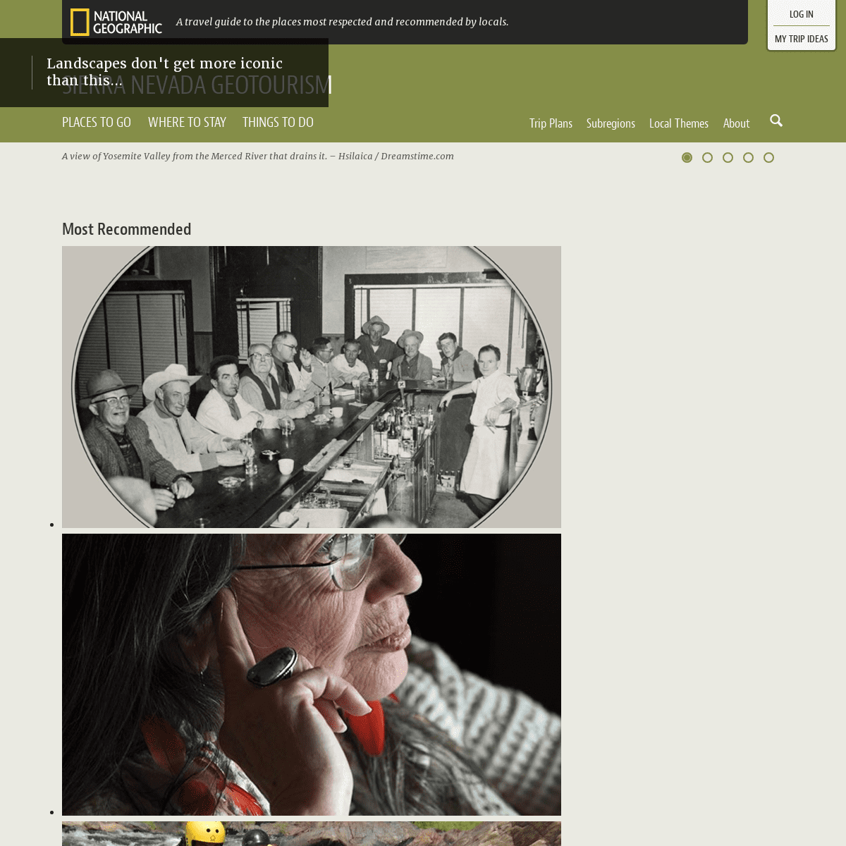
__ Judy Littewing DeRosa - Native American Artist / Spiritual Guide*
__ Whitewater Rafting on the Tuolumne River*
__ June Lake
*
__ Lake Tahoe Balloons*
__ Lake Tahoe Water Trail*
__ Cedar Glen Lodge
*
__ JT Basque Bar & Dining Room*
__ Judy Littewing DeRosa - Native American Artist / Spiritual Guide*
__ Whitewater Rafting on the Tuolumne River WELCOME TO OUR HOME. Explore 25 million acres of timeless traditions, local culture, events, and world-class adventures from Lava Beds National Monument to Sequoia and Kings Canyon National Parks. Use our Sierra Nevada travel planning map and the Free Mobile App to guide you through a breathtaking landscape that shapes our lives and unforgettable vacations. Get off the beaten path and find our favorite places by Exploring Themes or Subregions - Northern Sierra Cascade, Southern Sierra, Tahoe Emigrant Corridor, and Yosemite Gateway. Click the map below to explore the interactive guide that includes over 1,700 authentic places to go and things to do in the SierraNevada region.
NOMINATE A PLACE TO THE MAPGUIDE Help tell the story of what is special about this place. Nominationsopen now!
Start nominating here! LOCAL THEMES: WHAT MAKES THIS REGION SPECIAL?__ Adventures
FEATURED SUBREGIONS
__ Tahoe
Emigrant Corridor
RECENT UPDATES
Museum, Theater, Interpretive Center: Visitor or Interpretive Center Joseph Research Library, Truckee __ Add to Trip Ideas __ Joseph Research Library, Truckee Accommodation: Hotel or MotelLake Front Cabins
__ Add to Trip Ideas __ Lake Front Cabins Festival or Event: Festival Event Sierra Valley Art + Ag Trail __ Add to Trip Ideas __ Sierra Valley Art + Ag Trail discover new people, places, and experiences authentic to this region FEATURED CONTRIBUTORS Featured Contributor Dennis Villavicencio Learn more about this contributor DENNIS VILLAVICENCIO LATEST CONTRIBUTIONS * __ Buckeye Tree Lodge * __ Sequoia Village Inn Interests and Areas of Expertise Husband and Father of two wonderful kids, trial lawyer, business owner, EMT and Tulare County Firefighter, 9 time Ironman, trail running and racing, bicycling, hiking, climbing mountains and adventuring around the world, sailing and environmental steward.Travel Style
Preferably with my wife, my kids, a backpack and a bicycle. Featured ContributorFred Weyman
Learn more about this contributorFRED WEYMAN
LATEST CONTRIBUTIONS * __ Convict Creek Basin* __ Maggies Peaks
Interests and Areas of ExpertisePhotography
Travel Style
Backpacking
Favorite Saying
"Thus every attempt to appreciate any one feature is beaten down by the overwhelming influence of all the others" John Muir Featured ContributorJuliana Olinka
Learn more about this contributorJULIANA OLINKA
LATEST CONTRIBUTIONS * __ Mammoth Food & Wine Experience * __ Edison Theatre at Mammoth Lakes Interests and Areas of Expertise Theatre, Education, Marketing, Fundraising, Cross-country skiing,Fishing
Travel Style
Hotel with spa
PROJECT SUPPORTERS
See All
CONTACT
SIERRA BUSINESS COUNCILP.O. Box 2428
Truckee, CA, 96160
Phone: 530.582.4800
Fax: 530.582.1230
www.sierrabusiness.org info@sierrabusiness.orgFOLLOW US
Twitter Donate
Auction
__ NOMINATE A PLACE
Sign Up | Log In
� Old Town Creative + Interactive. All Rights Reserved.MapGuide Supporters
Terms | Privacy PolicyMobile Site
close
Details
4