4
More Annotations


3


6
Favourite Annotations


5


4
Text
ERIC'S HIKESJOHN MUIR TRAILTRIP PLANNINGWIND RIVER HIGH ROUTE 2015SHORT ADVENTURESJULYABOUT ERIC'S HIKES Eric's Hikes. The map below shows hikes that I have posted. Double click to zoom in on an area. Click on a hiker icon to discover great hikes! Red stars indicate long distance hikes. ericshikes - Google My Maps. Open full screen to view more. This map was created by a ERIC'S HIKES: NORTH COUNTRY NATIONAL SCENIC TRAIL The North Country National Scenic Trail (NCT) is ~4600 miles from North Dakota to New York (soon Vermont). This trail is fast becoming one of my favorites. While it doesn't offer quite the frequency of dramatic vistas and mountainous scenery as other national scenic trails, its concept is different. Other National Scenic Trails may
have more
ERIC'S HIKES: NORTH COUNTRY TRAIL: BOWMAN LAKE TO BIRCH North Country Trail: Bowman Lake to Birch Grove Loop. September 18-20, 2015. Manistee National Forest. Distance: 60+ miles roundtrip. Highlights: Sterling Marsh, many lakes and creeks, Chuck's Prairie. Of all the national scenic trails, I have currently hiked the most miles on the North Country Trail, a 4600 mile trail from North Dakota to New ERIC'S HIKES: NORTH COUNTRY TRAIL: UPPER RIVER TRAILHEAD The distance between Upper River Road Trailhead and Freesoil Trailhead is the longest weekend mileage to date. I began the hike a short distance from the Red Bridge Manistee River access at the Upper River Road Trailhead on Friday evening. For a map of the route see below. It was a short hike on a spur trail to reach the NCT. ERIC'S HIKES: BACKPACKING LOOP AROUND MICHIGAN'S BEAVER ISLAND Circumnavigating Beaver Island is potentially one of the best backpacking loops in Michigan. Per Wikipedia, Beaver Island is the largest island in Lake Michigan, lying approximately 32 miles from the city of Charlevoix on the mainland, and can only be reached by air or boat. It is 13 miles long and 3 to 6 miles wide. ERIC'S HIKES: NORTH COUNTRY TRAIL: STRAITS STATE PARK TO North Country Trail: Straits State Park to Trout Brook Pond. May 13-16, 2016. ~ 45 unique NCT miles. Of all the national scenic trails, I have currently hiked the most miles on the North Country Trail, a 4600 mile. trail from North Dakota to New York (soon Vermont). Whether it be beautiful segments in the Boundary Waters Canoe Area Wilderness ERIC'S HIKES: PORCUPINE MOUNTAINS LOOP September 26-28, 2014 This loop was Part 5 of 6 of my NCT/Lake Superior Adventure Porcupine Mountains total distance: 52.2 miles Cumulative NCT/Lake Superior Adventure distance: 615.9 miles ERIC'S HIKES: LAKE SUPERIOR PROVINCIAL PARK COASTAL TRAIL The link to the park provides info regarding shuttle options. While maintained by the provincial park, the Coastal Trail is actually a part of the Voyageur Trail, a 700 km trail along the northern shores of Lakes Huron and Superior. While the Voyageur Trail is not continuous and has many gaps, many of the completed sections areexcellent hikes.
ERIC'S HIKES: WIND RIVER HIGH ROUTE DAY 7: SHADOW LAKE TO Wind River High Route Day 7: Shadow Lake to Big Sandy Trailhead. We began another beautiful day in the Wind River Range. We wandered through the forest a little before joining the trail on our way to Texas Pass. It was great hiking on our way to ERIC'S HIKES: HIGHBANKS TRAIL: HURON NATIONAL FOREST October 25, 2016. 7 miles. The Highbanks Trail is a scenic trail "along the towering bluffs of the Au Sable River, offering incredible vistas of the historic Au Sable River Valley." The trail is located in the Huron National Forest. Camping is allowed at designated campsites only, options include: Monument Campground and Sawmill Point (permits ERIC'S HIKESJOHN MUIR TRAILTRIP PLANNINGWIND RIVER HIGH ROUTE 2015SHORT ADVENTURESJULYABOUT ERIC'S HIKES Eric's Hikes. The map below shows hikes that I have posted. Double click to zoom in on an area. Click on a hiker icon to discover great hikes! Red stars indicate long distance hikes. ericshikes - Google My Maps. Open full screen to view more. This map was created by a ERIC'S HIKES: NORTH COUNTRY NATIONAL SCENIC TRAIL The North Country National Scenic Trail (NCT) is ~4600 miles from North Dakota to New York (soon Vermont). This trail is fast becoming one of my favorites. While it doesn't offer quite the frequency of dramatic vistas and mountainous scenery as other national scenic trails, its concept is different. Other National Scenic Trails mayhave more
ERIC'S HIKES: NORTH COUNTRY TRAIL: BOWMAN LAKE TO BIRCH North Country Trail: Bowman Lake to Birch Grove Loop. September 18-20, 2015. Manistee National Forest. Distance: 60+ miles roundtrip. Highlights: Sterling Marsh, many lakes and creeks, Chuck's Prairie. Of all the national scenic trails, I have currently hiked the most miles on the North Country Trail, a 4600 mile trail from North Dakota to New ERIC'S HIKES: NORTH COUNTRY TRAIL: UPPER RIVER TRAILHEAD The distance between Upper River Road Trailhead and Freesoil Trailhead is the longest weekend mileage to date. I began the hike a short distance from the Red Bridge Manistee River access at the Upper River Road Trailhead on Friday evening. For a map of the route see below. It was a short hike on a spur trail to reach the NCT. ERIC'S HIKES: BACKPACKING LOOP AROUND MICHIGAN'S BEAVER ISLAND Circumnavigating Beaver Island is potentially one of the best backpacking loops in Michigan. Per Wikipedia, Beaver Island is the largest island in Lake Michigan, lying approximately 32 miles from the city of Charlevoix on the mainland, and can only be reached by air or boat. It is 13 miles long and 3 to 6 miles wide. ERIC'S HIKES: NORTH COUNTRY TRAIL: STRAITS STATE PARK TO North Country Trail: Straits State Park to Trout Brook Pond. May 13-16, 2016. ~ 45 unique NCT miles. Of all the national scenic trails, I have currently hiked the most miles on the North Country Trail, a 4600 mile. trail from North Dakota to New York (soon Vermont). Whether it be beautiful segments in the Boundary Waters Canoe Area Wilderness ERIC'S HIKES: PORCUPINE MOUNTAINS LOOP September 26-28, 2014 This loop was Part 5 of 6 of my NCT/Lake Superior Adventure Porcupine Mountains total distance: 52.2 miles Cumulative NCT/Lake Superior Adventure distance: 615.9 miles ERIC'S HIKES: LAKE SUPERIOR PROVINCIAL PARK COASTAL TRAIL The link to the park provides info regarding shuttle options. While maintained by the provincial park, the Coastal Trail is actually a part of the Voyageur Trail, a 700 km trail along the northern shores of Lakes Huron and Superior. While the Voyageur Trail is not continuous and has many gaps, many of the completed sections areexcellent hikes.
ERIC'S HIKES: WIND RIVER HIGH ROUTE DAY 7: SHADOW LAKE TO Wind River High Route Day 7: Shadow Lake to Big Sandy Trailhead. We began another beautiful day in the Wind River Range. We wandered through the forest a little before joining the trail on our way to Texas Pass. It was great hiking on our way to ERIC'S HIKES: HIGHBANKS TRAIL: HURON NATIONAL FOREST October 25, 2016. 7 miles. The Highbanks Trail is a scenic trail "along the towering bluffs of the Au Sable River, offering incredible vistas of the historic Au Sable River Valley." The trail is located in the Huron National Forest. Camping is allowed at designated campsites only, options include: Monument Campground and Sawmill Point (permits ERIC'S HIKES: NORTH COUNTRY TRAIL: UPPER RIVER TRAILHEAD The distance between Upper River Road Trailhead and Freesoil Trailhead is the longest weekend mileage to date. I began the hike a short distance from the Red Bridge Manistee River access at the Upper River Road Trailhead on Friday evening. For a map of the route see below. It was a short hike on a spur trail to reach the NCT. ERIC'S HIKES: WIND RIVER HIGH ROUTE DAY 7: SHADOW LAKE TO Wind River High Route Day 7: Shadow Lake to Big Sandy Trailhead. We began another beautiful day in the Wind River Range. We wandered through the forest a little before joining the trail on our way to Texas Pass. It was great hiking on our way to ERIC'S HIKES: HIGHBANKS TRAIL: HURON NATIONAL FOREST October 25, 2016. 7 miles. The Highbanks Trail is a scenic trail "along the towering bluffs of the Au Sable River, offering incredible vistas of the historic Au Sable River Valley." The trail is located in the Huron National Forest. Camping is allowed at designated campsites only, options include: Monument Campground and Sawmill Point (permits ERIC'S HIKES: PICTURED ROCKS LAKE SHORE TRAIL/NCT The hike on the Pictured Rocks Lakeshore Trail was complete, as was my NCT/Lake Superior Adventure. The Lakeshore Trail offered some of the finest scenery in the midwest and was a great place to finish the adventure. Later in the evening we revisited the Pictured Rocks on a boat tour. Grand Portal Point. ERIC'S HIKES: GROS VENTRE WILDERNESS: SHOAL CREEK AND On my way west from Casper, Wyoming to Medford Oregon for my next job I stopped to complete two separate hikes in western Wyoming. First I completed a beautiful loop in the Washakie Wilderness.Then I drove through Yellowstone and the Tetons to backpack this excellent loop in the Gros Ventre Wilderness. ERIC'S HIKES: UINTA HIGHLINE TRAIL DAY 7: LAKE FORK RIVER Uinta Highline Trail Day 7: Lake Fork River to Triangle Lake. August 31, 2017. Daily Distance: 11.3. Cumulative Distance: 95.08. Passes: Red Knob and Deadhorse. It rained throughout much of the night and it was still quite wet in the morning but not raining when we began to pack up camp. Campsite by Lake Fork River. ERIC'S HIKES: SUPERIOR HIKING TRAIL: GRAND MARAIS TO 270 Superior Hiking Trail: Grand Marais to 270 Degree Overlook. Days 13-15: September 16-18, 2014. Grand Marais to 270 Degree Overlook (14.4+25.5+18.3= 58.2 miles) Cumulative SHT Miles (counting spurs and road walks to town): 262.15+58.2=320.35) NCT/Lake Superior Adventure Cumulative miles: 457.65 miles. Highlights: Pincushion Mountain, DevilTrack
ERIC'S HIKES: SUPERIOR HIKING TRAIL: SILVER BAY TO GRAND Superior Hiking Trail: Silver Bay to Grand Marais. Days 7-12: 10-15, 2014. Silver Bay to Grand Marais (6.1+24.95+26.8+16.1+23.0+21.8= 118.75) Cumulative SHT miles (143.4+118.75=262.15) NCT/Lake Superior Adventure Cumulative miles=399.45 miles. Highlights: Bean and Bear Lakes, Mount Trudee, Baptism High Falls, Egge Lake, Sonju Lake,Manitou
ERIC'S HIKES: HIKING THE BEACH: SOUTHWEST MICHIGAN April 10, 2015. ~3 miles. On a windy weekend day, I went for a short run on Silver Beach, one of the most popular in the area. The lighthouse is visible out on the pier. 6. Tiscornia Park to steep dune with American Flag. 1/2/16. ~11 miles roundtrip. ERIC'S HIKES: KEKEKABIC TRAIL THRU-HIKE 2014 Kekekabic Trail Thru-hike 2014. September 22-25, 2014. Gunflint Trail to Snowbank Lake Trailhead (11.5+14.5+8.25+5.25=39.5 miles) Cumulative NCT/Lake Superior Adventure Miles: 563.7. The "Kek" was part 4 of 6 of my NCT/Lake Superior Adventure. Campsites: ERIC'S HIKESJOHN MUIR TRAILTRIP PLANNINGWIND RIVER HIGH ROUTE 2015SHORT ADVENTURESJULYABOUT ERIC'S HIKES Eric's Hikes. The map below shows hikes that I have posted. Double click to zoom in on an area. Click on a hiker icon to discover great hikes! Red stars indicate long distance hikes. ericshikes - Google My Maps. Open full screen to view more. This map was created by a ERIC'S HIKES: NORTH COUNTRY NATIONAL SCENIC TRAIL The North Country National Scenic Trail (NCT) is ~4600 miles from North Dakota to New York (soon Vermont). This trail is fast becoming one of my favorites. While it doesn't offer quite the frequency of dramatic vistas and mountainous scenery as other national scenic trails, its concept is different. Other National Scenic Trails mayhave more
ERIC'S HIKES: NORTH COUNTRY TRAIL: BOWMAN LAKE TO BIRCH North Country Trail: Bowman Lake to Birch Grove Loop. September 18-20, 2015. Manistee National Forest. Distance: 60+ miles roundtrip. Highlights: Sterling Marsh, many lakes and creeks, Chuck's Prairie. Of all the national scenic trails, I have currently hiked the most miles on the North Country Trail, a 4600 mile trail from North Dakota to New ERIC'S HIKES: NORTH COUNTRY TRAIL: UPPER RIVER TRAILHEAD The distance between Upper River Road Trailhead and Freesoil Trailhead is the longest weekend mileage to date. I began the hike a short distance from the Red Bridge Manistee River access at the Upper River Road Trailhead on Friday evening. For a map of the route see below. It was a short hike on a spur trail to reach the NCT. ERIC'S HIKES: HIGH COUNTRY PATHWAY The High Country Pathway at ~80 miles is one of the longest backpacking trails in Michigan's Lower Peninsula. It is located north of Gaylord a short distance off the Vanderbilt exit. ERIC'S HIKES: BACKPACKING LOOP AROUND MICHIGAN'S BEAVER ISLAND Circumnavigating Beaver Island is potentially one of the best backpacking loops in Michigan. Per Wikipedia, Beaver Island is the largest island in Lake Michigan, lying approximately 32 miles from the city of Charlevoix on the mainland, and can only be reached by air or boat. It is 13 miles long and 3 to 6 miles wide. ERIC'S HIKES: LAKE SUPERIOR PROVINCIAL PARK COASTAL TRAIL The link to the park provides info regarding shuttle options. While maintained by the provincial park, the Coastal Trail is actually a part of the Voyageur Trail, a 700 km trail along the northern shores of Lakes Huron and Superior. While the Voyageur Trail is not continuous and has many gaps, many of the completed sections areexcellent hikes.
ERIC'S HIKES: PORCUPINE MOUNTAINS LOOP September 26-28, 2014 This loop was Part 5 of 6 of my NCT/Lake Superior Adventure Porcupine Mountains total distance: 52.2 miles Cumulative NCT/Lake Superior Adventure distance: 615.9 miles ERIC'S HIKES: WIND RIVER HIGH ROUTE DAY 7: SHADOW LAKE TO Wind River High Route Day 7: Shadow Lake to Big Sandy Trailhead. We began another beautiful day in the Wind River Range. We wandered through the forest a little before joining the trail on our way to Texas Pass. It was great hiking on our way to ERIC'S HIKES: NEWFOUNDLAND 2016 Newfoundland 2016. 1. International Appalachian Trail Newfoundland & Labrador. The International Appalachian Trail continues along the Appalachian Mountains from near the Appalachian Trail's northern terminus in Baxter State Park into Canada, Europe and even Africa. There are plans for it to be located in at least 19 nations and for itto be
ERIC'S HIKESJOHN MUIR TRAILTRIP PLANNINGWIND RIVER HIGH ROUTE 2015SHORT ADVENTURESJULYABOUT ERIC'S HIKES Eric's Hikes. The map below shows hikes that I have posted. Double click to zoom in on an area. Click on a hiker icon to discover great hikes! Red stars indicate long distance hikes. ericshikes - Google My Maps. Open full screen to view more. This map was created by a ERIC'S HIKES: NORTH COUNTRY NATIONAL SCENIC TRAIL The North Country National Scenic Trail (NCT) is ~4600 miles from North Dakota to New York (soon Vermont). This trail is fast becoming one of my favorites. While it doesn't offer quite the frequency of dramatic vistas and mountainous scenery as other national scenic trails, its concept is different. Other National Scenic Trails mayhave more
ERIC'S HIKES: NORTH COUNTRY TRAIL: BOWMAN LAKE TO BIRCH North Country Trail: Bowman Lake to Birch Grove Loop. September 18-20, 2015. Manistee National Forest. Distance: 60+ miles roundtrip. Highlights: Sterling Marsh, many lakes and creeks, Chuck's Prairie. Of all the national scenic trails, I have currently hiked the most miles on the North Country Trail, a 4600 mile trail from North Dakota to New ERIC'S HIKES: NORTH COUNTRY TRAIL: UPPER RIVER TRAILHEAD The distance between Upper River Road Trailhead and Freesoil Trailhead is the longest weekend mileage to date. I began the hike a short distance from the Red Bridge Manistee River access at the Upper River Road Trailhead on Friday evening. For a map of the route see below. It was a short hike on a spur trail to reach the NCT. ERIC'S HIKES: HIGH COUNTRY PATHWAY The High Country Pathway at ~80 miles is one of the longest backpacking trails in Michigan's Lower Peninsula. It is located north of Gaylord a short distance off the Vanderbilt exit. ERIC'S HIKES: BACKPACKING LOOP AROUND MICHIGAN'S BEAVER ISLAND Circumnavigating Beaver Island is potentially one of the best backpacking loops in Michigan. Per Wikipedia, Beaver Island is the largest island in Lake Michigan, lying approximately 32 miles from the city of Charlevoix on the mainland, and can only be reached by air or boat. It is 13 miles long and 3 to 6 miles wide. ERIC'S HIKES: LAKE SUPERIOR PROVINCIAL PARK COASTAL TRAIL The link to the park provides info regarding shuttle options. While maintained by the provincial park, the Coastal Trail is actually a part of the Voyageur Trail, a 700 km trail along the northern shores of Lakes Huron and Superior. While the Voyageur Trail is not continuous and has many gaps, many of the completed sections areexcellent hikes.
ERIC'S HIKES: PORCUPINE MOUNTAINS LOOP September 26-28, 2014 This loop was Part 5 of 6 of my NCT/Lake Superior Adventure Porcupine Mountains total distance: 52.2 miles Cumulative NCT/Lake Superior Adventure distance: 615.9 miles ERIC'S HIKES: WIND RIVER HIGH ROUTE DAY 7: SHADOW LAKE TO Wind River High Route Day 7: Shadow Lake to Big Sandy Trailhead. We began another beautiful day in the Wind River Range. We wandered through the forest a little before joining the trail on our way to Texas Pass. It was great hiking on our way to ERIC'S HIKES: NEWFOUNDLAND 2016 Newfoundland 2016. 1. International Appalachian Trail Newfoundland & Labrador. The International Appalachian Trail continues along the Appalachian Mountains from near the Appalachian Trail's northern terminus in Baxter State Park into Canada, Europe and even Africa. There are plans for it to be located in at least 19 nations and for itto be
ERIC'S HIKES: LAKE SUPERIOR PROVINCIAL PARK COASTAL TRAIL The link to the park provides info regarding shuttle options. While maintained by the provincial park, the Coastal Trail is actually a part of the Voyageur Trail, a 700 km trail along the northern shores of Lakes Huron and Superior. While the Voyageur Trail is not continuous and has many gaps, many of the completed sections areexcellent hikes.
ERIC'S HIKES: HIGH COUNTRY PATHWAY The High Country Pathway at ~80 miles is one of the longest backpacking trails in Michigan's Lower Peninsula. It is located north of Gaylord a short distance off the Vanderbilt exit. ERIC'S HIKES: WIND RIVER HIGH ROUTE DAY 7: SHADOW LAKE TO Wind River High Route Day 7: Shadow Lake to Big Sandy Trailhead. We began another beautiful day in the Wind River Range. We wandered through the forest a little before joining the trail on our way to Texas Pass. It was great hiking on our way to ERIC'S HIKES: PICTURED ROCKS LAKE SHORE TRAIL/NCT The hike on the Pictured Rocks Lakeshore Trail was complete, as was my NCT/Lake Superior Adventure. The Lakeshore Trail offered some of the finest scenery in the midwest and was a great place to finish the adventure. Later in the evening we revisited the Pictured Rocks on a boat tour. Grand Portal Point. ERIC'S HIKES: SUPERIOR HIKING TRAIL: SILVER BAY TO GRAND Superior Hiking Trail: Silver Bay to Grand Marais. Days 7-12: 10-15, 2014. Silver Bay to Grand Marais (6.1+24.95+26.8+16.1+23.0+21.8= 118.75) Cumulative SHT miles (143.4+118.75=262.15) NCT/Lake Superior Adventure Cumulative miles=399.45 miles. Highlights: Bean and Bear Lakes, Mount Trudee, Baptism High Falls, Egge Lake, Sonju Lake,Manitou
ERIC'S HIKES: COLORADO ADVENTURE PART VI: OURAY Days 23-27: August 11-14. Drive to Oury/Bear Creek and Horsethief Trails (Uncompahgre Wilderness) Distance: ~20 miles Overall Total Distance: 453 miles. Highlights: Mayflower Mill near Silverton, beautiful scenery on Highway 550, Pizza in Ouray, Comfort Inn’s comfort and breakfast, Bear Creek National Recreation Trail, cliffsabove Bear Creek
ERIC'S HIKES: UINTA HIGHLINE TRAIL DAY 7: LAKE FORK RIVER Uinta Highline Trail Day 7: Lake Fork River to Triangle Lake. August 31, 2017. Daily Distance: 11.3. Cumulative Distance: 95.08. Passes: Red Knob and Deadhorse. It rained throughout much of the night and it was still quite wet in the morning but not raining when we began to pack up camp. Campsite by Lake Fork River. ERIC'S HIKES: SOUTH MANITOU ISLAND July 16-18, 2016. South Manitou Island is located ~16 miles west of Leland, MI. It is part of Sleeping Bear Dunes National Lakeshore. The island is fairly small at three miles wide by three miles long, but it provides a relaxing weekend with an abundance of scenery. This is a great destination for a beginning backpacker but will be quite ERIC'S HIKES: NEWFOUNDLAND 2016 Newfoundland 2016. 1. International Appalachian Trail Newfoundland & Labrador. The International Appalachian Trail continues along the Appalachian Mountains from near the Appalachian Trail's northern terminus in Baxter State Park into Canada, Europe and even Africa. There are plans for it to be located in at least 19 nations and for itto be
ERIC'S HIKES: UINTA HIGHLINE TRAIL 2017 The biggest logistical challenge is coordinating a ride from one end of the trail to the other. We used Wilkins Bus Lines. One consideration with the Highline Trail is that most people don't understand the distance of the entire trail. Officially the entiretrail is between
ERIC'S HIKESJOHN MUIR TRAILTRIP PLANNINGWIND RIVER HIGH ROUTE 2015SHORT ADVENTURESJULYABOUT ERIC'S HIKES Eric's Hikes. The map below shows hikes that I have posted. Double click to zoom in on an area. Click on a hiker icon to discover great hikes! Red stars indicate long distance hikes. ericshikes - Google My Maps. Open full screen to view more. This map was created by a ERIC'S HIKES: NORTH COUNTRY NATIONAL SCENIC TRAIL The North Country National Scenic Trail (NCT) is ~4600 miles from North Dakota to New York (soon Vermont). This trail is fast becoming one of my favorites. While it doesn't offer quite the frequency of dramatic vistas and mountainous scenery as other national scenic trails, its concept is different. Other National Scenic Trails mayhave more
ERIC'S HIKES: NORTH COUNTRY TRAIL: BOWMAN LAKE TO BIRCH North Country Trail: Bowman Lake to Birch Grove Loop. September 18-20, 2015. Manistee National Forest. Distance: 60+ miles roundtrip. Highlights: Sterling Marsh, many lakes and creeks, Chuck's Prairie. Of all the national scenic trails, I have currently hiked the most miles on the North Country Trail, a 4600 mile trail from North Dakota to New ERIC'S HIKES: NORTH COUNTRY TRAIL: UPPER RIVER TRAILHEAD The distance between Upper River Road Trailhead and Freesoil Trailhead is the longest weekend mileage to date. I began the hike a short distance from the Red Bridge Manistee River access at the Upper River Road Trailhead on Friday evening. For a map of the route see below. It was a short hike on a spur trail to reach the NCT. ERIC'S HIKES: HIGH COUNTRY PATHWAY The High Country Pathway at ~80 miles is one of the longest backpacking trails in Michigan's Lower Peninsula. It is located north of Gaylord a short distance off the Vanderbilt exit. ERIC'S HIKES: BACKPACKING LOOP AROUND MICHIGAN'S BEAVER ISLAND Circumnavigating Beaver Island is potentially one of the best backpacking loops in Michigan. Per Wikipedia, Beaver Island is the largest island in Lake Michigan, lying approximately 32 miles from the city of Charlevoix on the mainland, and can only be reached by air or boat. It is 13 miles long and 3 to 6 miles wide. ERIC'S HIKES: LAKE SUPERIOR PROVINCIAL PARK COASTAL TRAIL The link to the park provides info regarding shuttle options. While maintained by the provincial park, the Coastal Trail is actually a part of the Voyageur Trail, a 700 km trail along the northern shores of Lakes Huron and Superior. While the Voyageur Trail is not continuous and has many gaps, many of the completed sections areexcellent hikes.
ERIC'S HIKES: PORCUPINE MOUNTAINS LOOP September 26-28, 2014 This loop was Part 5 of 6 of my NCT/Lake Superior Adventure Porcupine Mountains total distance: 52.2 miles Cumulative NCT/Lake Superior Adventure distance: 615.9 miles ERIC'S HIKES: WIND RIVER HIGH ROUTE DAY 7: SHADOW LAKE TO Wind River High Route Day 7: Shadow Lake to Big Sandy Trailhead. We began another beautiful day in the Wind River Range. We wandered through the forest a little before joining the trail on our way to Texas Pass. It was great hiking on our way to ERIC'S HIKES: NEWFOUNDLAND 2016 Newfoundland 2016. 1. International Appalachian Trail Newfoundland & Labrador. The International Appalachian Trail continues along the Appalachian Mountains from near the Appalachian Trail's northern terminus in Baxter State Park into Canada, Europe and even Africa. There are plans for it to be located in at least 19 nations and for itto be
ERIC'S HIKES: LAKE SUPERIOR PROVINCIAL PARK COASTAL TRAIL The link to the park provides info regarding shuttle options. While maintained by the provincial park, the Coastal Trail is actually a part of the Voyageur Trail, a 700 km trail along the northern shores of Lakes Huron and Superior. While the Voyageur Trail is not continuous and has many gaps, many of the completed sections areexcellent hikes.
ERIC'S HIKES: HIGH COUNTRY PATHWAY The High Country Pathway at ~80 miles is one of the longest backpacking trails in Michigan's Lower Peninsula. It is located north of Gaylord a short distance off the Vanderbilt exit. ERIC'S HIKES: WIND RIVER HIGH ROUTE DAY 7: SHADOW LAKE TO Wind River High Route Day 7: Shadow Lake to Big Sandy Trailhead. We began another beautiful day in the Wind River Range. We wandered through the forest a little before joining the trail on our way to Texas Pass. It was great hiking on our way to ERIC'S HIKES: PICTURED ROCKS LAKE SHORE TRAIL/NCT The hike on the Pictured Rocks Lakeshore Trail was complete, as was my NCT/Lake Superior Adventure. The Lakeshore Trail offered some of the finest scenery in the midwest and was a great place to finish the adventure. Later in the evening we revisited the Pictured Rocks on a boat tour. Grand Portal Point. ERIC'S HIKES: SUPERIOR HIKING TRAIL: SILVER BAY TO GRAND Superior Hiking Trail: Silver Bay to Grand Marais. Days 7-12: 10-15, 2014. Silver Bay to Grand Marais (6.1+24.95+26.8+16.1+23.0+21.8= 118.75) Cumulative SHT miles (143.4+118.75=262.15) NCT/Lake Superior Adventure Cumulative miles=399.45 miles. Highlights: Bean and Bear Lakes, Mount Trudee, Baptism High Falls, Egge Lake, Sonju Lake,Manitou
ERIC'S HIKES: COLORADO ADVENTURE PART VI: OURAY Days 23-27: August 11-14. Drive to Oury/Bear Creek and Horsethief Trails (Uncompahgre Wilderness) Distance: ~20 miles Overall Total Distance: 453 miles. Highlights: Mayflower Mill near Silverton, beautiful scenery on Highway 550, Pizza in Ouray, Comfort Inn’s comfort and breakfast, Bear Creek National Recreation Trail, cliffsabove Bear Creek
ERIC'S HIKES: UINTA HIGHLINE TRAIL DAY 7: LAKE FORK RIVER Uinta Highline Trail Day 7: Lake Fork River to Triangle Lake. August 31, 2017. Daily Distance: 11.3. Cumulative Distance: 95.08. Passes: Red Knob and Deadhorse. It rained throughout much of the night and it was still quite wet in the morning but not raining when we began to pack up camp. Campsite by Lake Fork River. ERIC'S HIKES: SOUTH MANITOU ISLAND July 16-18, 2016. South Manitou Island is located ~16 miles west of Leland, MI. It is part of Sleeping Bear Dunes National Lakeshore. The island is fairly small at three miles wide by three miles long, but it provides a relaxing weekend with an abundance of scenery. This is a great destination for a beginning backpacker but will be quite ERIC'S HIKES: NEWFOUNDLAND 2016 Newfoundland 2016. 1. International Appalachian Trail Newfoundland & Labrador. The International Appalachian Trail continues along the Appalachian Mountains from near the Appalachian Trail's northern terminus in Baxter State Park into Canada, Europe and even Africa. There are plans for it to be located in at least 19 nations and for itto be
ERIC'S HIKES: UINTA HIGHLINE TRAIL 2017 The biggest logistical challenge is coordinating a ride from one end of the trail to the other. We used Wilkins Bus Lines. One consideration with the Highline Trail is that most people don't understand the distance of the entire trail. Officially the entiretrail is between
ERIC'S HIKESJOHN MUIR TRAILTRIP PLANNINGWIND RIVER HIGH ROUTE 2015SHORT ADVENTURESJULYABOUT ERIC'S HIKES Eric's Hikes. The map below shows hikes that I have posted. Double click to zoom in on an area. Click on a hiker icon to discover great hikes! Red stars indicate long distance hikes. ericshikes - Google My Maps. Open full screen to view more. This map was created by a ERIC'S HIKES: NORTH COUNTRY NATIONAL SCENIC TRAIL The North Country National Scenic Trail (NCT) is ~4600 miles from North Dakota to New York (soon Vermont). This trail is fast becoming one of my favorites. While it doesn't offer quite the frequency of dramatic vistas and mountainous scenery as other national scenic trails, its concept is different. Other National Scenic Trails mayhave more
ERIC'S HIKES: NORTH COUNTRY TRAIL: BOWMAN LAKE TO BIRCH North Country Trail: Bowman Lake to Birch Grove Loop. September 18-20, 2015. Manistee National Forest. Distance: 60+ miles roundtrip. Highlights: Sterling Marsh, many lakes and creeks, Chuck's Prairie. Of all the national scenic trails, I have currently hiked the most miles on the North Country Trail, a 4600 mile trail from North Dakota to New ERIC'S HIKES: NORTH COUNTRY TRAIL: UPPER RIVER TRAILHEAD The distance between Upper River Road Trailhead and Freesoil Trailhead is the longest weekend mileage to date. I began the hike a short distance from the Red Bridge Manistee River access at the Upper River Road Trailhead on Friday evening. For a map of the route see below. It was a short hike on a spur trail to reach the NCT. ERIC'S HIKES: PORCUPINE MOUNTAINS LOOP September 26-28, 2014 This loop was Part 5 of 6 of my NCT/Lake Superior Adventure Porcupine Mountains total distance: 52.2 miles Cumulative NCT/Lake Superior Adventure distance: 615.9 miles ERIC'S HIKES: BACKPACKING LOOP AROUND MICHIGAN'S BEAVER ISLAND Circumnavigating Beaver Island is potentially one of the best backpacking loops in Michigan. Per Wikipedia, Beaver Island is the largest island in Lake Michigan, lying approximately 32 miles from the city of Charlevoix on the mainland, and can only be reached by air or boat. It is 13 miles long and 3 to 6 miles wide. ERIC'S HIKES: NORTH COUNTRY TRAIL: STRAITS STATE PARK TO North Country Trail: Straits State Park to Trout Brook Pond. May 13-16, 2016. ~ 45 unique NCT miles. Of all the national scenic trails, I have currently hiked the most miles on the North Country Trail, a 4600 mile. trail from North Dakota to New York (soon Vermont). Whether it be beautiful segments in the Boundary Waters Canoe Area Wilderness ERIC'S HIKES: LAKE SUPERIOR PROVINCIAL PARK COASTAL TRAIL The link to the park provides info regarding shuttle options. While maintained by the provincial park, the Coastal Trail is actually a part of the Voyageur Trail, a 700 km trail along the northern shores of Lakes Huron and Superior. While the Voyageur Trail is not continuous and has many gaps, many of the completed sections areexcellent hikes.
ERIC'S HIKES: WIND RIVER HIGH ROUTE DAY 7: SHADOW LAKE TO Wind River High Route Day 7: Shadow Lake to Big Sandy Trailhead. We began another beautiful day in the Wind River Range. We wandered through the forest a little before joining the trail on our way to Texas Pass. It was great hiking on our way to ERIC'S HIKES: HIGHBANKS TRAIL: HURON NATIONAL FOREST October 25, 2016. 7 miles. The Highbanks Trail is a scenic trail "along the towering bluffs of the Au Sable River, offering incredible vistas of the historic Au Sable River Valley." The trail is located in the Huron National Forest. Camping is allowed at designated campsites only, options include: Monument Campground and Sawmill Point (permits ERIC'S HIKESJOHN MUIR TRAILTRIP PLANNINGWIND RIVER HIGH ROUTE 2015SHORT ADVENTURESJULYABOUT ERIC'S HIKES Eric's Hikes. The map below shows hikes that I have posted. Double click to zoom in on an area. Click on a hiker icon to discover great hikes! Red stars indicate long distance hikes. ericshikes - Google My Maps. Open full screen to view more. This map was created by a ERIC'S HIKES: NORTH COUNTRY NATIONAL SCENIC TRAIL The North Country National Scenic Trail (NCT) is ~4600 miles from North Dakota to New York (soon Vermont). This trail is fast becoming one of my favorites. While it doesn't offer quite the frequency of dramatic vistas and mountainous scenery as other national scenic trails, its concept is different. Other National Scenic Trails mayhave more
ERIC'S HIKES: NORTH COUNTRY TRAIL: BOWMAN LAKE TO BIRCH North Country Trail: Bowman Lake to Birch Grove Loop. September 18-20, 2015. Manistee National Forest. Distance: 60+ miles roundtrip. Highlights: Sterling Marsh, many lakes and creeks, Chuck's Prairie. Of all the national scenic trails, I have currently hiked the most miles on the North Country Trail, a 4600 mile trail from North Dakota to New ERIC'S HIKES: NORTH COUNTRY TRAIL: UPPER RIVER TRAILHEAD The distance between Upper River Road Trailhead and Freesoil Trailhead is the longest weekend mileage to date. I began the hike a short distance from the Red Bridge Manistee River access at the Upper River Road Trailhead on Friday evening. For a map of the route see below. It was a short hike on a spur trail to reach the NCT. ERIC'S HIKES: PORCUPINE MOUNTAINS LOOP September 26-28, 2014 This loop was Part 5 of 6 of my NCT/Lake Superior Adventure Porcupine Mountains total distance: 52.2 miles Cumulative NCT/Lake Superior Adventure distance: 615.9 miles ERIC'S HIKES: BACKPACKING LOOP AROUND MICHIGAN'S BEAVER ISLAND Circumnavigating Beaver Island is potentially one of the best backpacking loops in Michigan. Per Wikipedia, Beaver Island is the largest island in Lake Michigan, lying approximately 32 miles from the city of Charlevoix on the mainland, and can only be reached by air or boat. It is 13 miles long and 3 to 6 miles wide. ERIC'S HIKES: NORTH COUNTRY TRAIL: STRAITS STATE PARK TO North Country Trail: Straits State Park to Trout Brook Pond. May 13-16, 2016. ~ 45 unique NCT miles. Of all the national scenic trails, I have currently hiked the most miles on the North Country Trail, a 4600 mile. trail from North Dakota to New York (soon Vermont). Whether it be beautiful segments in the Boundary Waters Canoe Area Wilderness ERIC'S HIKES: LAKE SUPERIOR PROVINCIAL PARK COASTAL TRAIL The link to the park provides info regarding shuttle options. While maintained by the provincial park, the Coastal Trail is actually a part of the Voyageur Trail, a 700 km trail along the northern shores of Lakes Huron and Superior. While the Voyageur Trail is not continuous and has many gaps, many of the completed sections areexcellent hikes.
ERIC'S HIKES: WIND RIVER HIGH ROUTE DAY 7: SHADOW LAKE TO Wind River High Route Day 7: Shadow Lake to Big Sandy Trailhead. We began another beautiful day in the Wind River Range. We wandered through the forest a little before joining the trail on our way to Texas Pass. It was great hiking on our way to ERIC'S HIKES: HIGHBANKS TRAIL: HURON NATIONAL FOREST October 25, 2016. 7 miles. The Highbanks Trail is a scenic trail "along the towering bluffs of the Au Sable River, offering incredible vistas of the historic Au Sable River Valley." The trail is located in the Huron National Forest. Camping is allowed at designated campsites only, options include: Monument Campground and Sawmill Point (permits ERIC'S HIKES: HIGH COUNTRY PATHWAY The High Country Pathway at ~80 miles is one of the longest backpacking trails in Michigan's Lower Peninsula. It is located north of Gaylord a short distance off the Vanderbilt exit. ERIC'S HIKES: HIGHBANKS TRAIL: HURON NATIONAL FOREST October 25, 2016. 7 miles. The Highbanks Trail is a scenic trail "along the towering bluffs of the Au Sable River, offering incredible vistas of the historic Au Sable River Valley." The trail is located in the Huron National Forest. Camping is allowed at designated campsites only, options include: Monument Campground and Sawmill Point (permits ERIC'S HIKES: WIND RIVER HIGH ROUTE DAY 7: SHADOW LAKE TO Wind River High Route Day 7: Shadow Lake to Big Sandy Trailhead. We began another beautiful day in the Wind River Range. We wandered through the forest a little before joining the trail on our way to Texas Pass. It was great hiking on our way to ERIC'S HIKES: COLORADO TRAIL ADVENTURE PART IV: SPRING Colorado Trail Adventure Part IV: Spring Creek Pass to Molas Lake. Days 14-18: August 2-6. Spring Creek Pass to Molas Lake with side trip into Weminuche Wilderness. Distance: ~75 miles Total Distance: 360 miles. Highlights: Jarosa Mesa, Colorado Trail Friends Yurt, meeting other hikers, Lake San Cristobal, CT high point, Cataract Ridge and ERIC'S HIKES: NORTH COUNTRY TRAIL: LAKE SUPERIOR STATE North Country Trail: Lake Superior State Campground to Grand Sable Visitor Center. June 24-26, 2016. Of all the national scenic trails, I have currently hiked the most miles on the North Country Trail, a 4600 mile. trail from North Dakota to New York (soon Vermont). Whether it be beautiful segments in the Boundary Waters Canoe Area Wilderness ERIC'S HIKES: GROS VENTRE WILDERNESS: SHOAL CREEK AND On my way west from Casper, Wyoming to Medford Oregon for my next job I stopped to complete two separate hikes in western Wyoming. First I completed a beautiful loop in the Washakie Wilderness.Then I drove through Yellowstone and the Tetons to backpack this excellent loop in the Gros Ventre Wilderness. ERIC'S HIKES: SUPERIOR HIKING TRAIL: SILVER BAY TO GRAND Superior Hiking Trail: Silver Bay to Grand Marais. Days 7-12: 10-15, 2014. Silver Bay to Grand Marais (6.1+24.95+26.8+16.1+23.0+21.8= 118.75) Cumulative SHT miles (143.4+118.75=262.15) NCT/Lake Superior Adventure Cumulative miles=399.45 miles. Highlights: Bean and Bear Lakes, Mount Trudee, Baptism High Falls, Egge Lake, Sonju Lake,Manitou
ERIC'S HIKES: SUPERIOR HIKING TRAIL: DULUTH SECTION Superior Hiking Trail: Duluth Section. Superior Hiking Trail cumulative miles: 49.6 miles. NCT/Lake Superior Adventure cumulative miles: 137.3+ 49.6= 186.9 miles. The Duluth Section of the Superior Hiking Trail is one that should not be missed during a thru-hike. It includes great variety and many scenic views overlooking Duluth andLake
ERIC'S HIKES: SUPERIOR HIKING TRAIL: GRAND MARAIS TO 270 Superior Hiking Trail: Grand Marais to 270 Degree Overlook. Days 13-15: September 16-18, 2014. Grand Marais to 270 Degree Overlook (14.4+25.5+18.3= 58.2 miles) Cumulative SHT Miles (counting spurs and road walks to town): 262.15+58.2=320.35) NCT/Lake Superior Adventure Cumulative miles: 457.65 miles. Highlights: Pincushion Mountain, DevilTrack
ERIC'S HIKES: UINTA HIGHLINE TRAIL DAY 7: LAKE FORK RIVER Uinta Highline Trail Day 7: Lake Fork River to Triangle Lake. August 31, 2017. Daily Distance: 11.3. Cumulative Distance: 95.08. Passes: Red Knob and Deadhorse. It rained throughout much of the night and it was still quite wet in the morning but not raining when we began to pack up camp. Campsite by Lake Fork River. ERIC'S HIKESJOHN MUIR TRAILTRIP PLANNINGWIND RIVER HIGH ROUTE 2015SHORT ADVENTURESJULYABOUT ERIC'S HIKES Eric's Hikes. The map below shows hikes that I have posted. Double click to zoom in on an area. Click on a hiker icon to discover great hikes! Red stars indicate long distance hikes. ericshikes - Google My Maps. Open full screen to view more. This map was created by a ERIC'S HIKES: NORTH COUNTRY NATIONAL SCENIC TRAILNORTH COUNTRY NATIONAL SCENIC TRAILNORTH COUNTRY SCENIC TRAIL MAPNORTH COUNTRY SCENIC TRAIL PAFLORIDA SCENIC TRAILNORTH COUNTRY TRAIL MAPNATIONALSCENIC TRAILS MAP
The North Country National Scenic Trail (NCT) is ~4600 miles from North Dakota to New York (soon Vermont). This trail is fast becoming one of my favorites. While it doesn't offer quite the frequency of dramatic vistas and mountainous scenery as other national scenic trails, its concept is different. Other National Scenic Trails mayhave more
ERIC'S HIKES: NORTH COUNTRY TRAIL: BOWMAN LAKE TO BIRCH North Country Trail: Bowman Lake to Birch Grove Loop. September 18-20, 2015. Manistee National Forest. Distance: 60+ miles roundtrip. Highlights: Sterling Marsh, many lakes and creeks, Chuck's Prairie. Of all the national scenic trails, I have currently hiked the most miles on the North Country Trail, a 4600 mile trail from North Dakota to New ERIC'S HIKES: HIGH COUNTRY PATHWAY The High Country Pathway at ~80 miles is one of the longest backpacking trails in Michigan's Lower Peninsula. It is located north of Gaylord a short distance off the Vanderbilt exit. ERIC'S HIKES: NORTH COUNTRY TRAIL: UPPER RIVER TRAILHEAD The distance between Upper River Road Trailhead and Freesoil Trailhead is the longest weekend mileage to date. I began the hike a short distance from the Red Bridge Manistee River access at the Upper River Road Trailhead on Friday evening. For a map of the route see below. It was a short hike on a spur trail to reach the NCT. ERIC'S HIKES: BACKPACKING LOOP AROUND MICHIGAN'S BEAVER ISLAND Circumnavigating Beaver Island is potentially one of the best backpacking loops in Michigan. Per Wikipedia, Beaver Island is the largest island in Lake Michigan, lying approximately 32 miles from the city of Charlevoix on the mainland, and can only be reached by air or boat. It is 13 miles long and 3 to 6 miles wide. ERIC'S HIKES: PORCUPINE MOUNTAINS LOOP September 26-28, 2014 This loop was Part 5 of 6 of my NCT/Lake Superior Adventure Porcupine Mountains total distance: 52.2 miles Cumulative NCT/Lake Superior Adventure distance: 615.9 miles ERIC'S HIKES: LAKE SUPERIOR PROVINCIAL PARK COASTAL TRAILLAKE SUPERIOR PROVINCIAL PARKLAKE SUPERIOR PROVINCIAL PARK HIKESLAKE SUPERIOR PROVINCIAL PARK CANADALAKE SUPERIOR PROVINCIAL PARK WEATHERLAKE SUPERIOR PROVINCIAL PARK CAMPINGLAKE SUPERIOR PROVINCIAL PARK WAWA The link to the park provides info regarding shuttle options. While maintained by the provincial park, the Coastal Trail is actually a part of the Voyageur Trail, a 700 km trail along the northern shores of Lakes Huron and Superior. While the Voyageur Trail is not continuous and has many gaps, many of the completed sections areexcellent hikes.
ERIC'S HIKES: WIND RIVER HIGH ROUTE DAY 7: SHADOW LAKE TO Wind River High Route Day 7: Shadow Lake to Big Sandy Trailhead. We began another beautiful day in the Wind River Range. We wandered through the forest a little before joining the trail on our way to Texas Pass. It was great hiking on our way to ERIC'S HIKES: HIGHBANKS TRAIL: HURON NATIONAL FOREST October 25, 2016. 7 miles. The Highbanks Trail is a scenic trail "along the towering bluffs of the Au Sable River, offering incredible vistas of the historic Au Sable River Valley." The trail is located in the Huron National Forest. Camping is allowed at designated campsites only, options include: Monument Campground and Sawmill Point (permits ERIC'S HIKESJOHN MUIR TRAILTRIP PLANNINGWIND RIVER HIGH ROUTE 2015SHORT ADVENTURESJULYABOUT ERIC'S HIKES Eric's Hikes. The map below shows hikes that I have posted. Double click to zoom in on an area. Click on a hiker icon to discover great hikes! Red stars indicate long distance hikes. ericshikes - Google My Maps. Open full screen to view more. This map was created by a ERIC'S HIKES: NORTH COUNTRY NATIONAL SCENIC TRAILNORTH COUNTRY NATIONAL SCENIC TRAILNORTH COUNTRY SCENIC TRAIL MAPNORTH COUNTRY SCENIC TRAIL PAFLORIDA SCENIC TRAILNORTH COUNTRY TRAIL MAPNATIONALSCENIC TRAILS MAP
The North Country National Scenic Trail (NCT) is ~4600 miles from North Dakota to New York (soon Vermont). This trail is fast becoming one of my favorites. While it doesn't offer quite the frequency of dramatic vistas and mountainous scenery as other national scenic trails, its concept is different. Other National Scenic Trails mayhave more
ERIC'S HIKES: NORTH COUNTRY TRAIL: BOWMAN LAKE TO BIRCH North Country Trail: Bowman Lake to Birch Grove Loop. September 18-20, 2015. Manistee National Forest. Distance: 60+ miles roundtrip. Highlights: Sterling Marsh, many lakes and creeks, Chuck's Prairie. Of all the national scenic trails, I have currently hiked the most miles on the North Country Trail, a 4600 mile trail from North Dakota to New ERIC'S HIKES: HIGH COUNTRY PATHWAY The High Country Pathway at ~80 miles is one of the longest backpacking trails in Michigan's Lower Peninsula. It is located north of Gaylord a short distance off the Vanderbilt exit. ERIC'S HIKES: NORTH COUNTRY TRAIL: UPPER RIVER TRAILHEAD The distance between Upper River Road Trailhead and Freesoil Trailhead is the longest weekend mileage to date. I began the hike a short distance from the Red Bridge Manistee River access at the Upper River Road Trailhead on Friday evening. For a map of the route see below. It was a short hike on a spur trail to reach the NCT. ERIC'S HIKES: BACKPACKING LOOP AROUND MICHIGAN'S BEAVER ISLAND Circumnavigating Beaver Island is potentially one of the best backpacking loops in Michigan. Per Wikipedia, Beaver Island is the largest island in Lake Michigan, lying approximately 32 miles from the city of Charlevoix on the mainland, and can only be reached by air or boat. It is 13 miles long and 3 to 6 miles wide. ERIC'S HIKES: PORCUPINE MOUNTAINS LOOP September 26-28, 2014 This loop was Part 5 of 6 of my NCT/Lake Superior Adventure Porcupine Mountains total distance: 52.2 miles Cumulative NCT/Lake Superior Adventure distance: 615.9 miles ERIC'S HIKES: LAKE SUPERIOR PROVINCIAL PARK COASTAL TRAILLAKE SUPERIOR PROVINCIAL PARKLAKE SUPERIOR PROVINCIAL PARK HIKESLAKE SUPERIOR PROVINCIAL PARK CANADALAKE SUPERIOR PROVINCIAL PARK WEATHERLAKE SUPERIOR PROVINCIAL PARK CAMPINGLAKE SUPERIOR PROVINCIAL PARK WAWA The link to the park provides info regarding shuttle options. While maintained by the provincial park, the Coastal Trail is actually a part of the Voyageur Trail, a 700 km trail along the northern shores of Lakes Huron and Superior. While the Voyageur Trail is not continuous and has many gaps, many of the completed sections areexcellent hikes.
ERIC'S HIKES: WIND RIVER HIGH ROUTE DAY 7: SHADOW LAKE TO Wind River High Route Day 7: Shadow Lake to Big Sandy Trailhead. We began another beautiful day in the Wind River Range. We wandered through the forest a little before joining the trail on our way to Texas Pass. It was great hiking on our way to ERIC'S HIKES: HIGHBANKS TRAIL: HURON NATIONAL FOREST October 25, 2016. 7 miles. The Highbanks Trail is a scenic trail "along the towering bluffs of the Au Sable River, offering incredible vistas of the historic Au Sable River Valley." The trail is located in the Huron National Forest. Camping is allowed at designated campsites only, options include: Monument Campground and Sawmill Point (permits ERIC'S HIKES: HIGH COUNTRY PATHWAY The High Country Pathway at ~80 miles is one of the longest backpacking trails in Michigan's Lower Peninsula. It is located north of Gaylord a short distance off the Vanderbilt exit. ERIC'S HIKES: NORTH COUNTRY TRAIL/LAKE SUPERIOR ADVENTURE 2014 This rugged 65 mile wilderness trail offers some of the best scenery in the Boundary Waters Canoe Area Wilderness with a major emphasis of trail design placed on routing the trail to spectacular views overlooking beautiful lakes and Canada. Part 4: Kekekabic Trail. This ~40 mile trail was the most remote and rugged trail of my adventure. ERIC'S HIKES: WIND RIVER HIGH ROUTE DAY 7: SHADOW LAKE TO Wind River High Route Day 7: Shadow Lake to Big Sandy Trailhead. We began another beautiful day in the Wind River Range. We wandered through the forest a little before joining the trail on our way to Texas Pass. It was great hiking on our way to ERIC'S HIKES: HIGHBANKS TRAIL: HURON NATIONAL FOREST October 25, 2016. 7 miles. The Highbanks Trail is a scenic trail "along the towering bluffs of the Au Sable River, offering incredible vistas of the historic Au Sable River Valley." The trail is located in the Huron National Forest. Camping is allowed at designated campsites only, options include: Monument Campground and Sawmill Point (permits ERIC'S HIKES: BIGHORN MOUNTAINS CIRCLE PARK LOOP Bighorn Mountains Circle Park Loop. June 30-July 1, 2018. This was a one-night ~16 mile loop including spectacular mountain scenery and many lakes with some off-trail hiking. Almost the entire route is in the Cloud Peak Wilderness. The trailhead is located near Buffalo,Wyoming.
ERIC'S HIKES: THREE SISTERS LOOP OREGON September 21-23, 2018. ~60 miles. The Three Sisters Loop is one of the classic Oregon backpacking loops with outstanding scenery of the one of the most beautiful areas in Oregon. This is a very popular loop and beginning in 2020 very strict permit regulations will begin. ERIC'S HIKES: GROS VENTRE WILDERNESS: SHOAL CREEK AND On my way west from Casper, Wyoming to Medford Oregon for my next job I stopped to complete two separate hikes in western Wyoming. First I completed a beautiful loop in the Washakie Wilderness.Then I drove through Yellowstone and the Tetons to backpack this excellent loop in the Gros Ventre Wilderness. ERIC'S HIKES: SOUTH MANITOU ISLAND July 16-18, 2016. South Manitou Island is located ~16 miles west of Leland, MI. It is part of Sleeping Bear Dunes National Lakeshore. The island is fairly small at three miles wide by three miles long, but it provides a relaxing weekend with an abundance of scenery. This is a great destination for a beginning backpacker but will be quite ERIC'S HIKES: GREAT SIERRA LOOP This Great Sierra Loop is a narrow loop that stretches from Twin Lakes all the way south of Mount Whitney to Horseshoe Meadows. My goal is to find the most remote and scenic non-technical route while utilizing the JMT/PCT only went it offers the finest scenery. ERIC'S HIKES: UINTA HIGHLINE TRAIL 2017 The biggest logistical challenge is coordinating a ride from one end of the trail to the other. We used Wilkins Bus Lines. One consideration with the Highline Trail is that most people don't understand the distance of the entire trail. Officially the entiretrail is between
ERIC'S HIKESJOHN MUIR TRAILTRIP PLANNINGWIND RIVER HIGH ROUTE 2015SHORT ADVENTURESJULYABOUT ERIC'S HIKES August 21-23, 2020 ~46 miles. I had the chance to complete another section of the PCT in Oregon in the Three Sisters Wilderness. I was able to form a narrow loop using trails to the west of the PCT. ERIC'S HIKES: NORTH COUNTRY NATIONAL SCENIC TRAILNORTH COUNTRY NATIONAL SCENIC TRAILNORTH COUNTRY SCENIC TRAIL MAPNORTH COUNTRY SCENIC TRAIL PAFLORIDA SCENIC TRAILNORTH COUNTRY TRAIL MAPNATIONALSCENIC TRAILS MAP
From North to South: Wilderness State Park to Mackinaw City: wetlands, inland dunes and lakes, straits of Mackinaw and the Mackinaw Bridge, Sturgeon Bay Between Van Road and Petoskey State Park : excellent single track forest hiking, paved trail past scenic lakes, and Little Traverse Bay. Between Chandler Hills and Petoskey State Park ERIC'S HIKES: NORTH COUNTRY TRAIL: BOWMAN LAKE TO BIRCH That vandalism at the trail register was the work of the "wily" porcupine. i had one near me eating the wood register for two solid nights at the Jordan Valley Pathway campground. ERIC'S HIKES: NORTH COUNTRY TRAIL: UPPER RIVER TRAILHEAD Of all the national scenic trails, I have currently hiked the most miles on the North Country Trail, a 4600 mile trail from North Dakota to New York (soon Vermont). ERIC'S HIKES: BACKPACKING LOOP AROUND MICHIGAN'S BEAVER ISLAND Circumnavigating Beaver Island is potentially one of the best backpacking loops in Michigan. Per Wikipedia, Beaver Island is the largest island in Lake Michigan, lying approximately 32 miles from the city of Charlevoix on the mainland, and can only be reached by air or boat. It is 13 miles long and 3 to 6 miles wide. ERIC'S HIKES: LAKE SUPERIOR PROVINCIAL PARK COASTAL TRAILLAKE SUPERIOR PROVINCIAL PARKLAKE SUPERIOR PROVINCIAL PARK HIKESLAKE SUPERIOR PROVINCIAL PARK CANADALAKE SUPERIOR PROVINCIAL PARK WEATHERLAKE SUPERIOR PROVINCIAL PARK CAMPINGLAKE SUPERIOR PROVINCIAL PARK WAWA Located about 1.5 hours north of Sault Ste. Marie, the Coastal Trail in Lake Superior Provincial Park is one of the most spectacular and challenging hikes in the greater Michigan region. ERIC'S HIKES: PORCUPINE MOUNTAINS LOOP September 26-28, 2014 This loop was Part 5 of 6 of my NCT/Lake Superior Adventure Porcupine Mountains total distance: 52.2 miles Cumulative NCT/Lake Superior Adventure distance: 615.9 miles ERIC'S HIKES: HIGHBANKS TRAIL: HURON NATIONAL FOREST The Highbanks Trail is a scenic trail "along the towering bluffs of the Au Sable River, offering incredible vistas of the historic Au Sable River Valley." ERIC'S HIKES: WIND RIVER HIGH ROUTE DAY 7: SHADOW LAKE TO Overall, this certainly was one of my favorite hikes. The scenery of the Winds is some of the best that I have seen! This hike was special as it was the first long distance hike that my brother Andrew was ableto join me.
ERIC'S HIKES: COLORADO ADVENTURE PART VI: OURAY Highlights: Mayflower Mill near Silverton, beautiful scenery on Highway 550, Pizza in Ouray, Comfort Inn’s comfort and breakfast, Bear Creek National Recreation Trail, cliffs above Bear Creek, Grizzly Bear and Yellow Jacket mines, Uncompahgre Wilderness, Horsethief Trail, Wildhorse Peak, sheep, beautiful scenery above treeline, climbs to high alpine passes, Bridge of Heaven, Black Canyon of ERIC'S HIKESJOHN MUIR TRAILTRIP PLANNINGWIND RIVER HIGH ROUTE 2015SHORT ADVENTURESJULYABOUT ERIC'S HIKES August 21-23, 2020 ~46 miles. I had the chance to complete another section of the PCT in Oregon in the Three Sisters Wilderness. I was able to form a narrow loop using trails to the west of the PCT. ERIC'S HIKES: NORTH COUNTRY NATIONAL SCENIC TRAILNORTH COUNTRY NATIONAL SCENIC TRAILNORTH COUNTRY SCENIC TRAIL MAPNORTH COUNTRY SCENIC TRAIL PAFLORIDA SCENIC TRAILNORTH COUNTRY TRAIL MAPNATIONALSCENIC TRAILS MAP
From North to South: Wilderness State Park to Mackinaw City: wetlands, inland dunes and lakes, straits of Mackinaw and the Mackinaw Bridge, Sturgeon Bay Between Van Road and Petoskey State Park : excellent single track forest hiking, paved trail past scenic lakes, and Little Traverse Bay. Between Chandler Hills and Petoskey State Park ERIC'S HIKES: NORTH COUNTRY TRAIL: BOWMAN LAKE TO BIRCH That vandalism at the trail register was the work of the "wily" porcupine. i had one near me eating the wood register for two solid nights at the Jordan Valley Pathway campground. ERIC'S HIKES: NORTH COUNTRY TRAIL: UPPER RIVER TRAILHEAD Of all the national scenic trails, I have currently hiked the most miles on the North Country Trail, a 4600 mile trail from North Dakota to New York (soon Vermont). ERIC'S HIKES: BACKPACKING LOOP AROUND MICHIGAN'S BEAVER ISLAND Circumnavigating Beaver Island is potentially one of the best backpacking loops in Michigan. Per Wikipedia, Beaver Island is the largest island in Lake Michigan, lying approximately 32 miles from the city of Charlevoix on the mainland, and can only be reached by air or boat. It is 13 miles long and 3 to 6 miles wide. ERIC'S HIKES: LAKE SUPERIOR PROVINCIAL PARK COASTAL TRAILLAKE SUPERIOR PROVINCIAL PARKLAKE SUPERIOR PROVINCIAL PARK HIKESLAKE SUPERIOR PROVINCIAL PARK CANADALAKE SUPERIOR PROVINCIAL PARK WEATHERLAKE SUPERIOR PROVINCIAL PARK CAMPINGLAKE SUPERIOR PROVINCIAL PARK WAWA Located about 1.5 hours north of Sault Ste. Marie, the Coastal Trail in Lake Superior Provincial Park is one of the most spectacular and challenging hikes in the greater Michigan region. ERIC'S HIKES: PORCUPINE MOUNTAINS LOOP September 26-28, 2014 This loop was Part 5 of 6 of my NCT/Lake Superior Adventure Porcupine Mountains total distance: 52.2 miles Cumulative NCT/Lake Superior Adventure distance: 615.9 miles ERIC'S HIKES: HIGHBANKS TRAIL: HURON NATIONAL FOREST The Highbanks Trail is a scenic trail "along the towering bluffs of the Au Sable River, offering incredible vistas of the historic Au Sable River Valley." ERIC'S HIKES: WIND RIVER HIGH ROUTE DAY 7: SHADOW LAKE TO Overall, this certainly was one of my favorite hikes. The scenery of the Winds is some of the best that I have seen! This hike was special as it was the first long distance hike that my brother Andrew was ableto join me.
ERIC'S HIKES: COLORADO ADVENTURE PART VI: OURAY Highlights: Mayflower Mill near Silverton, beautiful scenery on Highway 550, Pizza in Ouray, Comfort Inn’s comfort and breakfast, Bear Creek National Recreation Trail, cliffs above Bear Creek, Grizzly Bear and Yellow Jacket mines, Uncompahgre Wilderness, Horsethief Trail, Wildhorse Peak, sheep, beautiful scenery above treeline, climbs to high alpine passes, Bridge of Heaven, Black Canyon of ERIC'S HIKES: WIND RIVER HIGH ROUTE DAY 7: SHADOW LAKE TO Overall, this certainly was one of my favorite hikes. The scenery of the Winds is some of the best that I have seen! This hike was special as it was the first long distance hike that my brother Andrew was ableto join me.
ERIC'S HIKES: NORTH COUNTRY TRAIL/LAKE SUPERIOR ADVENTURE 2014 This ~135 mile route starts from Windigo and includes the Feldtman, Greenstone, and Minong Ridge Trails with only slight backtracking needed. This is quite possibly the best week long route Isle Royale National Park has to offer for those willing to hike 20+ miles/day. ERIC'S HIKES: HIGHBANKS TRAIL: HURON NATIONAL FOREST The Highbanks Trail is a scenic trail "along the towering bluffs of the Au Sable River, offering incredible vistas of the historic Au Sable River Valley." ERIC'S HIKES: NORTH COUNTRY TRAIL: STRAITS STATE PARK TO trail from North Dakota to New York (soon Vermont). Whether it be beautiful segments in the Boundary Waters Canoe Area Wilderness (Border Route Trail, Kekekabic Trail), along Lake Superior's beautiful shoreline (Superior Hiking Trail, Pictured Rocks National Lakeshore), or in Michigan's Lower Peninsula (Manistee River, Jordan River Pathway), the NCT has provided exceptional backpacking ERIC'S HIKES: THREE SISTERS LOOP OREGON I had taken Friday off work and starting early Friday morning, the Green Lakes Trailhead was empty. The reason I started from the Green Lakes Trailhead was because I planned to hike clockwise and wanted to be able to hike a full day and not be limited by camping restrictions in the Obsidian Limited entry area. ERIC'S HIKES: GROS VENTRE WILDERNESS: SHOAL CREEK AND On my way west from Casper, Wyoming to Medford Oregon for my next job I stopped to complete two separate hikes in western Wyoming. First I completed a beautiful loop in the Washakie Wilderness.Then I drove through Yellowstone and the Tetons to backpack this excellent loop in the Gros Ventre Wilderness. ERIC'S HIKES: SOUTH MANITOU ISLAND South Manitou Island is located ~16 miles west of Leland, MI. It is part of Sleeping Bear Dunes National Lakeshore. The island is fairly small at three miles wide by three miles long, but it provides a relaxing weekend with an abundance of scenery. ERIC'S HIKES: GREAT SIERRA LOOP This Great Sierra Loop is a narrow loop that stretches from Twin Lakes all the way south of Mount Whitney to Horseshoe Meadows. My goal is to find the most remote and scenic non-technical route while utilizing the JMT/PCT only went it offers the finest scenery. ERIC'S HIKES: UINTA HIGHLINE TRAIL 2017 This was the third year my brother, Andrew, and I decided to go for an approximately week-long hike, the week before Labor Day Weekend. After researching many options we decided that Uinta Highline Trail would bea great option.
ERIC'S HIKES: NEWFOUNDLAND 2016 Treks Himalaya an indoor outdoor trekking and tours operative company takes you that further way to guarantee you has a memorable trip that you have been dream with us is part of your choice for Trekking in Nepal.We have 3 days to 30 days your Nepal Trekking to choose but it depending of your timetable for Trek in Nepal.We always respect our duty to constantly your Nepal Holiday for Nepal Tour.ERIC'S HIKES
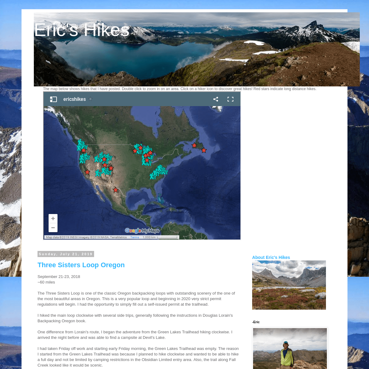
The map below shows hikes that I have posted. Double click to zoom in on an area. Click on a hiker icon to discover great hikes! Red stars indicate long distance hikes. SUNDAY, JULY 21, 2019 THREE SISTERS LOOP OREGON September 21-23, 2018~60 miles
The Three Sisters Loop is one of the classic Oregon backpacking loops with outstanding scenery of the one of the most beautiful areas in Oregon. This is a very popular loop and beginning in 2020 very strict permit regulations will begin. I had the opportunity to simply fill out a self-issued permit at the trailhead. I hiked the main loop clockwise with several side trips, generally following the instructions in Douglas Lorain's Backpacking Oregonbook.
One difference from Lorain's route, I began the adventure from the Green Lakes Trailhead hiking clockwise. I arrived the night before and was able to find a campsite at Devil's Lake. I had taken Friday off work and starting early Friday morning, the Green Lakes Trailhead was empty. The reason I started from the Green Lakes Trailhead was because I planned to hike clockwise and wanted to be able to hike a full day and not be limited by camping restrictions in the Obsidian Limited entry area. Also, the trail along Fall Creek looked like it would be scenic. The Fall Creek Trail quickly entered the Three Sisters Wildernessarea.
There were several beautiful waterfalls along the trail. After a gradual climb, I reached a trail junction and turned toward Moraine Lake. The scenery was unusual. Moraine Lake and South Sister There is a trail from Moraine Lake to the top of South Sister, but I didn't have time to summit. I made my way over toward the PCT and the trail was wide and easyhiking.
I made it to the Pacific Crest Trail, one of the most spectacular trails in the world. I saw a couple other hikers but the trail didn't seem all that busy. I could see both Middle Sister and South Sister. There was another "family member" nearby but I don't remember whichone it is.
Middle Sister
I stopped to get some water at a small pond with a great view of SouthSister.
I detoured off the PCT to Linton Meadows, Husband Lake, and EileenLake.
The trail went through some nice meadows.Husband Lake
Husband Lake and South Sister Middle and South Sister from Eileen LakeSouth Sister
There were some fall colors in the bushes along the trail. Back on the PCT there was great open hiking with a view of MiddleSister.
There was a distant view to the west. After a long day, I reached the Obsidian Limited entry area boundary. There was lots of interesting, shiny obsidian beside the trail. Camping isn't allowed in the Obsidian area without a permit so prior to entering the area, I went to the west of the trail and found a beautiful camp site. There was an outstanding view to the north. I think the pointy mountain is Three-Fingered Jack. North and Middle Sister The sun began to shine under the clouds. It was a nice sunset. The moon began to rise over South Sister as I went to sleep. I awoke the next morning to cloudy skies and the first rain I had experienced in Oregon since I arrived in early August. Within a short distance I reached Obsidian Falls. Then I hiked through the wind and fog. The terrain was very unique in this area.Opie Dilldock Pass
South Matthieu Lake
I turned south and began the eastern side of the loop. Much of this portion of the loop has been burned by forest fire. The rain stopped and the sun came out partly.North Sister
I enjoyed distant views to the east.North Sister
I decided I had time to go five miles up to Camp Lake to spend thenight.
It was cloudy and I wasn't sure what all the mountains I was seeingwere.
The Three Sisters were in the clouds. I made it to Camp Lake and there were several other groups camped nearby. It was windy and I looked for a sheltered place to camp. The trail wasn't maintained but kept going up to a pass between South and Middle Sister I believe. I didn't go any further.Camp Lake
Camp Lake
I found a somewhat shelter spot on Northwestern ridge above the lake. I awoke in the night and discovered by moonlight, that the South Sister was towering over the lake. In the morning there was great morning light on the mountains.South Sister
Camp Lake and South Sister South Sister, Camp Lake, and Middle Sister Camp Lake, Middle Sister, and North Sister I packed up camp and started the journey back to my car. There was frost on the ground. There were great mountain views as I descended.Broken Top Mountain
Soon I was back on the main loop. Squaw Creek (I believe) Much of the hiking in this section was in the forest, but I came to asmall pond.
Park Meadow offered nice views of Broken Top. I could see distant mountains, maybe Mount Washington and Jefferson. I reached a pass above Green Lakes.Broken Top
South Sister
Green Lakes
The water was so clear! South Sister from Green Lakes There were nice reflections. Soon I was back on the Fall Creek Trail and the loop was almostcomplete.
I made it back to find the parking lot completely full and many cars parked out on the road, quite the contrast to when I had left my carparked by itself.
Overall, this was a wonderful loop for my first backpacking adventure in Oregon. I really enjoyed seeing the Three Sisters from different perspectives as I hiked around them. The trails didn't seem overly crowded except for at Green Lakes and Fall Creek when I was leaving. I think starting Friday morning helped significantly. The hiking is fairly easy. Some of the trail on the eastern side is sandy and not as scenic due to recent forest fires.Posted by Eric
at 1:46 PM
No comments:
Email This
BlogThis!
Share
to Twitter
Share
to Facebook
Share
to Pinterest
Older Posts
Home
Subscribe to: Posts (Atom)ABOUT ME
* Eric I've
been born and raised in the great state of Michigan. I recently graduated from physical therapy school. I enjoy being active, playing sports, and running. Backpacking has become a great interest as it is a physical challenge that provides many rewarding views and experiences. I strive to make a difference in the lives of those encounter in every day life, on the trail, or even just on this blog. May God bless each of you. Now go find an adventure! It's only a fewfeet away!
View my complete profileABOUT ERIC'S HIKES
-ERIC
PAGES
* Newfoundland 2016
* Wind River High Route 2015 * North Country National Scenic Trail * North Country Trail/Lake Superior Adventure 2014 * Big Bend National Park 2013 * Colorado Trail Adventure 2013 * Wonderland Trail 2012 * John Muir Trail: 2011* Short Adventures
* Trip Planning: Best routes * Uinta Highline Trail 2017 FREE BIBLE STUDY SERIESGLOW
BLOG ARCHIVE
* ▼ 2019 (6)
* ▼ July (2)
* Three Sisters Loop Oregon * Crater Lake National Park Day Hikes* ► April (4)
* ► 2018 (7)
* ► July (3)
* ► May (1)
* ► January (3)* ► 2017 (10)
* ► October (1) * ► September (9)* ► 2016 (50)
* ► November (4) * ► October (15) * ► September (6)* ► August (4)
* ► July (3)
* ► June (2)
* ► May (3)
* ► April (4)
* ► March (4)
* ► January (5)* ► 2015 (27)
* ► October (2) * ► September (8)* ► August (5)
* ► July (5)
* ► June (3)
* ► January (4)* ► 2014 (30)
* ► November (2) * ► October (12)* ► August (4)
* ► February (1) * ► January (11)* ► 2013 (51)
* ► December (12) * ► November (11)* ► August (7)
* ► March (21)
Simple theme. Powered by Blogger .Details
5