6
More Annotations


5


6
Favourite Annotations


6


2
Text
HOME | TRAJECTORY
MAGAZINEABOUTCONTACTSUBSCRIBEKEYNOTESCIVILAPPLICATIONS Commercial GEOINT continues to make impressive strides, propelled by myriad factors: market competition, agile development processes, and unprecedented technological advances. Better planned, more informed operations with satellite derived bathymetry. Trajectory_TCarta_2021.mp4 from TCarta on Vimeo. ADVANCES IN 3D/4D VISUALIZATION As new technology becomes more readily integrated, available, and easy-to-use, Lavier stated anyone can do the “heavy-lifting” associated with geospatial data and applications. What’s so special about 3D and 4D visualization, however, is the restructuring of the analytic cycle. Chris Andrews, Group Product Manager at Esri, comparedit to
ADVANCED ANALYTICS AND MODELING Advanced analytics and modeling enable the discovery, assessment, understanding, measurement, enrichment, and use of geospatial data from around the world. The analytical capabilities of today’s global GEOINT enterprise continue to build a rich foundation of unstructured and structured information in multiple dimensions and formats.DISPOSABLE DRONES
Disposable Drones. Delivering supplies to military troops in remote combat settings is logistically challenging and often dangerous. Airdrops by plane or helicopter are disruptive and anti-aircraft weaponry can put human lives at risk. Additionally, most unmanned aerial vehicles (UAVs) are heavy, expensive, and not always precise. THE END OF NGA BUILDING 213 The End of NGA Building 213. The U.S. Navy constructed Building 213 in 1944 to store steel blanks for guns. At the time, no one could have foreseen that the building, on the corner of First and M streets at the Navy Yard in Southeast Washington, D.C., would become home to the CIA’s National Photographic Interpretation Center (NPIC). THE STATE AND FUTURE OF AI-ENABLED GEOINT LEARNINGSEE MORE ON TRAJECTORYMAGAZINE.COM TIME-DOMINANT FUSION IN A COMPLEX WORLD Time-dominant fusion is an evolutionary step that can dramatically increase the value of every ISR sortie by relying on fusion activities to adjust missions dynamically, adapting in real time and shortening decision cycles rather than adhering to rigid practices that are HUMAN-ON-THE-LOOP: GEOSPATIAL INTELLIGENCE IN THE AGE OF Future of GEOINT. As the GEOINT community moves toward “the age of automation,” an automated “human-on-the-loop” hybrid system is the preferred future of the GEOINT enterprise. Humans have always been the key to our success in providing actionable GEOINT to the warfighter and our national policy-makers. SYNTHESIZING INTELLIGENCE Synthesizing Intelligence. When asked what he had learned about the changing geospatial analytical landscape, Patrick Biltgen, technical director for analytics at Vencore, challenged the question. It lacks context, he said. “We talk a lot about intelligence analysis,” Biltgen said Sunday during a panel at GEOINT Foreword in which AN INTERVIEW WITH JEFF 'SKUNK' BAXTER An Interview with Jeff ‘Skunk’ Baxter. Many often wonder how Jeff “Skunk” Baxter, famed lead guitarist for the Doobie Brothers and Steely Dan, came to be a well-known figure in the Intelligence Community. Following a meeting with the USGIF Young Professionals Group at GEOINT 2012 in October, Baxter took the time to sit down withHOME | TRAJECTORY
MAGAZINEABOUTCONTACTSUBSCRIBEKEYNOTESCIVILAPPLICATIONS Commercial GEOINT continues to make impressive strides, propelled by myriad factors: market competition, agile development processes, and unprecedented technological advances. Better planned, more informed operations with satellite derived bathymetry. Trajectory_TCarta_2021.mp4 from TCarta on Vimeo. ADVANCES IN 3D/4D VISUALIZATION As new technology becomes more readily integrated, available, and easy-to-use, Lavier stated anyone can do the “heavy-lifting” associated with geospatial data and applications. What’s so special about 3D and 4D visualization, however, is the restructuring of the analytic cycle. Chris Andrews, Group Product Manager at Esri, comparedit to
ADVANCED ANALYTICS AND MODELING Advanced analytics and modeling enable the discovery, assessment, understanding, measurement, enrichment, and use of geospatial data from around the world. The analytical capabilities of today’s global GEOINT enterprise continue to build a rich foundation of unstructured and structured information in multiple dimensions and formats.DISPOSABLE DRONES
Disposable Drones. Delivering supplies to military troops in remote combat settings is logistically challenging and often dangerous. Airdrops by plane or helicopter are disruptive and anti-aircraft weaponry can put human lives at risk. Additionally, most unmanned aerial vehicles (UAVs) are heavy, expensive, and not always precise. THE END OF NGA BUILDING 213 The End of NGA Building 213. The U.S. Navy constructed Building 213 in 1944 to store steel blanks for guns. At the time, no one could have foreseen that the building, on the corner of First and M streets at the Navy Yard in Southeast Washington, D.C., would become home to the CIA’s National Photographic Interpretation Center (NPIC). THE STATE AND FUTURE OF AI-ENABLED GEOINT LEARNINGSEE MORE ON TRAJECTORYMAGAZINE.COM TIME-DOMINANT FUSION IN A COMPLEX WORLD Time-dominant fusion is an evolutionary step that can dramatically increase the value of every ISR sortie by relying on fusion activities to adjust missions dynamically, adapting in real time and shortening decision cycles rather than adhering to rigid practices that are HUMAN-ON-THE-LOOP: GEOSPATIAL INTELLIGENCE IN THE AGE OF Future of GEOINT. As the GEOINT community moves toward “the age of automation,” an automated “human-on-the-loop” hybrid system is the preferred future of the GEOINT enterprise. Humans have always been the key to our success in providing actionable GEOINT to the warfighter and our national policy-makers. SYNTHESIZING INTELLIGENCE Synthesizing Intelligence. When asked what he had learned about the changing geospatial analytical landscape, Patrick Biltgen, technical director for analytics at Vencore, challenged the question. It lacks context, he said. “We talk a lot about intelligence analysis,” Biltgen said Sunday during a panel at GEOINT Foreword in which AN INTERVIEW WITH JEFF 'SKUNK' BAXTER An Interview with Jeff ‘Skunk’ Baxter. Many often wonder how Jeff “Skunk” Baxter, famed lead guitarist for the Doobie Brothers and Steely Dan, came to be a well-known figure in the Intelligence Community. Following a meeting with the USGIF Young Professionals Group at GEOINT 2012 in October, Baxter took the time to sit down withDISPOSABLE DRONES
Disposable Drones. Delivering supplies to military troops in remote combat settings is logistically challenging and often dangerous. Airdrops by plane or helicopter are disruptive and anti-aircraft weaponry can put human lives at risk. Additionally, most unmanned aerial vehicles (UAVs) are heavy, expensive, and not always precise. WEEKLY GEOINT COMMUNITY NEWS Trajectory is the official publication of the United States Geospatial Intelligence Foundation (USGIF) – the nonprofit, educational organization supporting. STATE AND FUTURE OF GEOINT REPORT USGIF’s 2020 State and Future of GEOINT Report presents forward-looking trends in the GEOINT Community. Through the lens of people, process, technology, and data, the report offers insights about the state and potential of our community and its tradecraft. This year’s report demonstrates the power of collaboration acrossacademia, industry
HUMAN-ON-THE-LOOP: GEOSPATIAL INTELLIGENCE IN THE AGE OF Future of GEOINT. As the GEOINT community moves toward “the age of automation,” an automated “human-on-the-loop” hybrid system is the preferred future of the GEOINT enterprise. Humans have always been the key to our success in providing actionable GEOINT to the warfighter and our national policy-makers.EYES WIDE OPEN
Eyes Wide Open. Every fifth grader knows Earth has seven continents and five oceans. Some 270 million years ago, however, there was just one of each. According to the “continental drift theory,” during the Paleozoic era the planet comprised a single supercontinent, Pangaea, surrounded by a single superocean: Panthalassa. THE CHANGING NATURE OF GIS The Changing Nature of GIS. The notion of the geographic information systems ( GIS) profession is becoming increasingly hard to pin down to one point on a map. From one direction, a flood of geospatial data has stressed the abilities of traditional GIS suites to process information and respond to queries. From another, the rise ofopen-source
ACTIVATING ARTIFICIAL INTELLIGENCE Activating Artificial Intelligence. At last year’s GEOINT Symposium, National Geospatial-Intelligence Agency (NGA) Director Robert Cardillo said his agency was drowning in a “data deluge.”. “We’re in a world that has moved from data scarcity to data abundance, from hunting for that one perfect image to creating coherence from a CUBESATS AND UNIVERSITIES CubeSats and Universities. When the National Science Foundation (NSF) first launched its CubeSat program in 2007, it received 27 proposals, including those from prior skeptics who said they could never scale their payload to be small enough to fly on a CubeSat. “They were some of the first to try,” said Therese Jorgensen, program director THE PAST, PRESENT, AND FUTURE OF GEOSPATIAL DATA USE The Past, Present, and Future of Geospatial Data Use. Over the past quarter century, information in the form of digital data has become the foundation on which governments, industries, and organizations base many of their decisions. In our modern world, there exists a deluge of data that grows exponentially each day. HOW MARITIME GEOSPATIAL ANALYSIS HELPS IDENTIFY ASYMMETRIC Geospatial analytics help identify asymmetric threats by leveraging artificial intelligence (AI) and near real-time data analysis. This article is part of USGIF’s 2019 State & Future of GEOINT Report. Download the PDF to view the report in its entirety.HOME | TRAJECTORY
MAGAZINEABOUTCONTACTSUBSCRIBEKEYNOTESCIVILAPPLICATIONS Commercial GEOINT continues to make impressive strides, propelled by myriad factors: market competition, agile development processes, and unprecedented technological advances. Better planned, more informed operations with satellite derived bathymetry. Trajectory_TCarta_2021.mp4 from TCarta on Vimeo. ADVANCES IN 3D/4D VISUALIZATION As new technology becomes more readily integrated, available, and easy-to-use, Lavier stated anyone can do the “heavy-lifting” associated with geospatial data and applications. What’s so special about 3D and 4D visualization, however, is the restructuring of the analytic cycle. Chris Andrews, Group Product Manager at Esri, comparedit to
ADVANCED ANALYTICS AND MODELING Advanced analytics and modeling enable the discovery, assessment, understanding, measurement, enrichment, and use of geospatial data from around the world. The analytical capabilities of today’s global GEOINT enterprise continue to build a rich foundation of unstructured and structured information in multiple dimensions and formats.DISPOSABLE DRONES
Disposable Drones. Delivering supplies to military troops in remote combat settings is logistically challenging and often dangerous. Airdrops by plane or helicopter are disruptive and anti-aircraft weaponry can put human lives at risk. Additionally, most unmanned aerial vehicles (UAVs) are heavy, expensive, and not always precise. THE END OF NGA BUILDING 213 The End of NGA Building 213. The U.S. Navy constructed Building 213 in 1944 to store steel blanks for guns. At the time, no one could have foreseen that the building, on the corner of First and M streets at the Navy Yard in Southeast Washington, D.C., would become home to the CIA’s National Photographic Interpretation Center (NPIC). THE STATE AND FUTURE OF AI-ENABLED GEOINT LEARNINGSEE MORE ON TRAJECTORYMAGAZINE.COM TIME-DOMINANT FUSION IN A COMPLEX WORLD Time-dominant fusion is an evolutionary step that can dramatically increase the value of every ISR sortie by relying on fusion activities to adjust missions dynamically, adapting in real time and shortening decision cycles rather than adhering to rigid practices that are HUMAN-ON-THE-LOOP: GEOSPATIAL INTELLIGENCE IN THE AGE OF Future of GEOINT. As the GEOINT community moves toward “the age of automation,” an automated “human-on-the-loop” hybrid system is the preferred future of the GEOINT enterprise. Humans have always been the key to our success in providing actionable GEOINT to the warfighter and our national policy-makers. SYNTHESIZING INTELLIGENCE Synthesizing Intelligence. When asked what he had learned about the changing geospatial analytical landscape, Patrick Biltgen, technical director for analytics at Vencore, challenged the question. It lacks context, he said. “We talk a lot about intelligence analysis,” Biltgen said Sunday during a panel at GEOINT Foreword in which AN INTERVIEW WITH JEFF 'SKUNK' BAXTER An Interview with Jeff ‘Skunk’ Baxter. Many often wonder how Jeff “Skunk” Baxter, famed lead guitarist for the Doobie Brothers and Steely Dan, came to be a well-known figure in the Intelligence Community. Following a meeting with the USGIF Young Professionals Group at GEOINT 2012 in October, Baxter took the time to sit down withHOME | TRAJECTORY
MAGAZINEABOUTCONTACTSUBSCRIBEKEYNOTESCIVILAPPLICATIONS Commercial GEOINT continues to make impressive strides, propelled by myriad factors: market competition, agile development processes, and unprecedented technological advances. Better planned, more informed operations with satellite derived bathymetry. Trajectory_TCarta_2021.mp4 from TCarta on Vimeo. ADVANCES IN 3D/4D VISUALIZATION As new technology becomes more readily integrated, available, and easy-to-use, Lavier stated anyone can do the “heavy-lifting” associated with geospatial data and applications. What’s so special about 3D and 4D visualization, however, is the restructuring of the analytic cycle. Chris Andrews, Group Product Manager at Esri, comparedit to
ADVANCED ANALYTICS AND MODELING Advanced analytics and modeling enable the discovery, assessment, understanding, measurement, enrichment, and use of geospatial data from around the world. The analytical capabilities of today’s global GEOINT enterprise continue to build a rich foundation of unstructured and structured information in multiple dimensions and formats.DISPOSABLE DRONES
Disposable Drones. Delivering supplies to military troops in remote combat settings is logistically challenging and often dangerous. Airdrops by plane or helicopter are disruptive and anti-aircraft weaponry can put human lives at risk. Additionally, most unmanned aerial vehicles (UAVs) are heavy, expensive, and not always precise. THE END OF NGA BUILDING 213 The End of NGA Building 213. The U.S. Navy constructed Building 213 in 1944 to store steel blanks for guns. At the time, no one could have foreseen that the building, on the corner of First and M streets at the Navy Yard in Southeast Washington, D.C., would become home to the CIA’s National Photographic Interpretation Center (NPIC). THE STATE AND FUTURE OF AI-ENABLED GEOINT LEARNINGSEE MORE ON TRAJECTORYMAGAZINE.COM TIME-DOMINANT FUSION IN A COMPLEX WORLD Time-dominant fusion is an evolutionary step that can dramatically increase the value of every ISR sortie by relying on fusion activities to adjust missions dynamically, adapting in real time and shortening decision cycles rather than adhering to rigid practices that are HUMAN-ON-THE-LOOP: GEOSPATIAL INTELLIGENCE IN THE AGE OF Future of GEOINT. As the GEOINT community moves toward “the age of automation,” an automated “human-on-the-loop” hybrid system is the preferred future of the GEOINT enterprise. Humans have always been the key to our success in providing actionable GEOINT to the warfighter and our national policy-makers. SYNTHESIZING INTELLIGENCE Synthesizing Intelligence. When asked what he had learned about the changing geospatial analytical landscape, Patrick Biltgen, technical director for analytics at Vencore, challenged the question. It lacks context, he said. “We talk a lot about intelligence analysis,” Biltgen said Sunday during a panel at GEOINT Foreword in which AN INTERVIEW WITH JEFF 'SKUNK' BAXTER An Interview with Jeff ‘Skunk’ Baxter. Many often wonder how Jeff “Skunk” Baxter, famed lead guitarist for the Doobie Brothers and Steely Dan, came to be a well-known figure in the Intelligence Community. Following a meeting with the USGIF Young Professionals Group at GEOINT 2012 in October, Baxter took the time to sit down withDISPOSABLE DRONES
Disposable Drones. Delivering supplies to military troops in remote combat settings is logistically challenging and often dangerous. Airdrops by plane or helicopter are disruptive and anti-aircraft weaponry can put human lives at risk. Additionally, most unmanned aerial vehicles (UAVs) are heavy, expensive, and not always precise. WEEKLY GEOINT COMMUNITY NEWS Trajectory is the official publication of the United States Geospatial Intelligence Foundation (USGIF) – the nonprofit, educational organization supporting. STATE AND FUTURE OF GEOINT REPORT USGIF’s 2020 State and Future of GEOINT Report presents forward-looking trends in the GEOINT Community. Through the lens of people, process, technology, and data, the report offers insights about the state and potential of our community and its tradecraft. This year’s report demonstrates the power of collaboration acrossacademia, industry
HUMAN-ON-THE-LOOP: GEOSPATIAL INTELLIGENCE IN THE AGE OF Future of GEOINT. As the GEOINT community moves toward “the age of automation,” an automated “human-on-the-loop” hybrid system is the preferred future of the GEOINT enterprise. Humans have always been the key to our success in providing actionable GEOINT to the warfighter and our national policy-makers.EYES WIDE OPEN
Eyes Wide Open. Every fifth grader knows Earth has seven continents and five oceans. Some 270 million years ago, however, there was just one of each. According to the “continental drift theory,” during the Paleozoic era the planet comprised a single supercontinent, Pangaea, surrounded by a single superocean: Panthalassa. THE CHANGING NATURE OF GIS The Changing Nature of GIS. The notion of the geographic information systems ( GIS) profession is becoming increasingly hard to pin down to one point on a map. From one direction, a flood of geospatial data has stressed the abilities of traditional GIS suites to process information and respond to queries. From another, the rise ofopen-source
ACTIVATING ARTIFICIAL INTELLIGENCE Activating Artificial Intelligence. At last year’s GEOINT Symposium, National Geospatial-Intelligence Agency (NGA) Director Robert Cardillo said his agency was drowning in a “data deluge.”. “We’re in a world that has moved from data scarcity to data abundance, from hunting for that one perfect image to creating coherence from a CUBESATS AND UNIVERSITIES CubeSats and Universities. When the National Science Foundation (NSF) first launched its CubeSat program in 2007, it received 27 proposals, including those from prior skeptics who said they could never scale their payload to be small enough to fly on a CubeSat. “They were some of the first to try,” said Therese Jorgensen, program director THE PAST, PRESENT, AND FUTURE OF GEOSPATIAL DATA USE The Past, Present, and Future of Geospatial Data Use. Over the past quarter century, information in the form of digital data has become the foundation on which governments, industries, and organizations base many of their decisions. In our modern world, there exists a deluge of data that grows exponentially each day. HOW MARITIME GEOSPATIAL ANALYSIS HELPS IDENTIFY ASYMMETRIC Geospatial analytics help identify asymmetric threats by leveraging artificial intelligence (AI) and near real-time data analysis. This article is part of USGIF’s 2019 State & Future of GEOINT Report. Download the PDF to view the report in its entirety.HOME | TRAJECTORY
MAGAZINEABOUTCONTACTSUBSCRIBEKEYNOTESCIVILAPPLICATIONS Commercial GEOINT continues to make impressive strides, propelled by myriad factors: market competition, agile development processes, and unprecedented technological advances. Better planned, more informed operations with satellite derived bathymetry. Trajectory_TCarta_2021.mp4 from TCarta on Vimeo. ADVANCED ANALYTICS AND MODELING Advanced analytics and modeling enable the discovery, assessment, understanding, measurement, enrichment, and use of geospatial data from around the world. The analytical capabilities of today’s global GEOINT enterprise continue to build a rich foundation of unstructured and structured information in multiple dimensions and formats.DISPOSABLE DRONES
Disposable Drones. Delivering supplies to military troops in remote combat settings is logistically challenging and often dangerous. Airdrops by plane or helicopter are disruptive and anti-aircraft weaponry can put human lives at risk. Additionally, most unmanned aerial vehicles (UAVs) are heavy, expensive, and not always precise. SYNTHESIZING INTELLIGENCE Synthesizing Intelligence. When asked what he had learned about the changing geospatial analytical landscape, Patrick Biltgen, technical director for analytics at Vencore, challenged the question. It lacks context, he said. “We talk a lot about intelligence analysis,” Biltgen said Sunday during a panel at GEOINT Foreword in which TIME-DOMINANT FUSION IN A COMPLEX WORLD Time-dominant fusion is an evolutionary step that can dramatically increase the value of every ISR sortie by relying on fusion activities to adjust missions dynamically, adapting in real time and shortening decision cycles rather than adhering to rigid practices that are THE END OF NGA BUILDING 213 The End of NGA Building 213. The U.S. Navy constructed Building 213 in 1944 to store steel blanks for guns. At the time, no one could have foreseen that the building, on the corner of First and M streets at the Navy Yard in Southeast Washington, D.C., would become home to the CIA’s National Photographic Interpretation Center (NPIC). THE STATE AND FUTURE OF AI-ENABLED GEOINT LEARNINGSEE MORE ON TRAJECTORYMAGAZINE.COM WEEKLY GEOINT COMMUNITY NEWS HERE Technologies announced the launch of HERE Tracking, a cloud platform for real-time tracking of goods, devices, and people. The service is built on the HERE Open Location Platform and includes industry-grade maps with geo-coding capabilities, accurate offline positioning technology, and tracking, geo-fencing, and analytics APIs. HUMAN-ON-THE-LOOP: GEOSPATIAL INTELLIGENCE IN THE AGE OF Future of GEOINT. As the GEOINT community moves toward “the age of automation,” an automated “human-on-the-loop” hybrid system is the preferred future of the GEOINT enterprise. Humans have always been the key to our success in providing actionable GEOINT to the warfighter and our national policy-makers. SAR PRESENTS OPPORTUNITIES, CHALLENGES FOR GEOINT SAR Presents Opportunities, Challenges for GEOINT. One of the richest yet most under-utilized sources of geospatial intelligence (GEOINT) is about to become more widely available. Earlier this year, ICEYE launched the first microsatellite carrying a synthetic aperture radar (SAR) sensor. The Finnish company expects to have a constellation of18
HOME | TRAJECTORY
MAGAZINEABOUTCONTACTSUBSCRIBEKEYNOTESCIVILAPPLICATIONS Commercial GEOINT continues to make impressive strides, propelled by myriad factors: market competition, agile development processes, and unprecedented technological advances. Better planned, more informed operations with satellite derived bathymetry. Trajectory_TCarta_2021.mp4 from TCarta on Vimeo. ADVANCED ANALYTICS AND MODELING Advanced analytics and modeling enable the discovery, assessment, understanding, measurement, enrichment, and use of geospatial data from around the world. The analytical capabilities of today’s global GEOINT enterprise continue to build a rich foundation of unstructured and structured information in multiple dimensions and formats.DISPOSABLE DRONES
Disposable Drones. Delivering supplies to military troops in remote combat settings is logistically challenging and often dangerous. Airdrops by plane or helicopter are disruptive and anti-aircraft weaponry can put human lives at risk. Additionally, most unmanned aerial vehicles (UAVs) are heavy, expensive, and not always precise. SYNTHESIZING INTELLIGENCE Synthesizing Intelligence. When asked what he had learned about the changing geospatial analytical landscape, Patrick Biltgen, technical director for analytics at Vencore, challenged the question. It lacks context, he said. “We talk a lot about intelligence analysis,” Biltgen said Sunday during a panel at GEOINT Foreword in which TIME-DOMINANT FUSION IN A COMPLEX WORLD Time-dominant fusion is an evolutionary step that can dramatically increase the value of every ISR sortie by relying on fusion activities to adjust missions dynamically, adapting in real time and shortening decision cycles rather than adhering to rigid practices that are THE END OF NGA BUILDING 213 The End of NGA Building 213. The U.S. Navy constructed Building 213 in 1944 to store steel blanks for guns. At the time, no one could have foreseen that the building, on the corner of First and M streets at the Navy Yard in Southeast Washington, D.C., would become home to the CIA’s National Photographic Interpretation Center (NPIC). THE STATE AND FUTURE OF AI-ENABLED GEOINT LEARNINGSEE MORE ON TRAJECTORYMAGAZINE.COM WEEKLY GEOINT COMMUNITY NEWS HERE Technologies announced the launch of HERE Tracking, a cloud platform for real-time tracking of goods, devices, and people. The service is built on the HERE Open Location Platform and includes industry-grade maps with geo-coding capabilities, accurate offline positioning technology, and tracking, geo-fencing, and analytics APIs. HUMAN-ON-THE-LOOP: GEOSPATIAL INTELLIGENCE IN THE AGE OF Future of GEOINT. As the GEOINT community moves toward “the age of automation,” an automated “human-on-the-loop” hybrid system is the preferred future of the GEOINT enterprise. Humans have always been the key to our success in providing actionable GEOINT to the warfighter and our national policy-makers. SAR PRESENTS OPPORTUNITIES, CHALLENGES FOR GEOINT SAR Presents Opportunities, Challenges for GEOINT. One of the richest yet most under-utilized sources of geospatial intelligence (GEOINT) is about to become more widely available. Earlier this year, ICEYE launched the first microsatellite carrying a synthetic aperture radar (SAR) sensor. The Finnish company expects to have a constellation of18
WEEKLY GEOINT COMMUNITY NEWS Trajectory is the official publication of the United States Geospatial Intelligence Foundation (USGIF) – the nonprofit, educational organization supporting. JOURNAL OF GEOSPATIAL INTELLIGENCE Trajectory is the official publication of the United States Geospatial Intelligence Foundation (USGIF) – the nonprofit, educational organization supporting. THE CHANGING NATURE OF GIS The Changing Nature of GIS. The notion of the geographic information systems ( GIS) profession is becoming increasingly hard to pin down to one point on a map. From one direction, a flood of geospatial data has stressed the abilities of traditional GIS suites to process information and respond to queries. From another, the rise ofopen-source
VISUALIZING VESSELS
Visualizing Vessels. The ship moved slowly away from its berth and headed for the channel at the Port of Long Beach as dozens of vessels do every day. Suddenly the ship turned hard to port toward an anchored tanker and stopped only after a collision that punctured the outer skin of the double-hulled ship. Meanwhile on shore, Randy Parsons HUMAN-ON-THE-LOOP: GEOSPATIAL INTELLIGENCE IN THE AGE OF Future of GEOINT. As the GEOINT community moves toward “the age of automation,” an automated “human-on-the-loop” hybrid system is the preferred future of the GEOINT enterprise. Humans have always been the key to our success in providing actionable GEOINT to the warfighter and our national policy-makers. STATE AND FUTURE OF GEOINT REPORT USGIF’s 2020 State and Future of GEOINT Report presents forward-looking trends in the GEOINT Community. Through the lens of people, process, technology, and data, the report offers insights about the state and potential of our community and its tradecraft. This year’s report demonstrates the power of collaboration acrossacademia, industry
NEXT-GENERATION GEOINT SYSTEMS—INFLUENCES AND NEEDS From a data storage and management perspective, there are three potential solutions: Heavy processing at or near the sensor to minimize comms. Integration across data centers of convenience (inter-cloud). Centralization into common data stores. The first option, processing at or near the sensor, is always a good idea and isnearly always
KNOWING YOUR OPPONENT AND KNOWING YOURSELF This article speaks to the necessity of a comparative view of yourself and an opponent in GEOINT. We illustrate the need for a comparative approach in education by examining GEOINT in the United States and the Russian Federation (RU). Our example is to illustrate that reliable GEOINT demands knowing both your opponent and yourself. GEOSPATIAL INTELLIGENCE REVOLUTION IN INSURANCE AND RISK The Louisiana School Board is an early adopter of parametric insurance. Under the basic terms of their coverage through SwissRe, the Louisiana School Board receives an automatic payout of up to $1.25 million if a named storm produces sustained winds of 80 miles per hour for at least a minute without any strings attached, like those associated with federal disaster aid. AN INTERVIEW WITH JEFF 'SKUNK' BAXTER An Interview with Jeff ‘Skunk’ Baxter. Many often wonder how Jeff “Skunk” Baxter, famed lead guitarist for the Doobie Brothers and Steely Dan, came to be a well-known figure in the Intelligence Community. Following a meeting with the USGIF Young Professionals Group at GEOINT 2012 in October, Baxter took the time to sit down withHOME | TRAJECTORY
MAGAZINEABOUTCONTACTSUBSCRIBEKEYNOTESCIVILAPPLICATIONS Commercial GEOINT continues to make impressive strides, propelled by myriad factors: market competition, agile development processes, and unprecedented technological advances. Better planned, more informed operations with satellite derived bathymetry. Trajectory_TCarta_2021.mp4 from TCarta on Vimeo.ABOUT TRAJECTORY
Brad Causey Editor, GLC. As an editor for trajectory, Brad manages magazine and website production and oversees the talented group of contributing writers.He is a managing editor for GLC, the marketing communications agency USGIF has partnered with to produce trajectory.He has a master’s degree in journalism and mass communications from the University of Iowa. ADVANCED ANALYTICS AND MODELING Advanced analytics and modeling enable the discovery, assessment, understanding, measurement, enrichment, and use of geospatial data from around the world. The analytical capabilities of today’s global GEOINT enterprise continue to build a rich foundation of unstructured and structured information in multiple dimensions and formats.VISUALIZING VESSELS
Visualizing Vessels. The ship moved slowly away from its berth and headed for the channel at the Port of Long Beach as dozens of vessels do every day. Suddenly the ship turned hard to port toward an anchored tanker and stopped only after a collision that punctured the outer skin of the double-hulled ship. Meanwhile on shore, Randy Parsons THE END OF NGA BUILDING 213 The End of NGA Building 213. The U.S. Navy constructed Building 213 in 1944 to store steel blanks for guns. At the time, no one could have foreseen that the building, on the corner of First and M streets at the Navy Yard in Southeast Washington, D.C., would become home to the CIA’s National Photographic Interpretation Center (NPIC). SYNTHESIZING INTELLIGENCE Synthesizing Intelligence. When asked what he had learned about the changing geospatial analytical landscape, Patrick Biltgen, technical director for analytics at Vencore, challenged the question. It lacks context, he said. “We talk a lot about intelligence analysis,” Biltgen said Sunday during a panel at GEOINT Foreword in which TIME-DOMINANT FUSION IN A COMPLEX WORLD Time-dominant fusion is an evolutionary step that can dramatically increase the value of every ISR sortie by relying on fusion activities to adjust missions dynamically, adapting in real time and shortening decision cycles rather than adhering to rigid practices that are WEEKLY GEOINT COMMUNITY NEWS HERE Technologies announced the launch of HERE Tracking, a cloud platform for real-time tracking of goods, devices, and people. The service is built on the HERE Open Location Platform and includes industry-grade maps with geo-coding capabilities, accurate offline positioning technology, and tracking, geo-fencing, and analytics APIs. CREATING SHARED CONSCIOUSNESS Creating Shared Consciousness. While writing his memoir, My Share of the Task, Gen. Stanley McChrystal realized the most interesting part of the story was the transformation of Joint Special Operations Command (JSOC) during the war in Iraq. “We fundamentally changed the way we operated and the culture of the organization,” McChrystalsaid.
AN INTERVIEW WITH JEFF 'SKUNK' BAXTER An Interview with Jeff ‘Skunk’ Baxter. Many often wonder how Jeff “Skunk” Baxter, famed lead guitarist for the Doobie Brothers and Steely Dan, came to be a well-known figure in the Intelligence Community. Following a meeting with the USGIF Young Professionals Group at GEOINT 2012 in October, Baxter took the time to sit down withHOME | TRAJECTORY
MAGAZINEABOUTCONTACTSUBSCRIBEKEYNOTESCIVILAPPLICATIONS Commercial GEOINT continues to make impressive strides, propelled by myriad factors: market competition, agile development processes, and unprecedented technological advances. Better planned, more informed operations with satellite derived bathymetry. Trajectory_TCarta_2021.mp4 from TCarta on Vimeo.ABOUT TRAJECTORY
Brad Causey Editor, GLC. As an editor for trajectory, Brad manages magazine and website production and oversees the talented group of contributing writers.He is a managing editor for GLC, the marketing communications agency USGIF has partnered with to produce trajectory.He has a master’s degree in journalism and mass communications from the University of Iowa. ADVANCED ANALYTICS AND MODELING Advanced analytics and modeling enable the discovery, assessment, understanding, measurement, enrichment, and use of geospatial data from around the world. The analytical capabilities of today’s global GEOINT enterprise continue to build a rich foundation of unstructured and structured information in multiple dimensions and formats.VISUALIZING VESSELS
Visualizing Vessels. The ship moved slowly away from its berth and headed for the channel at the Port of Long Beach as dozens of vessels do every day. Suddenly the ship turned hard to port toward an anchored tanker and stopped only after a collision that punctured the outer skin of the double-hulled ship. Meanwhile on shore, Randy Parsons THE END OF NGA BUILDING 213 The End of NGA Building 213. The U.S. Navy constructed Building 213 in 1944 to store steel blanks for guns. At the time, no one could have foreseen that the building, on the corner of First and M streets at the Navy Yard in Southeast Washington, D.C., would become home to the CIA’s National Photographic Interpretation Center (NPIC). SYNTHESIZING INTELLIGENCE Synthesizing Intelligence. When asked what he had learned about the changing geospatial analytical landscape, Patrick Biltgen, technical director for analytics at Vencore, challenged the question. It lacks context, he said. “We talk a lot about intelligence analysis,” Biltgen said Sunday during a panel at GEOINT Foreword in which TIME-DOMINANT FUSION IN A COMPLEX WORLD Time-dominant fusion is an evolutionary step that can dramatically increase the value of every ISR sortie by relying on fusion activities to adjust missions dynamically, adapting in real time and shortening decision cycles rather than adhering to rigid practices that are WEEKLY GEOINT COMMUNITY NEWS HERE Technologies announced the launch of HERE Tracking, a cloud platform for real-time tracking of goods, devices, and people. The service is built on the HERE Open Location Platform and includes industry-grade maps with geo-coding capabilities, accurate offline positioning technology, and tracking, geo-fencing, and analytics APIs. CREATING SHARED CONSCIOUSNESS Creating Shared Consciousness. While writing his memoir, My Share of the Task, Gen. Stanley McChrystal realized the most interesting part of the story was the transformation of Joint Special Operations Command (JSOC) during the war in Iraq. “We fundamentally changed the way we operated and the culture of the organization,” McChrystalsaid.
AN INTERVIEW WITH JEFF 'SKUNK' BAXTER An Interview with Jeff ‘Skunk’ Baxter. Many often wonder how Jeff “Skunk” Baxter, famed lead guitarist for the Doobie Brothers and Steely Dan, came to be a well-known figure in the Intelligence Community. Following a meeting with the USGIF Young Professionals Group at GEOINT 2012 in October, Baxter took the time to sit down withABOUT TRAJECTORY
Brad Causey Editor, GLC. As an editor for trajectory, Brad manages magazine and website production and oversees the talented group of contributing writers.He is a managing editor for GLC, the marketing communications agency USGIF has partnered with to produce trajectory.He has a master’s degree in journalism and mass communications from the University of Iowa.LEADING BY EXAMPLE
Krumwiede is a remote sensing specialist and Great Lakes regional geospatial coordinator with the Baldwin Group at the National Oceanic and Atmospheric Administration’s (NOAA) Office for Coastal Management. He views coastal intelligence as a subset of GEOINT, and combines GEOINT technologies with environmental data to help decision-makers along the coast strengthen their ACTIVATING ARTIFICIAL INTELLIGENCE Activating Artificial Intelligence. At last year’s GEOINT Symposium, National Geospatial-Intelligence Agency (NGA) Director Robert Cardillo said his agency was drowning in a “data deluge.”. “We’re in a world that has moved from data scarcity to data abundance, from hunting for that one perfect image to creating coherence from a THE STATE AND FUTURE OF AI-ENABLED GEOINT LEARNING The Future of AI-enabled GEOINT Education. AI is already starting to be deployed in education and is expected to grow in the U.S. by 48% from 2018–2022. As we pointed out earlier, becoming an expert in GEOINT is exceptionally difficult and time-consuming. KNOWING YOUR OPPONENT AND KNOWING YOURSELF This article speaks to the necessity of a comparative view of yourself and an opponent in GEOINT. We illustrate the need for a comparative approach in education by examining GEOINT in the United States and the Russian Federation (RU). Our example is to illustrate that reliable GEOINT demands knowing both your opponent and yourself. THE BORDERS OF CYBERSPACE The Borders of Cyberspace. As the internet permeates more and more of everyday life and the cyber and physical worlds continue to intersect in new ways, legislators are faced with the difficult responsibility of defining law and policy within this complex domain. In 2013, a wrinkle in cyber policy appeared that the Supreme Court is still GEOSPATIAL INTELLIGENCE: THE MADE-UP TERM THAT'S CHANGING Geospatial Intelligence: The Made-Up Term That’s Changing the World. Around 2003, we in the intelligence and defense communities had a problem. Years earlier, we’d forced together remote sensing and imagery analysis with mapping and charting—two distinct disciplines and cultures—to create the imaginatively named National Imagery and THE PAST, PRESENT, AND FUTURE OF GEOSPATIAL DATA USE The Past, Present, and Future of Geospatial Data Use. Over the past quarter century, information in the form of digital data has become the foundation on which governments, industries, and organizations base many of their decisions. In our modern world, there exists a deluge of data that grows exponentially each day. GEOINT 2019 SNEAK PEEK As such, 265 NGA representatives will attend GEOINT 2019, to be held June 2-5 in San Antonio, Texas. “We are very excited about the GEOINT Symposium this year,” Caniano told the audience at USGIF’s GEOINT Symposium Sneak Peek event in McLean, Va., April 23. “This one is going to be exciting for us with a new director.”. NRO DECLARES INTENT TO PURCHASE COMMERCIAL GEOINT The National Reconnaissance Office has something it wants you to know: It does not have a hit out on commercial imagery.“I want to address that pesky little persistent rumor that keeps popping up about the NRO wanting to kill commercial GEOINT,” NRO Deputy Director of GEOINT Jimmy Comfort said Monday during a presentation on the GEOINT 2017 Government Pavilion Stage.* Home
* About
* Subscribe
* Advertise
* Membership
* Events
* Contact
* Vimeo
* RSS
__ Explore __ Close
__ Menu __ Close
Search for:
Entire Site Award Winner SpotlightsCertificationCertification Holder SpotlightsContributedEducationEvent RecapsFeaturesFrom the FloorGEOINT Certificate Holder SpotlightsGEOINT ForewordGEOINT Symposiumgot geoint?Government PavilionIndividual Member SpotlightsKeynotesMonday News KickoffsNewsOrganizational Member SpotlightsPanel DiscussionsPerspectivePodcastsProfessional ParlanceScholarship Winner SpotlightsScholarship WinnersSpecial Edition 2017Sponsored ContentSpotlightsSymposium FeaturesSymposium Top StoryTop StoryTrajectory MagUSGIF Working GroupsUSGIF-Accredited ProgramsVantage PointYoung Professional SpotlightsYoung ProfessionalsCATEGORIES
Monday News Kickoffsgot
geoint? Features
From the Floor
Contributed
Symposium
Features
Event
Recaps
Organizational
Member Spotlights
News
Keynotes
GEOINT
Foreword
USGIF-Accredited
Programs
Vantage
Point Panel
Discussions
Young
Professionals
Government
Pavilion
Education
Perspective
Scholarship
Winners
Scholarship
Winner Spotlights
TAGS
Intelligence Remote
Sensing Data
Defense & Military
Education
Machine Learning & AIInnovation
Analysis
NGA
GIS
Contracts
Research & DevelopmentApplications
Civil
Small Sats
Disaster Relief
Public Safety &
Emergency ManagementHumanitarian
Issues
Training &
Certification
Mergers &
Acquisitions
ARCHIVES
March 2020 February 2020January 2020
December 2019
November 2019
October 2019
September 2019
August 2019
July 2019
June 2019
May 2019
April 2019
* Latest
* Popular
* All Topics
* Features
* Sections
* News
* Education
* Spotlights
* Q&A Interviews
* From the CEO’s Desk * Contributed Articles* Sponsored Content
* GEOINT Symposium
* Videos
__
* Publications
* Trajectory Magazine * State and Future of GEOINT Report * GEOINT Symposium Show Daily * 2017 Special Edition: Public Safety__
* Home
* About
* Subscribe
* Advertise
* Membership
* Events
* Contact
* Vimeo
* RSS
Trajectory Magazine
We are the official publication of the United States Geospatial Intelligence Foundation (USGIF) – the nonprofit, educational organization supporting the geospatial intelligence tradecraft* Latest
* Popular
* All Topics
* Features
* Sections
* News
* Education
* Spotlights
* Q&A Interviews
* From the CEO’s Desk * Contributed Articles* Sponsored Content
* GEOINT Symposium
* Videos
* Publications
* Trajectory Magazine * State and Future of GEOINT Report * GEOINT Symposium Show Daily * 2017 Special Edition: Public Safety Featured Weekly GEOINT Community News* __ Explore
* __ Menu
* __ Menu
HOME
*
<
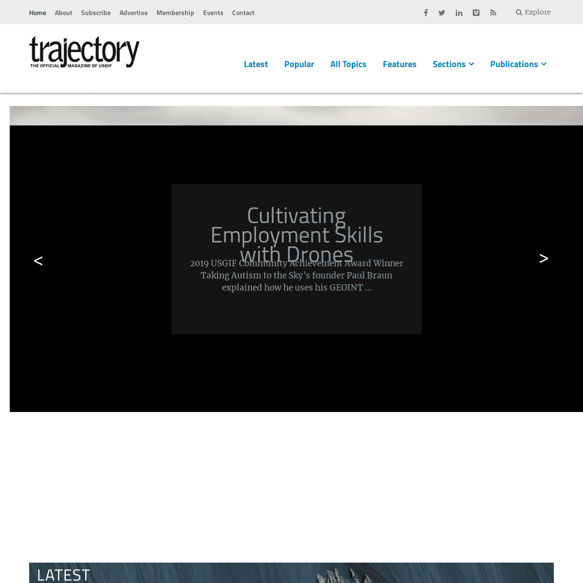
Cultivating Employment Skills with Drones 2019 USGIF Community Achievement Award Winner Taking Autism to the Sky’s founder Paul Braun explained how he uses his GEOINT …>
LATEST
Monday News Kickoffs WEEKLY GEOINT COMMUNITY NEWS Northrop Grumman Completes First Docking of Mission Extension Vehicle, Dell Technologies to Provide Industry’s Fastest Hybrid CloudDeployme…
USGIF | Mar 2, 2020
Monday News Kickoffs WEEKLY GEOINT COMMUNITY NEWS Ball Aerospace Completes MethaneSAT Preliminary Design Review, General Dynamics Awarded High-Performance Computing Contract, IBM Certifieda…
USGIF | Feb 24, 2020Event Recaps
TRADECRAFT BUILT ON INTEROPERABILITY AND DISCOVERABILITY GEOINT Innovation Tradecraft Competition provides insights into advanced capabilities Lisbeth Perez | Feb 18, 2020 Monday News Kickoffs WEEKLY GEOINT COMMUNITY NEWS President’s Executive Order to Secure U.S. Infrastructure, L3Harris Selected by U.S. Air Force for Artificial Intelligence Contract,Parsons…
USGIF | Feb 18, 2020 Monday News Kickoffs WEEKLY GEOINT COMMUNITY NEWS Space Flight Laboratory Collaborates with Kepler Communications on Nanosatellites, Micron Delivers First Mass-Produced, Low-Power DDR5DRAM,…
USGIF | Feb 10, 2020 Award Winner Spotlights CULTIVATING EMPLOYMENT SKILLS WITH DRONES 2019 USGIF Community Achievement Award Winner Taking Autism to the Sky’s founder Paul Braun explained how he uses his GEOINT backgroundto g…
Lisbeth Perez | Feb 5, 2020EDUCATION
Scholarship Winners
2019 USGIF SCHOLARSHIP AWARDS Supporting the future GEOINT workforce USGIF | Nov 11, 2019Education
BUILDING BRIDGES
USGIF’s new GEOINTegration Summit to highlight GEOINT workforcedevelopment
Kristin Quinn | Aug 14, 2019Education
CONTRIBUTE TO THE 2020 STATE & FUTURE OF GEOINT REPORT USGIF announces a call for abstracts seeking topics and authors for annual GEOINT Community report USGIF | Jun 19, 2019VANTAGE POINT
Vantage Point
TRADECRAFT AND THE POWER OF THE COLLECTIVE Coming together as a community to discuss mission advances and solutions to pressing problems The Honorable Jeffrey K. Harris | Nov 11, 2019 CURRENT ISSUE OF _TRAJECTORY_ 2019 ISSUE 4 DOWNLOAD FIGHTING ON NEW FRONTIERS: GEOINT’S ROLE IN URBAN AND UNDERGROUNDWARFARE
DIGITAL NATIVES BRING A NEW PERSPECTIVE TO THE GEOINT WORKFORCE 2019 USGIF SCHOLARSHIP AWARDS SAIC: CREATING AN INDUSTRIAL ECOSYSTEM PIXELEMENT: 3D TOOLS FOR FASTER, SMARTER DECISION-MAKINGFEATURED
Scholarship Winners
2019 USGIF SCHOLARSHIP AWARDS Supporting the future GEOINT workforce USGIF | Nov 11, 2019 2019 STATE AND FUTURE OF GEOINT REPORT This annual report is a collection of articles intended for use by all GEOINT practitioners. These unclassified documents illustrate trends in the GEOINT Community, reflect on the continuing GEOINT Revolution, and contemplate the ongoing evolutionof the tradecraft.
ARTICLES
2019 STATE AND FUTURE OF GEOINT REPORTContributed
UNLOCKING THE CULTURAL DIGITAL FOOTPRINT FROM NATURAL LANGUAGE ATSCALE
The growth of social media yields an unprecedented ability for a populous to passively report cultural data USGIF | Jan 25, 2019Contributed
GEOINT TRANSFORMATION AND DRIVING THE FUTURE OF INFORMATION DOMINANCE Not since the transition from film to digital imagery has the geospatial analysis profession experienced such a rapid transformation USGIF | Jan 25, 2019Contributed
THE TRADECRAFT OF ARTIFICIAL INTELLIGENCE AND MACHINE LEARNING The integration of AI and machine learning into GEOINT tradecraft presents a significant paradigm shift USGIF | Jan 25, 2019Contributed
THE FRONTIER OF MULTIMODAL MAPPING The future of secure, integrated data visualization USGIF | Jan 25, 2019Contributed
HOW MARITIME GEOSPATIAL ANALYSIS HELPS IDENTIFY ASYMMETRIC THREATS Geospatial analytics help identify asymmetric threats by leveraging AI and near real-time data analysis USGIF | Jan 25, 2019Contributed
OPEN-SOURCE COLLABORATION A model to supercharge GEOINT success USGIF | Jan 25, 2019POPULAR
1The Changing Nature of GIS 2Locating the Blockchain 3The Tradecraft of Artificial Intelligence and Machine Learning 4Unlocking the Cultural Digital Footprint from Natural Language atScale
5How Maritime Geospatial Analysis Helps Identify Asymmetric ThreatsPERSPECTIVE
THE EVOLVING GEOINT MISSION A conversation with former astronaut and USGIF Interim CEO SteveOswald
ALL PRESENT AND ACCOUNTED FOR Q&A with Patty Mims, director of Global National Government at Esri and a USGIF Board memberSPOTLIGHTS
INDIVIDUAL MEMBER PROFILE COMPETENCY AND TEAMWORK Q&A with Steven Truitt, Government and Platform Operations, DescartesLabs
INDIVIDUAL MEMBER PROFILE BUILDING ANALYTIC CULTURES Q&A with Kathy Pherson, chief executive officer, Pherson Associates “Today’s technologies and volumes of information require an entirely new way of doing business… Being able to prove something is possible is not always sufficient to make it happen. There are very real inertial changes that have to occur first.” – STEVEN TRUITT, DESCARTES LABSVIDEOS
_Trajectory_ is the official publication of the United States Geospatial Intelligence Foundation (USGIF ) – the nonprofit, educational organization supporting the geospatial intelligence tradecraft.FOLLOW _TRAJECTORY_
*
*
*
*
*
USGIF Privacy Policy | Terms of UseUSGIF
* About USGIF
* About Trajectory
* Membership
* Events
TRAJECTORY MAGAZINE
* Publications
* Subscribe
* Advertise
* Contact
Copyright © 2020 United States Geospatial Intelligence Foundation, Inc. All rights reserved. This website uses cookies, including from third parties, to improve your user experience. By clicking any link on this page you are giving your consent for us to do so. Accept Read More Privacy & Cookies Policy Necessary Always EnabledDetails
3