1
More Annotations


1


2
Favourite Annotations


4


1
Text
PA WEATHER ACTION
Highs Soaring to Near 90 Degrees By End of Week, Nearing Record Highs. Temperatures are rapidly rising as a very tall ridge will work as a heat-pump, bringing in high temperatures 10 to 20 degrees above average in a few days. We expect to come within 3 to 5 degrees of record-highs, but do not anticipate anywhere around the state willbreak records.
LOCAL DAILY FORECAST Visit the post for more. Short Term. Expect partly cloudy skies with temperatures remaining around the mid 80s this morning.WEATHER RADAR
WEATHER RADAR – PA Weather Action. Layers. Alerts. Radar - Global (Derived) Lightning Strikes - Icons 5m. Satellite - GeoColor. Temperatures. Temperatures - Text. Timeline.WINTER WEATHER
Winter Weather By Lead Forecaster Josh Adams February 10, 2021. Much more of the state will be impacted by the snow coming late this evening into Thursday morning, as guidance has shifted north (shocking). Snow will move in from west to east after dinnertime, and continue through tonight before wrapping up around dawn Thursday.MAJOR WINTER STORM
Major Winter Storm, Winter Weather By Lead Forecaster Josh Adams February 26, 2020. A strong storm system will deliver heavy snow, rain and even thunderstorms for parts of Pennsylvania tonight and into Thursday. Similar to previous winter storms this winter, the low pressure associated with this storm will track directly over ourregion tonight.
WEDNESDAY TO BRING EVERYTHING FROM SNOW TO STRONG STORMS We are in that period in between winter weather and severe storms where there sometimes isn’t much to talk about weather-wise, but Wednesday looks to potentially bring a little of both to Pennsylvania. In typical fashion for late April, the snow will fall across northwestern PA, and our line of HEAT CONTINUES THIS WEEKEND WITH A MARGINAL RISK OF STRONG The heat will continue this weekend, with highs getting into the 80s across most of the state. A few places may even hit the 90 degree mark, likely near Philadelphia. Mostly sunny skies are expected overhead today, and partly cloudy skies are likely Saturday and Sunday. A few spotty showers/storms are possible Saturday afternoonand
JANUARY 2021 WEATHER OUTLOOK: GROWING COLDER & SNOWIER Furthermore, a sudden stratospheric warming event has occurred over the North Pole, causing the Polar Vortex to be displaced southward. Although we believe Northern Asia will receive more anomalous cold than North America due to this event, it still looks likely that a decent Arctic cold air source will setup by mid January, and spill southward into the Northern Plains, Great Lakes, and MARGINAL RISK OF STRONG STORMS IN NEPA TODAY; MUCH-NEEDED Wow has it been dry lately! The high pressure responsible for the dry stretch is finally exiting the area, and rain chances are finally in sight. We are not expecting much out of today’s marginal risk besides a few isolated storms in northeast Pennsylvania this afternoonand evening. Only a
FIRST CALL SNOWFALL FORECAST FOR MONDAY NIGHT INTO TUESDAY After going three weeks without any widespread winter weather to talk about in January, we are finally expecting a moderate winter storm. A weakening low pressure system coming from the Great Plains will bring a wintry mix of precipitation to the state, starting Monday evening and continuing into Tuesday for many. Travel disruptions are expectedPA WEATHER ACTION
Highs Soaring to Near 90 Degrees By End of Week, Nearing Record Highs. Temperatures are rapidly rising as a very tall ridge will work as a heat-pump, bringing in high temperatures 10 to 20 degrees above average in a few days. We expect to come within 3 to 5 degrees of record-highs, but do not anticipate anywhere around the state willbreak records.
LOCAL DAILY FORECAST Visit the post for more. Short Term. Expect partly cloudy skies with temperatures remaining around the mid 80s this morning.WEATHER RADAR
WEATHER RADAR – PA Weather Action. Layers. Alerts. Radar - Global (Derived) Lightning Strikes - Icons 5m. Satellite - GeoColor. Temperatures. Temperatures - Text. Timeline.WINTER WEATHER
Winter Weather By Lead Forecaster Josh Adams February 10, 2021. Much more of the state will be impacted by the snow coming late this evening into Thursday morning, as guidance has shifted north (shocking). Snow will move in from west to east after dinnertime, and continue through tonight before wrapping up around dawn Thursday.MAJOR WINTER STORM
Major Winter Storm, Winter Weather By Lead Forecaster Josh Adams February 26, 2020. A strong storm system will deliver heavy snow, rain and even thunderstorms for parts of Pennsylvania tonight and into Thursday. Similar to previous winter storms this winter, the low pressure associated with this storm will track directly over ourregion tonight.
WEDNESDAY TO BRING EVERYTHING FROM SNOW TO STRONG STORMS We are in that period in between winter weather and severe storms where there sometimes isn’t much to talk about weather-wise, but Wednesday looks to potentially bring a little of both to Pennsylvania. In typical fashion for late April, the snow will fall across northwestern PA, and our line of HEAT CONTINUES THIS WEEKEND WITH A MARGINAL RISK OF STRONG The heat will continue this weekend, with highs getting into the 80s across most of the state. A few places may even hit the 90 degree mark, likely near Philadelphia. Mostly sunny skies are expected overhead today, and partly cloudy skies are likely Saturday and Sunday. A few spotty showers/storms are possible Saturday afternoonand
JANUARY 2021 WEATHER OUTLOOK: GROWING COLDER & SNOWIER Furthermore, a sudden stratospheric warming event has occurred over the North Pole, causing the Polar Vortex to be displaced southward. Although we believe Northern Asia will receive more anomalous cold than North America due to this event, it still looks likely that a decent Arctic cold air source will setup by mid January, and spill southward into the Northern Plains, Great Lakes, and MARGINAL RISK OF STRONG STORMS IN NEPA TODAY; MUCH-NEEDED Wow has it been dry lately! The high pressure responsible for the dry stretch is finally exiting the area, and rain chances are finally in sight. We are not expecting much out of today’s marginal risk besides a few isolated storms in northeast Pennsylvania this afternoonand evening. Only a
FIRST CALL SNOWFALL FORECAST FOR MONDAY NIGHT INTO TUESDAY After going three weeks without any widespread winter weather to talk about in January, we are finally expecting a moderate winter storm. A weakening low pressure system coming from the Great Plains will bring a wintry mix of precipitation to the state, starting Monday evening and continuing into Tuesday for many. Travel disruptions are expectedMAY 18, 2021
May 18, 2021. Temperatures are rapidly rising as a very tall ridge will work as a heat-pump, bringing in high temperatures 10 to 20 degrees above average in a few days. We expect to come within 3 to 5 degrees of record-highs, but do not anticipate anywhere around the state will break records. With any threat of precipitation. HEAT CONTINUES THIS WEEKEND WITH A MARGINAL RISK OF STRONG The heat will continue this weekend, with highs getting into the 80s across most of the state. A few places may even hit the 90 degree mark, likely near Philadelphia. Mostly sunny skies are expected overhead today, and partly cloudy skies are likely Saturday and Sunday. A few spotty showers/storms are possible Saturday afternoonand
NORTHWESTERN PA WEATHER ALERTS NORTHWESTERN PA WEATHER ALERTS CLARION COUNTY, PA CRAWFORD COUNTY, PA ELK COUNTY, PA NORTHERN ERIE COUNTY, PA SOUTHERN ERIE COUNTY, PA FOREST COUNTY, PA JEFFERSON COUNTY, PA McKEAN COUNTY, PA MERCER COUNTY, PA VENANGO COUNTY, PA WARREN COUNTY, PA Share1414 Shares POP-UP SHOWERS & A FEW STORMS TODAY ACROSS EASTERN HALF OF So far, this May has been on the cool side, which has resulted in a delayed start to thunderstorm season not only across PA, but across the entire country. That all looks to change though as we head into the coming few weeks, with temperatures quickly MARGINAL RISK FOR STRONG TO SEVERE THUNDERSTORMS TODAY A warm and humid day is on tap, and unlike yesterday, we expect some sun to break out by the late morning. Scattered showers and thunderstorms are expected to pop-up by mid to late afternoon, however there is a low chance of severe activity. The Storm Prediction Centerhas issued a
LOCALLY HEAVY DOWNPOURS EXPECTED ACROSS PARTS OF THE STATE Scattered showers are likely in western PA this morning before the rain shifts into central PA by the afternoon. Locally heavy downpours are expected across the Laurel Highlands and Southcentral PA mid to late this afternoon. A quick half-inch to inch of rain looks possible in those areas. Temperatures will also rapidly fall about 10 JANUARY 2021 WEATHER OUTLOOK: GROWING COLDER & SNOWIER Furthermore, a sudden stratospheric warming event has occurred over the North Pole, causing the Polar Vortex to be displaced southward. Although we believe Northern Asia will receive more anomalous cold than North America due to this event, it still looks likely that a decent Arctic cold air source will setup by mid January, and spill southward into the Northern Plains, Great Lakes, and SCENARIO MAPS FOR SUNDAY INTO MONDAY’S POTENTIAL MAJOR SCENARIO #1: 40% PROBABILITY. SCENARIO 1: This scenario is based on moderate snow for many on Sunday followed by a low pressure about 100 miles off the coast of OC,MD Sunday night into Monday, sending moderate snow back into much of PA south of I-80. Areas in southern PA would likely benefit the most from both systems, resulting in majorOFFICIAL 2019
Official 2019 – 2020 Pennsylvania Winter Forecast. Whether you are ready or not, winter is knocking on the door! In today’s article we will dive into the full details regarding this upcoming winter. We will discuss the science and data that backs up our forecast throughout the article, as well as the month-by-month breakdown andsnowfall
MARCH 2019 – PA WEATHER ACTION High pressure builds in today behind yesterday’s weak cold front, bringing sunny skies to the entire state. Temperatures will be 5-10 degrees below average, but will rebound into the 60s late this week.PA WEATHER ACTION
Highs Soaring to Near 90 Degrees By End of Week, Nearing Record Highs. Temperatures are rapidly rising as a very tall ridge will work as a heat-pump, bringing in high temperatures 10 to 20 degrees above average in a few days. We expect to come within 3 to 5 degrees of record-highs, but do not anticipate anywhere around the state willbreak records.
LOCAL DAILY FORECAST Visit the post for more. Short Term. Expect mostly sunny skies with temperatures remaining around the lower 90s this afternoon.SEVERE WEATHER
Severe Weather, Weekend Forecast By Lead Forecaster Josh Adams May 21, 2021. The heat will continue this weekend, with highs getting into the 80s across most of the state. A few places may even hit the 90 degree mark, likely near Philadelphia. Mostly sunny skies are expected overhead today, and partly cloudy skies are likely Saturday andSunday.
WINTER WEATHER
Winter Weather By Lead Forecaster Josh Adams February 10, 2021. Much more of the state will be impacted by the snow coming late this evening into Thursday morning, as guidance has shifted north (shocking). Snow will move in from west to east after dinnertime, and continue through tonight before wrapping up around dawn Thursday.MAJOR WINTER STORM
Major Winter Storm, Winter Weather By Lead Forecaster Josh Adams February 26, 2020. A strong storm system will deliver heavy snow, rain and even thunderstorms for parts of Pennsylvania tonight and into Thursday. Similar to previous winter storms this winter, the low pressure associated with this storm will track directly over ourregion tonight.
2021 – PAGE 5 – PA WEATHER ACTION Tracking this storm has certainly been a roller coaster ride. As of Thursday morning, it seemed there was a consensus that most of the state would see a major snowstorm. NORTHWESTERN PA WEATHER ALERTS NORTHWESTERN PA WEATHER ALERTS CLARION COUNTY, PA CRAWFORD COUNTY, PA ELK COUNTY, PA NORTHERN ERIE COUNTY, PA SOUTHERN ERIE COUNTY, PA FOREST COUNTY, PA JEFFERSON COUNTY, PA McKEAN COUNTY, PA MERCER COUNTY, PA VENANGO COUNTY, PA WARREN COUNTY, PA Share1414 Shares WEDNESDAY TO BRING EVERYTHING FROM SNOW TO STRONG STORMS We are in that period in between winter weather and severe storms where there sometimes isn’t much to talk about weather-wise, but Wednesday looks to potentially bring a little of both to Pennsylvania. In typical fashion for late April, the snow will fall across northwestern PA, and our line of HEAT CONTINUES THIS WEEKEND WITH A MARGINAL RISK OF STRONG The heat will continue this weekend, with highs getting into the 80s across most of the state. A few places may even hit the 90 degree mark, likely near Philadelphia. Mostly sunny skies are expected overhead today, and partly cloudy skies are likely Saturday and Sunday. A few spotty showers/storms are possible Saturday afternoonand
MARCH 2019 – PA WEATHER ACTION High pressure builds in today behind yesterday’s weak cold front, bringing sunny skies to the entire state. Temperatures will be 5-10 degrees below average, but will rebound into the 60s late this week.WEATHER RADAR
WEATHER RADAR – PA Weather Action. Layers. Alerts. Radar - Global (Derived) Lightning Strikes - Icons 5m. Satellite - GeoColor. Temperatures. Temperatures - Text. Timeline. FALL FOLIAGE UPDATES Pennsylvania Fall Foliage Report #6: Oct. 29th – Nov. 4th, 2020; Fall Foliage Season Winding Down In Most of PA. Fall Foliage Updates By Lead Forecaster Josh Adams October 30, 2020. Fall foliage certainly did not disappoint this year, but the season is coming to a close in most of the state. However, from York into the Philadelphia regionJUNE 2, 2021
Scattered thunderstorms are expected to form ahead of a weak front Thursday afternoon, especially across the eastern half of the state. However, all of the state except NWPA has been added to the Marginal Risk, accompanied by the expanded Slight Risk.MAY 18, 2021
May 18, 2021. Temperatures are rapidly rising as a very tall ridge will work as a heat-pump, bringing in high temperatures 10 to 20 degrees above average in a few days. We expect to come within 3 to 5 degrees of record-highs, but do not anticipate anywhere around the state will break records. With any threat of precipitation. 2021 – PAGE 5 – PA WEATHER ACTION Tracking this storm has certainly been a roller coaster ride. As of Thursday morning, it seemed there was a consensus that most of the state would see a major snowstorm. SOUTHEASTERN PA WEATHER ALERTS SOUTHEASTERN PA WEATHER ALERTS BERKS COUNTY, PA LOWER BUCKS COUNTY, PA UPPER BUCKS COUNTY, PA EASTERN CHESTER COUNTY, PA WESTERN CHESTER COUNTY, PA DELAWARE COUNTY, PA LANCASTER COUNTY, PA LEBANON COUNTY, PA LEHIGH COUNTY, PA EASTERN MONTGOMERY COUNTY, PA WESTERN MONTGOMERY COUNTY, PA NORTHAMPTON MOBILE APP – PA WEATHER ACTION MOBILE APP – PA Weather Action. A simple design featuring more weather information than any other app on the store! Current conditions, alerts and lightning, and your hourly forecast all on the first screen. See info for every hour for 96 hours and every day for 15 days! Track nearby storms and temperatures with interactive radar. HEAT CONTINUES THIS WEEKEND WITH A MARGINAL RISK OF STRONG The heat will continue this weekend, with highs getting into the 80s across most of the state. A few places may even hit the 90 degree mark, likely near Philadelphia. Mostly sunny skies are expected overhead today, and partly cloudy skies are likely Saturday and Sunday. A few spotty showers/storms are possible Saturday afternoonand
POP-UP SHOWERS & A FEW STORMS TODAY ACROSS EASTERN HALF OF So far, this May has been on the cool side, which has resulted in a delayed start to thunderstorm season not only across PA, but across the entire country. That all looks to change though as we head into the coming few weeks, with temperatures quickly LOCALLY HEAVY DOWNPOURS EXPECTED ACROSS PARTS OF THE STATE Scattered showers are likely in western PA this morning before the rain shifts into central PA by the afternoon. Locally heavy downpours are expected across the Laurel Highlands and Southcentral PA mid to late this afternoon. A quick half-inch to inch of rain looks possible in those areas. Temperatures will also rapidly fall about 10PA WEATHER ACTION
Highs Soaring to Near 90 Degrees By End of Week, Nearing Record Highs. Temperatures are rapidly rising as a very tall ridge will work as a heat-pump, bringing in high temperatures 10 to 20 degrees above average in a few days. We expect to come within 3 to 5 degrees of record-highs, but do not anticipate anywhere around the state willbreak records.
SEVERE WEATHER
Severe Weather, Weekend Forecast By Lead Forecaster Josh Adams May 21, 2021. The heat will continue this weekend, with highs getting into the 80s across most of the state. A few places may even hit the 90 degree mark, likely near Philadelphia. Mostly sunny skies are expected overhead today, and partly cloudy skies are likely Saturday andSunday.
WINTER WEATHER
Winter Weather By Lead Forecaster Josh Adams February 10, 2021. Much more of the state will be impacted by the snow coming late this evening into Thursday morning, as guidance has shifted north (shocking). Snow will move in from west to east after dinnertime, and continue through tonight before wrapping up around dawn Thursday.MAJOR WINTER STORM
Major Winter Storm, Winter Weather By Lead Forecaster Josh Adams February 26, 2020. A strong storm system will deliver heavy snow, rain and even thunderstorms for parts of Pennsylvania tonight and into Thursday. Similar to previous winter storms this winter, the low pressure associated with this storm will track directly over ourregion tonight.
MAY 18, 2021
May 18, 2021. Temperatures are rapidly rising as a very tall ridge will work as a heat-pump, bringing in high temperatures 10 to 20 degrees above average in a few days. We expect to come within 3 to 5 degrees of record-highs, but do not anticipate anywhere around the state will break records. With any threat of precipitation. PRELIMINARY 2020-2021 WINTER FORECAST: ACTIVE HOLIDAY Last year, winter briefly showed up in November before taking the rest of the season off. Records were set all around the country, including here in Pennsylvania, for the least snowy season in recorded history. Philadelphia failed to reach an inch of snow, and Harrisburg saw about a half foot. Is that the new normal?MAY 21, 2021
May 21, 2021. The heat will continue this weekend, with highs getting into the 80s across most of the state. A few places may even hit the 90 degree mark, likely near Philadelphia. Mostly sunny skies are expected overhead today, and partly cloudy skies are likely Saturday and Sunday. A few spotty showers/storms are possible Saturdayafternoon
JANUARY 23, 2021
January 23, 2021. After going three weeks without any widespread winter weather to talk about in January, we are finally expecting a moderate winter storm. A weakening low pressure system coming from the Great Plains will bring a wintry mix of precipitation to the state, starting Monday evening and continuing into Tuesday for many. JANUARY 2021 WEATHER OUTLOOK: GROWING COLDER & SNOWIER Furthermore, a sudden stratospheric warming event has occurred over the North Pole, causing the Polar Vortex to be displaced southward. Although we believe Northern Asia will receive more anomalous cold than North America due to this event, it still looks likely that a decent Arctic cold air source will setup by mid January, and spill southward into the Northern Plains, Great Lakes, and MARCH 2019 – PA WEATHER ACTION High pressure builds in today behind yesterday’s weak cold front, bringing sunny skies to the entire state. Temperatures will be 5-10 degrees below average, but will rebound into the 60s late this week.PA WEATHER ACTION
Highs Soaring to Near 90 Degrees By End of Week, Nearing Record Highs. Temperatures are rapidly rising as a very tall ridge will work as a heat-pump, bringing in high temperatures 10 to 20 degrees above average in a few days. We expect to come within 3 to 5 degrees of record-highs, but do not anticipate anywhere around the state willbreak records.
SEVERE WEATHER
Severe Weather, Weekend Forecast By Lead Forecaster Josh Adams May 21, 2021. The heat will continue this weekend, with highs getting into the 80s across most of the state. A few places may even hit the 90 degree mark, likely near Philadelphia. Mostly sunny skies are expected overhead today, and partly cloudy skies are likely Saturday andSunday.
WINTER WEATHER
Winter Weather By Lead Forecaster Josh Adams February 10, 2021. Much more of the state will be impacted by the snow coming late this evening into Thursday morning, as guidance has shifted north (shocking). Snow will move in from west to east after dinnertime, and continue through tonight before wrapping up around dawn Thursday.MAJOR WINTER STORM
Major Winter Storm, Winter Weather By Lead Forecaster Josh Adams February 26, 2020. A strong storm system will deliver heavy snow, rain and even thunderstorms for parts of Pennsylvania tonight and into Thursday. Similar to previous winter storms this winter, the low pressure associated with this storm will track directly over ourregion tonight.
MAY 18, 2021
May 18, 2021. Temperatures are rapidly rising as a very tall ridge will work as a heat-pump, bringing in high temperatures 10 to 20 degrees above average in a few days. We expect to come within 3 to 5 degrees of record-highs, but do not anticipate anywhere around the state will break records. With any threat of precipitation. PRELIMINARY 2020-2021 WINTER FORECAST: ACTIVE HOLIDAY Last year, winter briefly showed up in November before taking the rest of the season off. Records were set all around the country, including here in Pennsylvania, for the least snowy season in recorded history. Philadelphia failed to reach an inch of snow, and Harrisburg saw about a half foot. Is that the new normal?MAY 21, 2021
May 21, 2021. The heat will continue this weekend, with highs getting into the 80s across most of the state. A few places may even hit the 90 degree mark, likely near Philadelphia. Mostly sunny skies are expected overhead today, and partly cloudy skies are likely Saturday and Sunday. A few spotty showers/storms are possible Saturdayafternoon
JANUARY 23, 2021
January 23, 2021. After going three weeks without any widespread winter weather to talk about in January, we are finally expecting a moderate winter storm. A weakening low pressure system coming from the Great Plains will bring a wintry mix of precipitation to the state, starting Monday evening and continuing into Tuesday for many. JANUARY 2021 WEATHER OUTLOOK: GROWING COLDER & SNOWIER Furthermore, a sudden stratospheric warming event has occurred over the North Pole, causing the Polar Vortex to be displaced southward. Although we believe Northern Asia will receive more anomalous cold than North America due to this event, it still looks likely that a decent Arctic cold air source will setup by mid January, and spill southward into the Northern Plains, Great Lakes, and MARCH 2019 – PA WEATHER ACTION High pressure builds in today behind yesterday’s weak cold front, bringing sunny skies to the entire state. Temperatures will be 5-10 degrees below average, but will rebound into the 60s late this week.WEATHER RADAR
WEATHER RADAR – PA Weather Action. Layers. Alerts. Radar - Global (Derived) Lightning Strikes - Icons 5m. Satellite - GeoColor. Temperatures. Temperatures - Text. Wind Speeds. LOCAL DAILY FORECAST Visit the post for more. Short Term. Expect mostly sunny skies with temperatures remaining around the lower 90s this afternoon.JUNE 2, 2021
Scattered thunderstorms are expected to form ahead of a weak front Thursday afternoon, especially across the eastern half of the state. However, all of the state except NWPA has been added to the Marginal Risk, accompanied by the expanded Slight Risk. JUNE 2020 – PA WEATHER ACTION Heavy Rain, Long Range Forecast, Weekend Forecast By Lead Forecaster Josh Adams June 11, 2020. After heat indexes in the 90s to near 100° this week, below average temperatures will flow into the area for the weekend. Highs in the 60s and 70s are expected both Saturday and Sunday, with a chance of showers in southern and eastern PA Sunday. 2021 – PAGE 5 – PA WEATHER ACTION Tracking this storm has certainly been a roller coaster ride. As of Thursday morning, it seemed there was a consensus that most of the state would see a major snowstorm.MAY 18, 2021
May 18, 2021. Temperatures are rapidly rising as a very tall ridge will work as a heat-pump, bringing in high temperatures 10 to 20 degrees above average in a few days. We expect to come within 3 to 5 degrees of record-highs, but do not anticipate anywhere around the state will break records. With any threat of precipitation. MAY 2021 – PA WEATHER ACTION The heat will continue this weekend, with highs getting into the 80s across most of the state. A few places may even hit the 90 degree mark, likely near Philadelphia.MAY 21, 2021
May 21, 2021. The heat will continue this weekend, with highs getting into the 80s across most of the state. A few places may even hit the 90 degree mark, likely near Philadelphia. Mostly sunny skies are expected overhead today, and partly cloudy skies are likely Saturday and Sunday. A few spotty showers/storms are possible Saturdayafternoon
HEAT CONTINUES THIS WEEKEND WITH A MARGINAL RISK OF STRONG The heat will continue this weekend, with highs getting into the 80s across most of the state. A few places may even hit the 90 degree mark, likely near Philadelphia. Mostly sunny skies are expected overhead today, and partly cloudy skies are likely Saturday and Sunday. A few spotty showers/storms are possible Saturday afternoonand
WEDNESDAY TO BRING EVERYTHING FROM SNOW TO STRONG STORMS We are in that period in between winter weather and severe storms where there sometimes isn’t much to talk about weather-wise, but Wednesday looks to potentially bring a little of both to Pennsylvania. In typical fashion for late April, the snow will fall across northwestern PA, and our line ofSkip to content
Facebook Twitter
PA Weather Action
Pennsylvania Weather Action, LLC* YOUR FORECAST
* INTERACTIVE RADAR
* WEATHER ALERTS __
* NORTHWESTERN PA WEATHER ALERTS * NORTHCENTRAL PA WEATHER ALERTS * NORTHEASTERN PA WEATHER ALERTS * SOUTHWESTERN PA WEATHER ALERTS * SOUTHCENTRAL PA WEATHER ALERTS * SOUTHEASTERN PA WEATHER ALERTS* SHOP __
* MY CART
* CHECKOUT
* MY ACCOUNT
Search: __
__
Search: __
__
Search: __
__
* YOUR FORECAST
* INTERACTIVE RADAR
* WEATHER ALERTS __
* NORTHWESTERN PA WEATHER ALERTS * NORTHCENTRAL PA WEATHER ALERTS * NORTHEASTERN PA WEATHER ALERTS * SOUTHWESTERN PA WEATHER ALERTS * SOUTHCENTRAL PA WEATHER ALERTS * SOUTHEASTERN PA WEATHER ALERTS* SHOP __
* MY CART
* CHECKOUT
* MY ACCOUNT
Facebook Twitter
Facebook Twitter
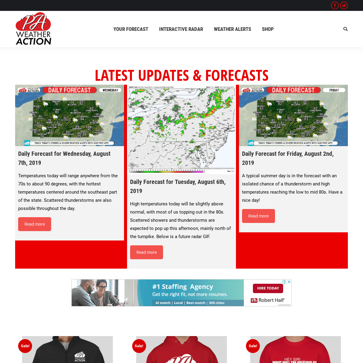
LATEST UPDATES & FORECASTS DAILY FORECAST FOR WEDNESDAY, AUGUST 7TH, 2019 Temperatures today will range anywhere from the 70s to about 90 degrees, with the hottest temperatures centered around the southeast part of the state. Scattered thunderstorms are also possiblethroughout the day.
Read more
DAILY FORECAST FOR TUESDAY, AUGUST 6TH, 2019 High temperatures today will be slightly above normal, with most of us topping out in the 80s. Scattered showers and thunderstorms are expected to pop up this afternoon, mainly north of the turnpike. Below is a future radar GIF.Read more
DAILY FORECAST FOR FRIDAY, AUGUST 2ND, 2019 A typical summer day is in the forecast with an isolated chance of a thunderstorm and high temperatures reaching the low to mid 80s. Have anice day!
Read more
PA WEATHER ACTION APPARELSale!
PREMIUM FLEECE JACKET$12.99 – $14.99
Select options
Sale!
PREMIUM QUALITY HOODIE$29.99 $14.99
Select options
Sale!
“TYPICAL WEATHER IN PA” LONG SLEEVE SHIRT$19.99 $10.99
Select options
____
DOWNLOAD OUR FREE APP!* YOUR FORECAST
* INTERACTIVE RADAR
* WEATHER ALERTS
* NORTHWESTERN PA WEATHER ALERTS * NORTHCENTRAL PA WEATHER ALERTS * NORTHEASTERN PA WEATHER ALERTS * SOUTHWESTERN PA WEATHER ALERTS * SOUTHCENTRAL PA WEATHER ALERTS * SOUTHEASTERN PA WEATHER ALERTS* SHOP
* MY CART
* CHECKOUT
* MY ACCOUNT
———YOUR FORECASTINTERACTIVE RADARWEATHER ALERTS— NORTHWESTERN PA WEATHER ALERTS— NORTHCENTRAL PA WEATHER ALERTS— NORTHEASTERN PA WEATHER ALERTS— SOUTHWESTERN PA WEATHER ALERTS— SOUTHCENTRAL PA WEATHER ALERTS— SOUTHEASTERN PA WEATHER ALERTSSHOP— MY CART— CHECKOUT— MY ACCOUNT———MENU #1 Copyright 2018 Pennsylvania Weather Action, LLCGo to Top
* YOUR FORECAST
* INTERACTIVE RADAR
* WEATHER ALERTS __
* NORTHWESTERN PA WEATHER ALERTS * NORTHCENTRAL PA WEATHER ALERTS * NORTHEASTERN PA WEATHER ALERTS * SOUTHWESTERN PA WEATHER ALERTS * SOUTHCENTRAL PA WEATHER ALERTS * SOUTHEASTERN PA WEATHER ALERTS* SHOP __
* MY CART
* CHECKOUT
* MY ACCOUNT
Search: __
__
Details
6