6
More Annotations


5


6
Favourite Annotations


3


2
Text
MOUNT GARIBALDI
Garibaldi is the most northern volcano on most climbers hit list that live in the Pacific Northwest. Its about a 2 hour drive north in Canada from the Washington State Border crossing.BEAR MOUNTAIN TRAIL
Bear Mountain is the hardest trail promoted by all the tourist brochures in Harrison Hot Springs. The trail relentlessly climbs up an old logging road with the occasional view of a waterfall or lake. The only real payoff is if you can make it all the way to the summit where there are big views of the Fraser Valley and the mountains to thesouth.
MINOT LOOKOUT SITE
With just over 1,000 feet of prominence, Minot Peak is an attractive objective for peakbaggers. Lookout baggers will also find the location interesting as it has quite a bit of fire lookout history. Today, the summit is packed full of communication towers. Olympic Lookouts. Elevation: 1,768 feet. STAFFORD CREEK LOOKOUT SITE Stafford Creek Lookout started prior to 1933, probably a camp. We learn from a Leavenworth newspaper in 1933 that B. D. March was the Stafford Creek lookout-fireman. The following year, in 1934 panoramas were taken from the ground. Trees had been cut to make a view, there was an outhouse but photos were taken from ground level.VEYO VOLCANO
Veyo Volcano. Distance: 1 mile. Elevation Gain: 600 feet. Summit Elevation: 5,239 feet. Access: Level 1. The Veyo Volcano is just south of Veyo which is easily reached by taking Highway 18 north out of St. George. There is a very large pullout on the east side of the Volcano as Highway 18 skirts the shoulder. You can also get to the north sideBEARDS HOLLOW
After the Columbia River jetties were built (1885-1915), the cove filled in and became a wetland. Washington State Parks has managed the site since 1982. The boardwalk bridge in Beards Hollow puts you right in the middle of a freshwater wetland. This site is a great bird-watching location, from tiny hummingbirds to the broad-wingedBald Eagle.
BETHEL RIDGE ROAD
A few miles east of Rimrock, look for the signed Bethel Ridge Road. Follow the wide gravel road avoiding any smaller turn-offs. Just before reaching the saddle at the top of the ridge, a signed road to the right should say, Tower Road. MALONEY RIDGE & MALONEY MOUNTAIN LOOKOUTS Washington Lookouts. Its a bit confusing as Maloney Ridge Lookout is a bit of distance from Maloney Ridge on the map. The lookout was closer to what is now called Sobieski Mountain. The spot shown on USGS maps north of Sobieski as having a lookout is labeled Maloney Ridge. There is also a location considered for a site much higher on MaloneyDUMAS BAY PARK
Federal Way seems to be keeping Dumas Bay Park a bit of a secret. Maybe it is because the park can only fit a handful of cars, around 15or so.
PLATTS LOOKOUT
So, looking up the census records from 1910 to 1940 for Clarence B. Platt (or any other Platts), here is what I learned. Having been born in Iowa around 1877, by 1920 Clarence Platt was a farmer at a dairy farm near Carnation. In 1930, he was renting a place on the Duvall Tolt Road in Carnation. He was 53 years old with a wife, one son, twoMOUNT GARIBALDI
Garibaldi is the most northern volcano on most climbers hit list that live in the Pacific Northwest. Its about a 2 hour drive north in Canada from the Washington State Border crossing.BEAR MOUNTAIN TRAIL
Bear Mountain is the hardest trail promoted by all the tourist brochures in Harrison Hot Springs. The trail relentlessly climbs up an old logging road with the occasional view of a waterfall or lake. The only real payoff is if you can make it all the way to the summit where there are big views of the Fraser Valley and the mountains to thesouth.
MINOT LOOKOUT SITE
With just over 1,000 feet of prominence, Minot Peak is an attractive objective for peakbaggers. Lookout baggers will also find the location interesting as it has quite a bit of fire lookout history. Today, the summit is packed full of communication towers. Olympic Lookouts. Elevation: 1,768 feet. STAFFORD CREEK LOOKOUT SITE Stafford Creek Lookout started prior to 1933, probably a camp. We learn from a Leavenworth newspaper in 1933 that B. D. March was the Stafford Creek lookout-fireman. The following year, in 1934 panoramas were taken from the ground. Trees had been cut to make a view, there was an outhouse but photos were taken from ground level.VEYO VOLCANO
Veyo Volcano. Distance: 1 mile. Elevation Gain: 600 feet. Summit Elevation: 5,239 feet. Access: Level 1. The Veyo Volcano is just south of Veyo which is easily reached by taking Highway 18 north out of St. George. There is a very large pullout on the east side of the Volcano as Highway 18 skirts the shoulder. You can also get to the north sideBEARDS HOLLOW
After the Columbia River jetties were built (1885-1915), the cove filled in and became a wetland. Washington State Parks has managed the site since 1982. The boardwalk bridge in Beards Hollow puts you right in the middle of a freshwater wetland. This site is a great bird-watching location, from tiny hummingbirds to the broad-wingedBald Eagle.
BETHEL RIDGE ROAD
A few miles east of Rimrock, look for the signed Bethel Ridge Road. Follow the wide gravel road avoiding any smaller turn-offs. Just before reaching the saddle at the top of the ridge, a signed road to the right should say, Tower Road. MALONEY RIDGE & MALONEY MOUNTAIN LOOKOUTS Washington Lookouts. Its a bit confusing as Maloney Ridge Lookout is a bit of distance from Maloney Ridge on the map. The lookout was closer to what is now called Sobieski Mountain. The spot shown on USGS maps north of Sobieski as having a lookout is labeled Maloney Ridge. There is also a location considered for a site much higher on MaloneyDUMAS BAY PARK
Federal Way seems to be keeping Dumas Bay Park a bit of a secret. Maybe it is because the park can only fit a handful of cars, around 15or so.
PLATTS LOOKOUT
So, looking up the census records from 1910 to 1940 for Clarence B. Platt (or any other Platts), here is what I learned. Having been born in Iowa around 1877, by 1920 Clarence Platt was a farmer at a dairy farm near Carnation. In 1930, he was renting a place on the Duvall Tolt Road in Carnation. He was 53 years old with a wife, one son, twoWILLHITEWEB.COM
Advice on world travel, mountain climbing, outdoor and travel adventures with children, camping clinics, pictures, maps. STAFFORD CREEK LOOKOUT SITE Stafford Creek Lookout started prior to 1933, probably a camp. We learn from a Leavenworth newspaper in 1933 that B. D. March was the Stafford Creek lookout-fireman. The following year, in 1934 panoramas were taken from the ground. Trees had been cut to make a view, there was an outhouse but photos were taken from ground level. SALMO MOUNTAIN FIRE LOOKOUT SITE Salmo south site in 1931. The site borders the Salmo-Priest Wilderness with great views into it. If you want to visit all four corners of Washington, Salmo would be the TOP SITE to visit in the northeast corner of Washington. You can easily look at the swath of cut trees representing the border two miles to the north, or the Selkirk Rangeof
DOG MOUNTAIN FIRE LOOKOUT Dog Mountain was used as a "fire lookout point" sometime around 1920 in order to serve the Mt. Hood National Forest to the south. The first structure on Dog Mountain was built in 1931 with a gable-roofed L-4 cab with windows on three sides. In 1953 it was replaced with a new L-4 cab. Both were located quarter mile south of the summit, 500DUMAS BAY PARK
Federal Way seems to be keeping Dumas Bay Park a bit of a secret. Maybe it is because the park can only fit a handful of cars, around 15or so.
HOLE-IN-THE-ROCK ROAD The road to Hole-in-the-Rock has a reputation. Although it isn t a difficult road to travel, the road is a long way to go on gravel, dirt, wash basins, tanks, and slickrock. GRANITE PEAK MONTANA Elevation Gain: 2,200+ feetDistance: 10 to 12 miles to basecampAccess: Good Gravel to last 1/2 mile. The highest peak in the state of Montana is Granite Peak, located in the south central part of the state in the Absaroka-Beartooth Wilderness. It is considered one of the hardeststate highpoints.
ELK ROCK LOOKOUT SITE A new lookout was built just a mile over called the Ted Gilbert Lookout. Elk Rock was hit by the blast of Mt. St. Helens but the foundation ruins still remain. Forest roads reach close to the summit but are usually gated and officially require a permit. The quickest access is to park in the Elk Rock Viewpoint on the Spirit LakeMemorial Highway.
RAVEN ROOST LOOKOUT SITE Proceed to Road #1902. Cross Crow Creek at the campground and take either the old or new road up to Ravens Roost (13 miles). Ravens Roost is a highpoint on a long east-west ridge located in the Naches Ranger District, just east of the crest. With over 1,400 feet of prominence, the views are quite nice. If you know how to identify it (with theRAINIER VIEW PARK
Rainier View Park in Sumner does have a good view of Mt. Rainier, possibly because the park is so new, the trees have not grown to blockthe mountain yet.
MOUNT GARIBALDI
Garibaldi is the most northern volcano on most climbers hit list that live in the Pacific Northwest. Its about a 2 hour drive north in Canada from the Washington State Border crossing.BEAR MOUNTAIN TRAIL
Bear Mountain is the hardest trail promoted by all the tourist brochures in Harrison Hot Springs. The trail relentlessly climbs up an old logging road with the occasional view of a waterfall or lake. The only real payoff is if you can make it all the way to the summit where there are big views of the Fraser Valley and the mountains to thesouth.
MINOT LOOKOUT SITE
With just over 1,000 feet of prominence, Minot Peak is an attractive objective for peakbaggers. Lookout baggers will also find the location interesting as it has quite a bit of fire lookout history. Today, the summit is packed full of communication towers. Olympic Lookouts. Elevation: 1,768 feet. STAFFORD CREEK LOOKOUT SITE Stafford Creek Lookout started prior to 1933, probably a camp. We learn from a Leavenworth newspaper in 1933 that B. D. March was the Stafford Creek lookout-fireman. The following year, in 1934 panoramas were taken from the ground. Trees had been cut to make a view, there was an outhouse but photos were taken from ground level.VEYO VOLCANO
Veyo Volcano. Distance: 1 mile. Elevation Gain: 600 feet. Summit Elevation: 5,239 feet. Access: Level 1. The Veyo Volcano is just south of Veyo which is easily reached by taking Highway 18 north out of St. George. There is a very large pullout on the east side of the Volcano as Highway 18 skirts the shoulder. You can also get to the north side MALONEY RIDGE & MALONEY MOUNTAIN LOOKOUTS Washington Lookouts. Its a bit confusing as Maloney Ridge Lookout is a bit of distance from Maloney Ridge on the map. The lookout was closer to what is now called Sobieski Mountain. The spot shown on USGS maps north of Sobieski as having a lookout is labeled Maloney Ridge. There is also a location considered for a site much higher on MaloneyBEARDS HOLLOW
After the Columbia River jetties were built (1885-1915), the cove filled in and became a wetland. Washington State Parks has managed the site since 1982. The boardwalk bridge in Beards Hollow puts you right in the middle of a freshwater wetland. This site is a great bird-watching location, from tiny hummingbirds to the broad-wingedBald Eagle.
LANGILLE RIDGE
1937 recreation map showing Langille Lookout (with trail) as well as 8 other well known lookouts in the area. Interesting that it doesn't show a trail connecting the ridge between the two but separate trails climbing up from the valley bottom.BETHEL RIDGE ROAD
A few miles east of Rimrock, look for the signed Bethel Ridge Road. Follow the wide gravel road avoiding any smaller turn-offs. Just before reaching the saddle at the top of the ridge, a signed road to the right should say, Tower Road.DUMAS BAY PARK
Federal Way seems to be keeping Dumas Bay Park a bit of a secret. Maybe it is because the park can only fit a handful of cars, around 15or so.
WILLHITEWEB.COM
Advice on world travel, mountain climbing, outdoor and travel adventures with children, camping clinics, pictures, maps. COOPER MOUNTAIN LOOKOUT SITE In 1920, a crow's nest was used. In 1927 a log cabin was built. This cabin burned in a forest fire. In 1931, the lookout station was the first in the Chelan National Forest to have a road access the lookoutstation.
SALMO MOUNTAIN FIRE LOOKOUT SITE Salmo south site in 1931. The site borders the Salmo-Priest Wilderness with great views into it. If you want to visit all four corners of Washington, Salmo would be the TOP SITE to visit in the northeast corner of Washington. You can easily look at the swath of cut trees representing the border two miles to the north, or the Selkirk Rangeof
HOLE-IN-THE-ROCK ROAD The road to Hole-in-the-Rock has a reputation. Although it isn t a difficult road to travel, the road is a long way to go on gravel, dirt, wash basins, tanks, and slickrock. DUWAMISH RIVER KAYAK TRIP It sounds funny to say you kayaked from the Southcenter Mall to Seattle but the route exists on the Duwamish River. The Duwamish makes its way north through one ofBETHEL RIDGE ROAD
A few miles east of Rimrock, look for the signed Bethel Ridge Road. Follow the wide gravel road avoiding any smaller turn-offs. Just before reaching the saddle at the top of the ridge, a signed road to the right should say, Tower Road. ELK ROCK LOOKOUT SITE A new lookout was built just a mile over called the Ted Gilbert Lookout. Elk Rock was hit by the blast of Mt. St. Helens but the foundation ruins still remain. Forest roads reach close to the summit but are usually gated and officially require a permit. The quickest access is to park in the Elk Rock Viewpoint on the Spirit LakeMemorial Highway.
GRANITE PEAK MONTANA Elevation Gain: 2,200+ feetDistance: 10 to 12 miles to basecampAccess: Good Gravel to last 1/2 mile. The highest peak in the state of Montana is Granite Peak, located in the south central part of the state in the Absaroka-Beartooth Wilderness. It is considered one of the hardeststate highpoints.
RAVEN ROOST LOOKOUT SITE Proceed to Road #1902. Cross Crow Creek at the campground and take either the old or new road up to Ravens Roost (13 miles). Ravens Roost is a highpoint on a long east-west ridge located in the Naches Ranger District, just east of the crest. With over 1,400 feet of prominence, the views are quite nice. If you know how to identify it (with theRAINIER VIEW PARK
Rainier View Park in Sumner does have a good view of Mt. Rainier, possibly because the park is so new, the trees have not grown to blockthe mountain yet.
WILLHITEWEB.COM
Advice on world travel, mountain climbing, outdoor and travel adventures with children, camping clinics, pictures, maps. SALMO MOUNTAIN FIRE LOOKOUT SITE Salmo south site in 1931. The site borders the Salmo-Priest Wilderness with great views into it. If you want to visit all four corners of Washington, Salmo would be the TOP SITE to visit in the northeast corner of Washington. You can easily look at the swath of cut trees representing the border two miles to the north, or the Selkirk Rangeof
MOUNT GARIBALDI
Garibaldi is the most northern volcano on most climbers hit list that live in the Pacific Northwest. Its about a 2 hour drive north in Canada from the Washington State Border crossing.BEAR MOUNTAIN TRAIL
Bear Mountain is the hardest trail promoted by all the tourist brochures in Harrison Hot Springs. The trail relentlessly climbs up an old logging road with the occasional view of a waterfall or lake. The only real payoff is if you can make it all the way to the summit where there are big views of the Fraser Valley and the mountains to thesouth.
COOPER MOUNTAIN LOOKOUT SITE In 1920, a crow's nest was used. In 1927 a log cabin was built. This cabin burned in a forest fire. In 1931, the lookout station was the first in the Chelan National Forest to have a road access the lookoutstation.
MINOT LOOKOUT SITE
With just over 1,000 feet of prominence, Minot Peak is an attractive objective for peakbaggers. Lookout baggers will also find the location interesting as it has quite a bit of fire lookout history. Today, the summit is packed full of communication towers. Olympic Lookouts. Elevation: 1,768 feet.VEYO VOLCANO
Veyo Volcano. Distance: 1 mile. Elevation Gain: 600 feet. Summit Elevation: 5,239 feet. Access: Level 1. The Veyo Volcano is just south of Veyo which is easily reached by taking Highway 18 north out of St. George. There is a very large pullout on the east side of the Volcano as Highway 18 skirts the shoulder. You can also get to the north side WASHINGTON FIRE LOOKOUT SITES Mount Adams. Green Mountain. First Butte. Burley Mountain Lookout. Alpine Lookout. Winchester Mountain. Tyee Mountain. (Feel free to contact me if you have information to share about one of these lookouts) willhiteweb@yahoo.com. That's me, fighting fire near the former Blue Slide Lookout.GIBSON SPIT HIKE
Olympic Hikes. Take Highway 101 to Sequim. Exit the highway on Washington Street. At the first stoplight at Sequim Avenue, turn right. In a mile is a traffic circle, go right on Port Williams Road. In 2.4 miles, reach the end of the road at the beach and Port Williams County Park. Finding parking could be tough on aMASON LAKE LOOKOUT
From Belfair, take Highway 106 west to a left turn on East Trails End Road. Follow it to the Green Diamond gate with a large pull-out, just after crossing Sherwood Creek at the north end of Mason Lake.WILLHITEWEB.COM
Advice on world travel, mountain climbing, outdoor and travel adventures with children, camping clinics, pictures, maps. SALMO MOUNTAIN FIRE LOOKOUT SITE Salmo south site in 1931. The site borders the Salmo-Priest Wilderness with great views into it. If you want to visit all four corners of Washington, Salmo would be the TOP SITE to visit in the northeast corner of Washington. You can easily look at the swath of cut trees representing the border two miles to the north, or the Selkirk Rangeof
MOUNT GARIBALDI
Garibaldi is the most northern volcano on most climbers hit list that live in the Pacific Northwest. Its about a 2 hour drive north in Canada from the Washington State Border crossing.BEAR MOUNTAIN TRAIL
Bear Mountain is the hardest trail promoted by all the tourist brochures in Harrison Hot Springs. The trail relentlessly climbs up an old logging road with the occasional view of a waterfall or lake. The only real payoff is if you can make it all the way to the summit where there are big views of the Fraser Valley and the mountains to thesouth.
COOPER MOUNTAIN LOOKOUT SITE In 1920, a crow's nest was used. In 1927 a log cabin was built. This cabin burned in a forest fire. In 1931, the lookout station was the first in the Chelan National Forest to have a road access the lookoutstation.
MINOT LOOKOUT SITE
With just over 1,000 feet of prominence, Minot Peak is an attractive objective for peakbaggers. Lookout baggers will also find the location interesting as it has quite a bit of fire lookout history. Today, the summit is packed full of communication towers. Olympic Lookouts. Elevation: 1,768 feet.VEYO VOLCANO
Veyo Volcano. Distance: 1 mile. Elevation Gain: 600 feet. Summit Elevation: 5,239 feet. Access: Level 1. The Veyo Volcano is just south of Veyo which is easily reached by taking Highway 18 north out of St. George. There is a very large pullout on the east side of the Volcano as Highway 18 skirts the shoulder. You can also get to the north side WASHINGTON FIRE LOOKOUT SITES Mount Adams. Green Mountain. First Butte. Burley Mountain Lookout. Alpine Lookout. Winchester Mountain. Tyee Mountain. (Feel free to contact me if you have information to share about one of these lookouts) willhiteweb@yahoo.com. That's me, fighting fire near the former Blue Slide Lookout.GIBSON SPIT HIKE
Olympic Hikes. Take Highway 101 to Sequim. Exit the highway on Washington Street. At the first stoplight at Sequim Avenue, turn right. In a mile is a traffic circle, go right on Port Williams Road. In 2.4 miles, reach the end of the road at the beach and Port Williams County Park. Finding parking could be tough on aMASON LAKE LOOKOUT
From Belfair, take Highway 106 west to a left turn on East Trails End Road. Follow it to the Green Diamond gate with a large pull-out, just after crossing Sherwood Creek at the north end of Mason Lake. COOPER MOUNTAIN LOOKOUT SITE In 1920, a crow's nest was used. In 1927 a log cabin was built. This cabin burned in a forest fire. In 1931, the lookout station was the first in the Chelan National Forest to have a road access the lookoutstation.
MINOT LOOKOUT SITE
With just over 1,000 feet of prominence, Minot Peak is an attractive objective for peakbaggers. Lookout baggers will also find the location interesting as it has quite a bit of fire lookout history. Today, the summit is packed full of communication towers. Olympic Lookouts. Elevation: 1,768 feet. STRAWBERRY MOUNTAIN LOOKOUT WillhiteWeb.com. Northeast Lookouts. Elevation: 5,855 feet. Hiking Distance: 2 miles. Elevation Gain: 1,880 feet. Access: High-clearance best for final few miles. Known as the hard one to reach on the Colville, Strawberry is a location that seems remote, that it may as well be 1940 when you are there. The tower was built in 1936.VEYO VOLCANO
Veyo Volcano. Distance: 1 mile. Elevation Gain: 600 feet. Summit Elevation: 5,239 feet. Access: Level 1. The Veyo Volcano is just south of Veyo which is easily reached by taking Highway 18 north out of St. George. There is a very large pullout on the east side of the Volcano as Highway 18 skirts the shoulder. You can also get to the north side FORMER CASCADE MOUNTAINS LOOKOUTS Information, pictures and maps for all Washington State Fire Lookouts, towers and former lookout sites.BEARHEAD MOUNTAIN
Bearhead Mountain is a great hike that is often overlooked in most of the hiking books. The summit provides excellent views over the Clearwater Wilderness and Mt. Rainier. Bearhead has two summits, one for hikers, and the other for peakbaggers. Bearhead was also once hometo a lookout tower.
BURROWS ISLAND LOOP AND SUMMIT CLIMB The summit area is flat and forested, continue on the ridge going up and down until you reach the highest spot which should have an open view to the north. A short detour near the BM triangle on the USGS map gives views out to the south. At Flounder Bay with Burrows Island in the distance. At Flounder Bay with Burrows Island in the distance.BETHEL RIDGE ROAD
A few miles east of Rimrock, look for the signed Bethel Ridge Road. Follow the wide gravel road avoiding any smaller turn-offs. Just before reaching the saddle at the top of the ridge, a signed road to the right should say, Tower Road. GRANITE PEAK MONTANA Elevation Gain: 2,200+ feetDistance: 10 to 12 miles to basecampAccess: Good Gravel to last 1/2 mile. The highest peak in the state of Montana is Granite Peak, located in the south central part of the state in the Absaroka-Beartooth Wilderness. It is considered one of the hardeststate highpoints.
ALONE IN THE WILDERNESS LOCATION MAP He stayed in a friends cabin until he could get his own built. After nearly 30 years, at the age of 82, Richard Proenneke left his cabin to the National Park Service. He lived his last four years in California with his brother. The cabin is a popular visitor attraction at Twin Lakes. When Lake Clark National Park was established, he worked with Outdoor and Travel AdventuresContact Me
OTHER STUFF
World Travel
Other States
Hiking with Kids
Camping with Kids
Travel with Kids
Contact Me
Canada Travel
My Background
LDS Travel
Family Research
Miscellaneous
Troop 333
Trance Music
Top Sights
Family Biking TrailsKayaking
State Parks
Puget Sound Hikes
King & Pierce Parks
Honeymoon
High Roads
Utah
Utah
Outdoor Clinics
Hiking Trips
I receive numerous requests each week for permission to use a photo from this website. If you would like to use one, please contact me. I can email a better copy with full permission use with a donation of$10 per photo.
Standing Cascade Lookouts Former Cascade Lookouts Olympic Peninsula/Willapa Southeast Washington Northeast WashingtonRelocated Lookouts
People Persuing Lookouts Osborne Panoramic ResearchLOOKOUT HOME PAGE
State Highpointing
WASHINGTON STATE
AWS Sites
My YouTube Channel
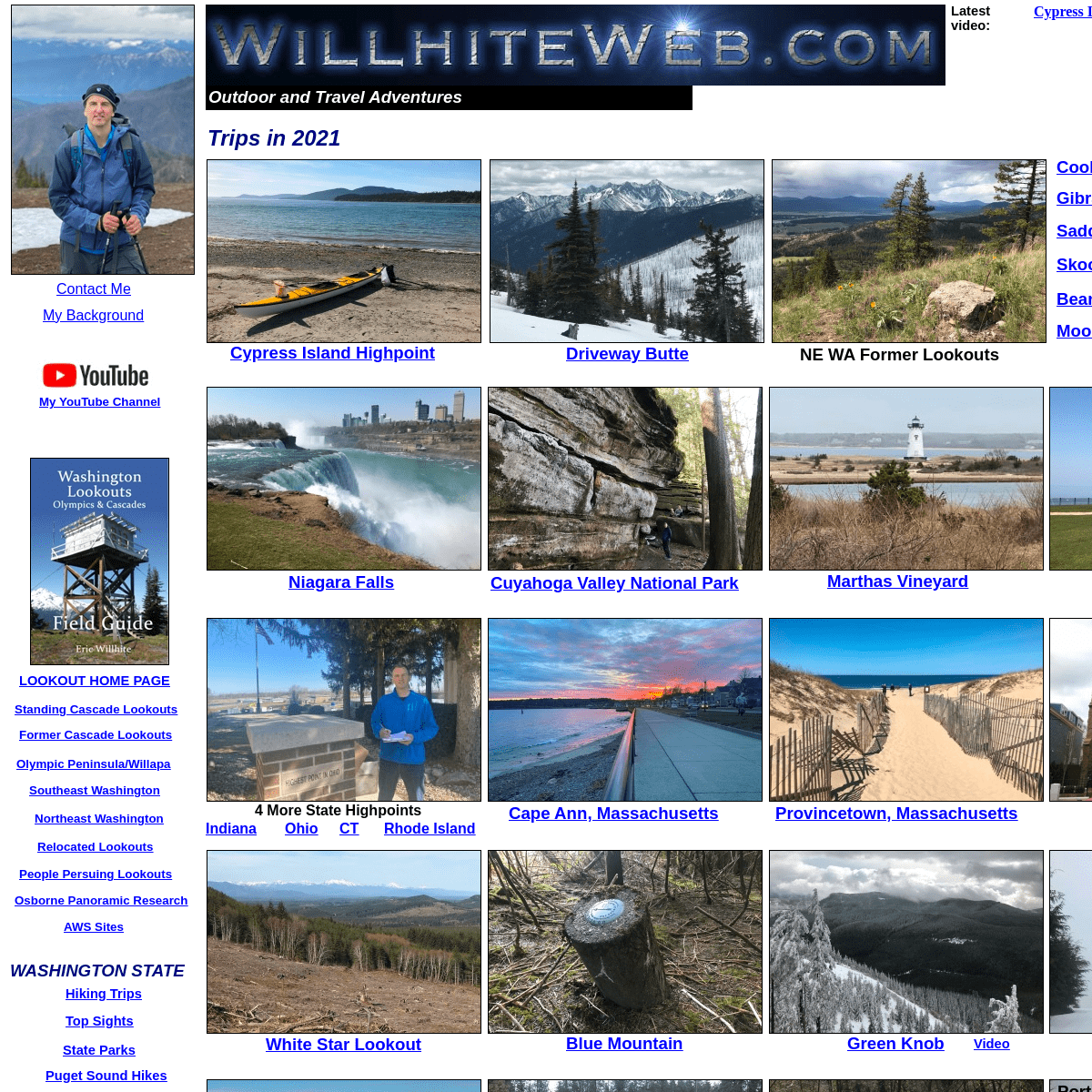
Trips in 2021
Overlanding
Sand Mountain LookoutKlone Peak
Lightning Peak
Three Fingered Jack
Video
Video
August to November 2020Clay Butte Lookout
Grand Canyon Hike
Mount Lincoln
White Butte
North Dakota State Highpoint Mount Coolidge LookoutSouth Dakota
Wyoming
Circle Peak
Beartooth Highway
Montana
Timberwolf Mountain
Johnson Mountain
Port Ludlow Kayak TripVegas Raceway Video
Sky Combat Video
Helicopter Guns VideoVideo
Lake Angeles
Copper City Trail
Video
Hawkeye Point
Iowa State HighpointTravel
Hiking & Climbing
Washington
Oregon
Nevada
Colorado
Arizona
California
Montana
Idaho
Wyoming
Canada
Aconcagua Climb
Denali Climb
Kilimanjaro Climb
Fuji Hike
Ultra 57 List
What is Prominence
Peakbagger Signs
Advice
Washington
Wyoming
Nevada
Montana
New Mexico
Oregon
South Dakota
Tennessee
Florida
Hawaii
Idaho
Iowa
Kentucky
Arizona
Arkansas
California
Colorado
Alaska
Alabama
PCT Mexico to Warner SpringsMount Higgins
Mica Peak
Video
December 2020
Driskill Mountain
Skyline Lake & Heather Ridge Cabrillo National Monument Louisiana State Highpoint Sunset Cliffs Natural Park Vacation Isle - San DiegoVideo
Green Knob
Video
K.O. Point
Willamette Stone
Portland 4
Scar Hill
St. Johns
Skyline
Madrona Park
Burgard
Mt. Hood Lookout History The Cascade VolcanoesBlue Mountain
White Star Lookout
4 More State Highpoints Cape Ann, MassachusettsIndiana
Ohio
Rhode Island
CT
Provincetown, Massachusetts Salem, MassachusettsNiagara Falls
Fort Niagara, New York Cuyahoga Valley National ParkMarthas Vineyard
Latest video:
Cypress Island HighpointDriveway Butte
NE WA Former LookoutsCooks Mountain
Cypress Island HighpointGibraltar Rock
Saddle Mountain
Skookum Peak
Bear Paw Ridge
Moon Hill
Do not contact me to place advertising on this website for compensation. I am not interested.Details
5