2
More Annotations


5


1
Favourite Annotations


2


3
Text
LIDAR NEWS - HOME OF THE LIDAR INDUSTRYLIDAR NEWSBLOGSARTICLESSHOWCASEENEWSLETTERINTERVIEWS The Lidar News website was the first digital media platform dedicated solely to 3D technologies involving lidar, laser scanning and * Twitter
* Facebook
measurement.
KOMATSU SMART CONSTRUCTION Implementation Beemobile. We first saw the Beemobile being presented at the Digital Construction fair in Brussels back in 2019. At that time, their presentation on the targeted usage of the system was already music to our ears: bridging the gap between the stationary use of laser scanners and the highly specialized service of bringing in a mobile mapping system. When we were rolling out our HOW LIDAR TECHNOLOGY ADVANCES TRUCKING SAFETY LiDAR Vision and Autonomous Trucks. LiDAR technology, which stands for Light Detection and Ranging, uses laser technology to gather a 3D data model around a vehicle in real time. This data allows autonomous vehicles to sense their surroundings at all times by allowing them to “see” objects such as pedestrians, cars, and road construction. SUBSURFACE INFORMATION MODELING: USING LIDAR TO BUILD ON Subsurface Information Modeling (SIM) will help to fill that gap and provide insight on potential conflicts that lie below the surface. This innovative term, crafted by Michael A Twohig, DGT’s Director of Subsurface Utility Mapping, mimics the advancement of GeoBIM. NAVVIS TECHNOLOGY IS A STEP CHANGE IN 3D DATA CAPTURE NavVis is a Step Change in 3D Data Capture and Point Cloud Management. An Interview with Matthew Craig, Owner & President / Visual PrecisionSolutions
MAPPING THE BATTLE OF GETTYSBURG Mapping The Battle of Gettysburg. GeoCue Group recently partnered with the National Park Service (NPS) in a pilot project to assess culturally significant areas within Gettysburg National Military Park using small unmanned aerial systems (sUAS). The area of interest (AOI)for
POINTCAB - LATEST POINT CLOUD SOFTWARE 4.0 REVIEW - LIDAR NEWS First things first: what is Origins 4.0? As many of you may already know, software manufacturer PointCab is well-known for their easy-to-use point cloud software packages, formerly known as “PointCab Suite” and “PointCab 3D Pro”. With their latest update, the company decided to completely re-brand and restructure their entiere company PRONTO AI IS THE LATEST LEVANDOWSKI ROBO TRUCK SCHEME Pronto AI, he announced on Tuesday, is developing a $5,000 aftermarket driver assistance system for semi-trucks, which will handle the steering, throttle, and brakes on the highway. To prove it works, Levandowski used the software to send his Toyota Prius across the country. In October, Levandowski says, the car drove 3,099 miles fromSan
AUTONOMOUS ORCHARD SPRAYER Autonomous Orchard Sprayer Guided by Velodyne Lidar. This is the history of the vision behind the world’s first and only autonomous orchard sprayer. The heritage of GUSS, which stands for Global Unmanned Spray System, goes back to 1982 when its inventor Dave Crinklaw and his father Bob started an agriculture spray business inthe Central
PENALTIES FOR FLYING A COMMERCIAL DRONE WITHOUT A LICENSE Commercial Drone Flying Without a Pilot’s License. The civil penalties for flying a commercial rig without first obtaining a remote pilot’s certificate from the FAA are up to $32,666 for each incidence. This fine is charged per day for continual illegal use of a drone for commercial purposes, after receiving a warning letter fromthe FAA.
LIDAR NEWS - HOME OF THE LIDAR INDUSTRYLIDAR NEWSBLOGSARTICLESSHOWCASEENEWSLETTERINTERVIEWS The Lidar News website was the first digital media platform dedicated solely to 3D technologies involving lidar, laser scanning andmeasurement.
KOMATSU SMART CONSTRUCTION Implementation Beemobile. We first saw the Beemobile being presented at the Digital Construction fair in Brussels back in 2019. At that time, their presentation on the targeted usage of the system was already music to our ears: bridging the gap between the stationary use of laser scanners and the highly specialized service of bringing in a mobile mapping system. When we were rolling out our HOW LIDAR TECHNOLOGY ADVANCES TRUCKING SAFETY LiDAR Vision and Autonomous Trucks. LiDAR technology, which stands for Light Detection and Ranging, uses laser technology to gather a 3D data model around a vehicle in real time. This data allows autonomous vehicles to sense their surroundings at all times by allowing them to “see” objects such as pedestrians, cars, and road construction. SUBSURFACE INFORMATION MODELING: USING LIDAR TO BUILD ON Subsurface Information Modeling (SIM) will help to fill that gap and provide insight on potential conflicts that lie below the surface. This innovative term, crafted by Michael A Twohig, DGT’s Director of Subsurface Utility Mapping, mimics the advancement of GeoBIM. NAVVIS TECHNOLOGY IS A STEP CHANGE IN 3D DATA CAPTURE NavVis is a Step Change in 3D Data Capture and Point Cloud Management. An Interview with Matthew Craig, Owner & President / Visual PrecisionSolutions
MAPPING THE BATTLE OF GETTYSBURG Mapping The Battle of Gettysburg. GeoCue Group recently partnered with the National Park Service (NPS) in a pilot project to assess culturally significant areas within Gettysburg National Military Park using small unmanned aerial systems (sUAS). The area of interest (AOI)for
POINTCAB - LATEST POINT CLOUD SOFTWARE 4.0 REVIEW - LIDAR NEWS First things first: what is Origins 4.0? As many of you may already know, software manufacturer PointCab is well-known for their easy-to-use point cloud software packages, formerly known as “PointCab Suite” and “PointCab 3D Pro”. With their latest update, the company decided to completely re-brand and restructure their entiere company PRONTO AI IS THE LATEST LEVANDOWSKI ROBO TRUCK SCHEME Pronto AI, he announced on Tuesday, is developing a $5,000 aftermarket driver assistance system for semi-trucks, which will handle the steering, throttle, and brakes on the highway. To prove it works, Levandowski used the software to send his Toyota Prius across the country. In October, Levandowski says, the car drove 3,099 miles fromSan
AUTONOMOUS ORCHARD SPRAYER Autonomous Orchard Sprayer Guided by Velodyne Lidar. This is the history of the vision behind the world’s first and only autonomous orchard sprayer. The heritage of GUSS, which stands for Global Unmanned Spray System, goes back to 1982 when its inventor Dave Crinklaw and his father Bob started an agriculture spray business inthe Central
PENALTIES FOR FLYING A COMMERCIAL DRONE WITHOUT A LICENSE Commercial Drone Flying Without a Pilot’s License. The civil penalties for flying a commercial rig without first obtaining a remote pilot’s certificate from the FAA are up to $32,666 for each incidence. This fine is charged per day for continual illegal use of a drone for commercial purposes, after receiving a warning letter fromthe FAA.
ARTICLES - LIDAR NEWS Velodyne Lidar Intelligent Infrastructure Solution Wins Smart 50 Award Velodyne Lidar, Inc. (Nasdaq: VLDR, VLDRW) today announced its Intelligent Infrastructure Solution, powered by Bluecity, was named a winner of the 2021 Smart 50 Award, recognizing the solution’s innovation in smart city applications. The awards, presented by SmartCities
OPERATIONS ARCHIVES
NUAIR and New York UAS Test Site Lead Path for Safe Drone Operations Over People with Workhorse and AVSS Collaboration 5th drone parachute validation for NUAIR, enabling scalable and economically viable advanced unmanned aircraft operations AVSS Parachute Deployed on Horsefly Drone at New York UAS Test Site NUAIR recently put the Aerial Vehicle Safety Solutions Inc. (AVSS) ADAPTIVE PERCEPTION SOFTWARE FOR SMART CITIES Partnership between 3D data-edge perception platform developer and leading LiDAR provider set to plug the gap between 3D sensing and real-world intelligent transport, smart spaces and securityapplications
NY UAS TEST SITE LEAD PATH FOR SAFE DRONE OPERATIONS NUAIR and New York UAS Test Site Lead Path for Safe Drone Operations Over People with Workhorse and AVSS Collaboration. 5th drone parachute validation for NUAIR, enabling scalable and economically viable advanced unmanned aircraft operations SEABED SELECTS VELODYNE LIDAR SENSORS FOR MOBILE MAPPING SAN JOSE, Calif.–(BUSINESS WIRE)–Velodyne Lidar, Inc. (Nasdaq: VLDR, VLDRW) today announced Seabed B.V., which specializes in high quality equipment for offshore surveying and dredging, has selected Puck™ sensors for its lidar mobile mapping system.The Seabed system is a turnkey mobile lidar solution for hydrographic surveys that can support sustainable planning which aims to protect FARO ACQUIRES HOLOBUILDER LAKE MARY, FL, June 7, 2021 – FARO ® Technologies, Inc. (Nasdaq: FARO), a global leader of 3D measurement, imaging, and realization solutions for the 3D Metrology, AEC (Architecture, Engineering & Construction), and Public Safety Analytics markets, today announced the acquisition of HoloBuilder, Inc.. HoloBuilder brings to FARO its leading photogrammetry-based 3D platform, which OUSTER - EXCLUSIVE SUPPLIER FOR PARIFEX SPEED ENFORCEMENT SAN FRANCISCO, CA – – Ouster, Inc. (NYSE: OUST), a leading provider of high-resolution digital lidar sensors for the industrial automation, smart infrastructure, robotics, and automotive industries, today announced that it has signed a strategic customer agreement with PARIFEX, a leading solution provider in project management for smart cities, to deploy Ouster’s OS1SEABED ARCHIVES
Equipped with Velodyne Puck™ Sensors, Seabed Mobile Mapping Systems Support Marine Environment Protection and Sustainability SAN JOSE, Calif.–(BUSINESS WIRE)–Velodyne Lidar, Inc. (Nasdaq: VLDR, VLDRW) today announced Seabed B.V., which specializes in high quality equipment for offshore surveying and dredging, has selected Puck™ sensors for its lidar mobile mapping system.VALIDATION ARCHIVES
NUAIR and New York UAS Test Site Lead Path for Safe Drone Operations Over People with Workhorse and AVSS Collaboration 5th drone parachute validation for NUAIR, enabling scalable and economically viable advanced unmanned aircraft operations AVSS Parachute Deployed on Horsefly Drone at New York UAS Test Site NUAIR recently put the Aerial Vehicle Safety Solutions Inc. (AVSS) AUTONOMOUS ORCHARD SPRAYER Autonomous Orchard Sprayer Guided by Velodyne Lidar. This is the history of the vision behind the world’s first and only autonomous orchard sprayer. The heritage of GUSS, which stands for Global Unmanned Spray System, goes back to 1982 when its inventor Dave Crinklaw and his father Bob started an agriculture spray business inthe Central
LIDAR NEWS - HOME OF THE LIDAR INDUSTRYLIDAR NEWSBLOGSARTICLESSHOWCASEENEWSLETTERINTERVIEWS The Lidar News website was the first digital media platform dedicated solely to 3D technologies involving lidar, laser scanning andmeasurement.
KOMATSU SMART CONSTRUCTION Implementation Beemobile. We first saw the Beemobile being presented at the Digital Construction fair in Brussels back in 2019. At that time, their presentation on the targeted usage of the system was already music to our ears: bridging the gap between the stationary use of laser scanners and the highly specialized service of bringing in a mobile mapping system. When we were rolling out our NAVVIS TECHNOLOGY IS A STEP CHANGE IN 3D DATA CAPTURE NavVis is a Step Change in 3D Data Capture and Point Cloud Management. An Interview with Matthew Craig, Owner & President / Visual PrecisionSolutions
INNOVIZ ANNOUNCES ANOTHER BREAKTHROUGH IN LIDAR Innoviz Announces Another Breakthrough in LiDAR Technology – 30X Performance Improvement and Embedded Perception Software. Revealing the new InnovizTwo specifications, the Company sets a new transparency standard; InnovizTwo scales in performance and cost and is designed to exceed customer expectations and democratize autonomous driving DRONE LIDAR DOCUMENTARY MAKES WAVES IN LOUISIANA … DRONE LIDAR DOCUMENTARY SHOW MAKES SOME WAVES IN THE LOUISIANA MARSH. Morris P. Hebert, Inc. uses drone LiDAR to analyze a Marsh restoration project in Southern Louisiana HOW LIDAR TECHNOLOGY ADVANCES TRUCKING SAFETY LiDAR Vision and Autonomous Trucks. LiDAR technology, which stands for Light Detection and Ranging, uses laser technology to gather a 3D data model around a vehicle in real time. This data allows autonomous vehicles to sense their surroundings at all times by allowing them to “see” objects such as pedestrians, cars, and road construction. UPDATED U.S. INTERAGENCY ELEVATION INVENTORY A new version of the U.S. Interagency Elevation Inventory, an online source for nationwide, publicly available elevation data, is now live.On top of an updated look and feel, changes include several new search functions—including text location search and draw-your-own-polygon—to make it easier to find elevation sourcedata.
MASER CONSULTING IS NOW COLLIERS ENGINEERING Maser Consulting, a national multi-discipline engineering design firm, is pleased to announce the completion of its rebranding as Colliers Engineering & Design. In 2020, Colliers (NASDAQ, TSX: CIGI), a leading global commercial real estate services and investment management firm, acquired a controlling interest in Maser Consulting. 3D LASER SCANNING STANDARDS AND GUIDELINES FROM CALTRANS 3D laser scanning standards and specifications for Caltrans applications were developed to promote large-scale deployment of this technology into Caltrans day-to-day survey operations. This report documents the AHMCT research project, “Creating Standards and Specifications for the Use of Laser Scanning in Caltrans Projects.”. PRONTO AI IS THE LATEST LEVANDOWSKI ROBO TRUCK SCHEME Pronto AI, he announced on Tuesday, is developing a $5,000 aftermarket driver assistance system for semi-trucks, which will handle the steering, throttle, and brakes on the highway. To prove it works, Levandowski used the software to send his Toyota Prius across the country. In October, Levandowski says, the car drove 3,099 miles fromSan
ARTICLES - LIDAR NEWS Velodyne Lidar Intelligent Infrastructure Solution Wins Smart 50 Award Velodyne Lidar, Inc. (Nasdaq: VLDR, VLDRW) today announced its Intelligent Infrastructure Solution, powered by Bluecity, was named a winner of the 2021 Smart 50 Award, recognizing the solution’s innovation in smart city applications. The awards, presented by SmartCities
OPERATIONS ARCHIVES
NUAIR and New York UAS Test Site Lead Path for Safe Drone Operations Over People with Workhorse and AVSS Collaboration 5th drone parachute validation for NUAIR, enabling scalable and economically viable advanced unmanned aircraft operations AVSS Parachute Deployed on Horsefly Drone at New York UAS Test Site NUAIR recently put the Aerial Vehicle Safety Solutions Inc. (AVSS) NY UAS TEST SITE LEAD PATH FOR SAFE DRONE OPERATIONS NUAIR and New York UAS Test Site Lead Path for Safe Drone Operations Over People with Workhorse and AVSS Collaboration. 5th drone parachute validation for NUAIR, enabling scalable and economically viable advanced unmanned aircraft operations ADAPTIVE PERCEPTION SOFTWARE FOR SMART CITIES Partnership between 3D data-edge perception platform developer and leading LiDAR provider set to plug the gap between 3D sensing and real-world intelligent transport, smart spaces and securityapplications
SEABED SELECTS VELODYNE LIDAR SENSORS FOR MOBILE MAPPING SAN JOSE, Calif.–(BUSINESS WIRE)–Velodyne Lidar, Inc. (Nasdaq: VLDR, VLDRW) today announced Seabed B.V., which specializes in high quality equipment for offshore surveying and dredging, has selected Puck™ sensors for its lidar mobile mapping system.The Seabed system is a turnkey mobile lidar solution for hydrographic surveys that can support sustainable planning which aims to protect OUSTER - EXCLUSIVE SUPPLIER FOR PARIFEX SPEED ENFORCEMENT SAN FRANCISCO, CA – – Ouster, Inc. (NYSE: OUST), a leading provider of high-resolution digital lidar sensors for the industrial automation, smart infrastructure, robotics, and automotive industries, today announced that it has signed a strategic customer agreement with PARIFEX, a leading solution provider in project management for smart cities, to deploy Ouster’s OS1 FARO ACQUIRES HOLOBUILDER LAKE MARY, FL, June 7, 2021 – FARO ® Technologies, Inc. (Nasdaq: FARO), a global leader of 3D measurement, imaging, and realization solutions for the 3D Metrology, AEC (Architecture, Engineering & Construction), and Public Safety Analytics markets, today announced the acquisition of HoloBuilder, Inc.. HoloBuilder brings to FARO its leading photogrammetry-based 3D platform, which VERIDAAS INITIATES CALIFORNIA STATEWIDE LIDAR COLLECTION VeriDaaS Initiates California Statewide LiDAR Collection Project. DENVER, Colorado — June 1, 2021 — VeriDaaS today announced that it has completed test flights necessary to begin its statewide California mapping project by acquiring high-density LiDAR elevation data on multiple areas of interest (AOIs).This data will be used for evaluation purposes by various state, federal and commercialVALIDATION ARCHIVES
NUAIR and New York UAS Test Site Lead Path for Safe Drone Operations Over People with Workhorse and AVSS Collaboration 5th drone parachute validation for NUAIR, enabling scalable and economically viable advanced unmanned aircraft operations AVSS Parachute Deployed on Horsefly Drone at New York UAS Test Site NUAIR recently put the Aerial Vehicle Safety Solutions Inc. (AVSS)SEABED ARCHIVES
Equipped with Velodyne Puck™ Sensors, Seabed Mobile Mapping Systems Support Marine Environment Protection and Sustainability SAN JOSE, Calif.–(BUSINESS WIRE)–Velodyne Lidar, Inc. (Nasdaq: VLDR, VLDRW) today announced Seabed B.V., which specializes in high quality equipment for offshore surveying and dredging, has selected Puck™ sensors for its lidar mobile mapping system. LIDAR NEWS - HOME OF THE LIDAR INDUSTRYLIDAR NEWSBLOGSARTICLESSHOWCASEENEWSLETTERINTERVIEWS The Lidar News website was the first digital media platform dedicated solely to 3D technologies involving lidar, laser scanning andmeasurement.
KOMATSU SMART CONSTRUCTION Implementation Beemobile. We first saw the Beemobile being presented at the Digital Construction fair in Brussels back in 2019. At that time, their presentation on the targeted usage of the system was already music to our ears: bridging the gap between the stationary use of laser scanners and the highly specialized service of bringing in a mobile mapping system. When we were rolling out our NAVVIS TECHNOLOGY IS A STEP CHANGE IN 3D DATA CAPTURE NavVis is a Step Change in 3D Data Capture and Point Cloud Management. An Interview with Matthew Craig, Owner & President / Visual PrecisionSolutions
INNOVIZ ANNOUNCES ANOTHER BREAKTHROUGH IN LIDAR Innoviz Announces Another Breakthrough in LiDAR Technology – 30X Performance Improvement and Embedded Perception Software. Revealing the new InnovizTwo specifications, the Company sets a new transparency standard; InnovizTwo scales in performance and cost and is designed to exceed customer expectations and democratize autonomous driving DRONE LIDAR DOCUMENTARY MAKES WAVES IN LOUISIANA … DRONE LIDAR DOCUMENTARY SHOW MAKES SOME WAVES IN THE LOUISIANA MARSH. Morris P. Hebert, Inc. uses drone LiDAR to analyze a Marsh restoration project in Southern Louisiana HOW LIDAR TECHNOLOGY ADVANCES TRUCKING SAFETY LiDAR Vision and Autonomous Trucks. LiDAR technology, which stands for Light Detection and Ranging, uses laser technology to gather a 3D data model around a vehicle in real time. This data allows autonomous vehicles to sense their surroundings at all times by allowing them to “see” objects such as pedestrians, cars, and road construction. UPDATED U.S. INTERAGENCY ELEVATION INVENTORY A new version of the U.S. Interagency Elevation Inventory, an online source for nationwide, publicly available elevation data, is now live.On top of an updated look and feel, changes include several new search functions—including text location search and draw-your-own-polygon—to make it easier to find elevation sourcedata.
MASER CONSULTING IS NOW COLLIERS ENGINEERING Maser Consulting, a national multi-discipline engineering design firm, is pleased to announce the completion of its rebranding as Colliers Engineering & Design. In 2020, Colliers (NASDAQ, TSX: CIGI), a leading global commercial real estate services and investment management firm, acquired a controlling interest in Maser Consulting. 3D LASER SCANNING STANDARDS AND GUIDELINES FROM CALTRANS 3D laser scanning standards and specifications for Caltrans applications were developed to promote large-scale deployment of this technology into Caltrans day-to-day survey operations. This report documents the AHMCT research project, “Creating Standards and Specifications for the Use of Laser Scanning in Caltrans Projects.”. PRONTO AI IS THE LATEST LEVANDOWSKI ROBO TRUCK SCHEME Pronto AI, he announced on Tuesday, is developing a $5,000 aftermarket driver assistance system for semi-trucks, which will handle the steering, throttle, and brakes on the highway. To prove it works, Levandowski used the software to send his Toyota Prius across the country. In October, Levandowski says, the car drove 3,099 miles fromSan
LIDAR NEWS - HOME OF THE LIDAR INDUSTRYLIDAR NEWSBLOGSARTICLESSHOWCASEENEWSLETTERINTERVIEWS The Lidar News website was the first digital media platform dedicated solely to 3D technologies involving lidar, laser scanning andmeasurement.
KOMATSU SMART CONSTRUCTION Implementation Beemobile. We first saw the Beemobile being presented at the Digital Construction fair in Brussels back in 2019. At that time, their presentation on the targeted usage of the system was already music to our ears: bridging the gap between the stationary use of laser scanners and the highly specialized service of bringing in a mobile mapping system. When we were rolling out our NAVVIS TECHNOLOGY IS A STEP CHANGE IN 3D DATA CAPTURE NavVis is a Step Change in 3D Data Capture and Point Cloud Management. An Interview with Matthew Craig, Owner & President / Visual PrecisionSolutions
INNOVIZ ANNOUNCES ANOTHER BREAKTHROUGH IN LIDAR Innoviz Announces Another Breakthrough in LiDAR Technology – 30X Performance Improvement and Embedded Perception Software. Revealing the new InnovizTwo specifications, the Company sets a new transparency standard; InnovizTwo scales in performance and cost and is designed to exceed customer expectations and democratize autonomous driving DRONE LIDAR DOCUMENTARY MAKES WAVES IN LOUISIANA … DRONE LIDAR DOCUMENTARY SHOW MAKES SOME WAVES IN THE LOUISIANA MARSH. Morris P. Hebert, Inc. uses drone LiDAR to analyze a Marsh restoration project in Southern Louisiana HOW LIDAR TECHNOLOGY ADVANCES TRUCKING SAFETY LiDAR Vision and Autonomous Trucks. LiDAR technology, which stands for Light Detection and Ranging, uses laser technology to gather a 3D data model around a vehicle in real time. This data allows autonomous vehicles to sense their surroundings at all times by allowing them to “see” objects such as pedestrians, cars, and road construction. UPDATED U.S. INTERAGENCY ELEVATION INVENTORY A new version of the U.S. Interagency Elevation Inventory, an online source for nationwide, publicly available elevation data, is now live.On top of an updated look and feel, changes include several new search functions—including text location search and draw-your-own-polygon—to make it easier to find elevation sourcedata.
MASER CONSULTING IS NOW COLLIERS ENGINEERING Maser Consulting, a national multi-discipline engineering design firm, is pleased to announce the completion of its rebranding as Colliers Engineering & Design. In 2020, Colliers (NASDAQ, TSX: CIGI), a leading global commercial real estate services and investment management firm, acquired a controlling interest in Maser Consulting. 3D LASER SCANNING STANDARDS AND GUIDELINES FROM CALTRANS 3D laser scanning standards and specifications for Caltrans applications were developed to promote large-scale deployment of this technology into Caltrans day-to-day survey operations. This report documents the AHMCT research project, “Creating Standards and Specifications for the Use of Laser Scanning in Caltrans Projects.”. PRONTO AI IS THE LATEST LEVANDOWSKI ROBO TRUCK SCHEME Pronto AI, he announced on Tuesday, is developing a $5,000 aftermarket driver assistance system for semi-trucks, which will handle the steering, throttle, and brakes on the highway. To prove it works, Levandowski used the software to send his Toyota Prius across the country. In October, Levandowski says, the car drove 3,099 miles fromSan
ARTICLES - LIDAR NEWS Velodyne Lidar Intelligent Infrastructure Solution Wins Smart 50 Award Velodyne Lidar, Inc. (Nasdaq: VLDR, VLDRW) today announced its Intelligent Infrastructure Solution, powered by Bluecity, was named a winner of the 2021 Smart 50 Award, recognizing the solution’s innovation in smart city applications. The awards, presented by SmartCities
OPERATIONS ARCHIVES
NUAIR and New York UAS Test Site Lead Path for Safe Drone Operations Over People with Workhorse and AVSS Collaboration 5th drone parachute validation for NUAIR, enabling scalable and economically viable advanced unmanned aircraft operations AVSS Parachute Deployed on Horsefly Drone at New York UAS Test Site NUAIR recently put the Aerial Vehicle Safety Solutions Inc. (AVSS) NY UAS TEST SITE LEAD PATH FOR SAFE DRONE OPERATIONS NUAIR and New York UAS Test Site Lead Path for Safe Drone Operations Over People with Workhorse and AVSS Collaboration. 5th drone parachute validation for NUAIR, enabling scalable and economically viable advanced unmanned aircraft operations ADAPTIVE PERCEPTION SOFTWARE FOR SMART CITIES Partnership between 3D data-edge perception platform developer and leading LiDAR provider set to plug the gap between 3D sensing and real-world intelligent transport, smart spaces and securityapplications
SEABED SELECTS VELODYNE LIDAR SENSORS FOR MOBILE MAPPING SAN JOSE, Calif.–(BUSINESS WIRE)–Velodyne Lidar, Inc. (Nasdaq: VLDR, VLDRW) today announced Seabed B.V., which specializes in high quality equipment for offshore surveying and dredging, has selected Puck™ sensors for its lidar mobile mapping system.The Seabed system is a turnkey mobile lidar solution for hydrographic surveys that can support sustainable planning which aims to protect OUSTER - EXCLUSIVE SUPPLIER FOR PARIFEX SPEED ENFORCEMENT SAN FRANCISCO, CA – – Ouster, Inc. (NYSE: OUST), a leading provider of high-resolution digital lidar sensors for the industrial automation, smart infrastructure, robotics, and automotive industries, today announced that it has signed a strategic customer agreement with PARIFEX, a leading solution provider in project management for smart cities, to deploy Ouster’s OS1 FARO ACQUIRES HOLOBUILDER LAKE MARY, FL, June 7, 2021 – FARO ® Technologies, Inc. (Nasdaq: FARO), a global leader of 3D measurement, imaging, and realization solutions for the 3D Metrology, AEC (Architecture, Engineering & Construction), and Public Safety Analytics markets, today announced the acquisition of HoloBuilder, Inc.. HoloBuilder brings to FARO its leading photogrammetry-based 3D platform, which VERIDAAS INITIATES CALIFORNIA STATEWIDE LIDAR COLLECTION VeriDaaS Initiates California Statewide LiDAR Collection Project. DENVER, Colorado — June 1, 2021 — VeriDaaS today announced that it has completed test flights necessary to begin its statewide California mapping project by acquiring high-density LiDAR elevation data on multiple areas of interest (AOIs).This data will be used for evaluation purposes by various state, federal and commercialVALIDATION ARCHIVES
NUAIR and New York UAS Test Site Lead Path for Safe Drone Operations Over People with Workhorse and AVSS Collaboration 5th drone parachute validation for NUAIR, enabling scalable and economically viable advanced unmanned aircraft operations AVSS Parachute Deployed on Horsefly Drone at New York UAS Test Site NUAIR recently put the Aerial Vehicle Safety Solutions Inc. (AVSS)SEABED ARCHIVES
Equipped with Velodyne Puck™ Sensors, Seabed Mobile Mapping Systems Support Marine Environment Protection and Sustainability SAN JOSE, Calif.–(BUSINESS WIRE)–Velodyne Lidar, Inc. (Nasdaq: VLDR, VLDRW) today announced Seabed B.V., which specializes in high quality equipment for offshore surveying and dredging, has selected Puck™ sensors for its lidar mobile mapping system. LIDAR NEWS - HOME OF THE LIDAR INDUSTRYLIDAR NEWSBLOGSARTICLESSHOWCASEENEWSLETTERINTERVIEWS The Lidar News website was the first digital media platform dedicated solely to 3D technologies involving lidar, laser scanning andmeasurement.
BENTLEY SYSTEMS ANNOUNCES ACQUISITIONS Bentley Systems Announces Acquisitions of sensemetrics and Vista Data Vision, Leaders Respectively in Software for Infrastructure Instrumentation and Sensor Management. sensemetrics connectivity and cloud management solutions for distributed sensor networks. To Accelerate the “Infrastructure IoT” Opportunity, for LivingDigital Twins!
HOW LIDAR TECHNOLOGY ADVANCES TRUCKING SAFETY LiDAR Vision and Autonomous Trucks. LiDAR technology, which stands for Light Detection and Ranging, uses laser technology to gather a 3D data model around a vehicle in real time. This data allows autonomous vehicles to sense their surroundings at all times by allowing them to “see” objects such as pedestrians, cars, and road construction. DRONE LIDAR DOCUMENTARY MAKES WAVES IN LOUISIANA … DRONE LIDAR DOCUMENTARY SHOW MAKES SOME WAVES IN THE LOUISIANA MARSH. Morris P. Hebert, Inc. uses drone LiDAR to analyze a Marsh restoration project in Southern Louisiana NAVVIS TECHNOLOGY IS A STEP CHANGE IN 3D DATA CAPTURE NavVis is a Step Change in 3D Data Capture and Point Cloud Management. An Interview with Matthew Craig, Owner & President / Visual PrecisionSolutions
POINTCAB - LATEST POINT CLOUD SOFTWARE 4.0 REVIEW - LIDAR NEWS First things first: what is Origins 4.0? As many of you may already know, software manufacturer PointCab is well-known for their easy-to-use point cloud software packages, formerly known as “PointCab Suite” and “PointCab 3D Pro”. With their latest update, the company decided to completely re-brand and restructure their entiere company PRONTO AI IS THE LATEST LEVANDOWSKI ROBO TRUCK SCHEME Pronto AI, he announced on Tuesday, is developing a $5,000 aftermarket driver assistance system for semi-trucks, which will handle the steering, throttle, and brakes on the highway. To prove it works, Levandowski used the software to send his Toyota Prius across the country. In October, Levandowski says, the car drove 3,099 miles fromSan
MAPPING THE BATTLE OF GETTYSBURG Mapping The Battle of Gettysburg. GeoCue Group recently partnered with the National Park Service (NPS) in a pilot project to assess culturally significant areas within Gettysburg National Military Park using small unmanned aerial systems (sUAS). The area of interest (AOI)for
AUTONOMOUS ORCHARD SPRAYER Autonomous Orchard Sprayer Guided by Velodyne Lidar. This is the history of the vision behind the world’s first and only autonomous orchard sprayer. The heritage of GUSS, which stands for Global Unmanned Spray System, goes back to 1982 when its inventor Dave Crinklaw and his father Bob started an agriculture spray business inthe Central
PENALTIES FOR FLYING A COMMERCIAL DRONE WITHOUT A LICENSE Commercial Drone Flying Without a Pilot’s License. The civil penalties for flying a commercial rig without first obtaining a remote pilot’s certificate from the FAA are up to $32,666 for each incidence. This fine is charged per day for continual illegal use of a drone for commercial purposes, after receiving a warning letter fromthe FAA.
LIDAR NEWS - HOME OF THE LIDAR INDUSTRYLIDAR NEWSBLOGSARTICLESSHOWCASEENEWSLETTERINTERVIEWS The Lidar News website was the first digital media platform dedicated solely to 3D technologies involving lidar, laser scanning andmeasurement.
BENTLEY SYSTEMS ANNOUNCES ACQUISITIONS Bentley Systems Announces Acquisitions of sensemetrics and Vista Data Vision, Leaders Respectively in Software for Infrastructure Instrumentation and Sensor Management. sensemetrics connectivity and cloud management solutions for distributed sensor networks. To Accelerate the “Infrastructure IoT” Opportunity, for LivingDigital Twins!
HOW LIDAR TECHNOLOGY ADVANCES TRUCKING SAFETY LiDAR Vision and Autonomous Trucks. LiDAR technology, which stands for Light Detection and Ranging, uses laser technology to gather a 3D data model around a vehicle in real time. This data allows autonomous vehicles to sense their surroundings at all times by allowing them to “see” objects such as pedestrians, cars, and road construction. DRONE LIDAR DOCUMENTARY MAKES WAVES IN LOUISIANA … DRONE LIDAR DOCUMENTARY SHOW MAKES SOME WAVES IN THE LOUISIANA MARSH. Morris P. Hebert, Inc. uses drone LiDAR to analyze a Marsh restoration project in Southern Louisiana NAVVIS TECHNOLOGY IS A STEP CHANGE IN 3D DATA CAPTURE NavVis is a Step Change in 3D Data Capture and Point Cloud Management. An Interview with Matthew Craig, Owner & President / Visual PrecisionSolutions
POINTCAB - LATEST POINT CLOUD SOFTWARE 4.0 REVIEW - LIDAR NEWS First things first: what is Origins 4.0? As many of you may already know, software manufacturer PointCab is well-known for their easy-to-use point cloud software packages, formerly known as “PointCab Suite” and “PointCab 3D Pro”. With their latest update, the company decided to completely re-brand and restructure their entiere company PRONTO AI IS THE LATEST LEVANDOWSKI ROBO TRUCK SCHEME Pronto AI, he announced on Tuesday, is developing a $5,000 aftermarket driver assistance system for semi-trucks, which will handle the steering, throttle, and brakes on the highway. To prove it works, Levandowski used the software to send his Toyota Prius across the country. In October, Levandowski says, the car drove 3,099 miles fromSan
MAPPING THE BATTLE OF GETTYSBURG Mapping The Battle of Gettysburg. GeoCue Group recently partnered with the National Park Service (NPS) in a pilot project to assess culturally significant areas within Gettysburg National Military Park using small unmanned aerial systems (sUAS). The area of interest (AOI)for
AUTONOMOUS ORCHARD SPRAYER Autonomous Orchard Sprayer Guided by Velodyne Lidar. This is the history of the vision behind the world’s first and only autonomous orchard sprayer. The heritage of GUSS, which stands for Global Unmanned Spray System, goes back to 1982 when its inventor Dave Crinklaw and his father Bob started an agriculture spray business inthe Central
PENALTIES FOR FLYING A COMMERCIAL DRONE WITHOUT A LICENSE Commercial Drone Flying Without a Pilot’s License. The civil penalties for flying a commercial rig without first obtaining a remote pilot’s certificate from the FAA are up to $32,666 for each incidence. This fine is charged per day for continual illegal use of a drone for commercial purposes, after receiving a warning letter fromthe FAA.
ARTICLES - LIDAR NEWS Velodyne Lidar Intelligent Infrastructure Solution Wins Smart 50 Award Velodyne Lidar, Inc. (Nasdaq: VLDR, VLDRW) today announced its Intelligent Infrastructure Solution, powered by Bluecity, was named a winner of the 2021 Smart 50 Award, recognizing the solution’s innovation in smart city applications. The awards, presented by SmartCities
HOLOBUILDER ARCHIVES LAKE MARY, FL, June 7, 2021 – FARO® Technologies, Inc. (Nasdaq: FARO), a global leader of 3D measurement, imaging, and realization solutions for the 3D Metrology, AEC (Architecture, Engineering & Construction), and Public Safety Analytics markets, today announced the acquisition of HoloBuilder, Inc. HoloBuilder brings to FARO its leading photogrammetry-based 3D platform, which GERMAN ENGINEERS FACILITATE POINT CLOUD MODELING WITH Note – If you liked this post click here to stay informed of all of the 3D laser scanning, geomatics, UAS, autonomous vehicle, Lidar News and more. If you have an informative 3D video that you would like us to promote, please forward to editor@lidarnews.com and if you would like to join the Younger Geospatial Professional movement click here. INNOVIZ ANNOUNCES ANOTHER BREAKTHROUGH IN LIDAR Innoviz Announces Another Breakthrough in LiDAR Technology – 30X Performance Improvement and Embedded Perception Software. Revealing the new InnovizTwo specifications, the Company sets a new transparency standard; InnovizTwo scales in performance and cost and is designed to exceed customer expectations and democratize autonomous driving BENTLEY - DIGITAL TWINS TO NVIDIA OMNIVERSE - LIDAR NEWS Bentley Systems Brings Infrastructure Digital Twins to NVIDIA Omniverse. Bentley iTwin First to Harness Real-time Rendering, AI, and Simulation Capabilities of NVIDIA Omniverse Image courtesy of Houston Waterworks Team (a Joint Venture of Jacobs Engineering Group, Inc. and CDM Constructors, Inc.) NUAIR - AUTOMATION GROUNDWORK FOR HIGH-DENSITY VERTIPORTS NUAIR manages the $897,000 task order for AAM and vertiport development on behalf of the New York UAS Test Site at Griffiss International Airport. The project team includes Deloitte, Boeing, Crown Consulting, Mosaic ATM, 5-Alpha LLC, Helicopter Association International (HAI) and the General Aircraft Manufacturers Association(GAMA).
NAVVIS TECHNOLOGY IS A STEP CHANGE IN 3D DATA CAPTURE NavVis is a Step Change in 3D Data Capture and Point Cloud Management. An Interview with Matthew Craig, Owner & President / Visual PrecisionSolutions
WHAT’S THE DIFFERENCE BETWEEN LASER RADAR AND LIDAR Laser Radar: Figure 1 shows a MV351, a “Laser-Radar” system manufactured by Nikon Metrology, in which the laser beam is steered by rotating around horizontal and vertical axes. This unit sends a distinct, focused laser pulse to an object and reads the return signal as described above. Unlike laser tracking and other surveying instruments, it does not need to use a retroreflector. 3D POINT CLOUD CLASSIFICATION TOOL LAUNCHED Supper & Supper has launched Pointly, a SaaS solution allowing to easily manage and classify 3D point clouds with the help of AI. Supper & Supper, one of the leading full-service data science service providers based in Berlin, Germany, has recently launched its cloud-based software called Pointly. The solution enables anaccelerated manual
MAPPING THE COASTAL ZONE (LITTO3D®) WITH THE HELP OF Ease of use. Advanced data processing functionality. SHOM selected Global Mapper for the Litto3D® project because it offers powerful data processing functionality in an affordable and easy-to-use package. According to Yves Pastol, a senior hydrographer in charge of the bathymetric LiDAR activities, “Global Mapper is a perfect toolfor our needs.
LIDAR NEWS - HOME OF THE LIDAR INDUSTRYLIDAR NEWSBLOGSARTICLESSHOWCASEENEWSLETTERINTERVIEWS The Lidar News website was the first digital media platform dedicated solely to 3D technologies involving lidar, laser scanning andmeasurement.
DRONE LIDAR DOCUMENTARY MAKES WAVES IN LOUISIANA … DRONE LIDAR DOCUMENTARY SHOW MAKES SOME WAVES IN THE LOUISIANA MARSH. Morris P. Hebert, Inc. uses drone LiDAR to analyze a Marsh restoration project in Southern Louisiana BENTLEY SYSTEMS ANNOUNCES ACQUISITIONS Bentley Systems Announces Acquisitions of sensemetrics and Vista Data Vision, Leaders Respectively in Software for Infrastructure Instrumentation and Sensor Management. sensemetrics connectivity and cloud management solutions for distributed sensor networks. To Accelerate the “Infrastructure IoT” Opportunity, for LivingDigital Twins!
HOW LIDAR TECHNOLOGY ADVANCES TRUCKING SAFETY LiDAR Vision and Autonomous Trucks. LiDAR technology, which stands for Light Detection and Ranging, uses laser technology to gather a 3D data model around a vehicle in real time. This data allows autonomous vehicles to sense their surroundings at all times by allowing them to “see” objects such as pedestrians, cars, and road construction. NAVVIS TECHNOLOGY IS A STEP CHANGE IN 3D DATA CAPTUREMATTER AND FORM3DNEW MATTER 3D
NavVis is a Step Change in 3D Data Capture and Point Cloud Management. An Interview with Matthew Craig, Owner & President / Visual PrecisionSolutions
PRONTO AI IS THE LATEST LEVANDOWSKI ROBO TRUCK SCHEME Pronto AI, he announced on Tuesday, is developing a $5,000 aftermarket driver assistance system for semi-trucks, which will handle the steering, throttle, and brakes on the highway. To prove it works, Levandowski used the software to send his Toyota Prius across the country. In October, Levandowski says, the car drove 3,099 miles fromSan
POINTCAB - LATEST POINT CLOUD SOFTWARE 4.0 REVIEW - LIDAR NEWS First things first: what is Origins 4.0? As many of you may already know, software manufacturer PointCab is well-known for their easy-to-use point cloud software packages, formerly known as “PointCab Suite” and “PointCab 3D Pro”. With their latest update, the company decided to completely re-brand and restructure their entiere company AUTONOMOUS ORCHARD SPRAYER Autonomous Orchard Sprayer Guided by Velodyne Lidar. This is the history of the vision behind the world’s first and only autonomous orchard sprayer. The heritage of GUSS, which stands for Global Unmanned Spray System, goes back to 1982 when its inventor Dave Crinklaw and his father Bob started an agriculture spray business inthe Central
MAPPING THE COASTAL ZONE (LITTO3D®) WITH THE HELP OF Ease of use. Advanced data processing functionality. SHOM selected Global Mapper for the Litto3D® project because it offers powerful data processing functionality in an affordable and easy-to-use package. According to Yves Pastol, a senior hydrographer in charge of the bathymetric LiDAR activities, “Global Mapper is a perfect toolfor our needs.
PENALTIES FOR FLYING A COMMERCIAL DRONE WITHOUT A LICENSE Commercial Drone Flying Without a Pilot’s License. The civil penalties for flying a commercial rig without first obtaining a remote pilot’s certificate from the FAA are up to $32,666 for each incidence. This fine is charged per day for continual illegal use of a drone for commercial purposes, after receiving a warning letter fromthe FAA.
ARTICLES - LIDAR NEWS Velodyne Lidar Intelligent Infrastructure Solution Wins Smart 50 Award Velodyne Lidar, Inc. (Nasdaq: VLDR, VLDRW) today announced its Intelligent Infrastructure Solution, powered by Bluecity, was named a winner of the 2021 Smart 50 Award, recognizing the solution’s innovation in smart city applications. The awards, presented by SmartCities
HOLOBUILDER ARCHIVES LAKE MARY, FL, June 7, 2021 – FARO® Technologies, Inc. (Nasdaq: FARO), a global leader of 3D measurement, imaging, and realization solutions for the 3D Metrology, AEC (Architecture, Engineering & Construction), and Public Safety Analytics markets, today announced the acquisition of HoloBuilder, Inc. HoloBuilder brings to FARO its leading photogrammetry-based 3D platform, which GERMAN ENGINEERS FACILITATE POINT CLOUD MODELING WITH Note – If you liked this post click here to stay informed of all of the 3D laser scanning, geomatics, UAS, autonomous vehicle, Lidar News and more. If you have an informative 3D video that you would like us to promote, please forward to editor@lidarnews.com and if you would like to join the Younger Geospatial Professional movement click here. INNOVIZ ANNOUNCES ANOTHER BREAKTHROUGH IN LIDAR Innoviz Announces Another Breakthrough in LiDAR Technology – 30X Performance Improvement and Embedded Perception Software. Revealing the new InnovizTwo specifications, the Company sets a new transparency standard; InnovizTwo scales in performance and cost and is designed to exceed customer expectations and democratize autonomous driving BENTLEY - DIGITAL TWINS TO NVIDIA OMNIVERSE - LIDAR NEWS Bentley Systems Brings Infrastructure Digital Twins to NVIDIA Omniverse. Bentley iTwin First to Harness Real-time Rendering, AI, and Simulation Capabilities of NVIDIA Omniverse Image courtesy of Houston Waterworks Team (a Joint Venture of Jacobs Engineering Group, Inc. and CDM Constructors, Inc.) NUAIR - AUTOMATION GROUNDWORK FOR HIGH-DENSITY VERTIPORTS NUAIR manages the $897,000 task order for AAM and vertiport development on behalf of the New York UAS Test Site at Griffiss International Airport. The project team includes Deloitte, Boeing, Crown Consulting, Mosaic ATM, 5-Alpha LLC, Helicopter Association International (HAI) and the General Aircraft Manufacturers Association(GAMA).
WHAT’S THE DIFFERENCE BETWEEN LASER RADAR AND LIDAR Laser Radar: Figure 1 shows a MV351, a “Laser-Radar” system manufactured by Nikon Metrology, in which the laser beam is steered by rotating around horizontal and vertical axes. This unit sends a distinct, focused laser pulse to an object and reads the return signal as described above. Unlike laser tracking and other surveying instruments, it does not need to use a retroreflector. 3D POINT CLOUD CLASSIFICATION TOOL LAUNCHED Supper & Supper has launched Pointly, a SaaS solution allowing to easily manage and classify 3D point clouds with the help of AI. Supper & Supper, one of the leading full-service data science service providers based in Berlin, Germany, has recently launched its cloud-based software called Pointly. The solution enables anaccelerated manual
MAPPING THE COASTAL ZONE (LITTO3D®) WITH THE HELP OF Ease of use. Advanced data processing functionality. SHOM selected Global Mapper for the Litto3D® project because it offers powerful data processing functionality in an affordable and easy-to-use package. According to Yves Pastol, a senior hydrographer in charge of the bathymetric LiDAR activities, “Global Mapper is a perfect toolfor our needs.
3D HISTORIC PRESERVATION AND LANDSCAPE ARCHITECTURE 3D Historic Preservation #2. In May of 2018 Tom founded The GeoNAV Group, LLC with an eye to developing a new suite of 3D-based data capture and design services. The GeoNAV group utilizes cutting edge technology to scan and document buildings, landscapes and other unique features. Accessible indoor or outdoor, natural or man-made spaces canbe
Skip to content
LIDAR NEWS
Home of the LiDAR Industry* Linked In
Search for: Sidebar
Menu
* Lidar News
* About
* Privacy Statement
* Blogs
* In the Scan
* Learn Mobile Lidar* Articles
* Showcase
* eNewsletter
* Interviews
* Webinars
* Events
* Videos
* Contact
* Sales Lead Contact Form*
KOMATSU SMART CONSTRUCTION – BEEMOBILE Case study Introduction Smart Construction is a department within Komatsu that focuses on delivering an interconnected software and hardware package to digitalize the work that concerns machines, material, and peopleRead more »
*
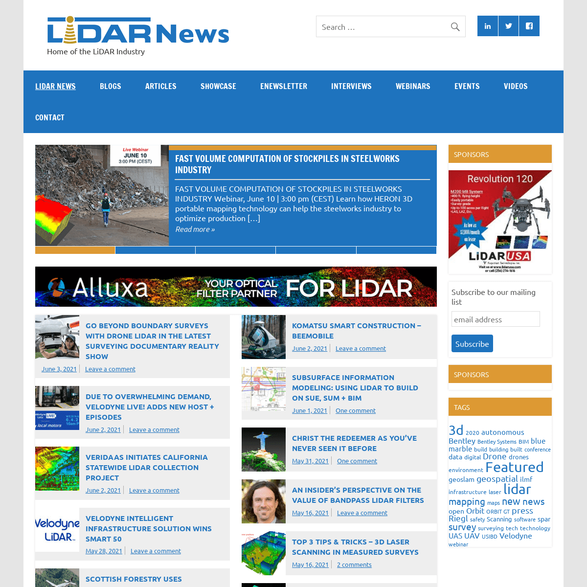
FAST VOLUME COMPUTATION OF STOCKPILES IN STEELWORKS INDUSTRY FAST VOLUME COMPUTATION OF STOCKPILES IN STEELWORKS INDUSTRY Webinar, June 10 | 3:00 pm (CEST) Learn how HERON 3D portable mapping technology can help the steelworks industry to optimize productionRead more »
*
GO BEYOND BOUNDARY SURVEYS WITH DRONE LIDAR IN THE LATEST SURVEYING DOCUMENTARY REALITY SHOW Go Beyond Boundary Surveys With Drone LiDAR in the Latest Surveying Documentary Reality Show Carlson, Brigance & Doering, Inc., uses drone Lidar to create a boundary survey in Southern TexasRead more »
*
DUE TO OVERWHELMING DEMAND, VELODYNE LIVE! ADDS NEW HOST + EPISODES Due to Overwhelming Demand, Velodyne Lidar LIVE! Adds New Host and Episodes Upcoming Episodes Examine What’s Happening in Autonomous Solutions to Shape a Safer, More Intelligent Future SAN JOSE,Calif.–(BUSINESS
Read more »
*
VERIDAAS INITIATES CALIFORNIA STATEWIDE LIDAR COLLECTION PROJECT VeriDaaS Initiates California Statewide LiDAR Collection Project DENVER, Colorado — June 1, 2021 — VeriDaaS today announced that it has completed test flights necessary to begin its statewide California mapping projectRead more »
*
KOMATSU SMART CONSTRUCTION – BEEMOBILE Case study Introduction Smart Construction is a department within Komatsu that focuses on delivering an interconnected software and hardware package to digitalize the work that concerns machines, material, and peopleRead more »
*
FAST VOLUME COMPUTATION OF STOCKPILES IN STEELWORKS INDUSTRY FAST VOLUME COMPUTATION OF STOCKPILES IN STEELWORKS INDUSTRY Webinar, June 10 | 3:00 pm (CEST) Learn how HERON 3D portable mapping technology can help the steelworks industry to optimize productionRead more »
* 1
* 2
* 3
* 4
* 5
* Previous
* Next
GO BEYOND BOUNDARY SURVEYS WITH DRONE LIDAR IN THE LATEST SURVEYING DOCUMENTARY REALITY SHOWJune 3, 2021
Leave a comment
DUE TO OVERWHELMING DEMAND, VELODYNE LIVE! ADDS NEW HOST + EPISODESJune 2, 2021
Leave a comment
VERIDAAS INITIATES CALIFORNIA STATEWIDE LIDAR COLLECTION PROJECTJune 2, 2021
Leave a comment
VELODYNE INTELLIGENT INFRASTRUCTURE SOLUTION WINS SMART 50May 28, 2021
Leave a comment
SCOTTISH FORESTRY USES PHOTOMAPS TO MONITOR TREE HEALTHMay 27, 2021
Leave a comment
MAKING DRONE DELIVERIES SCALABLE AND ECONOMICALLY VIABLEMay 27, 2021
Leave a comment
KOMATSU SMART CONSTRUCTION – BEEMOBILEJune 2, 2021
Leave a comment
SUBSURFACE INFORMATION MODELING: USING LIDAR TO BUILD ON SUE, SUM +BIM
June 1, 2021
One comment
CHRIST THE REDEEMER AS YOU’VE NEVER SEEN IT BEFOREMay 31, 2021
One comment
AN INSIDER’S PERSPECTIVE ON THE VALUE OF BANDPASS LIDAR FILTERSMay 16, 2021
Leave a comment
TOP 3 TIPS & TRICKS – 3D LASER SCANNING IN MEASURED SURVEYSMay 16, 2021
2 comments
A COMMITMENT TO QUALITYMay 4, 2021
One comment
SHOWCASE
FAST VOLUME COMPUTATION OF STOCKPILES IN STEELWORKS INDUSTRYJune 4, 2021
Leave a comment
FAST VOLUME COMPUTATION OF STOCKPILES IN STEELWORKS INDUSTRY Webinar, June 10 | 3:00 pm (CEST) Learn how HERON 3D portable mapping technology can help the THE DEFINITIVE GUIDE TO SLAM & MOBILE MAPPINGMay 29, 2021
Leave a comment
GERMAN ENGINEERS FACILITATE POINT CLOUD MODELING WITH BRICSCADMay 25, 2021
Leave a comment
HOVERMAP – DISCOVER 20+ DATA CAPTURE APPLICATIONSMay 21, 2021
Leave a comment
Sidebar
SPONSORS
* Subscribe to our mailing list** Comments
This field is for validation purposes and should be left unchanged.SPONSORS
TAGS
3d 2020
autonomous
Bentley
Bentley Systems
BIM
blue marble
build
building
built
conference
data
digital
Drone
drones
environment
Featured
geoslam
geospatial
ilmf
infrastructure
laser
lidar
mapping
maps
new
news open
Orbit
ORBIT GT
press
Riegl
safety
Scanning
software
spar
survey
surveying
tech
technology
UAS
UAV
USIBD Velodyne
webinar
�MPN Components, Inc. – All rights reserved / Privacy StatementNotifications
Details
4