3
More Annotations


3


5
Favourite Annotations


2


5
Text
ESRI CANADA
7 steps for improving spatial data governance. Providing training to support your long-term success. Learning Solution. Paperless field data collection made easy. Unleashing data's potential in every industry. Solution Spotlight. ArcGIS Mission: Enhance Tactical Team Awareness and Communication. Maps and apps we love.CONTACT US - ESRI
12 Concorde Place, Suite 900 Toronto, ON M3C 3R8 T: 416-441-6035 F: 416-441-6838 Parking InformationWEBINARS - ESRI
Webinars. Take just one hour out of your day to acquire new skills and knowledge that can be immediately applied to your daily work. Our webinars are live, interactive, free and streamed directly to your desktop. Delivered by an Esri Canada technical expert, these one hour sessions offer the perfect opportunity to brush up on the latestproduct
GEOFOUNDATION EXCHANGE The GeoFoundation Exchange (GFX) is a national, collaborative, open data exchange for accurate and authoritative geographic base mapping data. It is designed to facilitate the coordination and modernization of Canadian base mapping. The GFX employs innovative, cloud-based services to coordinate the activities of authoritative base mappingCITYWORKS - ESRI
Cityworks AMS is designed to help organizations manage public assets and their associated data, work activities, and business processes. Service requests, work orders, and inspection tasks can be configured to meet your specific needs. Cityworks AMS is built exclusively on ArcGIS, allowing workers in the field to interact directly with GISassets.
ARCGIS PRO - ESRI CANADA Getting Started with ArcGIS Pro: Making Data Connections. This video is a continuation of our series to get you started with working in ArcGIS Pro. In this video we will take you through the steps of connecting to your data and adding it to your new projects. Watch Video. Attend the Esri Virtual UC from July 12-15. ESRI CANADA GIS CENTRES OF EXCELLENCE Esri Canada, the leading provider of geographic information system (GIS) solutions, launched its Centres of Excellence initiative in 2014. Through this program, Esri Canada aims to encourage innovation in GIS research and promote teaching excellence in spatial data management and analysis in higher education institutions acrossCanada.
MIGRATING FROM ARCMAP TO ARCGIS PRO With faster tools and integrated 2D and 3D capabilities, ArcGIS Pro will streamline your GIS projects. This course prepares experienced ArcMap users to be productive right away. Learn essential ArcGIS Pro terminology and concepts and how to efficiently complete a variety of tasks related to mapping, editing, analyzing and sharing geospatial data and resources.VIDEO: Join Certified Instructor YOUR GUIDE TO CANADIAN DATUM TRANSFORMATIONS AND ARCGIS Your Guide to Canadian Datum Transformations and ArcGIS Online (Part 3) Published Date. May 27, 2019. Author. Sarah Sibbett. Welcome to the final post in our Canadian Datum Transformation series! So far, we’ve been learning why it’s important to apply the correct datum transformation method to your map prior to publishing to ArcGIS Online CONFIGURE YOUR PYTHON IDE TO WORK WITH ARCMAP AND ARCGIS With the increasing popularity of ArcGIS Pro, you may find yourself building Python scripts in both ArcMap and ArcGIS Pro on the same system. Sorting out which Python interpreter version to use can become confusing and frustrating, resulting in module and DLL errors.ESRI CANADA
7 steps for improving spatial data governance. Providing training to support your long-term success. Learning Solution. Paperless field data collection made easy. Unleashing data's potential in every industry. Solution Spotlight. ArcGIS Mission: Enhance Tactical Team Awareness and Communication. Maps and apps we love.CONTACT US - ESRI
12 Concorde Place, Suite 900 Toronto, ON M3C 3R8 T: 416-441-6035 F: 416-441-6838 Parking InformationWEBINARS - ESRI
Webinars. Take just one hour out of your day to acquire new skills and knowledge that can be immediately applied to your daily work. Our webinars are live, interactive, free and streamed directly to your desktop. Delivered by an Esri Canada technical expert, these one hour sessions offer the perfect opportunity to brush up on the latestproduct
GEOFOUNDATION EXCHANGE The GeoFoundation Exchange (GFX) is a national, collaborative, open data exchange for accurate and authoritative geographic base mapping data. It is designed to facilitate the coordination and modernization of Canadian base mapping. The GFX employs innovative, cloud-based services to coordinate the activities of authoritative base mappingCITYWORKS - ESRI
Cityworks AMS is designed to help organizations manage public assets and their associated data, work activities, and business processes. Service requests, work orders, and inspection tasks can be configured to meet your specific needs. Cityworks AMS is built exclusively on ArcGIS, allowing workers in the field to interact directly with GISassets.
ARCGIS PRO - ESRI CANADA Getting Started with ArcGIS Pro: Making Data Connections. This video is a continuation of our series to get you started with working in ArcGIS Pro. In this video we will take you through the steps of connecting to your data and adding it to your new projects. Watch Video. Attend the Esri Virtual UC from July 12-15. ESRI CANADA GIS CENTRES OF EXCELLENCE Esri Canada, the leading provider of geographic information system (GIS) solutions, launched its Centres of Excellence initiative in 2014. Through this program, Esri Canada aims to encourage innovation in GIS research and promote teaching excellence in spatial data management and analysis in higher education institutions acrossCanada.
MIGRATING FROM ARCMAP TO ARCGIS PRO With faster tools and integrated 2D and 3D capabilities, ArcGIS Pro will streamline your GIS projects. This course prepares experienced ArcMap users to be productive right away. Learn essential ArcGIS Pro terminology and concepts and how to efficiently complete a variety of tasks related to mapping, editing, analyzing and sharing geospatial data and resources.VIDEO: Join Certified Instructor YOUR GUIDE TO CANADIAN DATUM TRANSFORMATIONS AND ARCGIS Your Guide to Canadian Datum Transformations and ArcGIS Online (Part 3) Published Date. May 27, 2019. Author. Sarah Sibbett. Welcome to the final post in our Canadian Datum Transformation series! So far, we’ve been learning why it’s important to apply the correct datum transformation method to your map prior to publishing to ArcGIS Online CONFIGURE YOUR PYTHON IDE TO WORK WITH ARCMAP AND ARCGIS With the increasing popularity of ArcGIS Pro, you may find yourself building Python scripts in both ArcMap and ArcGIS Pro on the same system. Sorting out which Python interpreter version to use can become confusing and frustrating, resulting in module and DLL errors.TRAINING - ESRI
Our training solutions ensure that you not only protect your investment in GIS technology, but also enhance it. You can attend an instructor-led class at a training center or online, or you can learn on your own with our self-paced training options. Track your training history, view your course schedule and more. Login to your account.CONTACT US - ESRI
1425, boul. René-Lévesque Ouest, bureau 1110 Montréal, QC H3G 1T7 T: 514-875-8568 Toll free: 1-866-564-4367 F: 514-875-9362 FORMATION - ESRITRANSLATE THIS PAGE Trouvez une solution parfaite pour vous. Cours ouverts à tous. En classe ou en ligne, apprenez à utiliser ArcGIS auprès de nos formateurs certifiés par Esri. En savoir plus. En savoir plus. Formation magistrale en ligne. Cours donnés en temps réel par un formateur agréé par Esri et expert du domaine. En savoir plus. Ensavoir plus.
SEMINARS - ESRI
Wed, June 2, 2021. Time: 2021-06-03. Virtual Seminar. Language: English. Join us for this virtual seminar to discover how to digitally enable mobile workflows with location intelligence so field work can be completed faster, more efficiently and provide you with a better return on investment. This seminar will be held from 12:00 - 3:20 p.m.ET.
CITYWORKS - ESRI
Cityworks AMS is designed to help organizations manage public assets and their associated data, work activities, and business processes. Service requests, work orders, and inspection tasks can be configured to meet your specific needs. Cityworks AMS is built exclusively on ArcGIS, allowing workers in the field to interact directly with GISassets.
COURSE SCHEDULE
Online (Eastern Time) Thu, June 10 - Fri, June 11, 2021. 9 a.m. - 5 p.m. Eastern Time. English. Maintain the accuracy of your authoritative GIS data. Register Now. Online. Create Informative Maps with Excel Spreadsheets. #78639E. ARCGIS PRO - ESRI CANADA Getting Started with ArcGIS Pro: Making Data Connections. This video is a continuation of our series to get you started with working in ArcGIS Pro. In this video we will take you through the steps of connecting to your data and adding it to your new projects. Watch Video. Attend the Esri Virtual UC from July 12-15. ESRI CANADA GIS SCHOLARSHIPS Information for Students; Recent Posts | Profiles: Scholarship Recipients Award Recipients . 2021 GIS Scholarships. Participating institutions must submit the names of their candidates between January 15 and April 15, 2021.All required information and documents, including a poster and report, must be received by Esri Canada before the candidate will be confirmed as a scholarship recipient and ESRI CANADA GIS CENTRES OF EXCELLENCE Esri Canada, the leading provider of geographic information system (GIS) solutions, launched its Centres of Excellence initiative in 2014. Through this program, Esri Canada aims to encourage innovation in GIS research and promote teaching excellence in spatial data management and analysis in higher education institutions acrossCanada.
NEXT GENERATION 9-1-1 What is next-generation 9-1-1? NG9-1-1 is the transition of 9-1-1 from analogue systems to IP-based systems. The change will enhance emergency number (9-1-1) services to create a faster, more resilient system allowing voice, data, photos, videos and text messagesESRI CANADA
7 steps for improving spatial data governance. Providing training to support your long-term success. Learning Solution. Paperless field data collection made easy. Unleashing data's potential in every industry. Solution Spotlight. ArcGIS Mission: Enhance Tactical Team Awareness and Communication. Maps and apps we love.TRAINING - ESRI
Our training solutions ensure that you not only protect your investment in GIS technology, but also enhance it. You can attend an instructor-led class at a training center or online, or you can learn on your own with our self-paced training options. Track your training history, view your course schedule and more. Login to your account.CONTACT US - ESRI
12 Concorde Place, Suite 900 Toronto, ON M3C 3R8 T: 416-441-6035 F: 416-441-6838 Parking InformationWEBINARS - ESRI
Webinars. Take just one hour out of your day to acquire new skills and knowledge that can be immediately applied to your daily work. Our webinars are live, interactive, free and streamed directly to your desktop. Delivered by an Esri Canada technical expert, these one hour sessions offer the perfect opportunity to brush up on the latestproduct
ARCGIS PRO - ESRI CANADA Getting Started with ArcGIS Pro: Making Data Connections. This video is a continuation of our series to get you started with working in ArcGIS Pro. In this video we will take you through the steps of connecting to your data and adding it to your new projects. Watch Video. Attend the Esri Virtual UC from July 12-15. ESRI CANADA SCHOLARS PORTAL Esri Young Scholars Award in Canada . The Esri Young Scholars Award program was launched in 2012 to recognize the exemplary work in geospatial sciences of undergraduate and graduate students at universities around the world. ESRI CANADA GIS CENTRES OF EXCELLENCE Esri Canada, the leading provider of geographic information system (GIS) solutions, launched its Centres of Excellence initiative in 2014. Through this program, Esri Canada aims to encourage innovation in GIS research and promote teaching excellence in spatial data management and analysis in higher education institutions acrossCanada.
HOW TO CHANGE THE PROJECTION IN ARCGIS ONLINE IN ONE EASY STEP You might be surprised to learn that you can do this in one easy step. When adding a data layer with the desired projection to your map in ArcGIS Online, select the option to use it as a basemap. This will cause the viewer to select the projection parameters associated with the layer and display the map in your chosen projection. You can then YOUR GUIDE TO CANADIAN DATUM TRANSFORMATIONS AND ARCGIS Your Guide to Canadian Datum Transformations and ArcGIS Online (Part 3) Published Date. May 27, 2019. Author. Sarah Sibbett. Welcome to the final post in our Canadian Datum Transformation series! So far, we’ve been learning why it’s important to apply the correct datum transformation method to your map prior to publishing to ArcGIS Online CONFIGURE YOUR PYTHON IDE TO WORK WITH ARCMAP AND ARCGIS With the increasing popularity of ArcGIS Pro, you may find yourself building Python scripts in both ArcMap and ArcGIS Pro on the same system. Sorting out which Python interpreter version to use can become confusing and frustrating, resulting in module and DLL errors.ESRI CANADA
7 steps for improving spatial data governance. Providing training to support your long-term success. Learning Solution. Paperless field data collection made easy. Unleashing data's potential in every industry. Solution Spotlight. ArcGIS Mission: Enhance Tactical Team Awareness and Communication. Maps and apps we love.TRAINING - ESRI
Our training solutions ensure that you not only protect your investment in GIS technology, but also enhance it. You can attend an instructor-led class at a training center or online, or you can learn on your own with our self-paced training options. Track your training history, view your course schedule and more. Login to your account.CONTACT US - ESRI
12 Concorde Place, Suite 900 Toronto, ON M3C 3R8 T: 416-441-6035 F: 416-441-6838 Parking InformationWEBINARS - ESRI
Webinars. Take just one hour out of your day to acquire new skills and knowledge that can be immediately applied to your daily work. Our webinars are live, interactive, free and streamed directly to your desktop. Delivered by an Esri Canada technical expert, these one hour sessions offer the perfect opportunity to brush up on the latestproduct
ARCGIS PRO - ESRI CANADA Getting Started with ArcGIS Pro: Making Data Connections. This video is a continuation of our series to get you started with working in ArcGIS Pro. In this video we will take you through the steps of connecting to your data and adding it to your new projects. Watch Video. Attend the Esri Virtual UC from July 12-15. ESRI CANADA SCHOLARS PORTAL Esri Young Scholars Award in Canada . The Esri Young Scholars Award program was launched in 2012 to recognize the exemplary work in geospatial sciences of undergraduate and graduate students at universities around the world. ESRI CANADA GIS CENTRES OF EXCELLENCE Esri Canada, the leading provider of geographic information system (GIS) solutions, launched its Centres of Excellence initiative in 2014. Through this program, Esri Canada aims to encourage innovation in GIS research and promote teaching excellence in spatial data management and analysis in higher education institutions acrossCanada.
HOW TO CHANGE THE PROJECTION IN ARCGIS ONLINE IN ONE EASY STEP You might be surprised to learn that you can do this in one easy step. When adding a data layer with the desired projection to your map in ArcGIS Online, select the option to use it as a basemap. This will cause the viewer to select the projection parameters associated with the layer and display the map in your chosen projection. You can then YOUR GUIDE TO CANADIAN DATUM TRANSFORMATIONS AND ARCGIS Your Guide to Canadian Datum Transformations and ArcGIS Online (Part 3) Published Date. May 27, 2019. Author. Sarah Sibbett. Welcome to the final post in our Canadian Datum Transformation series! So far, we’ve been learning why it’s important to apply the correct datum transformation method to your map prior to publishing to ArcGIS Online CONFIGURE YOUR PYTHON IDE TO WORK WITH ARCMAP AND ARCGIS With the increasing popularity of ArcGIS Pro, you may find yourself building Python scripts in both ArcMap and ArcGIS Pro on the same system. Sorting out which Python interpreter version to use can become confusing and frustrating, resulting in module and DLL errors.CONTACT US - ESRI
1425, boul. René-Lévesque Ouest, bureau 1110 Montréal, QC H3G 1T7 T: 514-875-8568 Toll free: 1-866-564-4367 F: 514-875-9362SEMINARS - ESRI
Wed, June 2, 2021. Time: 2021-06-03. Virtual Seminar. Language: English. Join us for this virtual seminar to discover how to digitally enable mobile workflows with location intelligence so field work can be completed faster, more efficiently and provide you with a better return on investment. This seminar will be held from 12:00 - 3:20 p.m.ET.
FORMATION - ESRITRANSLATE THIS PAGE Trouvez une solution parfaite pour vous. Cours ouverts à tous. En classe ou en ligne, apprenez à utiliser ArcGIS auprès de nos formateurs certifiés par Esri. En savoir plus. En savoir plus. Formation magistrale en ligne. Cours donnés en temps réel par un formateur agréé par Esri et expert du domaine. En savoir plus. Ensavoir plus.
GEOFOUNDATION EXCHANGE The GeoFoundation Exchange (GFX) is a national, collaborative, open data exchange for accurate and authoritative geographic base mapping data. It is designed to facilitate the coordination and modernization of Canadian base mapping. The GFX employs innovative, cloud-based services to coordinate the activities of authoritative base mapping EDUCATION - ESRI CANADA Building a sense of place and community with free digital tools for K 12 education. Learn how to create a collaborative field study to gather primary source data on your community and environment using ArcGIS Survey123, a digital survey tool that is part of ArcGIS Online. Surveys cre. Watch Video.CITYWORKS - ESRI
Cityworks AMS is designed to help organizations manage public assets and their associated data, work activities, and business processes. Service requests, work orders, and inspection tasks can be configured to meet your specific needs. Cityworks AMS is built exclusively on ArcGIS, allowing workers in the field to interact directly with GISassets.
ESRI CANADA SCHOLARS PORTAL Esri Young Scholars Award in Canada . The Esri Young Scholars Award program was launched in 2012 to recognize the exemplary work in geospatial sciences of undergraduate and graduate students at universities around the world. ESRI CANADA GIS SCHOLARSHIPS 2021 GIS Scholarships. Participating institutions must submit the names of their candidates between January 15 and April 15, 2021. All required information and documents, including a poster and report, must be received by Esri Canada before the candidate will be confirmed as a scholarship recipient and no later than June 1, 2021. ESRI CANADA GIS CENTRES OF EXCELLENCE Esri Canada, the leading provider of geographic information system (GIS) solutions, launched its Centres of Excellence initiative in 2014. Through this program, Esri Canada aims to encourage innovation in GIS research and promote teaching excellence in spatial data management and analysis in higher education institutions acrossCanada.
CONFIGURE YOUR PYTHON IDE TO WORK WITH ARCMAP AND ARCGIS With the increasing popularity of ArcGIS Pro, you may find yourself building Python scripts in both ArcMap and ArcGIS Pro on the same system. Sorting out which Python interpreter version to use can become confusing and frustrating, resulting in module and DLL errors.ESRI CANADA
7 steps for improving spatial data governance. Providing training to support your long-term success. Learning Solution. Paperless field data collection made easy. Unleashing data's potential in every industry. Solution Spotlight. ArcGIS Mission: Enhance Tactical Team Awareness and Communication. Maps and apps we love.TRAINING - ESRI
Our training solutions ensure that you not only protect your investment in GIS technology, but also enhance it. You can attend an instructor-led class at a training center or online, or you can learn on your own with our self-paced training options. Track your training history, view your course schedule and more. Login to your account.CONTACT US - ESRI
12 Concorde Place, Suite 900 Toronto, ON M3C 3R8 T: 416-441-6035 F: 416-441-6838 Parking InformationWEBINARS - ESRI
Webinars. Take just one hour out of your day to acquire new skills and knowledge that can be immediately applied to your daily work. Our webinars are live, interactive, free and streamed directly to your desktop. Delivered by an Esri Canada technical expert, these one hour sessions offer the perfect opportunity to brush up on the latestproduct
GEOFOUNDATION EXCHANGE The GeoFoundation Exchange (GFX) is a national, collaborative, open data exchange for accurate and authoritative geographic base mapping data. It is designed to facilitate the coordination and modernization of Canadian base mapping. The GFX employs innovative, cloud-based services to coordinate the activities of authoritative base mapping ARCGIS PRO - ESRI CANADA Getting Started with ArcGIS Pro: Making Data Connections. This video is a continuation of our series to get you started with working in ArcGIS Pro. In this video we will take you through the steps of connecting to your data and adding it to your new projects. Watch Video. Attend the Esri Virtual UC from July 12-15. ESRI CANADA SCHOLARS PORTAL Esri Young Scholars Award in Canada . The Esri Young Scholars Award program was launched in 2012 to recognize the exemplary work in geospatial sciences of undergraduate and graduate students at universities around the world. MIGRATING FROM ARCMAP TO ARCGIS PRO With faster tools and integrated 2D and 3D capabilities, ArcGIS Pro will streamline your GIS projects. This course prepares experienced ArcMap users to be productive right away. Learn essential ArcGIS Pro terminology and concepts and how to efficiently complete a variety of tasks related to mapping, editing, analyzing and sharing geospatial data and resources.VIDEO: Join Certified Instructor YOUR GUIDE TO CANADIAN DATUM TRANSFORMATIONS AND ARCGIS Your Guide to Canadian Datum Transformations and ArcGIS Online (Part 3) Published Date. May 27, 2019. Author. Sarah Sibbett. Welcome to the final post in our Canadian Datum Transformation series! So far, we’ve been learning why it’s important to apply the correct datum transformation method to your map prior to publishing to ArcGIS Online CONFIGURE YOUR PYTHON IDE TO WORK WITH ARCMAP AND ARCGISCONFIGURE PYTHON INTERPRETER PYCHARMDOWNLOAD PYTHON INTERPRETER FOR PYCHARMINVALID PYTHON INTERPRETER PYCHARMPYCHARM PYTHON 3 7 DOWNLOADPYCHARM PYTHON 3 9PYCHARM PYTHON DOWNLOAD With the increasing popularity of ArcGIS Pro, you may find yourself building Python scripts in both ArcMap and ArcGIS Pro on the same system. Sorting out which Python interpreter version to use can become confusing and frustrating, resulting in module and DLL errors.ESRI CANADA
7 steps for improving spatial data governance. Providing training to support your long-term success. Learning Solution. Paperless field data collection made easy. Unleashing data's potential in every industry. Solution Spotlight. ArcGIS Mission: Enhance Tactical Team Awareness and Communication. Maps and apps we love.TRAINING - ESRI
Our training solutions ensure that you not only protect your investment in GIS technology, but also enhance it. You can attend an instructor-led class at a training center or online, or you can learn on your own with our self-paced training options. Track your training history, view your course schedule and more. Login to your account.CONTACT US - ESRI
12 Concorde Place, Suite 900 Toronto, ON M3C 3R8 T: 416-441-6035 F: 416-441-6838 Parking InformationWEBINARS - ESRI
Webinars. Take just one hour out of your day to acquire new skills and knowledge that can be immediately applied to your daily work. Our webinars are live, interactive, free and streamed directly to your desktop. Delivered by an Esri Canada technical expert, these one hour sessions offer the perfect opportunity to brush up on the latestproduct
GEOFOUNDATION EXCHANGE The GeoFoundation Exchange (GFX) is a national, collaborative, open data exchange for accurate and authoritative geographic base mapping data. It is designed to facilitate the coordination and modernization of Canadian base mapping. The GFX employs innovative, cloud-based services to coordinate the activities of authoritative base mapping ARCGIS PRO - ESRI CANADA Getting Started with ArcGIS Pro: Making Data Connections. This video is a continuation of our series to get you started with working in ArcGIS Pro. In this video we will take you through the steps of connecting to your data and adding it to your new projects. Watch Video. Attend the Esri Virtual UC from July 12-15. ESRI CANADA SCHOLARS PORTAL Esri Young Scholars Award in Canada . The Esri Young Scholars Award program was launched in 2012 to recognize the exemplary work in geospatial sciences of undergraduate and graduate students at universities around the world. MIGRATING FROM ARCMAP TO ARCGIS PRO With faster tools and integrated 2D and 3D capabilities, ArcGIS Pro will streamline your GIS projects. This course prepares experienced ArcMap users to be productive right away. Learn essential ArcGIS Pro terminology and concepts and how to efficiently complete a variety of tasks related to mapping, editing, analyzing and sharing geospatial data and resources.VIDEO: Join Certified Instructor YOUR GUIDE TO CANADIAN DATUM TRANSFORMATIONS AND ARCGIS Your Guide to Canadian Datum Transformations and ArcGIS Online (Part 3) Published Date. May 27, 2019. Author. Sarah Sibbett. Welcome to the final post in our Canadian Datum Transformation series! So far, we’ve been learning why it’s important to apply the correct datum transformation method to your map prior to publishing to ArcGIS Online CONFIGURE YOUR PYTHON IDE TO WORK WITH ARCMAP AND ARCGISCONFIGURE PYTHON INTERPRETER PYCHARMDOWNLOAD PYTHON INTERPRETER FOR PYCHARMINVALID PYTHON INTERPRETER PYCHARMPYCHARM PYTHON 3 7 DOWNLOADPYCHARM PYTHON 3 9PYCHARM PYTHON DOWNLOAD With the increasing popularity of ArcGIS Pro, you may find yourself building Python scripts in both ArcMap and ArcGIS Pro on the same system. Sorting out which Python interpreter version to use can become confusing and frustrating, resulting in module and DLL errors.CONTACT US - ESRI
1425, boul. René-Lévesque Ouest, bureau 1110 Montréal, QC H3G 1T7 T: 514-875-8568 Toll free: 1-866-564-4367 F: 514-875-9362SEMINARS - ESRI
Wed, June 2, 2021. Time: 2021-06-03. Virtual Seminar. Language: English. Join us for this virtual seminar to discover how to digitally enable mobile workflows with location intelligence so field work can be completed faster, more efficiently and provide you with a better return on investment. This seminar will be held from 12:00 - 3:20 p.m.ET.
GEOFOUNDATION EXCHANGE The GeoFoundation Exchange (GFX) is a national, collaborative, open data exchange for accurate and authoritative geographic base mapping data. It is designed to facilitate the coordination and modernization of Canadian base mapping. The GFX employs innovative, cloud-based services to coordinate the activities of authoritative base mapping EDUCATION - ESRI CANADA Building a sense of place and community with free digital tools for K 12 education. Learn how to create a collaborative field study to gather primary source data on your community and environment using ArcGIS Survey123, a digital survey tool that is part of ArcGIS Online. Surveys cre. Watch Video.COURSE SCHEDULE
Online (Eastern Time) Thu, June 10 - Fri, June 11, 2021. 9 a.m. - 5 p.m. Eastern Time. English. Maintain the accuracy of your authoritative GIS data. Register Now. Online. Create Informative Maps with Excel Spreadsheets. #78639E.CITYWORKS - ESRI
Cityworks AMS is designed to help organizations manage public assets and their associated data, work activities, and business processes. Service requests, work orders, and inspection tasks can be configured to meet your specific needs. Cityworks AMS is built exclusively on ArcGIS, allowing workers in the field to interact directly with GISassets.
GETTING TECHNICAL
Maximize your mapping potential with ArcGIS for Personal Use. Buy Now about 1 month ago Getting Technical - April 2021 Esri Canada’s Getting Technical blog post brings you the latest and most significant news about Esri technology. ESRI CANADA GIS SCHOLARSHIPS Information for Students; Recent Posts | Profiles: Scholarship Recipients Award Recipients . 2021 GIS Scholarships. Participating institutions must submit the names of their candidates between January 15 and April 15, 2021.All required information and documents, including a poster and report, must be received by Esri Canada before the candidate will be confirmed as a scholarship recipient and ESRI CANADA GIS CENTRES OF EXCELLENCE Esri Canada, the leading provider of geographic information system (GIS) solutions, launched its Centres of Excellence initiative in 2014. Through this program, Esri Canada aims to encourage innovation in GIS research and promote teaching excellence in spatial data management and analysis in higher education institutions acrossCanada.
NEXT GENERATION 9-1-1 What is next-generation 9-1-1? NG9-1-1 is the transition of 9-1-1 from analogue systems to IP-based systems. The change will enhance emergency number (9-1-1) services to create a faster, more resilient system allowing voice, data, photos, videos and text messagesESRI CANADA
7 steps for improving spatial data governance. Providing training to support your long-term success. Learning Solution. Paperless field data collection made easy. Unleashing data's potential in every industry. Solution Spotlight. ArcGIS Mission: Enhance Tactical Team Awareness and Communication. Maps and apps we love.TRAINING - ESRI
Our training solutions ensure that you not only protect your investment in GIS technology, but also enhance it. You can attend an instructor-led class at a training center or online, or you can learn on your own with our self-paced training options. Track your training history, view your course schedule and more. Login to your account.CONTACT US - ESRI
12 Concorde Place, Suite 900 Toronto, ON M3C 3R8 T: 416-441-6035 F: 416-441-6838 Parking InformationWEBINARS - ESRI
Webinars. Take just one hour out of your day to acquire new skills and knowledge that can be immediately applied to your daily work. Our webinars are live, interactive, free and streamed directly to your desktop. Delivered by an Esri Canada technical expert, these one hour sessions offer the perfect opportunity to brush up on the latestproduct
GEOFOUNDATION EXCHANGE The GeoFoundation Exchange (GFX) is a national, collaborative, open data exchange for accurate and authoritative geographic base mapping data. It is designed to facilitate the coordination and modernization of Canadian base mapping. The GFX employs innovative, cloud-based services to coordinate the activities of authoritative base mapping ARCGIS PRO - ESRI CANADA Getting Started with ArcGIS Pro: Making Data Connections. This video is a continuation of our series to get you started with working in ArcGIS Pro. In this video we will take you through the steps of connecting to your data and adding it to your new projects. Watch Video. Attend the Esri Virtual UC from July 12-15. ESRI CANADA SCHOLARS PORTAL Esri Young Scholars Award in Canada . The Esri Young Scholars Award program was launched in 2012 to recognize the exemplary work in geospatial sciences of undergraduate and graduate students at universities around the world. MIGRATING FROM ARCMAP TO ARCGIS PRO With faster tools and integrated 2D and 3D capabilities, ArcGIS Pro will streamline your GIS projects. This course prepares experienced ArcMap users to be productive right away. Learn essential ArcGIS Pro terminology and concepts and how to efficiently complete a variety of tasks related to mapping, editing, analyzing and sharing geospatial data and resources.VIDEO: Join Certified Instructor YOUR GUIDE TO CANADIAN DATUM TRANSFORMATIONS AND ARCGIS Your Guide to Canadian Datum Transformations and ArcGIS Online (Part 3) Published Date. May 27, 2019. Author. Sarah Sibbett. Welcome to the final post in our Canadian Datum Transformation series! So far, we’ve been learning why it’s important to apply the correct datum transformation method to your map prior to publishing to ArcGIS Online CONFIGURE YOUR PYTHON IDE TO WORK WITH ARCMAP AND ARCGISCONFIGURE PYTHON INTERPRETER PYCHARMDOWNLOAD PYTHON INTERPRETER FOR PYCHARMINVALID PYTHON INTERPRETER PYCHARMPYCHARM PYTHON 3 7 DOWNLOADPYCHARM PYTHON 3 9PYCHARM PYTHON DOWNLOAD With the increasing popularity of ArcGIS Pro, you may find yourself building Python scripts in both ArcMap and ArcGIS Pro on the same system. Sorting out which Python interpreter version to use can become confusing and frustrating, resulting in module and DLL errors.ESRI CANADA
7 steps for improving spatial data governance. Providing training to support your long-term success. Learning Solution. Paperless field data collection made easy. Unleashing data's potential in every industry. Solution Spotlight. ArcGIS Mission: Enhance Tactical Team Awareness and Communication. Maps and apps we love.TRAINING - ESRI
Our training solutions ensure that you not only protect your investment in GIS technology, but also enhance it. You can attend an instructor-led class at a training center or online, or you can learn on your own with our self-paced training options. Track your training history, view your course schedule and more. Login to your account.CONTACT US - ESRI
12 Concorde Place, Suite 900 Toronto, ON M3C 3R8 T: 416-441-6035 F: 416-441-6838 Parking InformationWEBINARS - ESRI
Webinars. Take just one hour out of your day to acquire new skills and knowledge that can be immediately applied to your daily work. Our webinars are live, interactive, free and streamed directly to your desktop. Delivered by an Esri Canada technical expert, these one hour sessions offer the perfect opportunity to brush up on the latestproduct
GEOFOUNDATION EXCHANGE The GeoFoundation Exchange (GFX) is a national, collaborative, open data exchange for accurate and authoritative geographic base mapping data. It is designed to facilitate the coordination and modernization of Canadian base mapping. The GFX employs innovative, cloud-based services to coordinate the activities of authoritative base mapping ARCGIS PRO - ESRI CANADA Getting Started with ArcGIS Pro: Making Data Connections. This video is a continuation of our series to get you started with working in ArcGIS Pro. In this video we will take you through the steps of connecting to your data and adding it to your new projects. Watch Video. Attend the Esri Virtual UC from July 12-15. ESRI CANADA SCHOLARS PORTAL Esri Young Scholars Award in Canada . The Esri Young Scholars Award program was launched in 2012 to recognize the exemplary work in geospatial sciences of undergraduate and graduate students at universities around the world. MIGRATING FROM ARCMAP TO ARCGIS PRO With faster tools and integrated 2D and 3D capabilities, ArcGIS Pro will streamline your GIS projects. This course prepares experienced ArcMap users to be productive right away. Learn essential ArcGIS Pro terminology and concepts and how to efficiently complete a variety of tasks related to mapping, editing, analyzing and sharing geospatial data and resources.VIDEO: Join Certified Instructor YOUR GUIDE TO CANADIAN DATUM TRANSFORMATIONS AND ARCGIS Your Guide to Canadian Datum Transformations and ArcGIS Online (Part 3) Published Date. May 27, 2019. Author. Sarah Sibbett. Welcome to the final post in our Canadian Datum Transformation series! So far, we’ve been learning why it’s important to apply the correct datum transformation method to your map prior to publishing to ArcGIS Online CONFIGURE YOUR PYTHON IDE TO WORK WITH ARCMAP AND ARCGISCONFIGURE PYTHON INTERPRETER PYCHARMDOWNLOAD PYTHON INTERPRETER FOR PYCHARMINVALID PYTHON INTERPRETER PYCHARMPYCHARM PYTHON 3 7 DOWNLOADPYCHARM PYTHON 3 9PYCHARM PYTHON DOWNLOAD With the increasing popularity of ArcGIS Pro, you may find yourself building Python scripts in both ArcMap and ArcGIS Pro on the same system. Sorting out which Python interpreter version to use can become confusing and frustrating, resulting in module and DLL errors.CONTACT US - ESRI
1425, boul. René-Lévesque Ouest, bureau 1110 Montréal, QC H3G 1T7 T: 514-875-8568 Toll free: 1-866-564-4367 F: 514-875-9362SEMINARS - ESRI
Wed, June 2, 2021. Time: 2021-06-03. Virtual Seminar. Language: English. Join us for this virtual seminar to discover how to digitally enable mobile workflows with location intelligence so field work can be completed faster, more efficiently and provide you with a better return on investment. This seminar will be held from 12:00 - 3:20 p.m.ET.
GEOFOUNDATION EXCHANGE The GeoFoundation Exchange (GFX) is a national, collaborative, open data exchange for accurate and authoritative geographic base mapping data. It is designed to facilitate the coordination and modernization of Canadian base mapping. The GFX employs innovative, cloud-based services to coordinate the activities of authoritative base mapping EDUCATION - ESRI CANADA Building a sense of place and community with free digital tools for K 12 education. Learn how to create a collaborative field study to gather primary source data on your community and environment using ArcGIS Survey123, a digital survey tool that is part of ArcGIS Online. Surveys cre. Watch Video.COURSE SCHEDULE
Online (Eastern Time) Thu, June 10 - Fri, June 11, 2021. 9 a.m. - 5 p.m. Eastern Time. English. Maintain the accuracy of your authoritative GIS data. Register Now. Online. Create Informative Maps with Excel Spreadsheets. #78639E.CITYWORKS - ESRI
Cityworks AMS is designed to help organizations manage public assets and their associated data, work activities, and business processes. Service requests, work orders, and inspection tasks can be configured to meet your specific needs. Cityworks AMS is built exclusively on ArcGIS, allowing workers in the field to interact directly with GISassets.
GETTING TECHNICAL
Maximize your mapping potential with ArcGIS for Personal Use. Buy Now about 1 month ago Getting Technical - April 2021 Esri Canada’s Getting Technical blog post brings you the latest and most significant news about Esri technology. ESRI CANADA GIS SCHOLARSHIPS Information for Students; Recent Posts | Profiles: Scholarship Recipients Award Recipients . 2021 GIS Scholarships. Participating institutions must submit the names of their candidates between January 15 and April 15, 2021.All required information and documents, including a poster and report, must be received by Esri Canada before the candidate will be confirmed as a scholarship recipient and ESRI CANADA GIS CENTRES OF EXCELLENCE Esri Canada, the leading provider of geographic information system (GIS) solutions, launched its Centres of Excellence initiative in 2014. Through this program, Esri Canada aims to encourage innovation in GIS research and promote teaching excellence in spatial data management and analysis in higher education institutions acrossCanada.
NEXT GENERATION 9-1-1 What is next-generation 9-1-1? NG9-1-1 is the transition of 9-1-1 from analogue systems to IP-based systems. The change will enhance emergency number (9-1-1) services to create a faster, more resilient system allowing voice, data, photos, videos and text messagesSkip to Content
* Products
Products
* CAPABILITIES
Mapping
Field Operations
Spatial Analysis & Data Science Imagery & Remote Sensing Real-Time Visualization & Analytics 3D Visualization & Analytics * GIS & MAPPING PRODUCTSArcGIS Online
Complete SaaS mapping platformArcGIS Pro
Next generation desktop GISArcGIS Enterprise
Foundational system for GIS and mapping ArcGIS for Developers Develop your own apps * GEO-ENABLED PRODUCTS ArcGIS Business Analyst Market intelligence for smarter business decisionsArcGIS Excalibur
Imagery exploitationArcGIS Hub
Community engagement and collaborationArcGIS Indoors
Smart building managementArcGIS Mission
A tactical situational awareness and mission management softwaresolution
ArcGIS Urban
Smart city planning for urban development ArcGIS Community AnalystCanadian Edition
* LOCATION ANALYTICSArcGIS Insights
Self-service location analytics ArcGIS Maps for Office Interactive maps in your spreadsheets and presentations ArcGIS Maps for Power BI Take your map visualizations to the next level ArcGIS Maps for SharePoint Map and search Microsoft SharePoint content * SPECIALIZED APPLICATIONSAddress Manager
Create, maintain and use authoritative civic address informationArcFM Solution
Complete enterprise GIS solution for facilities managementAssessment Analyst
Single platform to review, manage and analyze assessment data Assessment Analyst - GAMA Smarter property valuation using spatial dataCityworks
One-stop capital asset and infrastructure management* DATA
The Community Map of Canada Canada's single, common and accurate basemapLiving Atlas
Authoritative information from around the globe Demographic & Business Data Data from Canada's leading suppliers Imagery & Remote Sensing Earth observations to power your analysis ArcGIS Data Appliance Create, secure, publish your map servicesVaccineInsights
Access COVID-19 vaccination behavioural and trend data* EXPLORE MORE
All Products
What is GIS?
* BUY ONLINE
How to Buy
Esri Canada Store
ArcGIS Marketplace
*
Mapping
*
Field Operations
*
Spatial Analysis & Data Science*
Imagery & Remote Sensing*
Real-Time Visualization & Analytics*
3D Visualization & Analytics*
ArcGIS Online
Complete SaaS mapping platform*
ArcGIS Pro
Next generation desktop GIS*
ArcGIS Enterprise
Foundational system for GIS and mapping*
ArcGIS for Developers Develop your own apps*
ArcGIS Business Analyst Market intelligence for smarter business decisions*
ArcGIS Excalibur
Imagery exploitation*
ArcGIS Hub
Community engagement and collaboration*
ArcGIS Indoors
Smart building management*
ArcGIS Mission
A tactical situational awareness and mission management softwaresolution
*
ArcGIS Urban
Smart city planning for urban development*
ArcGIS Community AnalystCanadian Edition
*
ArcGIS Insights
Self-service location analytics*
ArcGIS Maps for Office Interactive maps in your spreadsheets and presentations*
ArcGIS Maps for Power BI Take your map visualizations to the next level*
ArcGIS Maps for SharePoint Map and search Microsoft SharePoint content*
Address Manager
Create, maintain and use authoritative civic address information*
ArcFM Solution
Complete enterprise GIS solution for facilities management*
Assessment Analyst
Single platform to review, manage and analyze assessment data*
Assessment Analyst - GAMA Smarter property valuation using spatial data*
Cityworks
One-stop capital asset and infrastructure management*
The Community Map of Canada Canada's single, common and accurate basemap*
Living Atlas
Authoritative information from around the globe*
Demographic & Business Data Data from Canada's leading suppliers*
Imagery & Remote Sensing Earth observations to power your analysis*
ArcGIS Data Appliance Create, secure, publish your map services*
VaccineInsights
Access COVID-19 vaccination behavioural and trend data*
All Products
*
What is GIS?
*
How to Buy
*
Esri Canada Store
*
ArcGIS Marketplace
* Solutions
Solutions
* BUSINESS NEEDS
Asset Tracking and Analysis Economic DevelopmentFacility Management
Field Service Management Logistics and Fulfillment Market and Customer Analysis Operational Efficiency Performance Monitoring Real-Time Location TrackingRisk Management
Site Analysis and Territory Planning Situational Awareness Supply Chain Digitization* INDUSTRIES
Commercial
Defence & Security
Education
Government
Health
Land & Property
Natural Resources
Public Safety
Transportation
Utilities
* TECHNOLOGY TRENDS
Location Intelligence Digital Transformation Artificial IntelligenceIoT
*
Asset Tracking and Analysis*
Economic Development*
Facility Management
*
Field Service Management*
Logistics and Fulfillment*
Market and Customer Analysis*
Operational Efficiency*
Performance Monitoring*
Real-Time Location Tracking*
Risk Management
*
Site Analysis and Territory Planning*
Situational Awareness*
Supply Chain Digitization*
Commercial
*
Defence & Security
*
Education
*
Government
*
Health
*
Land & Property
*
Natural Resources
*
Public Safety
*
Transportation
*
Utilities
*
Location Intelligence*
Digital Transformation*
Artificial Intelligence*
IoT
* Support & ServicesSupport & Services
* Overview
* Technical Support
* Customer Care
* Training
* Consulting Services* My Esri
* Contact Us
* News & Events
News & Events
*
NEWS
* Overview
* Esri Canada Blog
* Newsroom
* WhereNext Magazine* Podcasts
*
EVENTS
* Overview
* Seminars
* Webinars
* Esri Events
* Industry Events
* About
About
* About Us
* Sustainable Prosperity* Careers
* Partners
* Contact Us
Search Esri Canada
Cancel
0
Sign In
ESRI
Esri Canada Statement on COVID-19 (Coronavirus)Read more
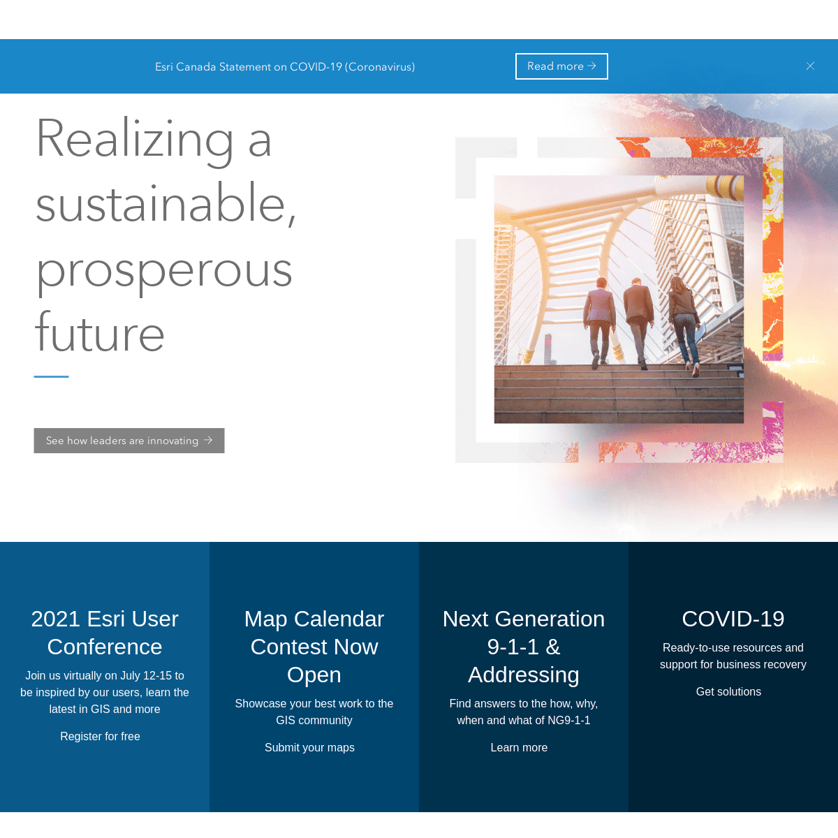
REALIZING A SUSTAINABLE, PROSPEROUS FUTURE ------------------------- See how leaders are innovating 2021 ESRI USER CONFERENCE Join us virtually on July 12-15 to be inspired by our users, learn the latest in GIS and moreRegister for free
MAP CALENDAR CONTEST NOW OPEN Showcase your best work to the GIS communitySubmit your maps
NEXT GENERATION 9-1-1 & ADDRESSING Find answers to the how, why, when and what of NG9-1-1Learn more
COVID-19
Ready-to-use resources and support for business recoveryGet solutions
Pioneering ArcGIS
, powerful
mapping and analytics softwarePRODUCT SPOTLIGHT
VaccineInsights
Hosting epic virtual and live events showcasing all things GISEVENTS
View upcoming seminars Inspiring innovation with customer storiesCASE STUDY
Imperial Oil improves safety inspections at large mine with FieldApps
Empowering businesses to gain competitive advantage with locationintelligence
THOUGHT LEADERSHIP
7 steps for improving spatial data governance Providing training to support your long-term successLEARNING SOLUTION
Paperless field data collection made easy Unleashing data's potential in every industrySOLUTION SPOTLIGHT
How Indoor GIS Can Support Facility Managers Post-COVIDMaps and apps
we love
APP OF THE MONTH
Make Tracks
ABOUT ESRI CANADA
WHAT IS GIS
opens in new window
Please select a language: Français (French)English (Global)Change* ArcGIS
* About ArcGIS
* ArcGIS Online
* ArcGIS Pro
* ArcGIS Enterprise
* Apps
* ArcGIS for Developers* Community
* Esri Canada User Conferences* Esri Canada Blog
* App Hub
* ArcGIS Blog
* Esri Blog
* Esri Community (GeoNet) * Early Adopter Community* Understanding GIS
* What is GIS?
* Resources
* Training
* Maps We Love
* WhereNext Magazine* Learn ArcGIS
* Company
* About Us
* Careers
* Job Postings
* Open Vision
* Partners
* Special Programs
* The Community Map of Canada* Living Atlas
* ArcGIS for Personal Use * ArcGIS for Student Use * GIS Ambassador Program * Young Professional Network* Nonprofit
Switch Language
* Email Preferences
* Legal
* Contact Us
* Privacy
* Accessibility
Details
4