3
More Annotations


5


1
Favourite Annotations


3


5
Text
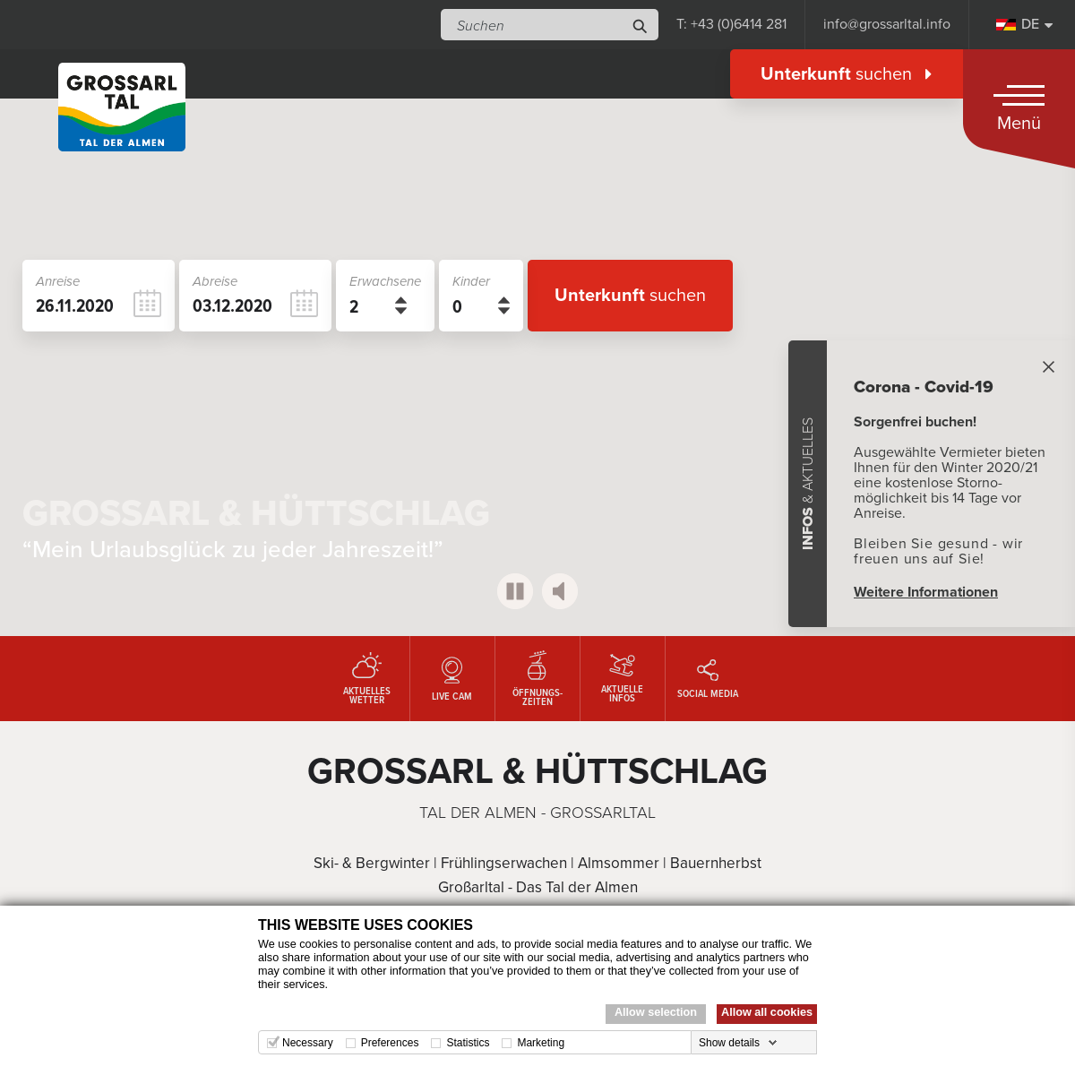
GROSSARLTAL TOURIST OFFICE OFFICIAL WEBPAGE OF THE TOURIST Experience Alpine Summer in Grossarltal, hiking up to our mountain huts and high peaks. As you go, discover the magnificent mountain panorama of the Hohe Tauern and allow yourself to be treated to a selection of homemade specialties at trail-side huts. from € GROSSARLTAL GROSSARLTAL TOURIST OFFICE Grossarltal. In a beautiful, fog-free alpine setting, Grossarltal lies ca. 70 km south of Salzburg City of Mozart in the Pongau district. Grossarltal valley, with its two communities Grossarl and Hüttschlag, separates the Hohe Tauern and Niedere Tauern ranges. It is an arm of the Radstädter Tauern and thus the easternmost of the Tauern valleys. DRAUGSTEINALM-SCHRAMBACHHÜTTE GROSSARLTAL TOURIST OFFICE Draugsteinalm-Schrambachhütte Grossarltal Tourist Office. P: +43 (0)6414 281 info@grossarltal.info. EN. Deutsch Čeština English Nederlands Italiano Polski Magyar ARRIVAL GROSSARLTAL TOURIST OFFICE Arrival by air. The nearest major airport for your trip to Grossarltal is Salzburg W. A. Mozart Airport, Tel.: +43 (0) 662 / 8580251. Salzburg Airport is about 70 km from Grossarltal. Flying doesn’t Twitter
The cookie is used in context with the local-storage function in the browser. This function allows the website to load faster by pre-loading certain procedures.LinkedIn
Remembers the user's selected language version of a websiteGoogle
Used by Google DoubleClick to register and report the website user's actions after viewing or clicking one of the advertiser's ads with the purpose of measuring the efficacy of an ad and to present targeted adsGoogle
Used to check if the user's browser supports cookies.Facebook
Used by Facebook to deliver a series of advertisement products such as real time bidding from third party advertisers.Google
Registers a unique ID that identifies a returning user's device. The ID is used for targeted ads.LinkedIn
Used by the social networking service, LinkedIn, for tracking the use of embedded services.LinkedIn
Used by the social networking service, LinkedIn, for tracking the use of embedded services.LinkedIn
Used by the social networking service, LinkedIn, for tracking the use of embedded services.LinkedIn
Used by the social networking service, LinkedIn, for tracking the use of embedded services.LinkedIn
Used to track visitors on multiple websites, in order to present relevant advertisement based on the visitor's preferences.Twitter
This cookie is set by Twitter - The cookie allows the visitor to share content from the website onto their Twitter profile.Google
LinkedIn
necessarily have to
LIECHTENSTEINKLAMM GROSSARLTAL TOURIST OFFICE Liechtensteinklamm at the entrance to Grossarltal in St. Johann im Pongau is one of the deepest and longest gorges in the Alps.Allow yourself to be enchanted by the mighty thunder of the waterfall, by the lush green of the moss-covered rocks and the fine mists of water that conjure up rainbows.VILLAGE MAP
Village map of Großarl and Hüttschlag with accommodations and infrastructure Markups - provided by the Großarltal Tourist Office. DRAUGSTEINALM-STEINMANNHÜTTE GROSSARLTAL TOURIST OFFICE Via an old alpine trail, you will reach both of the Draugsteinalmen huts (elev. 1,778 m) in about 1 ½ h. They lie at the foot of the Draugstein, a rather unusual mountain for Grossarltal – an imposing limestone edifice. Here, the native flora are especially beautiful. The Draugsteinalm-Steinmannhütte is the hut on the left when viewedfrom
FILZMOOSALM GROSSARLTAL TOURIST OFFICE The Filzmoosalm lies at 1,710 m in the upper Ellmautal in Grossarltal. You can hike in around 1 ¼ h from Grund up to the hut. A special feature of this area are the numerous pine trees that flank the hiking trail from the Filzmoosalm up to the Filzmoossattel. Hikers and mountain bikers are treated at the Filzmoosalm to delicious snacks of homemade products such as bread, cheese, butter and bacon. MOUNTAIN BIKING & CYCLING GROSSARLTAL TOURIST OFFICE Mountainbikers and cyclists are greeted in Grosarltal by 21 marked MTB trails, ranging in difficulty and with elevation gains between 300 and 1,000 meters in altitude depending on the tour. In total, Grossarltal offers over 160 km of posted, clearly marked mountain-bike trails, which adds up to some 14,000 meters in altitude. YouTube. HARVEST FESTIVAL PACKAGE GROSSARLTAL TOURIST OFFICE Harvest Festival is one of the most beautiful times of year to go hiking. The clear mountain air and seemingly endless views invite you to marvel at the unique alpine panoramas of the Hohe Tauern. Harvest Festival is also the time for colorful parades to welcome cattle home from summer grazing, and for an array of other local festivities. Harvest Festival unites 3 pillars of local life GROSSARLTAL TOURIST OFFICE OFFICIAL WEBPAGE OF THE TOURIST Experience Alpine Summer in Grossarltal, hiking up to our mountain huts and high peaks. As you go, discover the magnificent mountain panorama of the Hohe Tauern and allow yourself to be treated to a selection of homemade specialties at trail-side huts. from € GROSSARLTAL GROSSARLTAL TOURIST OFFICE Grossarltal. In a beautiful, fog-free alpine setting, Grossarltal lies ca. 70 km south of Salzburg City of Mozart in the Pongau district. Grossarltal valley, with its two communities Grossarl and Hüttschlag, separates the Hohe Tauern and Niedere Tauern ranges. It is an arm of the Radstädter Tauern and thus the easternmost of the Tauern valleys. DRAUGSTEINALM-SCHRAMBACHHÜTTE GROSSARLTAL TOURIST OFFICE Draugsteinalm-Schrambachhütte Grossarltal Tourist Office. P: +43 (0)6414 281 info@grossarltal.info. EN. Deutsch Čeština English Nederlands Italiano Polski Magyar ARRIVAL GROSSARLTAL TOURIST OFFICE Arrival by air. The nearest major airport for your trip to Grossarltal is Salzburg W. A. Mozart Airport, Tel.: +43 (0) 662 / 8580251. Salzburg Airport is about 70 km from Grossarltal. Flying doesn’tnecessarily have to
LIECHTENSTEINKLAMM GROSSARLTAL TOURIST OFFICE Liechtensteinklamm at the entrance to Grossarltal in St. Johann im Pongau is one of the deepest and longest gorges in the Alps.Allow yourself to be enchanted by the mighty thunder of the waterfall, by the lush green of the moss-covered rocks and the fine mists of water that conjure up rainbows.VILLAGE MAP
Village map of Großarl and Hüttschlag with accommodations and infrastructure Markups - provided by the Großarltal Tourist Office. DRAUGSTEINALM-STEINMANNHÜTTE GROSSARLTAL TOURIST OFFICE Via an old alpine trail, you will reach both of the Draugsteinalmen huts (elev. 1,778 m) in about 1 ½ h. They lie at the foot of the Draugstein, a rather unusual mountain for Grossarltal – an imposing limestone edifice. Here, the native flora are especially beautiful. The Draugsteinalm-Steinmannhütte is the hut on the left when viewedfrom
FILZMOOSALM GROSSARLTAL TOURIST OFFICE The Filzmoosalm lies at 1,710 m in the upper Ellmautal in Grossarltal. You can hike in around 1 ¼ h from Grund up to the hut. A special feature of this area are the numerous pine trees that flank the hiking trail from the Filzmoosalm up to the Filzmoossattel. Hikers and mountain bikers are treated at the Filzmoosalm to delicious snacks of homemade products such as bread, cheese, butter and bacon. MOUNTAIN BIKING & CYCLING GROSSARLTAL TOURIST OFFICE Mountainbikers and cyclists are greeted in Grosarltal by 21 marked MTB trails, ranging in difficulty and with elevation gains between 300 and 1,000 meters in altitude depending on the tour. In total, Grossarltal offers over 160 km of posted, clearly marked mountain-bike trails, which adds up to some 14,000 meters in altitude. YouTube. HARVEST FESTIVAL PACKAGE GROSSARLTAL TOURIST OFFICE Harvest Festival is one of the most beautiful times of year to go hiking. The clear mountain air and seemingly endless views invite you to marvel at the unique alpine panoramas of the Hohe Tauern. Harvest Festival is also the time for colorful parades to welcome cattle home from summer grazing, and for an array of other local festivities. Harvest Festival unites 3 pillars of local life GOOD TO KNOW GROSSARLTAL TOURIST OFFICE From St. Johann im Pongau, a bus runs via Grossarl and Hüttschlag to the Hüttschlag valley head.There is also a bus in summer that runs to Ellmautal as far as the “Grund” car park, while another bus runs in winter to Klausbauer Farm. With your Guest Card you can ride the post buses for € 1,00. A hiking taxi also operates in summer, while in winter a free ski bus will take you to the ARRIVAL GROSSARLTAL TOURIST OFFICE The nearest major airport for your trip to Grossarltal is Salzburg W. A. Mozart Airport, Tel.: +43 (0) 662 / 8580251.Salzburg Airport is about 70 km from Grossarltal. Flying doesn’t necessarily have to be expensive. Please look out for bargain fares offered weekly by cut-price airlines from Germany and many other countries to Salzburg.VILLAGE MAP
Village map of Großarl and Hüttschlag with accommodations and infrastructure Markups - provided by the Großarltal Tourist Office. HUTS & HIKING IM GROSSARLTAL GROSSARLTAL TOURIST OFFICE You hike along 400 km of signposted hiking paths to approx. 40 mountain huts.Due to the reason that there are such a lot of mountain huts, the Grossarltal is named also the "Valley of Huts".However, you cannot just hike to mountain huts, peaks and tarns are awaiting you as well. On this page, you get all the information about hiking, mountain huts, hiking pins, safe behavior in the mountains HÜTTSCHLAG GROSSARLTAL TOURIST OFFICE Hüttschlag is a former mining community and lies at 1,020 m above sea level, ca. 8 km from Grossarl. Hüttschlag itself has an area of 95.18 km². Since 1991, 1/3 of Hüttschlag lies within Hohe Tauern National Park, the biggest national park in the Alps. Since 2008, Hüttschlag has belonged to “Austria’s Mountaineering Villages”, a project of the Austrian Alpine Association within the HUTS IN GROSSARLTAL GROSSARLTAL TOURIST OFFICE While things are still quiet in the valley, the staff up at the huts are already hard at work. First working with the animals in the barn, then processing the milk.It is a long day with so much to do. But your hut hosts are always delighted to treat hikers to their homemade delicacies, prepared true to generations-old recipes, right there atthe hut itself:
TAPPENKARSEEHÜTTE GROSSARLTAL TOURIST OFFICE Tappenkarseehütte. Tappenkarseehütte elev. 1,820 m (3 h walk) The Tappenkarseehütte is in Kleinarl, on the shore of the Tappenkarsee, the biggest mountain lake in the Eastern Alps. This Alpine Association hut lies at 1,820 m. Hikers can reach this hut from Hüttschlag in ca. 3 h and from Grossarl in 5 h, or from Kleinarl and the car park at HIRSCHGRUBENALM GROSSARLTAL TOURIST OFFICE Nestled amid a broad valley basin, the Hirschgrubenalm lies at 1,564 m in the “mountaineering village” of Hüttschlag. The hut is over 1000 years old. In practically any weather, hikers, young and old, can reach the Hirschgrubenalm in about 1 h. The hosts treat hikers and mountain bikers to a selection of delicious products that are made HIKING MAPS GROSSARLTAL TOURIST OFFICE Hiking map No. 311 published by Tappeiner (scale 1:35 000) will get you safely to your destination.It shows all hiking paths, huts, mountains and valley crossings within reach of Grossarltal. Also clearly marked are cycle paths and mountainbike routes as well as back-country ski tours in Grossarl and Hüttschlag. And to help you get your bearings in Grossarltal even better, the back page of E-BIKE IN GROSSARLTAL GROSSARLTAL TOURIST OFFICE E-Biking – Laid-back cycling in Grossarltal. For mountainbikers there are about 160 km of signposted biketracks in Grossarltal. These are 21 tours of varying difficulty and with a difference in altitude from 300 to 1,000 meters per tour. A total of approx. 13,000 meters of altitude are waiting for you. GROSSARLTAL TOURIST OFFICE OFFICIAL WEBPAGE OF THE TOURIST Experience Alpine Summer in Grossarltal, hiking up to our mountain huts and high peaks. As you go, discover the magnificent mountain panorama of the Hohe Tauern and allow yourself to be treated to a selection of homemade specialties at trail-side huts. from € GROSSARLTAL GROSSARLTAL TOURIST OFFICE Grossarltal. In a beautiful, fog-free alpine setting, Grossarltal lies ca. 70 km south of Salzburg City of Mozart in the Pongau district. Grossarltal valley, with its two communities Grossarl and Hüttschlag, separates the Hohe Tauern and Niedere Tauern ranges. It is an arm of the Radstädter Tauern and thus the easternmost of the Tauern valleys. LIECHTENSTEINKLAMM GROSSARLTAL TOURIST OFFICE Liechtensteinklamm at the entrance to Grossarltal in St. Johann im Pongau is one of the deepest and longest gorges in the Alps.Allow yourself to be enchanted by the mighty thunder of the waterfall, by the lush green of the moss-covered rocks and the fine mists of water that conjure up rainbows. DRAUGSTEINALM-STEINMANNHÜTTE GROSSARLTAL TOURIST OFFICE Via an old alpine trail, you will reach both of the Draugsteinalmen huts (elev. 1,778 m) in about 1 ½ h. They lie at the foot of the Draugstein, a rather unusual mountain for Grossarltal – an imposing limestone edifice. Here, the native flora are especially beautiful. The Draugsteinalm-Steinmannhütte is the hut on the left when viewedfrom
FILZMOOSALM GROSSARLTAL TOURIST OFFICE The Filzmoosalm lies at 1,710 m in the upper Ellmautal in Grossarltal. You can hike in around 1 ¼ h from Grund up to the hut. A special feature of this area are the numerous pine trees that flank the hiking trail from the Filzmoosalm up to the Filzmoossattel. Hikers and mountain bikers are treated at the Filzmoosalm to delicious snacks of homemade products such as bread, cheese, butter and bacon. HÜTTSCHLAG GROSSARLTAL TOURIST OFFICE Hüttschlag is a former mining community and lies at 1,020 m above sea level, ca. 8 km from Grossarl. Hüttschlag itself has an area of 95.18 km². Since 1991, 1/3 of Hüttschlag lies within Hohe Tauern National Park, the biggest national park in the Alps. Since 2008, Hüttschlag has belonged to “Austria’s Mountaineering Villages”, a project of the Austrian Alpine Association within theVILLAGE MAP
Village map of Großarl and Hüttschlag with accommodations and infrastructure Markups - provided by the Großarltal Tourist Office. TAPPENKARSEEHÜTTE GROSSARLTAL TOURIST OFFICE Tappenkarseehütte. Tappenkarseehütte elev. 1,820 m (3 h walk) The Tappenkarseehütte is in Kleinarl, on the shore of the Tappenkarsee, the biggest mountain lake in the Eastern Alps. This Alpine Association hut lies at 1,820 m. Hikers can reach this hut from Hüttschlag in ca. 3 h and from Grossarl in 5 h, or from Kleinarl and the car park at MOUNTAIN BIKING & CYCLING GROSSARLTAL TOURIST OFFICE Mountainbikers and cyclists are greeted in Grosarltal by 21 marked MTB trails, ranging in difficulty and with elevation gains between 300 and 1,000 meters in altitude depending on the tour. In total, Grossarltal offers over 160 km of posted, clearly marked mountain-bike trails, which adds up to some 14,000 meters in altitude. YouTube. HARVEST FESTIVAL PACKAGE GROSSARLTAL TOURIST OFFICE Harvest Festival is one of the most beautiful times of year to go hiking. The clear mountain air and seemingly endless views invite you to marvel at the unique alpine panoramas of the Hohe Tauern. Harvest Festival is also the time for colorful parades to welcome cattle home from summer grazing, and for an array of other local festivities. Harvest Festival unites 3 pillars of local life GROSSARLTAL TOURIST OFFICE OFFICIAL WEBPAGE OF THE TOURIST Experience Alpine Summer in Grossarltal, hiking up to our mountain huts and high peaks. As you go, discover the magnificent mountain panorama of the Hohe Tauern and allow yourself to be treated to a selection of homemade specialties at trail-side huts. from € GROSSARLTAL GROSSARLTAL TOURIST OFFICE Grossarltal. In a beautiful, fog-free alpine setting, Grossarltal lies ca. 70 km south of Salzburg City of Mozart in the Pongau district. Grossarltal valley, with its two communities Grossarl and Hüttschlag, separates the Hohe Tauern and Niedere Tauern ranges. It is an arm of the Radstädter Tauern and thus the easternmost of the Tauern valleys. LIECHTENSTEINKLAMM GROSSARLTAL TOURIST OFFICE Liechtensteinklamm at the entrance to Grossarltal in St. Johann im Pongau is one of the deepest and longest gorges in the Alps.Allow yourself to be enchanted by the mighty thunder of the waterfall, by the lush green of the moss-covered rocks and the fine mists of water that conjure up rainbows. DRAUGSTEINALM-STEINMANNHÜTTE GROSSARLTAL TOURIST OFFICE Via an old alpine trail, you will reach both of the Draugsteinalmen huts (elev. 1,778 m) in about 1 ½ h. They lie at the foot of the Draugstein, a rather unusual mountain for Grossarltal – an imposing limestone edifice. Here, the native flora are especially beautiful. The Draugsteinalm-Steinmannhütte is the hut on the left when viewedfrom
FILZMOOSALM GROSSARLTAL TOURIST OFFICE The Filzmoosalm lies at 1,710 m in the upper Ellmautal in Grossarltal. You can hike in around 1 ¼ h from Grund up to the hut. A special feature of this area are the numerous pine trees that flank the hiking trail from the Filzmoosalm up to the Filzmoossattel. Hikers and mountain bikers are treated at the Filzmoosalm to delicious snacks of homemade products such as bread, cheese, butter and bacon. HÜTTSCHLAG GROSSARLTAL TOURIST OFFICE Hüttschlag is a former mining community and lies at 1,020 m above sea level, ca. 8 km from Grossarl. Hüttschlag itself has an area of 95.18 km². Since 1991, 1/3 of Hüttschlag lies within Hohe Tauern National Park, the biggest national park in the Alps. Since 2008, Hüttschlag has belonged to “Austria’s Mountaineering Villages”, a project of the Austrian Alpine Association within theVILLAGE MAP
Village map of Großarl and Hüttschlag with accommodations and infrastructure Markups - provided by the Großarltal Tourist Office. TAPPENKARSEEHÜTTE GROSSARLTAL TOURIST OFFICE Tappenkarseehütte. Tappenkarseehütte elev. 1,820 m (3 h walk) The Tappenkarseehütte is in Kleinarl, on the shore of the Tappenkarsee, the biggest mountain lake in the Eastern Alps. This Alpine Association hut lies at 1,820 m. Hikers can reach this hut from Hüttschlag in ca. 3 h and from Grossarl in 5 h, or from Kleinarl and the car park at MOUNTAIN BIKING & CYCLING GROSSARLTAL TOURIST OFFICE Mountainbikers and cyclists are greeted in Grosarltal by 21 marked MTB trails, ranging in difficulty and with elevation gains between 300 and 1,000 meters in altitude depending on the tour. In total, Grossarltal offers over 160 km of posted, clearly marked mountain-bike trails, which adds up to some 14,000 meters in altitude. YouTube. HARVEST FESTIVAL PACKAGE GROSSARLTAL TOURIST OFFICE Harvest Festival is one of the most beautiful times of year to go hiking. The clear mountain air and seemingly endless views invite you to marvel at the unique alpine panoramas of the Hohe Tauern. Harvest Festival is also the time for colorful parades to welcome cattle home from summer grazing, and for an array of other local festivities. Harvest Festival unites 3 pillars of local life HÜTTSCHLAG GROSSARLTAL TOURIST OFFICE Hüttschlag is a former mining community and lies at 1,020 m above sea level, ca. 8 km from Grossarl. Hüttschlag itself has an area of 95.18 km². Since 1991, 1/3 of Hüttschlag lies within Hohe Tauern National Park, the biggest national park in the Alps. Since 2008, Hüttschlag has belonged to “Austria’s Mountaineering Villages”, a project of the Austrian Alpine Association within the ARRIVAL GROSSARLTAL TOURIST OFFICE Arrival by air. The nearest major airport for your trip to Grossarltal is Salzburg W. A. Mozart Airport, Tel.: +43 (0) 662 / 8580251. Salzburg Airport is about 70 km from Grossarltal. Flying doesn’tnecessarily have to
CLIMBING GROSSARLTAL TOURIST OFFICE Other rock-climbing opportunities in Grossarltal include the “Bella Cascinaia” via ferrata on the Saukarkopf (elev. 2,048 m) along with some 10 climbing routes (varying in difficulty) on the Schuhflicker (2,214 m) and the peaks below it. A complete set of mountaineeringgear, including a
TAPPENKARSEEHÜTTE GROSSARLTAL TOURIST OFFICE Tappenkarseehütte. Tappenkarseehütte elev. 1,820 m (3 h walk) The Tappenkarseehütte is in Kleinarl, on the shore of the Tappenkarsee, the biggest mountain lake in the Eastern Alps. This Alpine Association hut lies at 1,820 m. Hikers can reach this hut from Hüttschlag in ca. 3 h and from Grossarl in 5 h, or from Kleinarl and the car park at GROSSARL MOUNTAIN LIFTS GROSSARLTAL TOURIST OFFICE 5611 Grossarl. Tel.: +43 (0) 6414 / 280. E-mail. All of this awaits you when you go skiing in Grossarltal: 17 modern lifts (5 gondolas, 3 6-seater chairlifts, 3 quad chairlifts, 2 double chairlifts, 4 tows and practice lifts) 73 km of perfectly groomed pistes (26 km easy, 36 km intermediate, 11 km expert, incl. 9 km of ski routes) 90 % of MOUNTAIN BIKING & CYCLING GROSSARLTAL TOURIST OFFICE Mountainbikers and cyclists are greeted in Grosarltal by 21 marked MTB trails, ranging in difficulty and with elevation gains between 300 and 1,000 meters in altitude depending on the tour.In total, Grossarltal offers over 160 km of posted, clearly marked mountain-bike trails,which adds up
HUTS IN GROSSARLTAL GROSSARLTAL TOURIST OFFICE While things are still quiet in the valley, the staff up at the huts are already hard at work. First working with the animals in the barn, then processing the milk.It is a long day with so much to do. But your hut hosts are always delighted to treat hikers to their homemade delicacies, prepared true to generations-old recipes, right there atthe hut itself:
E-BIKE IN GROSSARLTAL GROSSARLTAL TOURIST OFFICE E-Biking – Laid-back cycling in Grossarltal. For mountainbikers there are about 160 km of signposted biketracks in Grossarltal. These are 21 tours of varying difficulty and with a difference in altitude from 300 to 1,000 meters per tour. A total of approx. 13,000 meters of altitude are waiting for you. SALZBURGER ALMENWEG GROSSARLTAL TOURIST OFFICE The Salzburger Almenweg is a long-distance hike leading through the Pongau district of Salzburg. Extending a total of 350 km, this hiking path is divided into 31 daily stages varying in length, and takes you past over 120 mountain huts. Hikers love the unique concentration of huts in this region, something you encounter practically nowhere else. HARVEST FESTIVAL AND RUPERTIFEST GROSSARLTAL TOURIST OFFICE Harvest Festival service in Grossarl. Parade of local folk groups. Followed by Rupertifest on Grossarl market square with music, singers& great food.
GROSSARLTAL TOURIST OFFICE OFFICIAL WEBPAGE OF THE TOURIST Experience Alpine Summer in Grossarltal, hiking up to our mountain huts and high peaks. As you go, discover the magnificent mountain panorama of the Hohe Tauern and allow yourself to be treated to a selection of homemade specialties at trail-side huts. from € GROSSARLTAL GROSSARLTAL TOURIST OFFICE Grossarltal. In a beautiful, fog-free alpine setting, Grossarltal lies ca. 70 km south of Salzburg City of Mozart in the Pongau district. Grossarltal valley, with its two communities Grossarl and Hüttschlag, separates the Hohe Tauern and Niedere Tauern ranges. It is an arm of the Radstädter Tauern and thus the easternmost of the Tauern valleys. GROSSARL GROSSARLTAL TOURIST OFFICE The town of Grossarl (elev. 924 m) is the main community in Grossarltal, located essentially in the middle of the valley.Grossarl extends from the “Stegenwacht” to the village of Hüttschlag. It covers an area of 129.25 km². Aside from numerous mountain huts that greet visitors in summer, along with a ski area that extends to neighboring Gastein Valley, Grossarl also boasts an unusually DRAUGSTEINALM-SCHRAMBACHHÜTTE GROSSARLTAL TOURIST OFFICE Draugsteinalm-Schrambachhütte Grossarltal Tourist Office. P: +43 (0)6414 281 info@grossarltal.info. EN. Deutsch Čeština English Nederlands Italiano Polski Magyar HÜTTSCHLAG GROSSARLTAL TOURIST OFFICE Hüttschlag is a former mining community and lies at 1,020 m above sea level, ca. 8 km from Grossarl. Hüttschlag itself has an area of 95.18 km². Since 1991, 1/3 of Hüttschlag lies within Hohe Tauern National Park, the biggest national park in the Alps. Since 2008, Hüttschlag has belonged to “Austria’s Mountaineering Villages”, a project of the Austrian Alpine Association within the FILZMOOSALM GROSSARLTAL TOURIST OFFICE The Filzmoosalm lies at 1,710 m in the upper Ellmautal in Grossarltal. You can hike in around 1 ¼ h from Grund up to the hut. A special feature of this area are the numerous pine trees that flank the hiking trail from the Filzmoosalm up to the Filzmoossattel. Hikers and mountain bikers are treated at the Filzmoosalm to delicious snacks of homemade products such as bread, cheese, butter and bacon. LIECHTENSTEINKLAMM GROSSARLTAL TOURIST OFFICE Liechtensteinklamm at the entrance to Grossarltal in St. Johann im Pongau is one of the deepest and longest gorges in the Alps.Allow yourself to be enchanted by the mighty thunder of the waterfall, by the lush green of the moss-covered rocks and the fine mists of water that conjure up rainbows.VILLAGE MAP
Village map of Großarl and Hüttschlag with accommodations and infrastructure Markups - provided by the Großarltal Tourist Office. DRAUGSTEINALM-STEINMANNHÜTTE GROSSARLTAL TOURIST OFFICE Via an old alpine trail, you will reach both of the Draugsteinalmen huts (elev. 1,778 m) in about 1 ½ h. They lie at the foot of the Draugstein, a rather unusual mountain for Grossarltal – an imposing limestone edifice. Here, the native flora are especially beautiful. The Draugsteinalm-Steinmannhütte is the hut on the left when viewedfrom
TAPPENKARSEEHÜTTE GROSSARLTAL TOURIST OFFICE Tappenkarseehütte. Tappenkarseehütte elev. 1,820 m (3 h walk) The Tappenkarseehütte is in Kleinarl, on the shore of the Tappenkarsee, the biggest mountain lake in the Eastern Alps. This Alpine Association hut lies at 1,820 m. Hikers can reach this hut from Hüttschlag in ca. 3 h and from Grossarl in 5 h, or from Kleinarl and the car park at GROSSARLTAL TOURIST OFFICE OFFICIAL WEBPAGE OF THE TOURIST Experience Alpine Summer in Grossarltal, hiking up to our mountain huts and high peaks. As you go, discover the magnificent mountain panorama of the Hohe Tauern and allow yourself to be treated to a selection of homemade specialties at trail-side huts. from € GROSSARLTAL GROSSARLTAL TOURIST OFFICE Grossarltal. In a beautiful, fog-free alpine setting, Grossarltal lies ca. 70 km south of Salzburg City of Mozart in the Pongau district. Grossarltal valley, with its two communities Grossarl and Hüttschlag, separates the Hohe Tauern and Niedere Tauern ranges. It is an arm of the Radstädter Tauern and thus the easternmost of the Tauern valleys. GROSSARL GROSSARLTAL TOURIST OFFICE The town of Grossarl (elev. 924 m) is the main community in Grossarltal, located essentially in the middle of the valley.Grossarl extends from the “Stegenwacht” to the village of Hüttschlag. It covers an area of 129.25 km². Aside from numerous mountain huts that greet visitors in summer, along with a ski area that extends to neighboring Gastein Valley, Grossarl also boasts an unusually DRAUGSTEINALM-SCHRAMBACHHÜTTE GROSSARLTAL TOURIST OFFICE Draugsteinalm-Schrambachhütte Grossarltal Tourist Office. P: +43 (0)6414 281 info@grossarltal.info. EN. Deutsch Čeština English Nederlands Italiano Polski Magyar HÜTTSCHLAG GROSSARLTAL TOURIST OFFICE Hüttschlag is a former mining community and lies at 1,020 m above sea level, ca. 8 km from Grossarl. Hüttschlag itself has an area of 95.18 km². Since 1991, 1/3 of Hüttschlag lies within Hohe Tauern National Park, the biggest national park in the Alps. Since 2008, Hüttschlag has belonged to “Austria’s Mountaineering Villages”, a project of the Austrian Alpine Association within the FILZMOOSALM GROSSARLTAL TOURIST OFFICE The Filzmoosalm lies at 1,710 m in the upper Ellmautal in Grossarltal. You can hike in around 1 ¼ h from Grund up to the hut. A special feature of this area are the numerous pine trees that flank the hiking trail from the Filzmoosalm up to the Filzmoossattel. Hikers and mountain bikers are treated at the Filzmoosalm to delicious snacks of homemade products such as bread, cheese, butter and bacon. LIECHTENSTEINKLAMM GROSSARLTAL TOURIST OFFICE Liechtensteinklamm at the entrance to Grossarltal in St. Johann im Pongau is one of the deepest and longest gorges in the Alps.Allow yourself to be enchanted by the mighty thunder of the waterfall, by the lush green of the moss-covered rocks and the fine mists of water that conjure up rainbows.VILLAGE MAP
Village map of Großarl and Hüttschlag with accommodations and infrastructure Markups - provided by the Großarltal Tourist Office. DRAUGSTEINALM-STEINMANNHÜTTE GROSSARLTAL TOURIST OFFICE Via an old alpine trail, you will reach both of the Draugsteinalmen huts (elev. 1,778 m) in about 1 ½ h. They lie at the foot of the Draugstein, a rather unusual mountain for Grossarltal – an imposing limestone edifice. Here, the native flora are especially beautiful. The Draugsteinalm-Steinmannhütte is the hut on the left when viewedfrom
TAPPENKARSEEHÜTTE GROSSARLTAL TOURIST OFFICE Tappenkarseehütte. Tappenkarseehütte elev. 1,820 m (3 h walk) The Tappenkarseehütte is in Kleinarl, on the shore of the Tappenkarsee, the biggest mountain lake in the Eastern Alps. This Alpine Association hut lies at 1,820 m. Hikers can reach this hut from Hüttschlag in ca. 3 h and from Grossarl in 5 h, or from Kleinarl and the car park at GROSSARL GROSSARLTAL TOURIST OFFICE The town of Grossarl (elev. 924 m) is the main community in Grossarltal, located essentially in the middle of the valley.Grossarl extends from the “Stegenwacht” to the village of Hüttschlag. It covers an area of 129.25 km². Aside from numerous mountain huts that greet visitors in summer, along with a ski area that extends to neighboring Gastein Valley, Grossarl also boasts an unusually WEATHER GROSSARLTAL TOURIST OFFICE Weather Grossarltal Tourist Office. P: +43 (0)6414 281 info@grossarltal.info. EN. Deutsch Čeština English Nederlands Italiano Polski Magyar Hrvatski Dansk Français Română Slovenčina.Search &
VILLAGE MAP
Village map of Großarl and Hüttschlag with accommodations and infrastructure Markups - provided by the Großarltal Tourist Office. SKI-PASS PRICES IN SKI AMADÉ GROSSARLTAL TOURIST OFFICE 14 days € 494.50 € 371.00 € 247.50. Validity of half-days: 1.5-day tickets (3 half-days within 2 days) and 2.5-day tickets (5 half-days within 3 days). For multi-day tickets, the half-day portion ends at 12 noon. The 3-hour pass is valid within the ski area for 3 hours after the time of purchase. All prices subject to change. GROSSARL MOUNTAIN LIFTS GROSSARLTAL TOURIST OFFICE 5611 Grossarl. Tel.: +43 (0) 6414 / 280. E-mail. All of this awaits you when you go skiing in Grossarltal: 17 modern lifts (5 gondolas, 3 6-seater chairlifts, 3 quad chairlifts, 2 double chairlifts, 4 tows and practice lifts) 73 km of perfectly groomed pistes (26 km easy, 36 km intermediate, 11 km expert, incl. 9 km of ski routes) 90 % of FAMILY TREKKING PACKAGE GROSSARLTAL TOURIST OFFICE One special aspect of these tours is that you can leave any luggage you don't need during your 3-day hike at your valley lodgings, even though you won't be billed for those days. "Family Trekking" packages can only be booked through Grossarltal Tourist Office, Tel.: +43 (0) 6414 / 281, E-Mail. "Family Trekking" holidays can be booked from mid HIKING MAPS GROSSARLTAL TOURIST OFFICE Hiking map No. 311 published by Tappeiner (scale 1:35 000) will get you safely to your destination.It shows all hiking paths, huts, mountains and valley crossings within reach of Grossarltal. Also clearly marked are cycle paths and mountainbike routes as well as back-country ski tours in Grossarl and Hüttschlag. And to help you get your bearings in Grossarltal even better, the back page of HARVEST FESTIVAL PACKAGE GROSSARLTAL TOURIST OFFICE Harvest Festival is one of the most beautiful times of year to go hiking. The clear mountain air and seemingly endless views invite you to marvel at the unique alpine panoramas of the Hohe Tauern. Harvest Festival is also the time for colorful parades to welcome cattle home from summer grazing, and for an array of other local festivities. Harvest Festival unites 3 pillars of local life FREE SKI BUS IN GROSSARLTAL GROSSARLTAL TOURIST OFFICE The free ski bus runs every 7 or 15 minutes within the town itself. Another ski bus runs 5 times a day according to a fixed timetable, towards Hüttschlag and on to the valley head, as well as in the direction of St. Johann as far as the Gollegg stop. A free ski bus also runs to Ellmautal. You can also ride the free ski bus toneighboring
HARVEST FESTIVAL AND RUPERTIFEST GROSSARLTAL TOURIST OFFICE Harvest Festival service in Grossarl. Parade of local folk groups. Followed by Rupertifest on Grossarl market square with music, singers& great food.
GROSSARLTAL TOURIST OFFICE OFFICIAL WEBPAGE OF THE TOURIST Experience Alpine Summer in Grossarltal, hiking up to our mountain huts and high peaks. As you go, discover the magnificent mountain panorama of the Hohe Tauern and allow yourself to be treated to a selection of homemade specialties at trail-side huts. from € GROSSARLTAL GROSSARLTAL TOURIST OFFICE Grossarltal. In a beautiful, fog-free alpine setting, Grossarltal lies ca. 70 km south of Salzburg City of Mozart in the Pongau district. Grossarltal valley, with its two communities Grossarl and Hüttschlag, separates the Hohe Tauern and Niedere Tauern ranges. It is an arm of the Radstädter Tauern and thus the easternmost of the Tauern valleys. GROSSARL GROSSARLTAL TOURIST OFFICE The town of Grossarl (elev. 924 m) is the main community in Grossarltal, located essentially in the middle of the valley.Grossarl extends from the “Stegenwacht” to the village of Hüttschlag. It covers an area of 129.25 km². Aside from numerous mountain huts that greet visitors in summer, along with a ski area that extends to neighboring Gastein Valley, Grossarl also boasts an unusually DRAUGSTEINALM-SCHRAMBACHHÜTTE GROSSARLTAL TOURIST OFFICE Draugsteinalm-Schrambachhütte Grossarltal Tourist Office. P: +43 (0)6414 281 info@grossarltal.info. EN. Deutsch Čeština English Nederlands Italiano Polski Magyar Hrvatski Dansk Français Română Slovenčina. Search & book. HÜTTSCHLAG GROSSARLTAL TOURIST OFFICE Hüttschlag is a former mining community and lies at 1,020 m above sea level, ca. 8 km from Grossarl. Hüttschlag itself has an area of 95.18 km². Since 1991, 1/3 of Hüttschlag lies within Hohe Tauern National Park, the biggest national park in the Alps. Since 2008, Hüttschlag has belonged to “Austria’s Mountaineering Villages”, a project of the Austrian Alpine Association within the LIECHTENSTEINKLAMM GROSSARLTAL TOURIST OFFICE Liechtensteinklamm at the entrance to Grossarltal in St. Johann im Pongau is one of the deepest and longest gorges in the Alps.Allow yourself to be enchanted by the mighty thunder of the waterfall, by the lush green of the moss-covered rocks and the fine mists of water that conjure up rainbows. FILZMOOSALM GROSSARLTAL TOURIST OFFICE The Filzmoosalm lies at 1,710 m in the upper Ellmautal in Grossarltal. You can hike in around 1 ¼ h from Grund up to the hut. A special feature of this area are the numerous pine trees that flank the hiking trail from the Filzmoosalm up to the Filzmoossattel. Hikers and mountain bikers are treated at the Filzmoosalm to delicious snacks of homemade products such as bread, cheese, butter and bacon. DRAUGSTEINALM-STEINMANNHÜTTE GROSSARLTAL TOURIST OFFICE Via an old alpine trail, you will reach both of the Draugsteinalmen huts (elev. 1,778 m) in about 1 ½ h. They lie at the foot of the Draugstein, a rather unusual mountain for Grossarltal – an imposing limestone edifice. Here, the native flora are especially beautiful. The Draugsteinalm-Steinmannhütte is the hut on the left when viewedfrom
VILLAGE MAP
Village map of Großarl and Hüttschlag with accommodations and infrastructure Markups - provided by the Großarltal Tourist Office. TAPPENKARSEEHÜTTE GROSSARLTAL TOURIST OFFICE Tappenkarseehütte. Tappenkarseehütte elev. 1,820 m (3 h walk) The Tappenkarseehütte is in Kleinarl, on the shore of the Tappenkarsee, the biggest mountain lake in the Eastern Alps. This Alpine Association hut lies at 1,820 m. Hikers can reach this hut from Hüttschlag in ca. 3 h and from Grossarl in 5 h, or from Kleinarl and the car park at GROSSARLTAL TOURIST OFFICE OFFICIAL WEBPAGE OF THE TOURIST Experience Alpine Summer in Grossarltal, hiking up to our mountain huts and high peaks. As you go, discover the magnificent mountain panorama of the Hohe Tauern and allow yourself to be treated to a selection of homemade specialties at trail-side huts. from € GROSSARLTAL GROSSARLTAL TOURIST OFFICE Grossarltal. In a beautiful, fog-free alpine setting, Grossarltal lies ca. 70 km south of Salzburg City of Mozart in the Pongau district. Grossarltal valley, with its two communities Grossarl and Hüttschlag, separates the Hohe Tauern and Niedere Tauern ranges. It is an arm of the Radstädter Tauern and thus the easternmost of the Tauern valleys. GROSSARL GROSSARLTAL TOURIST OFFICE The town of Grossarl (elev. 924 m) is the main community in Grossarltal, located essentially in the middle of the valley.Grossarl extends from the “Stegenwacht” to the village of Hüttschlag. It covers an area of 129.25 km². Aside from numerous mountain huts that greet visitors in summer, along with a ski area that extends to neighboring Gastein Valley, Grossarl also boasts an unusually DRAUGSTEINALM-SCHRAMBACHHÜTTE GROSSARLTAL TOURIST OFFICE Draugsteinalm-Schrambachhütte Grossarltal Tourist Office. P: +43 (0)6414 281 info@grossarltal.info. EN. Deutsch Čeština English Nederlands Italiano Polski Magyar Hrvatski Dansk Français Română Slovenčina. Search & book. HÜTTSCHLAG GROSSARLTAL TOURIST OFFICE Hüttschlag is a former mining community and lies at 1,020 m above sea level, ca. 8 km from Grossarl. Hüttschlag itself has an area of 95.18 km². Since 1991, 1/3 of Hüttschlag lies within Hohe Tauern National Park, the biggest national park in the Alps. Since 2008, Hüttschlag has belonged to “Austria’s Mountaineering Villages”, a project of the Austrian Alpine Association within the LIECHTENSTEINKLAMM GROSSARLTAL TOURIST OFFICE Liechtensteinklamm at the entrance to Grossarltal in St. Johann im Pongau is one of the deepest and longest gorges in the Alps.Allow yourself to be enchanted by the mighty thunder of the waterfall, by the lush green of the moss-covered rocks and the fine mists of water that conjure up rainbows. FILZMOOSALM GROSSARLTAL TOURIST OFFICE The Filzmoosalm lies at 1,710 m in the upper Ellmautal in Grossarltal. You can hike in around 1 ¼ h from Grund up to the hut. A special feature of this area are the numerous pine trees that flank the hiking trail from the Filzmoosalm up to the Filzmoossattel. Hikers and mountain bikers are treated at the Filzmoosalm to delicious snacks of homemade products such as bread, cheese, butter and bacon. DRAUGSTEINALM-STEINMANNHÜTTE GROSSARLTAL TOURIST OFFICE Via an old alpine trail, you will reach both of the Draugsteinalmen huts (elev. 1,778 m) in about 1 ½ h. They lie at the foot of the Draugstein, a rather unusual mountain for Grossarltal – an imposing limestone edifice. Here, the native flora are especially beautiful. The Draugsteinalm-Steinmannhütte is the hut on the left when viewedfrom
VILLAGE MAP
Village map of Großarl and Hüttschlag with accommodations and infrastructure Markups - provided by the Großarltal Tourist Office. TAPPENKARSEEHÜTTE GROSSARLTAL TOURIST OFFICE Tappenkarseehütte. Tappenkarseehütte elev. 1,820 m (3 h walk) The Tappenkarseehütte is in Kleinarl, on the shore of the Tappenkarsee, the biggest mountain lake in the Eastern Alps. This Alpine Association hut lies at 1,820 m. Hikers can reach this hut from Hüttschlag in ca. 3 h and from Grossarl in 5 h, or from Kleinarl and the car park at GROSSARL GROSSARLTAL TOURIST OFFICE The town of Grossarl (elev. 924 m) is the main community in Grossarltal, located essentially in the middle of the valley.Grossarl extends from the “Stegenwacht” to the village of Hüttschlag. It covers an area of 129.25 km². Aside from numerous mountain huts that greet visitors in summer, along with a ski area that extends to neighboring Gastein Valley, Grossarl also boasts an unusually LIECHTENSTEINKLAMM GROSSARLTAL TOURIST OFFICE Liechtensteinklamm at the entrance to Grossarltal in St. Johann im Pongau is one of the deepest and longest gorges in the Alps.Allow yourself to be enchanted by the mighty thunder of the waterfall, by the lush green of the moss-covered rocks and the fine mists of water that conjure up rainbows.VILLAGE MAP
Village map of Großarl and Hüttschlag with accommodations and infrastructure Markups - provided by the Großarltal Tourist Office. WEATHER GROSSARLTAL TOURIST OFFICE Weather Grossarltal Tourist Office. P: +43 (0)6414 281 info@grossarltal.info. EN. Deutsch Čeština English Nederlands Italiano Polski Magyar Hrvatski Dansk Français Română Slovenčina.Search &
ALPINE SUMMER GROSSARLTAL TOURIST OFFICE Rustic, traditional, authentic. That’s the way how an ideal mountain hut has to be. After making their way up there, hikers should be treated to delicious products that have been created right there. A "Brettljause" platter of bacon and cheeses, a glass of fresh buttermilk, perhaps even a delicious freshly baked doughnut.The cows should be grazing on nearby pastures, where they also spend FAMILY TREKKING PACKAGE GROSSARLTAL TOURIST OFFICE One special aspect of these tours is that you can leave any luggage you don't need during your 3-day hike at your valley lodgings, even though you won't be billed for those days. "Family Trekking" packages can only be booked through Grossarltal Tourist Office, Tel.: +43 (0) 6414 / 281, E-Mail. "Family Trekking" holidays can be booked from mid HIKING MAPS GROSSARLTAL TOURIST OFFICE Hiking map No. 311 published by Tappeiner (scale 1:35 000) will get you safely to your destination.It shows all hiking paths, huts, mountains and valley crossings within reach of Grossarltal. Also clearly marked are cycle paths and mountainbike routes as well as back-country ski tours in Grossarl and Hüttschlag. And to help you get your bearings in Grossarltal even better, the back page of FAMILY TREKKING GROSSARLTAL TOURIST OFFICE Surrounding our mountain huts, children discover their own piece of paradise: meadows, springs, small forests and all kinds of animals, including pigs, cows and sheep, along with horses and goats.. The hiking stages are child-friendly, leaving plenty of time to collect berries and mushrooms, build huts out of branches, as well as to play, rest, look and listen. FREE SKI BUS IN GROSSARLTAL GROSSARLTAL TOURIST OFFICE The free ski bus runs every 7 or 15 minutes within the town itself. Another ski bus runs 5 times a day according to a fixed timetable, towards Hüttschlag and on to the valley head, as well as in the direction of St. Johann as far as the Gollegg stop. A free ski bus also runs to Ellmautal. You can also ride the free ski bus toneighboring
HARVEST FESTIVAL AND RUPERTIFEST GROSSARLTAL TOURIST OFFICE Harvest Festival service in Grossarl. Parade of local folk groups. Followed by Rupertifest on Grossarl market square with music, singers& great food.
GROSSARLTAL TOURIST OFFICE OFFICIAL WEBPAGE OF THE TOURIST Experience Alpine Summer in Grossarltal, hiking up to our mountain huts and high peaks. As you go, discover the magnificent mountain panorama of the Hohe Tauern and allow yourself to be treated to a selection of homemade specialties at trail-side huts. from € DRAUGSTEINALM-SCHRAMBACHHÜTTE GROSSARLTAL TOURIST OFFICE Draugsteinalm-Schrambachhütte Grossarltal Tourist Office. P: +43 (0)6414 281 info@grossarltal.info. EN. Deutsch Čeština English Nederlands Italiano Polski Magyar Hrvatski Dansk Français Română Slovenčina. Search & book. LIECHTENSTEINKLAMM GROSSARLTAL TOURIST OFFICE Liechtensteinklamm at the entrance to Grossarltal in St. Johann im Pongau is one of the deepest and longest gorges in the Alps.Allow yourself to be enchanted by the mighty thunder of the waterfall, by the lush green of the moss-covered rocks and the fine mists of water that conjure up rainbows. ARRIVAL GROSSARLTAL TOURIST OFFICE Arrival by air. The nearest major airport for your trip to Grossarltal is Salzburg W. A. Mozart Airport, Tel.: +43 (0) 662 / 8580251. Salzburg Airport is about 70 km from Grossarltal. Flying doesn’tnecessarily have to
DRAUGSTEINALM-STEINMANNHÜTTE GROSSARLTAL TOURIST OFFICE Via an old alpine trail, you will reach both of the Draugsteinalmen huts (elev. 1,778 m) in about 1 ½ h. They lie at the foot of the Draugstein, a rather unusual mountain for Grossarltal – an imposing limestone edifice. Here, the native flora are especially beautiful. The Draugsteinalm-Steinmannhütte is the hut on the left when viewedfrom
VILLAGE MAP
Village map of Großarl and Hüttschlag with accommodations and infrastructure Markups - provided by the Großarltal Tourist Office. FILZMOOSALM GROSSARLTAL TOURIST OFFICE The Filzmoosalm lies at 1,710 m in the upper Ellmautal in Grossarltal. You can hike in around 1 ¼ h from Grund up to the hut. A special feature of this area are the numerous pine trees that flank the hiking trail from the Filzmoosalm up to the Filzmoossattel. Hikers and mountain bikers are treated at the Filzmoosalm to delicious snacks of homemade products such as bread, cheese, butter and bacon. MOUNTAIN BIKING & CYCLING GROSSARLTAL TOURIST OFFICE Mountainbikers and cyclists are greeted in Grosarltal by 21 marked MTB trails, ranging in difficulty and with elevation gains between 300 and 1,000 meters in altitude depending on the tour. In total, Grossarltal offers over 160 km of posted, clearly marked mountain-bike trails, which adds up to some 14,000 meters in altitude. YouTube. TAPPENKARSEEHÜTTE GROSSARLTAL TOURIST OFFICE Tappenkarseehütte. Tappenkarseehütte elev. 1,820 m (3 h walk) The Tappenkarseehütte is in Kleinarl, on the shore of the Tappenkarsee, the biggest mountain lake in the Eastern Alps. This Alpine Association hut lies at 1,820 m. Hikers can reach this hut from Hüttschlag in ca. 3 h and from Grossarl in 5 h, or from Kleinarl and the car park at HARVEST FESTIVAL PACKAGE GROSSARLTAL TOURIST OFFICE Harvest Festival is one of the most beautiful times of year to go hiking. The clear mountain air and seemingly endless views invite you to marvel at the unique alpine panoramas of the Hohe Tauern. Harvest Festival is also the time for colorful parades to welcome cattle home from summer grazing, and for an array of other local festivities. Harvest Festival unites 3 pillars of local life GROSSARLTAL TOURIST OFFICE OFFICIAL WEBPAGE OF THE TOURIST Experience Alpine Summer in Grossarltal, hiking up to our mountain huts and high peaks. As you go, discover the magnificent mountain panorama of the Hohe Tauern and allow yourself to be treated to a selection of homemade specialties at trail-side huts. from € DRAUGSTEINALM-SCHRAMBACHHÜTTE GROSSARLTAL TOURIST OFFICE Draugsteinalm-Schrambachhütte Grossarltal Tourist Office. P: +43 (0)6414 281 info@grossarltal.info. EN. Deutsch Čeština English Nederlands Italiano Polski Magyar Hrvatski Dansk Français Română Slovenčina. Search & book. LIECHTENSTEINKLAMM GROSSARLTAL TOURIST OFFICE Liechtensteinklamm at the entrance to Grossarltal in St. Johann im Pongau is one of the deepest and longest gorges in the Alps.Allow yourself to be enchanted by the mighty thunder of the waterfall, by the lush green of the moss-covered rocks and the fine mists of water that conjure up rainbows. ARRIVAL GROSSARLTAL TOURIST OFFICE Arrival by air. The nearest major airport for your trip to Grossarltal is Salzburg W. A. Mozart Airport, Tel.: +43 (0) 662 / 8580251. Salzburg Airport is about 70 km from Grossarltal. Flying doesn’tnecessarily have to
DRAUGSTEINALM-STEINMANNHÜTTE GROSSARLTAL TOURIST OFFICE Via an old alpine trail, you will reach both of the Draugsteinalmen huts (elev. 1,778 m) in about 1 ½ h. They lie at the foot of the Draugstein, a rather unusual mountain for Grossarltal – an imposing limestone edifice. Here, the native flora are especially beautiful. The Draugsteinalm-Steinmannhütte is the hut on the left when viewedfrom
VILLAGE MAP
Village map of Großarl and Hüttschlag with accommodations and infrastructure Markups - provided by the Großarltal Tourist Office. FILZMOOSALM GROSSARLTAL TOURIST OFFICE The Filzmoosalm lies at 1,710 m in the upper Ellmautal in Grossarltal. You can hike in around 1 ¼ h from Grund up to the hut. A special feature of this area are the numerous pine trees that flank the hiking trail from the Filzmoosalm up to the Filzmoossattel. Hikers and mountain bikers are treated at the Filzmoosalm to delicious snacks of homemade products such as bread, cheese, butter and bacon. MOUNTAIN BIKING & CYCLING GROSSARLTAL TOURIST OFFICE Mountainbikers and cyclists are greeted in Grosarltal by 21 marked MTB trails, ranging in difficulty and with elevation gains between 300 and 1,000 meters in altitude depending on the tour. In total, Grossarltal offers over 160 km of posted, clearly marked mountain-bike trails, which adds up to some 14,000 meters in altitude. YouTube. TAPPENKARSEEHÜTTE GROSSARLTAL TOURIST OFFICE Tappenkarseehütte. Tappenkarseehütte elev. 1,820 m (3 h walk) The Tappenkarseehütte is in Kleinarl, on the shore of the Tappenkarsee, the biggest mountain lake in the Eastern Alps. This Alpine Association hut lies at 1,820 m. Hikers can reach this hut from Hüttschlag in ca. 3 h and from Grossarl in 5 h, or from Kleinarl and the car park at HARVEST FESTIVAL PACKAGE GROSSARLTAL TOURIST OFFICE Harvest Festival is one of the most beautiful times of year to go hiking. The clear mountain air and seemingly endless views invite you to marvel at the unique alpine panoramas of the Hohe Tauern. Harvest Festival is also the time for colorful parades to welcome cattle home from summer grazing, and for an array of other local festivities. Harvest Festival unites 3 pillars of local life GROSSARLTAL TOURIST OFFICE OFFICIAL WEBPAGE OF THE TOURIST Experience Alpine Summer in Grossarltal, hiking up to our mountain huts and high peaks. As you go, discover the magnificent mountain panorama of the Hohe Tauern and allow yourself to be treated to a selection of homemade specialties at trail-side huts. from € GOOD TO KNOW GROSSARLTAL TOURIST OFFICE From St. Johann im Pongau, a bus runs via Grossarl and Hüttschlag to the Hüttschlag valley head.There is also a bus in summer that runs to Ellmautal as far as the “Grund” car park, while another bus runs in winter to Klausbauer Farm. With your Guest Card you can ride the post buses for € 1,00. A hiking taxi also operates in summer, while in winter a free ski bus will take you to the MOUNTAIN HIGHLIGHTS GROSSARLTAL TOURIST OFFICE Snowpark Grossarltal – the start is just a bit beyond the Sonnenbahn mountain station on the valley side. With 2 lines and a length of around 500 m, you have a great opportunity to show everyone what you have in your bag of tricks.The snowpark is a real highlight for children and youths, though adults are always a welcome sight here aswell.
HUTS & HIKING IM GROSSARLTAL GROSSARLTAL TOURIST OFFICE You hike along 400 km of signposted hiking paths to approx. 40 mountain huts.Due to the reason that there are such a lot of mountain huts, the Grossarltal is named also the "Valley of Huts".However, you cannot just hike to mountain huts, peaks and tarns are awaiting you as well. On this page, you get all the information about hiking, mountain huts, hiking pins, safe behavior in the mountains CLIMBING GROSSARLTAL TOURIST OFFICE Other rock-climbing opportunities in Grossarltal include the “Bella Cascinaia” via ferrata on the Saukarkopf (elev. 2,048 m) along with some 10 climbing routes (varying in difficulty) on the Schuhflicker (2,214 m) and the peaks below it. A complete set of mountaineeringgear, including a
WEISSALM GROSSARLTAL TOURIST OFFICE At 1,724 m, the Weissalm is a popular hiking destination for young and old. The easiest way to reach the hut is from the Grund car park (ca. 1 ¼ h). The Salzburger Almenweg, a multi-stage hiking trail through the Pongau district of Salzburg, also runs right by the Weissalm. This centuries-old hut has been painstakingly restored. TAPPENKARSEEHÜTTE GROSSARLTAL TOURIST OFFICE Tappenkarseehütte. Tappenkarseehütte elev. 1,820 m (3 h walk) The Tappenkarseehütte is in Kleinarl, on the shore of the Tappenkarsee, the biggest mountain lake in the Eastern Alps. This Alpine Association hut lies at 1,820 m. Hikers can reach this hut from Hüttschlag in ca. 3 h and from Grossarl in 5 h, or from Kleinarl and the car park at ALPINE SUMMER GROSSARLTAL TOURIST OFFICE Rustic, traditional, authentic. That’s the way how an ideal mountain hut has to be. After making their way up there, hikers should be treated to delicious products that have been created right there. A "Brettljause" platter of bacon and cheeses, a glass of fresh buttermilk, perhaps even a delicious freshly baked doughnut.The cows should be grazing on nearby pastures, where they also spend SALZBURGER ALMENWEG GROSSARLTAL TOURIST OFFICE The Salzburger Almenweg is a long-distance hike leading through the Pongau district of Salzburg. Extending a total of 350 km, this hiking path is divided into 31 daily stages varying in length, and takes you past over 120 mountain huts. Hikers love the unique concentration of huts in this region, something you encounter practically nowhere else. E-BIKE IN GROSSARLTAL GROSSARLTAL TOURIST OFFICE E-Biking – Laid-back cycling in Grossarltal. For mountainbikers there are about 160 km of signposted biketracks in Grossarltal. These are 21 tours of varying difficulty and with a difference in altitude from 300 to 1,000 meters per tour. A total of approx. 13,000 meters of altitude are waiting for you. GROSSARLTAL TOURIST OFFICE OFFICIAL WEBPAGE OF THE TOURIST Experience Alpine Summer in Grossarltal, hiking up to our mountain huts and high peaks. As you go, discover the magnificent mountain panorama of the Hohe Tauern and allow yourself to be treated to a selection of homemade specialties at trail-side huts. from € DRAUGSTEINALM-SCHRAMBACHHÜTTE GROSSARLTAL TOURIST OFFICE Draugsteinalm-Schrambachhütte Grossarltal Tourist Office. P: +43 (0)6414 281 info@grossarltal.info. EN. Deutsch Čeština English Nederlands Italiano Polski Magyar Hrvatski Dansk Français Română Slovenčina. Search & book. LIECHTENSTEINKLAMM GROSSARLTAL TOURIST OFFICE Liechtensteinklamm at the entrance to Grossarltal in St. Johann im Pongau is one of the deepest and longest gorges in the Alps.Allow yourself to be enchanted by the mighty thunder of the waterfall, by the lush green of the moss-covered rocks and the fine mists of water that conjure up rainbows. ARRIVAL GROSSARLTAL TOURIST OFFICE Arrival by air. The nearest major airport for your trip to Grossarltal is Salzburg W. A. Mozart Airport, Tel.: +43 (0) 662 / 8580251. Salzburg Airport is about 70 km from Grossarltal. Flying doesn’tnecessarily have to
DRAUGSTEINALM-STEINMANNHÜTTE GROSSARLTAL TOURIST OFFICE Via an old alpine trail, you will reach both of the Draugsteinalmen huts (elev. 1,778 m) in about 1 ½ h. They lie at the foot of the Draugstein, a rather unusual mountain for Grossarltal – an imposing limestone edifice. Here, the native flora are especially beautiful. The Draugsteinalm-Steinmannhütte is the hut on the left when viewedfrom
VILLAGE MAP
Village map of Großarl and Hüttschlag with accommodations and infrastructure Markups - provided by the Großarltal Tourist Office. FILZMOOSALM GROSSARLTAL TOURIST OFFICE The Filzmoosalm lies at 1,710 m in the upper Ellmautal in Grossarltal. You can hike in around 1 ¼ h from Grund up to the hut. A special feature of this area are the numerous pine trees that flank the hiking trail from the Filzmoosalm up to the Filzmoossattel. Hikers and mountain bikers are treated at the Filzmoosalm to delicious snacks of homemade products such as bread, cheese, butter and bacon. MOUNTAIN BIKING & CYCLING GROSSARLTAL TOURIST OFFICE Mountainbikers and cyclists are greeted in Grosarltal by 21 marked MTB trails, ranging in difficulty and with elevation gains between 300 and 1,000 meters in altitude depending on the tour. In total, Grossarltal offers over 160 km of posted, clearly marked mountain-bike trails, which adds up to some 14,000 meters in altitude. YouTube. TAPPENKARSEEHÜTTE GROSSARLTAL TOURIST OFFICE Tappenkarseehütte. Tappenkarseehütte elev. 1,820 m (3 h walk) The Tappenkarseehütte is in Kleinarl, on the shore of the Tappenkarsee, the biggest mountain lake in the Eastern Alps. This Alpine Association hut lies at 1,820 m. Hikers can reach this hut from Hüttschlag in ca. 3 h and from Grossarl in 5 h, or from Kleinarl and the car park at HARVEST FESTIVAL PACKAGE GROSSARLTAL TOURIST OFFICE Harvest Festival is one of the most beautiful times of year to go hiking. The clear mountain air and seemingly endless views invite you to marvel at the unique alpine panoramas of the Hohe Tauern. Harvest Festival is also the time for colorful parades to welcome cattle home from summer grazing, and for an array of other local festivities. Harvest Festival unites 3 pillars of local life GROSSARLTAL TOURIST OFFICE OFFICIAL WEBPAGE OF THE TOURIST Experience Alpine Summer in Grossarltal, hiking up to our mountain huts and high peaks. As you go, discover the magnificent mountain panorama of the Hohe Tauern and allow yourself to be treated to a selection of homemade specialties at trail-side huts. from € DRAUGSTEINALM-SCHRAMBACHHÜTTE GROSSARLTAL TOURIST OFFICE Draugsteinalm-Schrambachhütte Grossarltal Tourist Office. P: +43 (0)6414 281 info@grossarltal.info. EN. Deutsch Čeština English Nederlands Italiano Polski Magyar Hrvatski Dansk Français Română Slovenčina. Search & book. LIECHTENSTEINKLAMM GROSSARLTAL TOURIST OFFICE Liechtensteinklamm at the entrance to Grossarltal in St. Johann im Pongau is one of the deepest and longest gorges in the Alps.Allow yourself to be enchanted by the mighty thunder of the waterfall, by the lush green of the moss-covered rocks and the fine mists of water that conjure up rainbows. ARRIVAL GROSSARLTAL TOURIST OFFICE Arrival by air. The nearest major airport for your trip to Grossarltal is Salzburg W. A. Mozart Airport, Tel.: +43 (0) 662 / 8580251. Salzburg Airport is about 70 km from Grossarltal. Flying doesn’tnecessarily have to
DRAUGSTEINALM-STEINMANNHÜTTE GROSSARLTAL TOURIST OFFICE Via an old alpine trail, you will reach both of the Draugsteinalmen huts (elev. 1,778 m) in about 1 ½ h. They lie at the foot of the Draugstein, a rather unusual mountain for Grossarltal – an imposing limestone edifice. Here, the native flora are especially beautiful. The Draugsteinalm-Steinmannhütte is the hut on the left when viewedfrom
VILLAGE MAP
Village map of Großarl and Hüttschlag with accommodations and infrastructure Markups - provided by the Großarltal Tourist Office. FILZMOOSALM GROSSARLTAL TOURIST OFFICE The Filzmoosalm lies at 1,710 m in the upper Ellmautal in Grossarltal. You can hike in around 1 ¼ h from Grund up to the hut. A special feature of this area are the numerous pine trees that flank the hiking trail from the Filzmoosalm up to the Filzmoossattel. Hikers and mountain bikers are treated at the Filzmoosalm to delicious snacks of homemade products such as bread, cheese, butter and bacon. MOUNTAIN BIKING & CYCLING GROSSARLTAL TOURIST OFFICE Mountainbikers and cyclists are greeted in Grosarltal by 21 marked MTB trails, ranging in difficulty and with elevation gains between 300 and 1,000 meters in altitude depending on the tour. In total, Grossarltal offers over 160 km of posted, clearly marked mountain-bike trails, which adds up to some 14,000 meters in altitude. YouTube. TAPPENKARSEEHÜTTE GROSSARLTAL TOURIST OFFICE Tappenkarseehütte. Tappenkarseehütte elev. 1,820 m (3 h walk) The Tappenkarseehütte is in Kleinarl, on the shore of the Tappenkarsee, the biggest mountain lake in the Eastern Alps. This Alpine Association hut lies at 1,820 m. Hikers can reach this hut from Hüttschlag in ca. 3 h and from Grossarl in 5 h, or from Kleinarl and the car park at HARVEST FESTIVAL PACKAGE GROSSARLTAL TOURIST OFFICE Harvest Festival is one of the most beautiful times of year to go hiking. The clear mountain air and seemingly endless views invite you to marvel at the unique alpine panoramas of the Hohe Tauern. Harvest Festival is also the time for colorful parades to welcome cattle home from summer grazing, and for an array of other local festivities. Harvest Festival unites 3 pillars of local life GROSSARLTAL TOURIST OFFICE OFFICIAL WEBPAGE OF THE TOURIST Experience Alpine Summer in Grossarltal, hiking up to our mountain huts and high peaks. As you go, discover the magnificent mountain panorama of the Hohe Tauern and allow yourself to be treated to a selection of homemade specialties at trail-side huts. from € GOOD TO KNOW GROSSARLTAL TOURIST OFFICE From St. Johann im Pongau, a bus runs via Grossarl and Hüttschlag to the Hüttschlag valley head.There is also a bus in summer that runs to Ellmautal as far as the “Grund” car park, while another bus runs in winter to Klausbauer Farm. With your Guest Card you can ride the post buses for € 1,00. A hiking taxi also operates in summer, while in winter a free ski bus will take you to the MOUNTAIN HIGHLIGHTS GROSSARLTAL TOURIST OFFICE Snowpark Grossarltal – the start is just a bit beyond the Sonnenbahn mountain station on the valley side. With 2 lines and a length of around 500 m, you have a great opportunity to show everyone what you have in your bag of tricks.The snowpark is a real highlight for children and youths, though adults are always a welcome sight here aswell.
HUTS & HIKING IM GROSSARLTAL GROSSARLTAL TOURIST OFFICE You hike along 400 km of signposted hiking paths to approx. 40 mountain huts.Due to the reason that there are such a lot of mountain huts, the Grossarltal is named also the "Valley of Huts".However, you cannot just hike to mountain huts, peaks and tarns are awaiting you as well. On this page, you get all the information about hiking, mountain huts, hiking pins, safe behavior in the mountains CLIMBING GROSSARLTAL TOURIST OFFICE Other rock-climbing opportunities in Grossarltal include the “Bella Cascinaia” via ferrata on the Saukarkopf (elev. 2,048 m) along with some 10 climbing routes (varying in difficulty) on the Schuhflicker (2,214 m) and the peaks below it. A complete set of mountaineeringgear, including a
TAPPENKARSEEHÜTTE GROSSARLTAL TOURIST OFFICE Tappenkarseehütte. Tappenkarseehütte elev. 1,820 m (3 h walk) The Tappenkarseehütte is in Kleinarl, on the shore of the Tappenkarsee, the biggest mountain lake in the Eastern Alps. This Alpine Association hut lies at 1,820 m. Hikers can reach this hut from Hüttschlag in ca. 3 h and from Grossarl in 5 h, or from Kleinarl and the car park at ALPINE SUMMER GROSSARLTAL TOURIST OFFICE Rustic, traditional, authentic. That’s the way how an ideal mountain hut has to be. After making their way up there, hikers should be treated to delicious products that have been created right there. A "Brettljause" platter of bacon and cheeses, a glass of fresh buttermilk, perhaps even a delicious freshly baked doughnut.The cows should be grazing on nearby pastures, where they also spend SALZBURGER ALMENWEG GROSSARLTAL TOURIST OFFICE The Salzburger Almenweg is a long-distance hike leading through the Pongau district of Salzburg. Extending a total of 350 km, this hiking path is divided into 31 daily stages varying in length, and takes you past over 120 mountain huts. Hikers love the unique concentration of huts in this region, something you encounter practically nowhere else. HIKING MAPS GROSSARLTAL TOURIST OFFICE Hiking map No. 311 published by Tappeiner (scale 1:35 000) will get you safely to your destination.It shows all hiking paths, huts, mountains and valley crossings within reach of Grossarltal. Also clearly marked are cycle paths and mountainbike routes as well as back-country ski tours in Grossarl and Hüttschlag. And to help you get your bearings in Grossarltal even better, the back page of E-BIKE IN GROSSARLTAL GROSSARLTAL TOURIST OFFICE E-Biking – Laid-back cycling in Grossarltal. For mountainbikers there are about 160 km of signposted biketracks in Grossarltal. These are 21 tours of varying difficulty and with a difference in altitude from 300 to 1,000 meters per tour. A total of approx. 13,000 meters of altitude are waiting for you. GROSSARLTAL TOURIST OFFICE OFFICIAL WEBPAGE OF THE TOURIST Experience Alpine Summer in Grossarltal, hiking up to our mountain huts and high peaks. As you go, discover the magnificent mountain panorama of the Hohe Tauern and allow yourself to be treated to a selection of homemade specialties at trail-side huts. from € GROSSARLTAL GROSSARLTAL TOURIST OFFICE Grossarltal. In a beautiful, fog-free alpine setting, Grossarltal lies ca. 70 km south of Salzburg City of Mozart in the Pongau district. Grossarltal valley, with its two communities Grossarl and Hüttschlag, separates the Hohe Tauern and Niedere Tauern ranges. It is an arm of the Radstädter Tauern and thus the easternmost of the Tauern valleys. DRAUGSTEINALM-SCHRAMBACHHÜTTE GROSSARLTAL TOURIST OFFICE Draugsteinalm-Schrambachhütte Grossarltal Tourist Office. P: +43 (0)6414 281 info@grossarltal.info. EN. Deutsch Čeština English Nederlands Italiano Polski Magyar Hrvatski Dansk Français Română Slovenčina. Search & book. HÜTTSCHLAG GROSSARLTAL TOURIST OFFICE Hüttschlag is a former mining community and lies at 1,020 m above sea level, ca. 8 km from Grossarl. Hüttschlag itself has an area of 95.18 km². Since 1991, 1/3 of Hüttschlag lies within Hohe Tauern National Park, the biggest national park in the Alps. Since 2008, Hüttschlag has belonged to “Austria’s Mountaineering Villages”, a project of the Austrian Alpine Association within the LIECHTENSTEINKLAMM GROSSARLTAL TOURIST OFFICE Liechtensteinklamm at the entrance to Grossarltal in St. Johann im Pongau is one of the deepest and longest gorges in the Alps.Allow yourself to be enchanted by the mighty thunder of the waterfall, by the lush green of the moss-covered rocks and the fine mists of water that conjure up rainbows. FILZMOOSALM GROSSARLTAL TOURIST OFFICE The Filzmoosalm lies at 1,710 m in the upper Ellmautal in Grossarltal. You can hike in around 1 ¼ h from Grund up to the hut. A special feature of this area are the numerous pine trees that flank the hiking trail from the Filzmoosalm up to the Filzmoossattel. Hikers and mountain bikers are treated at the Filzmoosalm to delicious snacks of homemade products such as bread, cheese, butter and bacon. DRAUGSTEINALM-STEINMANNHÜTTE GROSSARLTAL TOURIST OFFICE Via an old alpine trail, you will reach both of the Draugsteinalmen huts (elev. 1,778 m) in about 1 ½ h. They lie at the foot of the Draugstein, a rather unusual mountain for Grossarltal – an imposing limestone edifice. Here, the native flora are especially beautiful. The Draugsteinalm-Steinmannhütte is the hut on the left when viewedfrom
VILLAGE MAP
Village map of Großarl and Hüttschlag with accommodations and infrastructure Markups - provided by the Großarltal Tourist Office. TAPPENKARSEEHÜTTE GROSSARLTAL TOURIST OFFICE Tappenkarseehütte. Tappenkarseehütte elev. 1,820 m (3 h walk) The Tappenkarseehütte is in Kleinarl, on the shore of the Tappenkarsee, the biggest mountain lake in the Eastern Alps. This Alpine Association hut lies at 1,820 m. Hikers can reach this hut from Hüttschlag in ca. 3 h and from Grossarl in 5 h, or from Kleinarl and the car park at HARVEST FESTIVAL PACKAGE GROSSARLTAL TOURIST OFFICE Harvest Festival is one of the most beautiful times of year to go hiking. The clear mountain air and seemingly endless views invite you to marvel at the unique alpine panoramas of the Hohe Tauern. Harvest Festival is also the time for colorful parades to welcome cattle home from summer grazing, and for an array of other local festivities. Harvest Festival unites 3 pillars of local life GROSSARLTAL TOURIST OFFICE OFFICIAL WEBPAGE OF THE TOURIST Experience Alpine Summer in Grossarltal, hiking up to our mountain huts and high peaks. As you go, discover the magnificent mountain panorama of the Hohe Tauern and allow yourself to be treated to a selection of homemade specialties at trail-side huts. from € GROSSARLTAL GROSSARLTAL TOURIST OFFICE Grossarltal. In a beautiful, fog-free alpine setting, Grossarltal lies ca. 70 km south of Salzburg City of Mozart in the Pongau district. Grossarltal valley, with its two communities Grossarl and Hüttschlag, separates the Hohe Tauern and Niedere Tauern ranges. It is an arm of the Radstädter Tauern and thus the easternmost of the Tauern valleys. DRAUGSTEINALM-SCHRAMBACHHÜTTE GROSSARLTAL TOURIST OFFICE Draugsteinalm-Schrambachhütte Grossarltal Tourist Office. P: +43 (0)6414 281 info@grossarltal.info. EN. Deutsch Čeština English Nederlands Italiano Polski Magyar Hrvatski Dansk Français Română Slovenčina. Search & book. HÜTTSCHLAG GROSSARLTAL TOURIST OFFICE Hüttschlag is a former mining community and lies at 1,020 m above sea level, ca. 8 km from Grossarl. Hüttschlag itself has an area of 95.18 km². Since 1991, 1/3 of Hüttschlag lies within Hohe Tauern National Park, the biggest national park in the Alps. Since 2008, Hüttschlag has belonged to “Austria’s Mountaineering Villages”, a project of the Austrian Alpine Association within the LIECHTENSTEINKLAMM GROSSARLTAL TOURIST OFFICE Liechtensteinklamm at the entrance to Grossarltal in St. Johann im Pongau is one of the deepest and longest gorges in the Alps.Allow yourself to be enchanted by the mighty thunder of the waterfall, by the lush green of the moss-covered rocks and the fine mists of water that conjure up rainbows. FILZMOOSALM GROSSARLTAL TOURIST OFFICE The Filzmoosalm lies at 1,710 m in the upper Ellmautal in Grossarltal. You can hike in around 1 ¼ h from Grund up to the hut. A special feature of this area are the numerous pine trees that flank the hiking trail from the Filzmoosalm up to the Filzmoossattel. Hikers and mountain bikers are treated at the Filzmoosalm to delicious snacks of homemade products such as bread, cheese, butter and bacon. DRAUGSTEINALM-STEINMANNHÜTTE GROSSARLTAL TOURIST OFFICE Via an old alpine trail, you will reach both of the Draugsteinalmen huts (elev. 1,778 m) in about 1 ½ h. They lie at the foot of the Draugstein, a rather unusual mountain for Grossarltal – an imposing limestone edifice. Here, the native flora are especially beautiful. The Draugsteinalm-Steinmannhütte is the hut on the left when viewedfrom
VILLAGE MAP
Village map of Großarl and Hüttschlag with accommodations and infrastructure Markups - provided by the Großarltal Tourist Office. TAPPENKARSEEHÜTTE GROSSARLTAL TOURIST OFFICE Tappenkarseehütte. Tappenkarseehütte elev. 1,820 m (3 h walk) The Tappenkarseehütte is in Kleinarl, on the shore of the Tappenkarsee, the biggest mountain lake in the Eastern Alps. This Alpine Association hut lies at 1,820 m. Hikers can reach this hut from Hüttschlag in ca. 3 h and from Grossarl in 5 h, or from Kleinarl and the car park at HARVEST FESTIVAL PACKAGE GROSSARLTAL TOURIST OFFICE Harvest Festival is one of the most beautiful times of year to go hiking. The clear mountain air and seemingly endless views invite you to marvel at the unique alpine panoramas of the Hohe Tauern. Harvest Festival is also the time for colorful parades to welcome cattle home from summer grazing, and for an array of other local festivities. Harvest Festival unites 3 pillars of local life GROSSARL GROSSARLTAL TOURIST OFFICE The town of Grossarl (elev. 924 m) is the main community in Grossarltal, located essentially in the middle of the valley.Grossarl extends from the “Stegenwacht” to the village of Hüttschlag. It covers an area of 129.25 km². Aside from numerous mountain huts that greet visitors in summer, along with a ski area that extends to neighboring Gastein Valley, Grossarl also boasts an unusually WINTER GROSSARLTAL TOURIST OFFICE 73 of perfectly groomed pistes await you in Grossarltal-Dorfgastein ski area.On this page, you get to know everything which you should know about skiing and snowboarding in Grossarltal: Current lift and piste status, current ski info, ski panorama as well as snowmaking possibilities and snow reliability.Furthermore, you can order ski passes or season tickets. ARRIVAL GROSSARLTAL TOURIST OFFICE Arrival by air. The nearest major airport for your trip to Grossarltal is Salzburg W. A. Mozart Airport, Tel.: +43 (0) 662 / 8580251. Salzburg Airport is about 70 km from Grossarltal. Flying doesn’tnecessarily have to
VILLAGE MAP
Village map of Großarl and Hüttschlag with accommodations and infrastructure Markups - provided by the Großarltal Tourist Office. GROSSARL MOUNTAIN LIFTS GROSSARLTAL TOURIST OFFICE 5611 Grossarl. Tel.: +43 (0) 6414 / 280. E-mail. All of this awaits you when you go skiing in Grossarltal: 17 modern lifts (5 gondolas, 3 6-seater chairlifts, 3 quad chairlifts, 2 double chairlifts, 4 tows and practice lifts) 73 km of perfectly groomed pistes (26 km easy, 36 km intermediate, 11 km expert, incl. 9 km of ski routes) 90 % of E-BIKE IN GROSSARLTAL GROSSARLTAL TOURIST OFFICE E-Biking – Laid-back cycling in Grossarltal. For mountainbikers there are about 160 km of signposted biketracks in Grossarltal. These are 21 tours of varying difficulty and with a difference in altitude from 300 to 1,000 meters per tour. A total of approx. 13,000 meters of altitude are waiting for you. HIKING MAPS GROSSARLTAL TOURIST OFFICE Hiking map No. 311 published by Tappeiner (scale 1:35 000) will get you safely to your destination.It shows all hiking paths, huts, mountains and valley crossings within reach of Grossarltal. Also clearly marked are cycle paths and mountainbike routes as well as back-country ski tours in Grossarl and Hüttschlag. And to help you get your bearings in Grossarltal even better, the back page of HARVEST FESTIVAL PACKAGE GROSSARLTAL TOURIST OFFICE Harvest Festival is one of the most beautiful times of year to go hiking. The clear mountain air and seemingly endless views invite you to marvel at the unique alpine panoramas of the Hohe Tauern. Harvest Festival is also the time for colorful parades to welcome cattle home from summer grazing, and for an array of other local festivities. Harvest Festival unites 3 pillars of local life FREE SKI BUS IN GROSSARLTAL GROSSARLTAL TOURIST OFFICE The free ski bus runs every 7 or 15 minutes within the town itself. Another ski bus runs 5 times a day according to a fixed timetable, towards Hüttschlag and on to the valley head, as well as in the direction of St. Johann as far as the Gollegg stop. A free ski bus also runs to Ellmautal. You can also ride the free ski bus toneighboring
MOUNTAIN BIKING & CYCLING GROSSARLTAL TOURIST OFFICE Mountainbikers and cyclists are greeted in Grosarltal by 21 marked MTB trails, ranging in difficulty and with elevation gains between 300 and 1,000 meters in altitude depending on the tour. In total, Grossarltal offers over 160 km of posted, clearly marked mountain-bike trails, which adds up to some 14,000 meters in altitude. YouTube. GROSSARLTAL TOURIST OFFICE OFFICIAL WEBPAGE OF THE TOURIST Experience Alpine Summer in Grossarltal, hiking up to our mountain huts and high peaks. As you go, discover the magnificent mountain panorama of the Hohe Tauern and allow yourself to be treated to a selection of homemade specialties at trail-side huts. from € HARVEST FESTIVAL PACKAGE GROSSARLTAL TOURIST OFFICE Harvest Festival is one of the most beautiful times of year to go hiking. The clear mountain air and seemingly endless views invite you to marvel at the unique alpine panoramas of the Hohe Tauern. Harvest Festival is also the time for colorful parades to welcome cattle home from summer grazing, and for an array of other local festivities. Harvest Festival unites 3 pillars of local life GROSSARLTAL GROSSARLTAL TOURIST OFFICE Grossarltal. In a beautiful, fog-free alpine setting, Grossarltal lies ca. 70 km south of Salzburg City of Mozart in the Pongau district. Grossarltal valley, with its two communities Grossarl and Hüttschlag, separates the Hohe Tauern and Niedere Tauern ranges. It is an arm of the Radstädter Tauern and thus the easternmost of the Tauern valleys. DRAUGSTEINALM-SCHRAMBACHHÜTTE GROSSARLTAL TOURIST OFFICE Draugsteinalm-Schrambachhütte Grossarltal Tourist Office. P: +43 (0)6414 281 info@grossarltal.info. EN. Deutsch Čeština English Nederlands Italiano Polski Magyar Hrvatski Dansk Français Română Slovenčina. Search & book. ARRIVAL GROSSARLTAL TOURIST OFFICE Arrival by air. The nearest major airport for your trip to Grossarltal is Salzburg W. A. Mozart Airport, Tel.: +43 (0) 662 / 8580251. Salzburg Airport is about 70 km from Grossarltal. Flying doesn’tnecessarily have to
LIECHTENSTEINKLAMM GROSSARLTAL TOURIST OFFICE Liechtensteinklamm at the entrance to Grossarltal in St. Johann im Pongau is one of the deepest and longest gorges in the Alps.Allow yourself to be enchanted by the mighty thunder of the waterfall, by the lush green of the moss-covered rocks and the fine mists of water that conjure up rainbows. DRAUGSTEINALM-STEINMANNHÜTTE GROSSARLTAL TOURIST OFFICE Via an old alpine trail, you will reach both of the Draugsteinalmen huts (elev. 1,778 m) in about 1 ½ h. They lie at the foot of the Draugstein, a rather unusual mountain for Grossarltal – an imposing limestone edifice. Here, the native flora are especially beautiful. The Draugsteinalm-Steinmannhütte is the hut on the left when viewedfrom
FILZMOOSALM GROSSARLTAL TOURIST OFFICE The Filzmoosalm lies at 1,710 m in the upper Ellmautal in Grossarltal. You can hike in around 1 ¼ h from Grund up to the hut. A special feature of this area are the numerous pine trees that flank the hiking trail from the Filzmoosalm up to the Filzmoossattel. Hikers and mountain bikers are treated at the Filzmoosalm to delicious snacks of homemade products such as bread, cheese, butter and bacon. FISHING & ANGLING GROSSARLTAL TOURIST OFFICE The valley head of Grossarltal is the home to some of the most beautiful fishing waters in all of Salzburg province. The clear mountain water coming from Schödertal and the Keeskogel glacier provides an outstanding habitat for native fish. As you fish in Grossarltal, you will discover stretches of tranquilly flowing river, large pools, rapids, rocky undertows and gravel banks, surrounded by MOUNTAIN BIKING & CYCLING GROSSARLTAL TOURIST OFFICE Mountainbikers and cyclists are greeted in Grosarltal by 21 marked MTB trails, ranging in difficulty and with elevation gains between 300 and 1,000 meters in altitude depending on the tour. In total, Grossarltal offers over 160 km of posted, clearly marked mountain-bike trails, which adds up to some 14,000 meters in altitude. YouTube. GROSSARLTAL TOURIST OFFICE OFFICIAL WEBPAGE OF THE TOURIST Experience Alpine Summer in Grossarltal, hiking up to our mountain huts and high peaks. As you go, discover the magnificent mountain panorama of the Hohe Tauern and allow yourself to be treated to a selection of homemade specialties at trail-side huts. from € GROSSARLTAL GROSSARLTAL TOURIST OFFICE Grossarltal. In a beautiful, fog-free alpine setting, Grossarltal lies ca. 70 km south of Salzburg City of Mozart in the Pongau district. Grossarltal valley, with its two communities Grossarl and Hüttschlag, separates the Hohe Tauern and Niedere Tauern ranges. It is an arm of the Radstädter Tauern and thus the easternmost of the Tauern valleys. DRAUGSTEINALM-SCHRAMBACHHÜTTE GROSSARLTAL TOURIST OFFICE Draugsteinalm-Schrambachhütte Grossarltal Tourist Office. P: +43 (0)6414 281 info@grossarltal.info. EN. Deutsch Čeština English Nederlands Italiano Polski Magyar Hrvatski Dansk Français Română Slovenčina. Search & book. ARRIVAL GROSSARLTAL TOURIST OFFICE Arrival by air. The nearest major airport for your trip to Grossarltal is Salzburg W. A. Mozart Airport, Tel.: +43 (0) 662 / 8580251. Salzburg Airport is about 70 km from Grossarltal. Flying doesn’tnecessarily have to
LIECHTENSTEINKLAMM GROSSARLTAL TOURIST OFFICE Liechtensteinklamm at the entrance to Grossarltal in St. Johann im Pongau is one of the deepest and longest gorges in the Alps.Allow yourself to be enchanted by the mighty thunder of the waterfall, by the lush green of the moss-covered rocks and the fine mists of water that conjure up rainbows. DRAUGSTEINALM-STEINMANNHÜTTE GROSSARLTAL TOURIST OFFICE Via an old alpine trail, you will reach both of the Draugsteinalmen huts (elev. 1,778 m) in about 1 ½ h. They lie at the foot of the Draugstein, a rather unusual mountain for Grossarltal – an imposing limestone edifice. Here, the native flora are especially beautiful. The Draugsteinalm-Steinmannhütte is the hut on the left when viewedfrom
FILZMOOSALM GROSSARLTAL TOURIST OFFICE The Filzmoosalm lies at 1,710 m in the upper Ellmautal in Grossarltal. You can hike in around 1 ¼ h from Grund up to the hut. A special feature of this area are the numerous pine trees that flank the hiking trail from the Filzmoosalm up to the Filzmoossattel. Hikers and mountain bikers are treated at the Filzmoosalm to delicious snacks of homemade products such as bread, cheese, butter and bacon. FISHING & ANGLING GROSSARLTAL TOURIST OFFICE The valley head of Grossarltal is the home to some of the most beautiful fishing waters in all of Salzburg province. The clear mountain water coming from Schödertal and the Keeskogel glacier provides an outstanding habitat for native fish. As you fish in Grossarltal, you will discover stretches of tranquilly flowing river, large pools, rapids, rocky undertows and gravel banks, surrounded by HARVEST FESTIVAL PACKAGE GROSSARLTAL TOURIST OFFICE Harvest Festival is one of the most beautiful times of year to go hiking. The clear mountain air and seemingly endless views invite you to marvel at the unique alpine panoramas of the Hohe Tauern. Harvest Festival is also the time for colorful parades to welcome cattle home from summer grazing, and for an array of other local festivities. Harvest Festival unites 3 pillars of local life MOUNTAIN BIKING & CYCLING GROSSARLTAL TOURIST OFFICE Mountainbikers and cyclists are greeted in Grosarltal by 21 marked MTB trails, ranging in difficulty and with elevation gains between 300 and 1,000 meters in altitude depending on the tour. In total, Grossarltal offers over 160 km of posted, clearly marked mountain-bike trails, which adds up to some 14,000 meters in altitude. YouTube. GROSSARL GROSSARLTAL TOURIST OFFICE The town of Grossarl (elev. 924 m) is the main community in Grossarltal, located essentially in the middle of the valley.Grossarl extends from the “Stegenwacht” to the village of Hüttschlag. It covers an area of 129.25 km². Aside from numerous mountain huts that greet visitors in summer, along with a ski area that extends to neighboring Gastein Valley, Grossarl also boasts an unusually HIKING GROSSARLTAL TOURIST OFFICE On around 400 km of marked hiking paths, leading all the way into Hohe Tauern National Park, you will walk past some 40 huts and hikers' refuges, all of which invite you to stop by to relax and enjoy delicious regional specialties. Incidentally: Since 2010 it's official – Grossarltal now boasts the Austrian Hiking Seal of Quality.Clear proof of the Valley of Huts expertise in all hiking matters. HUTS & HIKING IM GROSSARLTAL GROSSARLTAL TOURIST OFFICE You hike along 400 km of signposted hiking paths to approx. 40 mountain huts.Due to the reason that there are such a lot of mountain huts, the Grossarltal is named also the "Valley of Huts".However, you cannot just hike to mountain huts, peaks and tarns are awaiting you as well. On this page, you get all the information about hiking, mountain huts, hiking pins, safe behavior in the mountainsVILLAGE MAP
Village map of Großarl and Hüttschlag with accommodations and infrastructure Markups - provided by the Großarltal Tourist Office. HUTS IN GROSSARLTAL GROSSARLTAL TOURIST OFFICE While things are still quiet in the valley, the staff up at the huts are already hard at work. First working with the animals in the barn, then processing the milk.It is a long day with so much to do. But your hut hosts are always delighted to treat hikers to their homemade delicacies, prepared true to generations-old recipes, right there atthe hut itself:
MOUNTAIN BIKING & CYCLING GROSSARLTAL TOURIST OFFICE Mountainbikers and cyclists are greeted in Grosarltal by 21 marked MTB trails, ranging in difficulty and with elevation gains between 300 and 1,000 meters in altitude depending on the tour.In total, Grossarltal offers over 160 km of posted, clearly marked mountain-bike trails,which adds up
FAMILY TREKKING GROSSARLTAL TOURIST OFFICE Surrounding our mountain huts, children discover their own piece of paradise: meadows, springs, small forests and all kinds of animals, including pigs, cows and sheep, along with horses and goats.. The hiking stages are child-friendly, leaving plenty of time to collect berries and mushrooms, build huts out of branches, as well as to play, rest, look and listen. FAMILY TREKKING PACKAGE GROSSARLTAL TOURIST OFFICE Family Trekking. mid-June to end-September 2021. This family trekking offer features a 3-day hike with the whole family from hut to hut. With child-friendly daily stages and walking times of 3 to 4 hours, children ages 4 and up can easily manage this hike. It also leaves you with plenty of time along the way to build dams or forest shelters HIKING MAPS GROSSARLTAL TOURIST OFFICE Hiking map No. 311 published by Tappeiner (scale 1:35 000) will get you safely to your destination.It shows all hiking paths, huts, mountains and valley crossings within reach of Grossarltal. Also clearly marked are cycle paths and mountainbike routes as well as back-country ski tours in Grossarl and Hüttschlag. And to help you get your bearings in Grossarltal even better, the back page of SALZBURGERLAND CARD GROSSARLTAL TOURIST OFFICE Prices for the SalzburgerLand Adult Child. 6-day Card. € 80.00 € 40.00. 12-day Card. € 95.00 € 47.00. With a valid guest card from Grossarltal, you receive € 2 off the adult SalzburgerLand Card, as well as € 1 off the children’s card. The SalzburgerLand Card also offer a special family bonus: As of the 3 rd child or more between THIS WEBSITE USES COOKIES We use cookies to personalise content and ads, to provide social media features and to analyse our traffic. We also share information about your use of our site with our social media, advertising and analytics partners who may combine it with other information that you’ve provided to them or that they’ve collected from your use of theirservices.
Use necessary cookies only Allow all cookies Show detailsOK
Use necessary cookies only Allow selection Allow all cookiesNecessary
Preferences
Statistics
Marketing
Show details
Cookie declaration About cookies Necessary (4) Preferences (4) Statistics (5) Marketing (29) Unclassified (11) Necessary cookies help make a website usable by enabling basic functions like page navigation and access to secure areas of the website. The website cannot function properly without these cookies.NAME
PROVIDER
PURPOSE
EXPIRY
TYPE
__cfduid
www.grossarltal.info Used by the content network, Cloudflare, to identify trusted webtraffic.
29 days
HTTP
CookieConsent
Cookiebot
Stores the user's cookie consent state for the current domain1 year
HTTP
PHPSESSID
www.grossarltal.info Preserves user session state across page requests.Session
HTTP
local_storage_support_testPersistent
HTML
Preference cookies enable a website to remember information that changes the way the website behaves or looks, like your preferred language or the region that you are in.NAME
PROVIDER
PURPOSE
EXPIRY
TYPE
lang
Session
HTTP
intercom-state-9e7fb24c6e48df26c894b9d2959ebf88dfbc83cdYumpu
Identifies the visitor across devices and visits, in order to optimize the chat-box function on the website.Persistent
HTML
yumpu.flip_engine_stateYumpu
Used to optimize the website’s e-book/magazine reader. Collects information regarding page-number, zoom depth etc. and maintains these preferences across session.Persistent
HTML
Statistic cookies help website owners to understand how visitors interact with websites by collecting and reporting informationanonymously.
NAME
PROVIDER
PURPOSE
EXPIRY
TYPE
_ga
www.grossarltal.info Registers a unique ID that is used to generate statistical data on how the visitor uses the website.2 years
HTTP
_gat
www.grossarltal.info Used by Google Analytics to throttle request rate1 day
HTTP
_gid
www.grossarltal.info Registers a unique ID that is used to generate statistical data on how the visitor uses the website.1 day
HTTP
flowplayerTestStorage www.grossarltal.info This cookie is used to store information on the Flowplayer-status of the visitor, which determines if the visitor can access media contenton the website.
Persistent
HTML
vuid
Vimeo
Collects data on the user's visits to the website, such as which pages have been read.2 years
HTTP
Marketing cookies are used to track visitors across websites. The intention is to display ads that are relevant and engaging for the individual user and thereby more valuable for publishers and thirdparty advertisers.
NAME
PROVIDER
PURPOSE
EXPIRY
TYPE
TDID
The Trade Desk
Registers a unique ID that identifies a returning user's device. The ID is used for targeted ads.1 year
HTTP
MUID
Microsoft
Used widely by Microsoft as a unique user ID. The cookie enables user tracking by synchronising the ID across many Microsoft domains.1 year
HTTP
IDE
to the user.
1 year
HTTP
test_cookie
1 day
HTTP
fr
3 months
HTTP
NID
6 months
HTTP
_fbp
www.grossarltal.info Used by Facebook to deliver a series of advertisement products such as real time bidding from third party advertisers.3 months
HTTP
_gcl_au
www.grossarltal.info Used by Google AdSense for experimenting with advertisement efficiency across websites using their services.3 months
HTTP
_uetsid
www.grossarltal.info Collects data on visitor behaviour from multiple websites, in order to present more relevant advertisement - This also allows the website to limit the number of times that they are shown the sameadvertisement.
1 day
HTML
_uetsid_exp
www.grossarltal.info Contains the expiry-date for the cookie with corresponding name.Persistent
HTML
_uetvid
www.grossarltal.info Used to track visitors on multiple websites, in order to present relevant advertisement based on the visitor's preferences.16 days
HTML
_uetvid_exp
www.grossarltal.info Contains the expiry-date for the cookie with corresponding name.Persistent
HTML
AVPUID
Advert Serve
Used to identify the visitor across visits and devices. This allows the website to present the visitor with relevant advertisement - The service is provided by third party advertisement hubs, which facilitate real-time bidding for advertisers.1 year
HTTP
iutk
Issuu
Recognises the user's device and what Issuu documents have beenread.
179 days
HTTP
bcookie
2 years
HTTP
bscookie
2 years
HTTP
lidc
1 day
HTTP
lissc
1 year
HTTP
UserMatchHistory
29 days
HTTP
__widgetsettings
Persistent
HTML
VISITOR_INFO1_LIVE
YouTube
Tries to estimate the users' bandwidth on pages with integratedYouTube videos.
179 days
HTTP
YSC
YouTube
Registers a unique ID to keep statistics of what videos from YouTubethe user has seen.
Session
HTTP
yt-remote-cast-installedYouTube
Stores the user's video player preferences using embedded YouTubevideo
Session
HTML
yt-remote-connected-devicesYouTube
Stores the user's video player preferences using embedded YouTubevideo
Persistent
HTML
yt-remote-device-id
YouTube
Stores the user's video player preferences using embedded YouTubevideo
Persistent
HTML
yt-remote-fast-check-periodYouTube
Stores the user's video player preferences using embedded YouTubevideo
Session
HTML
yt-remote-session-appYouTube
Stores the user's video player preferences using embedded YouTubevideo
Session
HTML
yt-remote-session-nameYouTube
Stores the user's video player preferences using embedded YouTubevideo
Session
HTML
RUL
Pending
1 year
HTTP
Unclassified cookies are cookies that we are in the process of classifying, together with the providers of individual cookies.NAME
PROVIDER
PURPOSE
EXPIRY
TYPE
ngForage/ng_forage/grossarl_UserContextBase.currency_data www.grossarltal.infoPending
Persistent
HTML
ngForage/ng_forage/grossarl_UserContextBase.currency_expiry www.grossarltal.infoPending
Persistent
HTML
ngForage/ng_forage/grossarl_UserContextBase.locationHistory_data www.grossarltal.infoPending
Persistent
HTML
ngForage/ng_forage/grossarl_UserContextBase.locationHistory_expiry www.grossarltal.infoPending
Persistent
HTML
ngForage/ng_forage/grossarl_UserContextBase.pageContexts_data www.grossarltal.infoPending
Persistent
HTML
ngForage/ng_forage/grossarl_UserContextBase.pageContexts_expiry www.grossarltal.infoPending
Persistent
HTML
ngForage/ng_forage/grossarl_UserContextBase.sessionId_data www.grossarltal.infoPending
Persistent
HTML
ngForage/ng_forage/grossarl_UserContextBase.sessionId_expiry www.grossarltal.infoPending
Persistent
HTML
SN55683ac437cd5
www.grossarltal.infoPending
Session
HTTP
li_sugr
Pending
3 months
HTTP
AVP_UUID
Yumpu
Pending
Persistent
HTML
Cookies are small text files that can be used by websites to make a user's experience more efficient. The law states that we can store cookies on your device if they are strictly necessary for the operation of this site. For all other types of cookies we need your permission. This site uses different types of cookies. Some cookies are placed by third party services that appear on our pages. You can at any time change or withdraw your consent from the Cookie Declaration on our website. Learn more about who we are, how you can contact us and how we process personal data in our Privacy Policy. Please state your consent ID and date when you contact us regarding
your consent.
Cookie declaration last updated on 11/17/20 by Cookiebot* 0 Zur Startseite
* 1 Navigation
* 2 Inhalt
* 3 Kontakt
* 4 Sitemap
suchen T: +43 (0)6414 281 info@grossarltal.infoDE
Deutsch
Čeština
English
Nederlands
Italiano
Polski
Magyar
Hrvatski
Dansk
Français
Română
Slovenčina
UNTERKUNFT suchen
Menü
* Grossarltal
* Unterkünfte
* Sommer
* Winter
* Service
* Zurück zur Übersicht* Grossarltal
* Großarltal
* Bilder & Filme
* Essen & Trinken
* Veranstaltungen
* Zurück zur Übersicht* Großarltal
* Großarl
* Hüttschlag
* Blog
* Newsletter
* Bergsteigerdorf
* Nationalpark Hohe Tauern* Ortsplan
* Großarltal von A - Z* Anreise
* Jobs im Großarltal * Zurück zur Übersicht* Bilder & Filme
* Live Webcams
* Filme
* Bildergalerie
* Fotopoint
* Zurück zur Übersicht* Essen & Trinken
* GenussRegion
* Restaurants
* Cafés
* Bars & Pubs
* Après-Ski
* Skihütten (Winter) * Almhütten (Sommer) * Zurück zur Übersicht* Veranstaltungen
* Veranstaltungskalender * Salzburger Bergadvent * Zurück zur Übersicht* Unterkünfte
* Suchen & Buchen
* Alle Unterkünfte
* Anfrage
* Prospekte bestellen* Prospekte ansehen
* Bestpreis Garantie * Storno, AGBs & Versicherung * Zurück zur Übersicht* Sommer
* Almen & Wandern
* Sport & Freizeit
* Familienurlaub
* Natur & Kultur
* Pauschalen
* Zurück zur Übersicht* Almen & Wandern
* Wandern
* Almen
* Wanderprofis
* Gipfel
* Bergseen
* Tourentipps
* Wanderkarten
* Wandertaxi
* Wandernadeln
* BERG-GESUND
* Themenwanderungen
* Kapellen-Wanderweg * Salzburger Almenweg * Salzburger Almsommer * Wanderdörfer & Gütesiegel* Bergsteigerdorf
* IVV Wanderwege
* Richtiges Verhalten * Zurück zur Übersicht* Sport & Freizeit
* Mountainbike & Rad* Erlebnisberg
* E-Bike
* Singletrail
* Mountainbikeprofis* Freizeitzentrum
* Klettern
* Schwimmen & Wellness* Seilbahnwandern
* Spazieren
* Fischen & Angeln
* Adventure
* E-Trial Park
* BERG-GESUND
* Tennis
* Modellsegelflieger* Golf
* Wöchentliche Veranstaltungen* Shops & Verleih
* Zurück zur Übersicht* Familienurlaub
* Rucki Zucki's Gaudi-Alm* Freizeitzentrum
* Märchenwanderungen* Familientrekking
* Wanderabzeichen
* Kinderwagenwege
* Familienausflugstipps* Fußballcamp
* Wandern mit Kindern* Familienprofis
* Zurück zur Übersicht* Natur & Kultur
* Talmuseum – Auf der Alm* Kösslerhäusl
* Kirchen & Kapellen* Bauernherbst
* Bibelweg
* Sinnesweg
* Alte Wacht
* Pfadfinder-Denkmäler * Liechtensteinklamm * Weitere Ausflugsziele * Salzburger Land Card* Ausflugsfahrten
* Nationalpark Hohe Tauern* Alpenblumen
* Natur erleben
* Musiktage & Tubatage* Kreuzweg
* Zurück zur Übersicht* Pauschalen
* Familientrekking
* Alm-Erlebnistage
* Almrosenwochen
* Almsommerwochen
* BERG-GESUND
* Bauernherbst
* Rad fahren & Mountainbiken* Kapellenwanderweg
* Wanderwochenende
* Aktivwochen inkl. Anreise* Walderlebnis
* Zurück zur Übersicht* Winter
* Ski & Snowboard
* Ski-Erlebnisberg
* Sport & Freizeit
* Familienurlaub
* Pauschalen
* Zurück zur Übersicht* Ski & Snowboard
* Skigebiet
* Aktueller Lift- und Pistenstatus * Aktuelle Skiinfo & Archiv* Ski amadé
* Skipanorama
* Skipass Preise
* Skitickets online kaufen* Gratis Skibus
* Skischulen
* Shops & Verleih
* Pisten & Beschneiung* Schneesicherheit
* Großarler Bergbahnen * Skiurlaub im Großarltal * Zurück zur Übersicht* Ski-Erlebnisberg
* Berghighlights
* Snowpark Großarltal* Funslope
* Kinderangebot
* Made My Day
* Skilinegenerator
* Fotopoint
* Skihütten
* Après-Ski
* Ski & Weingenuss
* Genuss-Ski-Routen
* Zurück zur Übersicht* Sport & Freizeit
* Langlaufen
* Winterwandern
* Rodeln
* BERG-GESUND
* Schneeschuhwandern* Skitouren
* Lawinensituation
* Pferdeschlittenfahrten* Eisstockschießen
* Tandem-Paragleiten * Schwimmen & Wellness* Ausflugsziele
* Winterurlaub im Großarltal * Zurück zur Übersicht* Familienurlaub
* Familienbonus
* Junior Weekend Discount* Saisonkarten
* Osterfamilienaktion * Kinder-Schmankerlbonus* Kinderskikurs
* Ski amadé Mini's Week * Kinderclub Kunterbunt * Snowpark Großarltal* Funslope
* Erlebniswiese Fischbacher * Zurück zur Übersicht* Pauschalen
* Salzburger Bergadvent* Ski amadé Start
* 4=3 (1 Tag gratis)* Sixty Plus
* Ski amadé Special* Sonnenskilauf
* Ski- und Weingenuss* Lady-Skiwoche
* BERG-GESUND
* Skigenusstage
* Bergsteigerdörfer hautnah * Osterfamilienaktion * Zurück zur Übersicht* Service
* Information
* Weitere Infos
* Presse
* Zurück zur Übersicht* Information
* Wetter
* Kontakt & Team
* Anreise
* Großarltal-Gutschein* Newsletter
* Prospekte bestellen* Prospekte ansehen
* Impressum
* Zurück zur Übersicht* Weitere Infos
* Ferienkalender
* Messetermine
* Jobs im Großarltal* Partner
* W-Lan
* Gut zu wissen
* Auszeichnungen
* Coronavirus Informationen * Zurück zur Übersicht* Presse
* Pressebilder
* Pressetexte
* Grossarltal
* Grossarltal
* Großarltal
* Großarltal
* Großarl
* Hüttschlag
* Blog
* Newsletter
* Bergsteigerdorf
* Nationalpark Hohe Tauern* Ortsplan
* Großarltal von A - Z* Anreise
* Jobs im Großarltal* Bilder & Filme
* Bilder & Filme
* Live Webcams
* Filme
* Bildergalerie
* Fotopoint
* Essen & Trinken
* Essen & Trinken
* GenussRegion
* Restaurants
* Cafés
* Bars & Pubs
* Après-Ski
* Skihütten (Winter) * Almhütten (Sommer)* Veranstaltungen
* Veranstaltungen
* Veranstaltungskalender * Salzburger Bergadvent* Unterkünfte
* Unterkünfte
* Suchen & Buchen
* Alle Unterkünfte
* Anfrage
* Prospekte bestellen* Prospekte ansehen
* Bestpreis Garantie * Storno, AGBs & Versicherung* Sommer
* Sommer
* Almen & Wandern
* Almen & Wandern
* Wandern
* Almen
* Wanderprofis
* Gipfel
* Bergseen
* Tourentipps
* Wanderkarten
* Wandertaxi
* Wandernadeln
* BERG-GESUND
* Themenwanderungen
* Kapellen-Wanderweg * Salzburger Almenweg * Salzburger Almsommer * Wanderdörfer & Gütesiegel* Bergsteigerdorf
* IVV Wanderwege
* Richtiges Verhalten* Sport & Freizeit
* Sport & Freizeit
* Mountainbike & Rad* Erlebnisberg
* E-Bike
* Singletrail
* Mountainbikeprofis* Freizeitzentrum
* Klettern
* Schwimmen & Wellness* Seilbahnwandern
* Spazieren
* Fischen & Angeln
* Adventure
* E-Trial Park
* BERG-GESUND
* Tennis
* Modellsegelflieger* Golf
* Wöchentliche Veranstaltungen* Shops & Verleih
* Familienurlaub
* Familienurlaub
* Rucki Zucki's Gaudi-Alm* Freizeitzentrum
* Märchenwanderungen* Familientrekking
* Wanderabzeichen
* Kinderwagenwege
* Familienausflugstipps* Fußballcamp
* Wandern mit Kindern* Familienprofis
* Natur & Kultur
* Natur & Kultur
* Talmuseum – Auf der Alm* Kösslerhäusl
* Kirchen & Kapellen* Bauernherbst
* Bibelweg
* Sinnesweg
* Alte Wacht
* Pfadfinder-Denkmäler * Liechtensteinklamm * Weitere Ausflugsziele * Salzburger Land Card* Ausflugsfahrten
* Nationalpark Hohe Tauern* Alpenblumen
* Natur erleben
* Musiktage & Tubatage* Kreuzweg
* Pauschalen
* Pauschalen
* Familientrekking
* Alm-Erlebnistage
* Almrosenwochen
* Almsommerwochen
* BERG-GESUND
* Bauernherbst
* Rad fahren & Mountainbiken* Kapellenwanderweg
* Wanderwochenende
* Aktivwochen inkl. Anreise* Walderlebnis
* Winter
* Winter
* Ski & Snowboard
* Ski & Snowboard
* Skigebiet
* Aktueller Lift- und Pistenstatus * Aktuelle Skiinfo & Archiv* Ski amadé
* Skipanorama
* Skipass Preise
* Skitickets online kaufen* Gratis Skibus
* Skischulen
* Shops & Verleih
* Pisten & Beschneiung* Schneesicherheit
* Großarler Bergbahnen * Skiurlaub im Großarltal* Ski-Erlebnisberg
* Ski-Erlebnisberg
* Berghighlights
* Snowpark Großarltal* Funslope
* Kinderangebot
* Made My Day
* Skilinegenerator
* Fotopoint
* Skihütten
* Après-Ski
* Ski & Weingenuss
* Genuss-Ski-Routen
* Sport & Freizeit
* Sport & Freizeit
* Langlaufen
* Winterwandern
* Rodeln
* BERG-GESUND
* Schneeschuhwandern* Skitouren
* Lawinensituation
* Pferdeschlittenfahrten* Eisstockschießen
* Tandem-Paragleiten * Schwimmen & Wellness* Ausflugsziele
* Winterurlaub im Großarltal* Familienurlaub
* Familienurlaub
* Familienbonus
* Junior Weekend Discount* Saisonkarten
* Osterfamilienaktion * Kinder-Schmankerlbonus* Kinderskikurs
* Ski amadé Mini's Week * Kinderclub Kunterbunt * Snowpark Großarltal* Funslope
* Erlebniswiese Fischbacher* Pauschalen
* Pauschalen
* Salzburger Bergadvent* Ski amadé Start
* 4=3 (1 Tag gratis)* Sixty Plus
* Ski amadé Special* Sonnenskilauf
* Ski- und Weingenuss* Lady-Skiwoche
* BERG-GESUND
* Skigenusstage
* Bergsteigerdörfer hautnah * Osterfamilienaktion* Service
* Service
* Information
* Information
* Wetter
* Kontakt & Team
* Anreise
* Großarltal-Gutschein* Newsletter
* Prospekte bestellen* Prospekte ansehen
* Impressum
* Weitere Infos
* Weitere Infos
* Ferienkalender
* Messetermine
* Jobs im Großarltal* Partner
* W-Lan
* Gut zu wissen
* Auszeichnungen
* Coronavirus Informationen* Presse
* Presse
* Pressebilder
* Pressetexte
Previous
Play Mute
Next
* 1
* 2
* 3
Grossarl & Hüttschlag “Mein Urlaubsglück zu jeder Jahreszeit!”Aktuelles
Wetter Live Cam
Öffnungs-
zeiten
Aktuelle
Infos Social Media
Aktuelles Wetter
Nachmittag
7°C
Donnerstag
5°C
Freitag
5°C
Wetterdetails
Geöffnete Pisten & Anlagen: SKIPISTEN IN BETRIEB0/39
LIFTE IN BETRIEB
0/17
Die Pisten sind von 17.00 UHR – 08.00 UHR gesperrt. Das Befahren/Betreten der Pisten ist innerhalb dieser Zeit verboten! Zuwiderhandlungen gegen dieses Verbot befreien den Liftbetreiber von jeder Haftung. Details finden Sie hier und den Übersichtsplan hier.
zuletzt aktualisiert am: 25.11.2020 16:19Aktuelle Ski-Info
ansehen
ÖFFNUNGSZEITEN
Wir freuen uns auf die kommende Wintersaison - mit Sicherheit! Den genauen Start der Skisaison werden wir noch bekannt geben. Aus derzeitiger Sicht Mitte Dezember 2020.ANLAGEN IM TAL:
08.30 bis 16.00 Uhr
ANLAGEN AM BERG:
08.45 bis 16.00 Uhr
AKTUELLE INFOS
Der Saisonkartenvorverkauf wurde bis 21. Dezember 2020 verlängert. Sichern Sie sich gleich HIER Ihre Saisonkarte mit der Corona-Payback-Garantie! Ski amadé my friends Club - my Passion, my Bonus Ihr persönliches Skiticket - Online Ticketing, gratis Pistenrettung, Intersport Einkaufsgutschein und viele weitere Vorteile - www.skiamade.com/my Nützliche Links für Ihren SkiurlaubSkiline
Mehr Informationen
Skibusfahrpläne
Mehr Informationen
Skibus Hauptsaison
Skibus Vorsaison
Postbus Ellmautal
Pistenplan
Mehr Informationen
Skipanorama
Livecams vom Grossarltal: Webcam Großarl 920 m Livecam Skigebiet 1.850 m Loosbühelalm Webcam 1.769 mAlle Livecams
Zum BLOG
INFOS & Aktuelles
Corona - Covid-19
Sorgenfrei buchen!
Ausgewählte Vermieter bieten Ihnen für den Winter 2020/21 eine kostenlose Storno- möglichkeit bis 14 Tage vor Anreise. Bleiben Sie gesund - wir freuen uns auf Sie! Weitere InformationenAnreise
Abreise
Erwachsene 1 15
Kinder 0 6
Alter Kind 0 15
UNTERKUNFT suchen
Grossarl & HüttschlagTal der Almen - Grossarltal Ski- & Bergwinter | Frühlingserwachen | Almsommer | Bauernherbst Großarltal - Das Tal der Almen Ski fahren im Grossarltal BESTENS PRÄPARIERTE PISTEN, MODERNE LIFTANLAGEN und die URIGSTEN SKIHÜTTEN der Alpen - das alles erwartet Sie auf der SKISCHAUKEL GROSSARLTAL-DORFGASTEIN. Berghighlights wie SKIKERIKI, gratis W-LAN, RUHE PLATZLN, FUNSLOPE und SNOWPARK sorgen für Spaß im Schnee. Ski fahren im GroßarltalAbseits der Pisten
Langlaufen, Skitouren, Schneeschuhwanderungen - die Natur im Großarltal entdecken. Saisonkarten bestellen Sichern Sie sich noch bis zum 21. Dezember 2020 günstige Saisonkarten. Sicher durch den Skiwinter Aufgrund der Corona Pandemie gibt es Sicherheitsmaßnahmen für den Skibetrieb in Ski amadé. Schneesicher- heit im Großarltal Rund 90 % der Pisten in Großarltal-Dorfgastein sind beschneibar.AKTUELLE
PAUSCHALEN SOMMERpauschalenWINTERpauschalen
Ski amadé Start Saisonstart bis 19. Dezember 2020 Günstig Ski fahren und snowboarden zum SAISONAUFTAKT in Ski amadé. Genießen Sie Ihren Winterurlaub im Großarltal in derVorweihnachtszeit.
ab € 481,00
Ski amadé Start Saisonstart bis 19. Dez. 2020 Günstig Ski fahren und snowboarden zum SAISONAUFTAKT im Großarltalin Ski amadé.
ab € 481,00
Salzburger Bergadvent 04. bis 20.12.2020 Der SALZBURGER BERGADVENT ist eine Gegenwelt zur vorweihnachtlichenHektik.
ab € 89,00
Ski amadé Special 09. bis 30. Jänner 2021 Attraktive SKIPAUSCHALE im Jänner - das ist günstig Ski fahren und snowboarden auf der Skischaukel Großarltal-Dorfgasteinab € 490,00
Ski amadé Special 09. bis 30. Jän. 2021 ATTRAKTIVE SKIPAUSCHALE für Ihren Skiurlaub im Großarltal imJänner.
ab € 490,00
Sonnenskilauf 13. März bis 11. April 2021 SONNENSKILAUF und GRATIS SKIPÄSSE für alle Kinder bis 15 Jahre.ab € 481,00
Sonnenskilauf 13. März bis 11. April 2021 SONNENSKILAUF und GRATIS SKIPÄSSE für alle Kinder bis 15 Jahre.ab € 481,00
Ski- und Weingenuss 13. bis 20. März 2021 SONNENSKILAUF und GENUSS im Großarltal. Top-Winzer und heimische Bauern verwöhnen Sie.ab € 489,00
Ski- und Weingenuss 13. bis 20. März 2021 SONNENSKILAUF und GENUSS mit Top-Winzern und heimischen Bauern.ab € 489,00
Lady-Skiwoche 20. bis 27. März 2021 Sonnenskilauf, gratis Skipässe für jede zweite Person und ein tollesProgramm.
ab € 249,00
Lady-Skiwoche 20. - 27. März 2021 Sonnenskilauf, gratis Skipässe für jede 2. Person.ab € 249,00
BERG-GESUND Saisonstart bis 11. April 2021 Geführte SCHNEESCHUHWANDERUNGEN und SKITOUREN sowie EISKLETTERN mit geprüften Tourenführern - das ist Winter abseits der Piste.ab € 168,00
BERG-GESUND Saisonstart bis 11. April 2021 Genießen Sie den Winter abseits dem Trubel auf der Piste mit geführten SCHNEESCHUHTOUREN, SKITOUREN & EISKLETTERN.ab € 168,00
Skigenusstage Saisonstart bis 11. April 2021 Gönnen Sie sich eine Auszeit & entfliehen Sie dem Alltag. Die SKIGENUSSTAGE sind das ANGEBOT für Ihren Kurzurlaub.ab € 178,00
Skigenusstage Saisonstart bis 11. April 2021 Gönnen Sie sich eine AUSZEIT im SCHNEE und entfliehen Sie dem Alltag.ab € 178,00
4=3 (1 Tag gratis) Saisonstart bis 24. Dezember 2020 Wir schenken Ihnen 1 TAG UNTERKUNFT und 1 TAG SKIPASS in Ski amadé. Der Hit für Ihren Kurzurlaub im Großarltal.ab € 234,00
4=3 (1 Tag gratis) Saisonstart bis 24. Dez. 2020 Wir schenken Ihnen 1 TAG UNTERKUNFT und 1 TAG SKIPASS in Ski amadé.ab € 234,00
Sixty Plus Pauschale 03. bis 11. April 2021 GRATIS SKI FAHREN für alle über 60. Dazu gibt es ein tolles Rahmenprogramm mit SKIGUIDING, SKITEST und SKISAFARI.ab € 322,00
Sixty Plus Pauschale 03. bis 14. April 2021 GRATIS SKI FAHREN für alle über 60. Dazu gibt es ein tolles Rahmenprogramm mit SKIGUIDING, SKITEST und SKISAFARI.ab € 322,00
Osterfamilienaktion 13. März bis 11. April 2021 GRATIS SKIPÄSSE für alle Kinder bis 15 Jahrenab € 481,00
Osterfamilienaktion 13. März bis 11. April 2021 GRATIS SKIPÄSSE für alle Kinder bis 15 Jahrenab € 481,00
Kontakt
Tourismusverband GroßarltalGemeindestraße 6
5611 Großarl
Tel.: +43 (0) 6414 / 281 info@grossarltal.infoWichtige Links
Live Webcams
Veranstaltungen
Sommerpauschalen Winterpauschalen Seitenübersicht ImpressumDatenschutz
Cookies Intranet
Copyright © algo.digitalZum BLOG
Die Beschreibung des nächsten Bildes ist:.Der Kopfbereich
Der Fußbereich
Titel des vorigen Bildes Titel des nächsten Bildes Sie befinden sich in diesem Dokument Sie befinden sich auf einer Unterseite dieses Links Zum Öffnen weiterer Menüpunkte hier klickenPrevNext
November 2020
MO
DI
MI
DO
FR
SA
SO
1
2
3
4
5
6
7
8
9
10
11
12
13
14
15
16
17
18
19
20
21
22
23
24
25
26
27
28
29
30
Details
5