6
More Annotations


2


2
Favourite Annotations


4


5
Text
GREEK REGIONS-LIST
The 13 Greek Administration Regions (Gr: Περιφέρειες - Perifereies) according to “Kallikratis” program, applied since 2011. populations according to 2011 census. Home. GREEK FRESHWATER FISH Acheloos Roach. Acheron Goby. Adriatic Chub. Adriatic Sturgeon. Aegean Chub. Aegean Gudgeon. Aggitis Spined Loach. Albanian Barbel. Albanian Roach. Amur Bitterling. Arachthos Spined Loach. Aristotle’S Catfish GREEK PERIFEREIES (REGIONS) MAP The Greek Regions (Gr: Περιφέρειες - Perifereies) according to “Kallikratis” program. click to see the name, zoom for more details on the map, check the complete list here. Home. Divisions. Regions. Regions-Map. Prefectures. Prefectures-Map. Municipalities. NATIONAL PARKS OF GREECE Greek National Parks. In Greece 17 areas have been declared National Parks from 1986 until 2009. When a large part of the Park is covered by forest, it is also classified as National Woodland Park or Ethnikos Drymos. They are all now part of the much wider network of Natura2000.
MAP OF GREEK BEACHES WITH BLUE FLAG About Blue Flags. For 2020, 497 Greek beaches and 14 marinas have got the international quality award of “Blue Flag”. These numbers bring Greece to second place worldwide (1st is Spain).GREEK FORESTS
Forests of Greece, the big picture: Map and General Information. Typesof vegetation.
NATURA 2000 MAP-GREECE The Natura 2000 areas of Greece. The 443 areas in Greece in the European network Natura 2000 . Natura 2000, launched in 1992, is a network of nature protection areas in the European Union. click to see the name, zoom for more details on the map GREEK NOMOI-PREFECTURES MAP Map of Greek prefectures 1997-2010. Map of the Prefectures of Greece. The Greek prefectures (Gr: Nomos, pl. Nomoi) according to “Kapodistrias” program, valid from 1997 to 2010 This division does not exist anymore, but has historical value and is still useful. ΧΆΡΤΗΣ ΝΟΜΏΝ ΕΛΛΆΔΑΣ Χάρτης των Ελληνικών Νομών σύμφωνα με το σχέδιο Καποδίστριας, σε ισχύ από το 1997 έως το 2010NATURA 2000
To πανευρωπαϊκό πρόγραμμα Natura 2000 Το Ευρωπαϊκό οικολογικό δίκτυο Natura 2000 είναι ένα δίκτυο ζωνών προστασίας της φύσης που εκτείνεται σε ολόκληρη την Κοινότητα και έχει ως στόχο να διασφαλίσει τη µακροπρόθεσµηδιατήρηση
GREEK ADMINISTRATIVE DIVISIONS Cascading and hierarchical presentation of the Complete administrative divisions of Greece in Peripheries (Regions), Prefectures, Municipalitis, Cities, villages, Koinotites, settlements GREEK PERIFEREIES (REGIONS) MAP Map of the 13 Greek Periphereies or Regions. Map of the Administrative Regions of Greece. The Greek Regions (Gr: Περιφέρειες - Perifereies) according to “Kallikratis” program click to see the name, zoom for more details on the map, check the complete list here WILDLIFE REFUGES IN GREECE Greek Wildlife Refuges. In Greece, 610 areas have been declared Wildlife Sanctuaries between 1998 and 2009. Home. Divisions. Regions. Regions-Map. Prefectures. Prefectures-Map. Municipalities. ΧΆΡΤΗΣ ΝΟΜΏΝ ΕΛΛΆΔΑΣ Χάρτης των Ελληνικών Νομών σύμφωνα με το σχέδιο Καποδίστριας, σε ισχύ από το 1997 έως το 2010 NATURAL MONUMENTS OF GREECE The Natural Monuments of Greece. Map and list of the 69 Natural Monuments of Greece . click to see the name and info, zoom for moredetails on the map
MAP OF GREEK BEACHES WITH BLUE FLAG For Greece, as mentioned above, 486 coasts and 12 marinas were awarded. The area with most Blue Flags was Chalkidiki with 71 flags. However, in September 2017, the Blue Flags were recalled for 19 beaches that were found to no longer meet certain conditions. These beaches are marked with a red marker on the map above.THE LAKES OF GREECE
The Lakes of Greece. Map and list of the Lakes of Greece with minimum surface area of 2 hectares (Some of the large or important artificial lakes are also included) click to see the name, zoom for more detailson the map
NATURA 2000
To πανευρωπαϊκό πρόγραμμα Natura 2000 Το Ευρωπαϊκό οικολογικό δίκτυο Natura 2000 είναι ένα δίκτυο ζωνών προστασίας της φύσης που εκτείνεται σε ολόκληρη την Κοινότητα και έχει ως στόχο να διασφαλίσει τη µακροπρόθεσµηδιατήρηση
ΠΛΉΡΗΣ ΔΙΟΙΚΗΤΙΚΉ ΔΙΑΊΡΕΣΗ ΤΗΣ ΕΛΛΆΔΑΣTRANSLATE THIS PAGE Πλήρης και ιεραρχημένη Διοικητική Διαίρεση της Ελλάδας κατά Περιφέρειες, Νομούς, Δήμους, Δημοτικές Ενότητες, Κοινότητες, Χωριά καιΟικισμούς
ΥΓΡΌΤΟΠΟΙ ΤΗΣ ΣΥΝΘΉΚΗΣ RAMSAR ΣΤΗΝ ΕΛΛΆΔΑTRANSLATE THIS PAGE Υγρότοποι της Συνθήκης Ramsar της Ελλάδας (πιο αναλυτικά). Διεθνώς, η Σύμβαση Ραμσάρ υπογράφηκε στην Ιρανική πόλη Ραμσάρ το 1971 και τέθηκε σε ισχύ το 1975.GREEK REGIONS-LIST
The 13 Greek Administration Regions (Gr: Περιφέρειες - Perifereies) according to “Kallikratis” program, applied since 2011. populations according to 2011 census. Home. GREEK FRESHWATER FISH Acheloos Roach. Acheron Goby. Adriatic Chub. Adriatic Sturgeon. Aegean Chub. Aegean Gudgeon. Aggitis Spined Loach. Albanian Barbel. Albanian Roach. Amur Bitterling. Arachthos Spined Loach. Aristotle’S Catfish GREEK ADMINISTRATIVE DIVISIONS Cascading and hierarchical presentation of the Complete administrative divisions of Greece in Peripheries (Regions), Prefectures, Municipalitis, Cities, villages, Koinotites, settlements NATIONAL PARKS OF GREECE Greek National Parks. In Greece 17 areas have been declared National Parks from 1986 until 2009. When a large part of the Park is covered by forest, it is also classified as National Woodland Park or Ethnikos Drymos. They are all now part of the much wider network of Natura2000.
MAP OF GREEK BEACHES WITH BLUE FLAG About Blue Flags. For 2020, 497 Greek beaches and 14 marinas have got the international quality award of “Blue Flag”. These numbers bring Greece to second place worldwide (1st is Spain).GREEK FORESTS
Forests of Greece, the big picture: Map and General Information. Typesof vegetation.
NATURA 2000 MAP-GREECE The Natura 2000 areas of Greece. The 443 areas in Greece in the European network Natura 2000 . Natura 2000, launched in 1992, is a network of nature protection areas in the European Union. click to see the name, zoom for more details on the map GREEK NOMOI-PREFECTURES MAP Map of Greek prefectures 1997-2010. Map of the Prefectures of Greece. The Greek prefectures (Gr: Nomos, pl. Nomoi) according to “Kapodistrias” program, valid from 1997 to 2010 This division does not exist anymore, but has historical value and is still useful. ΧΆΡΤΗΣ ΝΟΜΏΝ ΕΛΛΆΔΑΣ Χάρτης των Ελληνικών Νομών σύμφωνα με το σχέδιο Καποδίστριας, σε ισχύ από το 1997 έως το 2010NATURA 2000
To πανευρωπαϊκό πρόγραμμα Natura 2000 Το Ευρωπαϊκό οικολογικό δίκτυο Natura 2000 είναι ένα δίκτυο ζωνών προστασίας της φύσης που εκτείνεται σε ολόκληρη την Κοινότητα και έχει ως στόχο να διασφαλίσει τη µακροπρόθεσµηδιατήρηση
GREEK REGIONS-LIST
The 13 Greek Administration Regions (Gr: Περιφέρειες - Perifereies) according to “Kallikratis” program, applied since 2011. populations according to 2011 census. Home. GREEK FRESHWATER FISH Acheloos Roach. Acheron Goby. Adriatic Chub. Adriatic Sturgeon. Aegean Chub. Aegean Gudgeon. Aggitis Spined Loach. Albanian Barbel. Albanian Roach. Amur Bitterling. Arachthos Spined Loach. Aristotle’S Catfish GREEK ADMINISTRATIVE DIVISIONS Cascading and hierarchical presentation of the Complete administrative divisions of Greece in Peripheries (Regions), Prefectures, Municipalitis, Cities, villages, Koinotites, settlements NATIONAL PARKS OF GREECE Greek National Parks. In Greece 17 areas have been declared National Parks from 1986 until 2009. When a large part of the Park is covered by forest, it is also classified as National Woodland Park or Ethnikos Drymos. They are all now part of the much wider network of Natura2000.
MAP OF GREEK BEACHES WITH BLUE FLAG About Blue Flags. For 2020, 497 Greek beaches and 14 marinas have got the international quality award of “Blue Flag”. These numbers bring Greece to second place worldwide (1st is Spain).GREEK FORESTS
Forests of Greece, the big picture: Map and General Information. Typesof vegetation.
NATURA 2000 MAP-GREECE The Natura 2000 areas of Greece. The 443 areas in Greece in the European network Natura 2000 . Natura 2000, launched in 1992, is a network of nature protection areas in the European Union. click to see the name, zoom for more details on the map GREEK NOMOI-PREFECTURES MAP Map of Greek prefectures 1997-2010. Map of the Prefectures of Greece. The Greek prefectures (Gr: Nomos, pl. Nomoi) according to “Kapodistrias” program, valid from 1997 to 2010 This division does not exist anymore, but has historical value and is still useful. ΧΆΡΤΗΣ ΝΟΜΏΝ ΕΛΛΆΔΑΣ Χάρτης των Ελληνικών Νομών σύμφωνα με το σχέδιο Καποδίστριας, σε ισχύ από το 1997 έως το 2010NATURA 2000
To πανευρωπαϊκό πρόγραμμα Natura 2000 Το Ευρωπαϊκό οικολογικό δίκτυο Natura 2000 είναι ένα δίκτυο ζωνών προστασίας της φύσης που εκτείνεται σε ολόκληρη την Κοινότητα και έχει ως στόχο να διασφαλίσει τη µακροπρόθεσµηδιατήρηση
NATIONAL PARKS OF GREECE Greek National Parks. In Greece 17 areas have been declared National Parks from 1986 until 2009. When a large part of the Park is covered by forest, it is also classified as National Woodland Park or Ethnikos Drymos They are all now part of the much wider network of Natura 2000. GREEK ADMINISTRATIVE DIVISIONS Cascading and hierarchical presentation of the Complete administrative divisions of Greece in Peripheries (Regions), Prefectures, Municipalitis, Cities, villages, Koinotites, settlements GREEK PERIFEREIES (REGIONS) MAP Map of the 13 Greek Periphereies or Regions. Map of the Administrative Regions of Greece. The Greek Regions (Gr: Περιφέρειες - Perifereies) according to “Kallikratis” program click to see the name, zoom for more details on the map, check the complete list here WILDLIFE REFUGES IN GREECE Greek Wildlife Refuges. In Greece, 610 areas have been declared Wildlife Sanctuaries between 1998 and 2009. Home. Divisions. Regions. Regions-Map. Prefectures. Prefectures-Map. Municipalities. ΧΆΡΤΗΣ ΝΟΜΏΝ ΕΛΛΆΔΑΣ Χάρτης των Ελληνικών Νομών σύμφωνα με το σχέδιο Καποδίστριας, σε ισχύ από το 1997 έως το 2010 NATURAL MONUMENTS OF GREECE The Natural Monuments of Greece. Map and list of the 69 Natural Monuments of Greece . click to see the name and info, zoom for moredetails on the map
MAP OF GREEK BEACHES WITH BLUE FLAG For Greece, as mentioned above, 486 coasts and 12 marinas were awarded. The area with most Blue Flags was Chalkidiki with 71 flags. However, in September 2017, the Blue Flags were recalled for 19 beaches that were found to no longer meet certain conditions. These beaches are marked with a red marker on the map above.THE LAKES OF GREECE
The Lakes of Greece. Map and list of the Lakes of Greece with minimum surface area of 2 hectares (Some of the large or important artificial lakes are also included) click to see the name, zoom for more detailson the map
ΠΛΉΡΗΣ ΔΙΟΙΚΗΤΙΚΉ ΔΙΑΊΡΕΣΗ ΤΗΣ ΕΛΛΆΔΑΣTRANSLATE THIS PAGE Πλήρης και ιεραρχημένη Διοικητική Διαίρεση της Ελλάδας κατά Περιφέρειες, Νομούς, Δήμους, Δημοτικές Ενότητες, Κοινότητες, Χωριά καιΟικισμούς
ΔΙΟΙΚΗΤΙΚΈΣ ΠΕΡΙΦΈΡΕΙΕΣ ΤΗΣ ΕΛΛΆΔΑΣTRANSLATE THIS PAGE Οι Περιφέρειες της Ελλάδας - Χάρτης. Οι Ελληνικές Περιφέρειες σύμφωνα με το σχέδιο Καλλικράτης. κλικάρετε για να δείτε το όνομα της περιφέρειας, κάνετε ζουμ στο χάρτη για περισσότερεςGREEK REGIONS-LIST
The list of the 13 Greek Regions (Perifereies) Regions of Greece. The 13 Greek Administration Regions(Gr: Περιφέρειες-Perifereies) according to “Kallikratis” program, applied since 2011 populations according to 2011 census GREEK FRESHWATER FISH Acheloos Roach. Acheron Goby. Adriatic Chub. Adriatic Sturgeon. Aegean Chub. Aegean Gudgeon. Aggitis Spined Loach. Albanian Barbel. Albanian Roach. Amur Bitterling. Arachthos Spined Loach. Aristotle’S Catfish GREEK PERIFEREIES (REGIONS) MAPPRINTABLE MAP OF GREECETOURIST MAP OF GREECEGREEK REGIONMAP OF GREECE Map of the 13 Greek Periphereies or Regions. Map of the Administrative Regions of Greece. The Greek Regions (Gr: Περιφέρειες - Perifereies) according to “Kallikratis” program click to see the name, zoom for more details on the map, check the complete list hereGREEK FORESTS
Forests of Greece, the big picture: Map and General Information. Typesof vegetation.
NATURA 2000 MAP-GREECE The Natura 2000 areas of Greece. The 443 areas in Greece in the European network Natura 2000 . Natura 2000, launched in 1992, is a network of nature protection areas in the European Union. click to see the name, zoom for more details on the map GREEK NOMOI-PREFECTURES MAP Map of Greek prefectures 1997-2010. Map of the Prefectures of Greece. The Greek prefectures (Gr: Nomos, pl. Nomoi) according to “Kapodistrias” program, valid from 1997 to 2010 This division does not exist anymore, but has historical value and is still useful.NATURA 2000
To πανευρωπαϊκό πρόγραμμα Natura 2000 Το Ευρωπαϊκό οικολογικό δίκτυο Natura 2000 είναι ένα δίκτυο ζωνών προστασίας της φύσης που εκτείνεται σε ολόκληρη την Κοινότητα και έχει ως στόχο να διασφαλίσει τη µακροπρόθεσµηδιατήρηση
ΧΆΡΤΗΣ ΝΟΜΏΝ ΕΛΛΆΔΑΣ Χάρτης των Ελληνικών Νομών σύμφωνα με το σχέδιο Καποδίστριας, σε ισχύ από το 1997 έως το 2010 ΠΟΤΆΜΙΑ ΤΗΣ ΕΛΛΆΔΑΣ Ποτάμια και Ρέματα της Ελλάδας. Υδρογραφικός χάρτης της Ελλάδας με τα ποτάμια και (τα περισσότερα από) τα ρέματα που υπάρχουν στη χώρα. κλικάρετε για να δείτε το ΥΓΡΌΤΟΠΟΙ ΤΗΣ ΣΥΝΘΉΚΗΣ RAMSAR ΣΤΗΝΕΛΛΆΔΑ
Υγρότοποι της Συνθήκης Ramsar της Ελλάδας (πιο αναλυτικά). Διεθνώς, η Σύμβαση Ραμσάρ υπογράφηκε στην Ιρανική πόλη Ραμσάρ το 1971 και τέθηκε σε ισχύ το 1975.GREEK REGIONS-LIST
The list of the 13 Greek Regions (Perifereies) Regions of Greece. The 13 Greek Administration Regions(Gr: Περιφέρειες-Perifereies) according to “Kallikratis” program, applied since 2011 populations according to 2011 census GREEK FRESHWATER FISH Acheloos Roach. Acheron Goby. Adriatic Chub. Adriatic Sturgeon. Aegean Chub. Aegean Gudgeon. Aggitis Spined Loach. Albanian Barbel. Albanian Roach. Amur Bitterling. Arachthos Spined Loach. Aristotle’S Catfish GREEK PERIFEREIES (REGIONS) MAPPRINTABLE MAP OF GREECETOURIST MAP OF GREECEGREEK REGIONMAP OF GREECE Map of the 13 Greek Periphereies or Regions. Map of the Administrative Regions of Greece. The Greek Regions (Gr: Περιφέρειες - Perifereies) according to “Kallikratis” program click to see the name, zoom for more details on the map, check the complete list hereGREEK FORESTS
Forests of Greece, the big picture: Map and General Information. Typesof vegetation.
NATURA 2000 MAP-GREECE The Natura 2000 areas of Greece. The 443 areas in Greece in the European network Natura 2000 . Natura 2000, launched in 1992, is a network of nature protection areas in the European Union. click to see the name, zoom for more details on the map GREEK NOMOI-PREFECTURES MAP Map of Greek prefectures 1997-2010. Map of the Prefectures of Greece. The Greek prefectures (Gr: Nomos, pl. Nomoi) according to “Kapodistrias” program, valid from 1997 to 2010 This division does not exist anymore, but has historical value and is still useful.NATURA 2000
To πανευρωπαϊκό πρόγραμμα Natura 2000 Το Ευρωπαϊκό οικολογικό δίκτυο Natura 2000 είναι ένα δίκτυο ζωνών προστασίας της φύσης που εκτείνεται σε ολόκληρη την Κοινότητα και έχει ως στόχο να διασφαλίσει τη µακροπρόθεσµηδιατήρηση
ΧΆΡΤΗΣ ΝΟΜΏΝ ΕΛΛΆΔΑΣ Χάρτης των Ελληνικών Νομών σύμφωνα με το σχέδιο Καποδίστριας, σε ισχύ από το 1997 έως το 2010 ΠΟΤΆΜΙΑ ΤΗΣ ΕΛΛΆΔΑΣ Ποτάμια και Ρέματα της Ελλάδας. Υδρογραφικός χάρτης της Ελλάδας με τα ποτάμια και (τα περισσότερα από) τα ρέματα που υπάρχουν στη χώρα. κλικάρετε για να δείτε το ΥΓΡΌΤΟΠΟΙ ΤΗΣ ΣΥΝΘΉΚΗΣ RAMSAR ΣΤΗΝΕΛΛΆΔΑ
Υγρότοποι της Συνθήκης Ramsar της Ελλάδας (πιο αναλυτικά). Διεθνώς, η Σύμβαση Ραμσάρ υπογράφηκε στην Ιρανική πόλη Ραμσάρ το 1971 και τέθηκε σε ισχύ το 1975. ΠΑΤΡΙΔΟΓΝΩΣΊΑ-PATRIDOGNOSIA Βασικές Πληροφορίες και Δεδομένα για την Ελλάδα. Γεωγραφικά, Δημογραφικά,Ιστορικά
WILDLIFE REFUGES IN GREECE Greek Wildlife Refuges. In Greece, 610 areas have been declared Wildlife Sanctuaries between 1998 and 2009THE LAKES OF GREECE
The Lakes of Greece. Map and list of the Lakes of Greece with minimum surface area of 2 hectares (Some of the large or important artificial lakes are also included) click to see the name, zoom for more detailson the map
GREEK NOMOI-PREFECTURES MAP Map of Greek prefectures 1997-2010. Map of the Prefectures of Greece. The Greek prefectures (Gr: Nomos, pl. Nomoi) according to “Kapodistrias” program, valid from 1997 to 2010 This division does not exist anymore, but has historical value and is still useful. ΧΆΡΤΗΣ ΝΟΜΏΝ ΕΛΛΆΔΑΣ Χάρτης των Ελληνικών Νομών σύμφωνα με το σχέδιο Καποδίστριας, σε ισχύ από το 1997 έως το 2010 GREEK RIVERS,HYDRO-GRAPHIC MAP Rivers and Streams of Greece. Hydro-graphic map of Greece with all the rivers and most of the torrents and streams. click to see the name, zoom for more details on the mapMOUNTAINS OF GREECE
The mountains of Greece - The Map. The use of the content of this site is free for non-commercial use ΠΟΤΆΜΙΑ ΤΗΣ ΕΛΛΆΔΑΣ Ποτάμια και Ρέματα της Ελλάδας. Υδρογραφικός χάρτης της Ελλάδας με τα ποτάμια και (τα περισσότερα από) τα ρέματα που υπάρχουν στη χώρα. κλικάρετε για να δείτε το ΛΊΜΝΕΣ ΤΗΣ ΕΛΛΆΔΑΣ Οι Λίμνες της Ελλάδας (πιο αναλυτικά) Στην Ελλάδα δεν είναι πάνω από 50 λίμνες που η έκτασή τους είναι μεγαλύτερη από 20 στρέμματα. ΜΕΓΆΛΑ ΕΛΛΗΝΙΚΆ ΠΟΤΆΜΙΑ Τα 25 Μεγαλύτερα Ελληνικά Ποτάμια. Χάρτης και ΠίνακαςGREEK REGIONS-LIST
The list of the 13 Greek Regions (Perifereies) Regions of Greece. The 13 Greek Administration Regions(Gr: Περιφέρειες-Perifereies) according to “Kallikratis” program, applied since 2011 populations according to 2011 census GREEK FRESHWATER FISH Acheloos Roach. Acheron Goby. Adriatic Chub. Adriatic Sturgeon. Aegean Chub. Aegean Gudgeon. Aggitis Spined Loach. Albanian Barbel. Albanian Roach. Amur Bitterling. Arachthos Spined Loach. Aristotle’S Catfish GREEK PERIFEREIES (REGIONS) MAPPRINTABLE MAP OF GREECETOURIST MAP OF GREECEGREEK REGIONMAP OF GREECE Map of the 13 Greek Periphereies or Regions. Map of the Administrative Regions of Greece. The Greek Regions (Gr: Περιφέρειες - Perifereies) according to “Kallikratis” program click to see the name, zoom for more details on the map, check the complete list hereGREEK FORESTS
Forests of Greece, the big picture: Map and General Information. Typesof vegetation.
NATURA 2000 MAP-GREECE The Natura 2000 areas of Greece. The 443 areas in Greece in the European network Natura 2000 . Natura 2000, launched in 1992, is a network of nature protection areas in the European Union. click to see the name, zoom for more details on the map GREEK NOMOI-PREFECTURES MAP Map of Greek prefectures 1997-2010. Map of the Prefectures of Greece. The Greek prefectures (Gr: Nomos, pl. Nomoi) according to “Kapodistrias” program, valid from 1997 to 2010 This division does not exist anymore, but has historical value and is still useful.NATURA 2000
To πανευρωπαϊκό πρόγραμμα Natura 2000 Το Ευρωπαϊκό οικολογικό δίκτυο Natura 2000 είναι ένα δίκτυο ζωνών προστασίας της φύσης που εκτείνεται σε ολόκληρη την Κοινότητα και έχει ως στόχο να διασφαλίσει τη µακροπρόθεσµηδιατήρηση
ΧΆΡΤΗΣ ΝΟΜΏΝ ΕΛΛΆΔΑΣ Χάρτης των Ελληνικών Νομών σύμφωνα με το σχέδιο Καποδίστριας, σε ισχύ από το 1997 έως το 2010 ΠΟΤΆΜΙΑ ΤΗΣ ΕΛΛΆΔΑΣ Ποτάμια και Ρέματα της Ελλάδας. Υδρογραφικός χάρτης της Ελλάδας με τα ποτάμια και (τα περισσότερα από) τα ρέματα που υπάρχουν στη χώρα. κλικάρετε για να δείτε το ΥΓΡΌΤΟΠΟΙ ΤΗΣ ΣΥΝΘΉΚΗΣ RAMSAR ΣΤΗΝΕΛΛΆΔΑ
Υγρότοποι της Συνθήκης Ramsar της Ελλάδας (πιο αναλυτικά). Διεθνώς, η Σύμβαση Ραμσάρ υπογράφηκε στην Ιρανική πόλη Ραμσάρ το 1971 και τέθηκε σε ισχύ το 1975.GREEK REGIONS-LIST
The list of the 13 Greek Regions (Perifereies) Regions of Greece. The 13 Greek Administration Regions(Gr: Περιφέρειες-Perifereies) according to “Kallikratis” program, applied since 2011 populations according to 2011 census GREEK FRESHWATER FISH Acheloos Roach. Acheron Goby. Adriatic Chub. Adriatic Sturgeon. Aegean Chub. Aegean Gudgeon. Aggitis Spined Loach. Albanian Barbel. Albanian Roach. Amur Bitterling. Arachthos Spined Loach. Aristotle’S Catfish GREEK PERIFEREIES (REGIONS) MAPPRINTABLE MAP OF GREECETOURIST MAP OF GREECEGREEK REGIONMAP OF GREECE Map of the 13 Greek Periphereies or Regions. Map of the Administrative Regions of Greece. The Greek Regions (Gr: Περιφέρειες - Perifereies) according to “Kallikratis” program click to see the name, zoom for more details on the map, check the complete list hereGREEK FORESTS
Forests of Greece, the big picture: Map and General Information. Typesof vegetation.
NATURA 2000 MAP-GREECE The Natura 2000 areas of Greece. The 443 areas in Greece in the European network Natura 2000 . Natura 2000, launched in 1992, is a network of nature protection areas in the European Union. click to see the name, zoom for more details on the map GREEK NOMOI-PREFECTURES MAP Map of Greek prefectures 1997-2010. Map of the Prefectures of Greece. The Greek prefectures (Gr: Nomos, pl. Nomoi) according to “Kapodistrias” program, valid from 1997 to 2010 This division does not exist anymore, but has historical value and is still useful.NATURA 2000
To πανευρωπαϊκό πρόγραμμα Natura 2000 Το Ευρωπαϊκό οικολογικό δίκτυο Natura 2000 είναι ένα δίκτυο ζωνών προστασίας της φύσης που εκτείνεται σε ολόκληρη την Κοινότητα και έχει ως στόχο να διασφαλίσει τη µακροπρόθεσµηδιατήρηση
ΧΆΡΤΗΣ ΝΟΜΏΝ ΕΛΛΆΔΑΣ Χάρτης των Ελληνικών Νομών σύμφωνα με το σχέδιο Καποδίστριας, σε ισχύ από το 1997 έως το 2010 ΠΟΤΆΜΙΑ ΤΗΣ ΕΛΛΆΔΑΣ Ποτάμια και Ρέματα της Ελλάδας. Υδρογραφικός χάρτης της Ελλάδας με τα ποτάμια και (τα περισσότερα από) τα ρέματα που υπάρχουν στη χώρα. κλικάρετε για να δείτε το ΥΓΡΌΤΟΠΟΙ ΤΗΣ ΣΥΝΘΉΚΗΣ RAMSAR ΣΤΗΝΕΛΛΆΔΑ
Υγρότοποι της Συνθήκης Ramsar της Ελλάδας (πιο αναλυτικά). Διεθνώς, η Σύμβαση Ραμσάρ υπογράφηκε στην Ιρανική πόλη Ραμσάρ το 1971 και τέθηκε σε ισχύ το 1975. ΠΑΤΡΙΔΟΓΝΩΣΊΑ-PATRIDOGNOSIA Βασικές Πληροφορίες και Δεδομένα για την Ελλάδα. Γεωγραφικά, Δημογραφικά,Ιστορικά
WILDLIFE REFUGES IN GREECE Greek Wildlife Refuges. In Greece, 610 areas have been declared Wildlife Sanctuaries between 1998 and 2009THE LAKES OF GREECE
The Lakes of Greece. Map and list of the Lakes of Greece with minimum surface area of 2 hectares (Some of the large or important artificial lakes are also included) click to see the name, zoom for more detailson the map
GREEK NOMOI-PREFECTURES MAP Map of Greek prefectures 1997-2010. Map of the Prefectures of Greece. The Greek prefectures (Gr: Nomos, pl. Nomoi) according to “Kapodistrias” program, valid from 1997 to 2010 This division does not exist anymore, but has historical value and is still useful. ΧΆΡΤΗΣ ΝΟΜΏΝ ΕΛΛΆΔΑΣ Χάρτης των Ελληνικών Νομών σύμφωνα με το σχέδιο Καποδίστριας, σε ισχύ από το 1997 έως το 2010 GREEK RIVERS,HYDRO-GRAPHIC MAP Rivers and Streams of Greece. Hydro-graphic map of Greece with all the rivers and most of the torrents and streams. click to see the name, zoom for more details on the mapMOUNTAINS OF GREECE
The mountains of Greece - The Map. The use of the content of this site is free for non-commercial use ΠΟΤΆΜΙΑ ΤΗΣ ΕΛΛΆΔΑΣ Ποτάμια και Ρέματα της Ελλάδας. Υδρογραφικός χάρτης της Ελλάδας με τα ποτάμια και (τα περισσότερα από) τα ρέματα που υπάρχουν στη χώρα. κλικάρετε για να δείτε το ΛΊΜΝΕΣ ΤΗΣ ΕΛΛΆΔΑΣ Οι Λίμνες της Ελλάδας (πιο αναλυτικά) Στην Ελλάδα δεν είναι πάνω από 50 λίμνες που η έκτασή τους είναι μεγαλύτερη από 20 στρέμματα. ΜΕΓΆΛΑ ΕΛΛΗΝΙΚΆ ΠΟΤΆΜΙΑ Τα 25 Μεγαλύτερα Ελληνικά Ποτάμια. Χάρτης και ΠίνακαςΑποδοχή
Αυτός ο ιστότοπος χρησιμοποιεί cookies για τη βελτίωση της ποιότητας των υπηρεσιών του. Περισσότερα Cookie Consent plugin for the EU cookie lawΑρχική
Περιφέρειες Περιφέρειες-ΧάρτηςΝομοί
Νομοί-ΧάρτηςΔήμοι
Δήμοι-Χάρτης Πλήρης Διαίρεση Ευρετήριο Οικισμών Ψάρια Γλ. Νερού Εθνικά Πάρκα Εθνικοί Δρυμοί Υγρότοποι Ramsar Μνημεία Φύσης Natura 2000-ΧάρτηςΠαραλίες
Λίμνες
Ελληνικά ΔάσηΠοτάμια
Βουνά
Φράγματα
Σπήλαια
Cookies Policy
Επικοινωνία ΠΑΤΡΙΔΟΓΝΩΣΙΑwww.geogreece.gr
Διοικ. Διαιρεση Περιφέρειες Περιφέρειες-ΧάρτηςΝομοί
Νομοί-Χάρτης Δήμοι-Κατάλογος Δήμοι-Χάρτης Πλήρης ΔιαίρεσηΕυρετήριο
Γεωγραφια
Λίμνες
Ποτάμια
Μεγάλα Ποτάμια Βουνά–Χάρτης Βουνά–ΛίσταΣπήλαια
Φράγματα–Χάρτης Φράγματα–Λίστα Ελληνικά Δάση Αισθητικά ΔάσηΦυση
Ψάρια Γλ. Νερού Εθνικοί Δρυμοί Εθνικά Πάρκα Yγρότοποι Ramsar Μνημεία Φύσης Natura 2000-Χάρτης Natura 2000-ΛίσταΚαταφύγια
Παραλίες
Ιστορια
Κάστρα
Βυζάντιο
Μουσεία
Αριθμοι
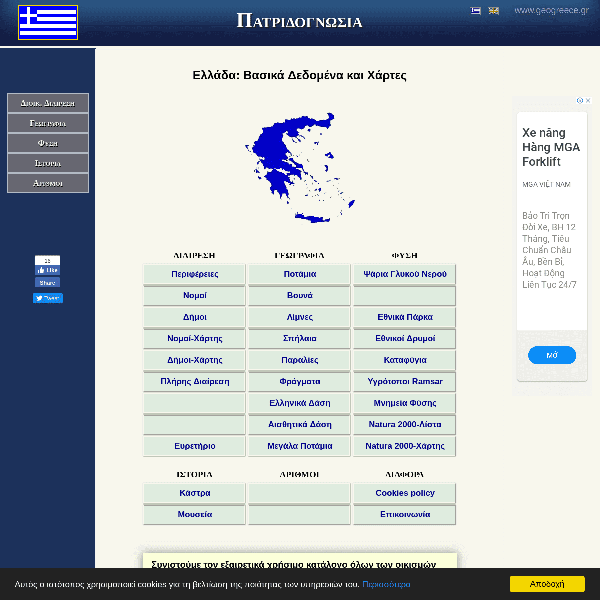
Υπό Κατασκευή Υπό Κατασκευή -------------------------ΕΛΛΆΔΑ:
ΒΑΣΙΚΆ ΔΕΔΟΜΈΝΑ ΚΑΙ ΧΆΡΤΕΣΔΙΑΙΡΕΣΗ
ΓΕΩΓΡΑΦΙΑ
ΦΥΣΗ
ΠεριφέρειεςΝομοί
Δήμοι
Νομοί-Χάρτης Δήμοι-Χάρτης Πλήρης ΔιαίρεσηΕυρετήριο
Ποτάμια
Βουνά
Λίμνες
Σπήλαια
Παραλίες
Φράγματα
Ελληνικά Δάση Αισθητικά Δάση Μεγάλα Ποτάμια Ψάρια Γλυκού Νερού Εθνικά Πάρκα Εθνικοί ΔρυμοίΚαταφύγια
Υγρότοποι Ramsar Μνημεία Φύσης Natura 2000-Λίστα Natura 2000-ΧάρτηςΙΣΤΟΡΙΑ
ΑΡΙΘΜΟΙ
ΔΙΑΦΟΡΑ
Κάστρα
Μουσεία
Cookies policy
Επικοινωνία Συνιστούμε τον εξαιρετικά χρήσιμο κατάλογο όλων των οικισμών και πόλεων της Ελλάδας (με την πλήρη διοικητική διαίρεση) ►ΕΔΏ◄ καθώς και το σχετικό ευρετήριο, ►ΕΔΏ◄ . ------------------------- -------------------------My "other" sites:
Ελληνικα Καστρα Βυζαντινον Χρονικον Γνωμικολογικον ΔΕΝ απαγορεύεται η αντιγραφή του περιεχομένου της ιστοσελίδας! To σωστό όμως είναι να αναφέρεται πάνταη πηγή.
Αρχική Σελίδα Κορυφή σελίδας2016-2019
ΜΑΝΏΛΗΣ ΠΑΠΑΘΑΝΑΣΊΟΥ ΕπικοινωνίαSite Map
Details
5