6
More Annotations


4


4
Favourite Annotations


6


1
Text
ESRI CANADA
7 steps for improving spatial data governance. Providing training to support your long-term success. Learning Solution. Paperless field data collection made easy. Unleashing data's potential in every industry. Solution Spotlight. ArcGIS Mission: Enhance Tactical Team Awareness and Communication. Maps and apps we love.TRAINING - ESRI
Our training solutions ensure that you not only protect your investment in GIS technology, but also enhance it. You can attend an instructor-led class at a training center or online, or you can learn on your own with our self-paced training options. Track your training history, view your course schedule and more. Login to your account.WEBINARS - ESRI
Webinars. Take just one hour out of your day to acquire new skills and knowledge that can be immediately applied to your daily work. Our webinars are live, interactive, free and streamed directly to your desktop. Delivered by an Esri Canada technical expert, these one hour sessions offer the perfect opportunity to brush up on the latestproduct
SEMINARS - ESRI
Wed, June 2, 2021. Time: 2021-06-03. Virtual Seminar. Language: English. Join us for this virtual seminar to discover how to digitally enable mobile workflows with location intelligence so field work can be completed faster, more efficiently and provide you with a better return on investment. This seminar will be held from 12:00 - 3:20 p.m.ET.
ARCGIS PRO - ESRI CANADA Getting Started with ArcGIS Pro: Making Data Connections. This video is a continuation of our series to get you started with working in ArcGIS Pro. In this video we will take you through the steps of connecting to your data and adding it to your new projects. Watch Video. Attend the Esri Virtual UC from July 12-15. ESRI CANADA SCHOLARS PORTAL Esri Young Scholars Award in Canada . The Esri Young Scholars Award program was launched in 2012 to recognize the exemplary work in geospatial sciences of undergraduate and graduate students at universities around the world. ESRI CANADA GIS CENTRES OF EXCELLENCE Esri Canada, the leading provider of geographic information system (GIS) solutions, launched its Centres of Excellence initiative in 2014. Through this program, Esri Canada aims to encourage innovation in GIS research and promote teaching excellence in spatial data management and analysis in higher education institutions acrossCanada.
HOW TO CHANGE THE PROJECTION IN ARCGIS ONLINE IN ONE EASY STEP You might be surprised to learn that you can do this in one easy step. When adding a data layer with the desired projection to your map in ArcGIS Online, select the option to use it as a basemap. This will cause the viewer to select the projection parameters associated with the layer and display the map in your chosen projection. You can then YOUR GUIDE TO CANADIAN DATUM TRANSFORMATIONS AND ARCGIS Your Guide to Canadian Datum Transformations and ArcGIS Online (Part 3) Published Date. May 27, 2019. Author. Sarah Sibbett. Welcome to the final post in our Canadian Datum Transformation series! So far, we’ve been learning why it’s important to apply the correct datum transformation method to your map prior to publishing to ArcGIS Online CONFIGURE YOUR PYTHON IDE TO WORK WITH ARCMAP AND ARCGIS With the increasing popularity of ArcGIS Pro, you may find yourself building Python scripts in both ArcMap and ArcGIS Pro on the same system. Sorting out which Python interpreter version to use can become confusing and frustrating, resulting in module and DLL errors.ESRI CANADA
7 steps for improving spatial data governance. Providing training to support your long-term success. Learning Solution. Paperless field data collection made easy. Unleashing data's potential in every industry. Solution Spotlight. ArcGIS Mission: Enhance Tactical Team Awareness and Communication. Maps and apps we love.TRAINING - ESRI
Our training solutions ensure that you not only protect your investment in GIS technology, but also enhance it. You can attend an instructor-led class at a training center or online, or you can learn on your own with our self-paced training options. Track your training history, view your course schedule and more. Login to your account.WEBINARS - ESRI
Webinars. Take just one hour out of your day to acquire new skills and knowledge that can be immediately applied to your daily work. Our webinars are live, interactive, free and streamed directly to your desktop. Delivered by an Esri Canada technical expert, these one hour sessions offer the perfect opportunity to brush up on the latestproduct
SEMINARS - ESRI
Wed, June 2, 2021. Time: 2021-06-03. Virtual Seminar. Language: English. Join us for this virtual seminar to discover how to digitally enable mobile workflows with location intelligence so field work can be completed faster, more efficiently and provide you with a better return on investment. This seminar will be held from 12:00 - 3:20 p.m.ET.
ARCGIS PRO - ESRI CANADA Getting Started with ArcGIS Pro: Making Data Connections. This video is a continuation of our series to get you started with working in ArcGIS Pro. In this video we will take you through the steps of connecting to your data and adding it to your new projects. Watch Video. Attend the Esri Virtual UC from July 12-15. ESRI CANADA SCHOLARS PORTAL Esri Young Scholars Award in Canada . The Esri Young Scholars Award program was launched in 2012 to recognize the exemplary work in geospatial sciences of undergraduate and graduate students at universities around the world. ESRI CANADA GIS CENTRES OF EXCELLENCE Esri Canada, the leading provider of geographic information system (GIS) solutions, launched its Centres of Excellence initiative in 2014. Through this program, Esri Canada aims to encourage innovation in GIS research and promote teaching excellence in spatial data management and analysis in higher education institutions acrossCanada.
HOW TO CHANGE THE PROJECTION IN ARCGIS ONLINE IN ONE EASY STEP You might be surprised to learn that you can do this in one easy step. When adding a data layer with the desired projection to your map in ArcGIS Online, select the option to use it as a basemap. This will cause the viewer to select the projection parameters associated with the layer and display the map in your chosen projection. You can then YOUR GUIDE TO CANADIAN DATUM TRANSFORMATIONS AND ARCGIS Your Guide to Canadian Datum Transformations and ArcGIS Online (Part 3) Published Date. May 27, 2019. Author. Sarah Sibbett. Welcome to the final post in our Canadian Datum Transformation series! So far, we’ve been learning why it’s important to apply the correct datum transformation method to your map prior to publishing to ArcGIS Online CONFIGURE YOUR PYTHON IDE TO WORK WITH ARCMAP AND ARCGIS With the increasing popularity of ArcGIS Pro, you may find yourself building Python scripts in both ArcMap and ArcGIS Pro on the same system. Sorting out which Python interpreter version to use can become confusing and frustrating, resulting in module and DLL errors.SEMINARS - ESRI
Wed, June 2, 2021. Time: 2021-06-03. Virtual Seminar. Language: English. Join us for this virtual seminar to discover how to digitally enable mobile workflows with location intelligence so field work can be completed faster, more efficiently and provide you with a better return on investment. This seminar will be held from 12:00 - 3:20 p.m.ET.
FORMATION - ESRITRANSLATE THIS PAGE Trouvez une solution parfaite pour vous. Cours ouverts à tous. En classe ou en ligne, apprenez à utiliser ArcGIS auprès de nos formateurs certifiés par Esri. En savoir plus. En savoir plus. Formation magistrale en ligne. Cours donnés en temps réel par un formateur agréé par Esri et expert du domaine. En savoir plus. Ensavoir plus.
GEOFOUNDATION EXCHANGE The GeoFoundation Exchange (GFX) is a national, collaborative, open data exchange for accurate and authoritative geographic base mapping data. It is designed to facilitate the coordination and modernization of Canadian base mapping. The GFX employs innovative, cloud-based services to coordinate the activities of authoritative base mapping ESRI CANADA SCHOLARS PORTAL Esri Young Scholars Award in Canada . The Esri Young Scholars Award program was launched in 2012 to recognize the exemplary work in geospatial sciences of undergraduate and graduate students at universities around the world. EDUCATION - ESRI CANADA Building a sense of place and community with free digital tools for K 12 education. Learn how to create a collaborative field study to gather primary source data on your community and environment using ArcGIS Survey123, a digital survey tool that is part of ArcGIS Online. Surveys cre. Watch Video.CITYWORKS - ESRI
Cityworks AMS is designed to help organizations manage public assets and their associated data, work activities, and business processes. Service requests, work orders, and inspection tasks can be configured to meet your specific needs. Cityworks AMS is built exclusively on ArcGIS, allowing workers in the field to interact directly with GISassets.
ARCGIS PRO - ESRI CANADA Getting Started with ArcGIS Pro: Making Data Connections. This video is a continuation of our series to get you started with working in ArcGIS Pro. In this video we will take you through the steps of connecting to your data and adding it to your new projects. Watch Video. Attend the Esri Virtual UC from July 12-15. ESRI CANADA GIS CENTRES OF EXCELLENCE Esri Canada, the leading provider of geographic information system (GIS) solutions, launched its Centres of Excellence initiative in 2014. Through this program, Esri Canada aims to encourage innovation in GIS research and promote teaching excellence in spatial data management and analysis in higher education institutions acrossCanada.
ESRI CANADA GIS SCHOLARSHIPS 2021 GIS Scholarships. Participating institutions must submit the names of their candidates between January 15 and April 15, 2021. All required information and documents, including a poster and report, must be received by Esri Canada before the candidate will be confirmed as a scholarship recipient and no later than June 1, 2021. NEXT GENERATION 9-1-1 What is next-generation 9-1-1? NG9-1-1 is the transition of 9-1-1 from analogue systems to IP-based systems. The change will enhance emergency number (9-1-1) services to create a faster, more resilient system allowing voice, data, photos, videos and text messagesESRI CANADA
7 steps for improving spatial data governance. Providing training to support your long-term success. Learning Solution. Paperless field data collection made easy. Unleashing data's potential in every industry. Solution Spotlight. ArcGIS Mission: Enhance Tactical Team Awareness and Communication. Maps and apps we love.TRAINING - ESRI
Our training solutions ensure that you not only protect your investment in GIS technology, but also enhance it. You can attend an instructor-led class at a training center or online, or you can learn on your own with our self-paced training options. Track your training history, view your course schedule and more. Login to your account.CONTACT US - ESRI
12 Concorde Place, Suite 900 Toronto, ON M3C 3R8 T: 416-441-6035 F: 416-441-6838 Parking InformationWEBINARS - ESRI
Webinars. Take just one hour out of your day to acquire new skills and knowledge that can be immediately applied to your daily work. Our webinars are live, interactive, free and streamed directly to your desktop. Delivered by an Esri Canada technical expert, these one hour sessions offer the perfect opportunity to brush up on the latestproduct
ARCGIS PRO - ESRI CANADA Getting Started with ArcGIS Pro: Making Data Connections. This video is a continuation of our series to get you started with working in ArcGIS Pro. In this video we will take you through the steps of connecting to your data and adding it to your new projects. Watch Video. Attend the Esri Virtual UC from July 12-15. ESRI CANADA SCHOLARS PORTAL Esri Young Scholars Award in Canada . The Esri Young Scholars Award program was launched in 2012 to recognize the exemplary work in geospatial sciences of undergraduate and graduate students at universities around the world. ESRI CANADA GIS CENTRES OF EXCELLENCE Esri Canada, the leading provider of geographic information system (GIS) solutions, launched its Centres of Excellence initiative in 2014. Through this program, Esri Canada aims to encourage innovation in GIS research and promote teaching excellence in spatial data management and analysis in higher education institutions acrossCanada.
HOW TO CHANGE THE PROJECTION IN ARCGIS ONLINE IN ONE EASY STEP You might be surprised to learn that you can do this in one easy step. When adding a data layer with the desired projection to your map in ArcGIS Online, select the option to use it as a basemap. This will cause the viewer to select the projection parameters associated with the layer and display the map in your chosen projection. You can then YOUR GUIDE TO CANADIAN DATUM TRANSFORMATIONS AND ARCGIS Your Guide to Canadian Datum Transformations and ArcGIS Online (Part 3) Published Date. May 27, 2019. Author. Sarah Sibbett. Welcome to the final post in our Canadian Datum Transformation series! So far, we’ve been learning why it’s important to apply the correct datum transformation method to your map prior to publishing to ArcGIS Online CONFIGURE YOUR PYTHON IDE TO WORK WITH ARCMAP AND ARCGIS With the increasing popularity of ArcGIS Pro, you may find yourself building Python scripts in both ArcMap and ArcGIS Pro on the same system. Sorting out which Python interpreter version to use can become confusing and frustrating, resulting in module and DLL errors.ESRI CANADA
7 steps for improving spatial data governance. Providing training to support your long-term success. Learning Solution. Paperless field data collection made easy. Unleashing data's potential in every industry. Solution Spotlight. ArcGIS Mission: Enhance Tactical Team Awareness and Communication. Maps and apps we love.TRAINING - ESRI
Our training solutions ensure that you not only protect your investment in GIS technology, but also enhance it. You can attend an instructor-led class at a training center or online, or you can learn on your own with our self-paced training options. Track your training history, view your course schedule and more. Login to your account.CONTACT US - ESRI
12 Concorde Place, Suite 900 Toronto, ON M3C 3R8 T: 416-441-6035 F: 416-441-6838 Parking InformationWEBINARS - ESRI
Webinars. Take just one hour out of your day to acquire new skills and knowledge that can be immediately applied to your daily work. Our webinars are live, interactive, free and streamed directly to your desktop. Delivered by an Esri Canada technical expert, these one hour sessions offer the perfect opportunity to brush up on the latestproduct
ARCGIS PRO - ESRI CANADA Getting Started with ArcGIS Pro: Making Data Connections. This video is a continuation of our series to get you started with working in ArcGIS Pro. In this video we will take you through the steps of connecting to your data and adding it to your new projects. Watch Video. Attend the Esri Virtual UC from July 12-15. ESRI CANADA SCHOLARS PORTAL Esri Young Scholars Award in Canada . The Esri Young Scholars Award program was launched in 2012 to recognize the exemplary work in geospatial sciences of undergraduate and graduate students at universities around the world. ESRI CANADA GIS CENTRES OF EXCELLENCE Esri Canada, the leading provider of geographic information system (GIS) solutions, launched its Centres of Excellence initiative in 2014. Through this program, Esri Canada aims to encourage innovation in GIS research and promote teaching excellence in spatial data management and analysis in higher education institutions acrossCanada.
HOW TO CHANGE THE PROJECTION IN ARCGIS ONLINE IN ONE EASY STEP You might be surprised to learn that you can do this in one easy step. When adding a data layer with the desired projection to your map in ArcGIS Online, select the option to use it as a basemap. This will cause the viewer to select the projection parameters associated with the layer and display the map in your chosen projection. You can then YOUR GUIDE TO CANADIAN DATUM TRANSFORMATIONS AND ARCGIS Your Guide to Canadian Datum Transformations and ArcGIS Online (Part 3) Published Date. May 27, 2019. Author. Sarah Sibbett. Welcome to the final post in our Canadian Datum Transformation series! So far, we’ve been learning why it’s important to apply the correct datum transformation method to your map prior to publishing to ArcGIS Online CONFIGURE YOUR PYTHON IDE TO WORK WITH ARCMAP AND ARCGIS With the increasing popularity of ArcGIS Pro, you may find yourself building Python scripts in both ArcMap and ArcGIS Pro on the same system. Sorting out which Python interpreter version to use can become confusing and frustrating, resulting in module and DLL errors.CONTACT US - ESRI
1425, boul. René-Lévesque Ouest, bureau 1110 Montréal, QC H3G 1T7 T: 514-875-8568 Toll free: 1-866-564-4367 F: 514-875-9362SEMINARS - ESRI
Wed, June 2, 2021. Time: 2021-06-03. Virtual Seminar. Language: English. Join us for this virtual seminar to discover how to digitally enable mobile workflows with location intelligence so field work can be completed faster, more efficiently and provide you with a better return on investment. This seminar will be held from 12:00 - 3:20 p.m.ET.
FORMATION - ESRITRANSLATE THIS PAGE Trouvez une solution parfaite pour vous. Cours ouverts à tous. En classe ou en ligne, apprenez à utiliser ArcGIS auprès de nos formateurs certifiés par Esri. En savoir plus. En savoir plus. Formation magistrale en ligne. Cours donnés en temps réel par un formateur agréé par Esri et expert du domaine. En savoir plus. Ensavoir plus.
GEOFOUNDATION EXCHANGE The GeoFoundation Exchange (GFX) is a national, collaborative, open data exchange for accurate and authoritative geographic base mapping data. It is designed to facilitate the coordination and modernization of Canadian base mapping. The GFX employs innovative, cloud-based services to coordinate the activities of authoritative base mapping EDUCATION - ESRI CANADA Building a sense of place and community with free digital tools for K 12 education. Learn how to create a collaborative field study to gather primary source data on your community and environment using ArcGIS Survey123, a digital survey tool that is part of ArcGIS Online. Surveys cre. Watch Video.CITYWORKS - ESRI
Cityworks AMS is designed to help organizations manage public assets and their associated data, work activities, and business processes. Service requests, work orders, and inspection tasks can be configured to meet your specific needs. Cityworks AMS is built exclusively on ArcGIS, allowing workers in the field to interact directly with GISassets.
ESRI CANADA SCHOLARS PORTAL Esri Young Scholars Award in Canada . The Esri Young Scholars Award program was launched in 2012 to recognize the exemplary work in geospatial sciences of undergraduate and graduate students at universities around the world. ESRI CANADA GIS SCHOLARSHIPS 2021 GIS Scholarships. Participating institutions must submit the names of their candidates between January 15 and April 15, 2021. All required information and documents, including a poster and report, must be received by Esri Canada before the candidate will be confirmed as a scholarship recipient and no later than June 1, 2021. ESRI CANADA GIS CENTRES OF EXCELLENCE Esri Canada, the leading provider of geographic information system (GIS) solutions, launched its Centres of Excellence initiative in 2014. Through this program, Esri Canada aims to encourage innovation in GIS research and promote teaching excellence in spatial data management and analysis in higher education institutions acrossCanada.
CONFIGURE YOUR PYTHON IDE TO WORK WITH ARCMAP AND ARCGIS With the increasing popularity of ArcGIS Pro, you may find yourself building Python scripts in both ArcMap and ArcGIS Pro on the same system. Sorting out which Python interpreter version to use can become confusing and frustrating, resulting in module and DLL errors.ESRI CANADA
7 steps for improving spatial data governance. Providing training to support your long-term success. Learning Solution. Paperless field data collection made easy. Unleashing data's potential in every industry. Solution Spotlight. ArcGIS Mission: Enhance Tactical Team Awareness and Communication. Maps and apps we love.CONTACT US - ESRI
12 Concorde Place, Suite 900 Toronto, ON M3C 3R8 T: 416-441-6035 F: 416-441-6838 Parking InformationWEBINARS - ESRI
Webinars. Take just one hour out of your day to acquire new skills and knowledge that can be immediately applied to your daily work. Our webinars are live, interactive, free and streamed directly to your desktop. Delivered by an Esri Canada technical expert, these one hour sessions offer the perfect opportunity to brush up on the latestproduct
GEOFOUNDATION EXCHANGE The GeoFoundation Exchange (GFX) is a national, collaborative, open data exchange for accurate and authoritative geographic base mapping data. It is designed to facilitate the coordination and modernization of Canadian base mapping. The GFX employs innovative, cloud-based services to coordinate the activities of authoritative base mappingCITYWORKS - ESRI
Cityworks AMS is designed to help organizations manage public assets and their associated data, work activities, and business processes. Service requests, work orders, and inspection tasks can be configured to meet your specific needs. Cityworks AMS is built exclusively on ArcGIS, allowing workers in the field to interact directly with GISassets.
ARCGIS PRO - ESRI CANADA Getting Started with ArcGIS Pro: Making Data Connections. This video is a continuation of our series to get you started with working in ArcGIS Pro. In this video we will take you through the steps of connecting to your data and adding it to your new projects. Watch Video. Attend the Esri Virtual UC from July 12-15. MIGRATING FROM ARCMAP TO ARCGIS PRO With faster tools and integrated 2D and 3D capabilities, ArcGIS Pro will streamline your GIS projects. This course prepares experienced ArcMap users to be productive right away. Learn essential ArcGIS Pro terminology and concepts and how to efficiently complete a variety of tasks related to mapping, editing, analyzing and sharing geospatial data and resources.VIDEO: Join Certified Instructor ESRI CANADA GIS CENTRES OF EXCELLENCE Esri Canada, the leading provider of geographic information system (GIS) solutions, launched its Centres of Excellence initiative in 2014. Through this program, Esri Canada aims to encourage innovation in GIS research and promote teaching excellence in spatial data management and analysis in higher education institutions acrossCanada.
YOUR GUIDE TO CANADIAN DATUM TRANSFORMATIONS AND ARCGIS Your Guide to Canadian Datum Transformations and ArcGIS Online (Part 3) Published Date. May 27, 2019. Author. Sarah Sibbett. Welcome to the final post in our Canadian Datum Transformation series! So far, we’ve been learning why it’s important to apply the correct datum transformation method to your map prior to publishing to ArcGIS Online CONFIGURE YOUR PYTHON IDE TO WORK WITH ARCMAP AND ARCGIS With the increasing popularity of ArcGIS Pro, you may find yourself building Python scripts in both ArcMap and ArcGIS Pro on the same system. Sorting out which Python interpreter version to use can become confusing and frustrating, resulting in module and DLL errors.ESRI CANADA
7 steps for improving spatial data governance. Providing training to support your long-term success. Learning Solution. Paperless field data collection made easy. Unleashing data's potential in every industry. Solution Spotlight. ArcGIS Mission: Enhance Tactical Team Awareness and Communication. Maps and apps we love.CONTACT US - ESRI
12 Concorde Place, Suite 900 Toronto, ON M3C 3R8 T: 416-441-6035 F: 416-441-6838 Parking InformationWEBINARS - ESRI
Webinars. Take just one hour out of your day to acquire new skills and knowledge that can be immediately applied to your daily work. Our webinars are live, interactive, free and streamed directly to your desktop. Delivered by an Esri Canada technical expert, these one hour sessions offer the perfect opportunity to brush up on the latestproduct
GEOFOUNDATION EXCHANGE The GeoFoundation Exchange (GFX) is a national, collaborative, open data exchange for accurate and authoritative geographic base mapping data. It is designed to facilitate the coordination and modernization of Canadian base mapping. The GFX employs innovative, cloud-based services to coordinate the activities of authoritative base mappingCITYWORKS - ESRI
Cityworks AMS is designed to help organizations manage public assets and their associated data, work activities, and business processes. Service requests, work orders, and inspection tasks can be configured to meet your specific needs. Cityworks AMS is built exclusively on ArcGIS, allowing workers in the field to interact directly with GISassets.
ARCGIS PRO - ESRI CANADA Getting Started with ArcGIS Pro: Making Data Connections. This video is a continuation of our series to get you started with working in ArcGIS Pro. In this video we will take you through the steps of connecting to your data and adding it to your new projects. Watch Video. Attend the Esri Virtual UC from July 12-15. MIGRATING FROM ARCMAP TO ARCGIS PRO With faster tools and integrated 2D and 3D capabilities, ArcGIS Pro will streamline your GIS projects. This course prepares experienced ArcMap users to be productive right away. Learn essential ArcGIS Pro terminology and concepts and how to efficiently complete a variety of tasks related to mapping, editing, analyzing and sharing geospatial data and resources.VIDEO: Join Certified Instructor ESRI CANADA GIS CENTRES OF EXCELLENCE Esri Canada, the leading provider of geographic information system (GIS) solutions, launched its Centres of Excellence initiative in 2014. Through this program, Esri Canada aims to encourage innovation in GIS research and promote teaching excellence in spatial data management and analysis in higher education institutions acrossCanada.
YOUR GUIDE TO CANADIAN DATUM TRANSFORMATIONS AND ARCGIS Your Guide to Canadian Datum Transformations and ArcGIS Online (Part 3) Published Date. May 27, 2019. Author. Sarah Sibbett. Welcome to the final post in our Canadian Datum Transformation series! So far, we’ve been learning why it’s important to apply the correct datum transformation method to your map prior to publishing to ArcGIS Online CONFIGURE YOUR PYTHON IDE TO WORK WITH ARCMAP AND ARCGIS With the increasing popularity of ArcGIS Pro, you may find yourself building Python scripts in both ArcMap and ArcGIS Pro on the same system. Sorting out which Python interpreter version to use can become confusing and frustrating, resulting in module and DLL errors.CONTACT US - ESRI
1425, boul. René-Lévesque Ouest, bureau 1110 Montréal, QC H3G 1T7 T: 514-875-8568 Toll free: 1-866-564-4367 F: 514-875-9362TRAINING - ESRI
Our training solutions ensure that you not only protect your investment in GIS technology, but also enhance it. You can attend an instructor-led class at a training center or online, or you can learn on your own with our self-paced training options. Track your training history, view your course schedule and more. Login to your account.SEMINARS - ESRI
Wed, June 2, 2021. Time: 2021-06-03. Virtual Seminar. Language: English. Join us for this virtual seminar to discover how to digitally enable mobile workflows with location intelligence so field work can be completed faster, more efficiently and provide you with a better return on investment. This seminar will be held from 12:00 - 3:20 p.m.ET.
FORMATION - ESRITRANSLATE THIS PAGE Trouvez une solution parfaite pour vous. Cours ouverts à tous. En classe ou en ligne, apprenez à utiliser ArcGIS auprès de nos formateurs certifiés par Esri. En savoir plus. En savoir plus. Formation magistrale en ligne. Cours donnés en temps réel par un formateur agréé par Esri et expert du domaine. En savoir plus. Ensavoir plus.
CITYWORKS - ESRI
Cityworks AMS is designed to help organizations manage public assets and their associated data, work activities, and business processes. Service requests, work orders, and inspection tasks can be configured to meet your specific needs. Cityworks AMS is built exclusively on ArcGIS, allowing workers in the field to interact directly with GISassets.
CITYWORKS ONLINE CANADA Cityworks Online Canada provides a cloud-hosted enterprise asset management platform that enables streamlined access from any device, giving you all the benefits of Cityworks without the challenges of managing IT resources. Learn more. From the Office to the Field. With Cityworks Online Canada, you can connect and collaborate fromvirtually
ESRI CANADA GIS SCHOLARSHIPS Information for Students; Recent Posts | Profiles: Scholarship Recipients Award Recipients . 2021 GIS Scholarships. Participating institutions must submit the names of their candidates between January 15 and April 15, 2021.All required information and documents, including a poster and report, must be received by Esri Canada before the candidate will be confirmed as a scholarship recipient and ESRI CANADA SCHOLARS PORTAL Esri Young Scholars Award in Canada . The Esri Young Scholars Award program was launched in 2012 to recognize the exemplary work in geospatial sciences of undergraduate and graduate students at universities around the world. ESRI CANADA GIS CENTRES OF EXCELLENCE Esri Canada, the leading provider of geographic information system (GIS) solutions, launched its Centres of Excellence initiative in 2014. Through this program, Esri Canada aims to encourage innovation in GIS research and promote teaching excellence in spatial data management and analysis in higher education institutions acrossCanada.
NEXT GENERATION 9-1-1 What is next-generation 9-1-1? NG9-1-1 is the transition of 9-1-1 from analogue systems to IP-based systems. The change will enhance emergency number (9-1-1) services to create a faster, more resilient system allowing voice, data, photos, videos and text messagesESRI CANADA
7 steps for improving spatial data governance. Providing training to support your long-term success. Learning Solution. Paperless field data collection made easy. Unleashing data's potential in every industry. Solution Spotlight. ArcGIS Mission: Enhance Tactical Team Awareness and Communication. Maps and apps we love.TRAINING - ESRI
Our training solutions ensure that you not only protect your investment in GIS technology, but also enhance it. You can attend an instructor-led class at a training center or online, or you can learn on your own with our self-paced training options. Track your training history, view your course schedule and more. Login to your account.CONTACT US - ESRI
12 Concorde Place, Suite 900 Toronto, ON M3C 3R8 T: 416-441-6035 F: 416-441-6838 Parking InformationWEBINARS - ESRI
Webinars. Take just one hour out of your day to acquire new skills and knowledge that can be immediately applied to your daily work. Our webinars are live, interactive, free and streamed directly to your desktop. Delivered by an Esri Canada technical expert, these one hour sessions offer the perfect opportunity to brush up on the latestproduct
GEOFOUNDATION EXCHANGE The GeoFoundation Exchange (GFX) is a national, collaborative, open data exchange for accurate and authoritative geographic base mapping data. It is designed to facilitate the coordination and modernization of Canadian base mapping. The GFX employs innovative, cloud-based services to coordinate the activities of authoritative base mapping ARCGIS PRO - ESRI CANADA Getting Started with ArcGIS Pro: Making Data Connections. This video is a continuation of our series to get you started with working in ArcGIS Pro. In this video we will take you through the steps of connecting to your data and adding it to your new projects. Watch Video. Attend the Esri Virtual UC from July 12-15. ESRI CANADA SCHOLARS PORTAL Esri Young Scholars Award in Canada . The Esri Young Scholars Award program was launched in 2012 to recognize the exemplary work in geospatial sciences of undergraduate and graduate students at universities around the world. MIGRATING FROM ARCMAP TO ARCGIS PRO With faster tools and integrated 2D and 3D capabilities, ArcGIS Pro will streamline your GIS projects. This course prepares experienced ArcMap users to be productive right away. Learn essential ArcGIS Pro terminology and concepts and how to efficiently complete a variety of tasks related to mapping, editing, analyzing and sharing geospatial data and resources.VIDEO: Join Certified Instructor YOUR GUIDE TO CANADIAN DATUM TRANSFORMATIONS AND ARCGIS Your Guide to Canadian Datum Transformations and ArcGIS Online (Part 3) Published Date. May 27, 2019. Author. Sarah Sibbett. Welcome to the final post in our Canadian Datum Transformation series! So far, we’ve been learning why it’s important to apply the correct datum transformation method to your map prior to publishing to ArcGIS Online CONFIGURE YOUR PYTHON IDE TO WORK WITH ARCMAP AND ARCGISCONFIGURE PYTHON INTERPRETER PYCHARMDOWNLOAD PYTHON INTERPRETER FOR PYCHARMINVALID PYTHON INTERPRETER PYCHARMPYCHARM PYTHON 3 7 DOWNLOADPYCHARM PYTHON 3 9PYCHARM PYTHON DOWNLOAD With the increasing popularity of ArcGIS Pro, you may find yourself building Python scripts in both ArcMap and ArcGIS Pro on the same system. Sorting out which Python interpreter version to use can become confusing and frustrating, resulting in module and DLL errors.ESRI CANADA
7 steps for improving spatial data governance. Providing training to support your long-term success. Learning Solution. Paperless field data collection made easy. Unleashing data's potential in every industry. Solution Spotlight. ArcGIS Mission: Enhance Tactical Team Awareness and Communication. Maps and apps we love.TRAINING - ESRI
Our training solutions ensure that you not only protect your investment in GIS technology, but also enhance it. You can attend an instructor-led class at a training center or online, or you can learn on your own with our self-paced training options. Track your training history, view your course schedule and more. Login to your account.CONTACT US - ESRI
12 Concorde Place, Suite 900 Toronto, ON M3C 3R8 T: 416-441-6035 F: 416-441-6838 Parking InformationWEBINARS - ESRI
Webinars. Take just one hour out of your day to acquire new skills and knowledge that can be immediately applied to your daily work. Our webinars are live, interactive, free and streamed directly to your desktop. Delivered by an Esri Canada technical expert, these one hour sessions offer the perfect opportunity to brush up on the latestproduct
GEOFOUNDATION EXCHANGE The GeoFoundation Exchange (GFX) is a national, collaborative, open data exchange for accurate and authoritative geographic base mapping data. It is designed to facilitate the coordination and modernization of Canadian base mapping. The GFX employs innovative, cloud-based services to coordinate the activities of authoritative base mapping ARCGIS PRO - ESRI CANADA Getting Started with ArcGIS Pro: Making Data Connections. This video is a continuation of our series to get you started with working in ArcGIS Pro. In this video we will take you through the steps of connecting to your data and adding it to your new projects. Watch Video. Attend the Esri Virtual UC from July 12-15. ESRI CANADA SCHOLARS PORTAL Esri Young Scholars Award in Canada . The Esri Young Scholars Award program was launched in 2012 to recognize the exemplary work in geospatial sciences of undergraduate and graduate students at universities around the world. MIGRATING FROM ARCMAP TO ARCGIS PRO With faster tools and integrated 2D and 3D capabilities, ArcGIS Pro will streamline your GIS projects. This course prepares experienced ArcMap users to be productive right away. Learn essential ArcGIS Pro terminology and concepts and how to efficiently complete a variety of tasks related to mapping, editing, analyzing and sharing geospatial data and resources.VIDEO: Join Certified Instructor YOUR GUIDE TO CANADIAN DATUM TRANSFORMATIONS AND ARCGIS Your Guide to Canadian Datum Transformations and ArcGIS Online (Part 3) Published Date. May 27, 2019. Author. Sarah Sibbett. Welcome to the final post in our Canadian Datum Transformation series! So far, we’ve been learning why it’s important to apply the correct datum transformation method to your map prior to publishing to ArcGIS Online CONFIGURE YOUR PYTHON IDE TO WORK WITH ARCMAP AND ARCGISCONFIGURE PYTHON INTERPRETER PYCHARMDOWNLOAD PYTHON INTERPRETER FOR PYCHARMINVALID PYTHON INTERPRETER PYCHARMPYCHARM PYTHON 3 7 DOWNLOADPYCHARM PYTHON 3 9PYCHARM PYTHON DOWNLOAD With the increasing popularity of ArcGIS Pro, you may find yourself building Python scripts in both ArcMap and ArcGIS Pro on the same system. Sorting out which Python interpreter version to use can become confusing and frustrating, resulting in module and DLL errors.CONTACT US - ESRI
1425, boul. René-Lévesque Ouest, bureau 1110 Montréal, QC H3G 1T7 T: 514-875-8568 Toll free: 1-866-564-4367 F: 514-875-9362SEMINARS - ESRI
Wed, June 2, 2021. Time: 2021-06-03. Virtual Seminar. Language: English. Join us for this virtual seminar to discover how to digitally enable mobile workflows with location intelligence so field work can be completed faster, more efficiently and provide you with a better return on investment. This seminar will be held from 12:00 - 3:20 p.m.ET.
GEOFOUNDATION EXCHANGE The GeoFoundation Exchange (GFX) is a national, collaborative, open data exchange for accurate and authoritative geographic base mapping data. It is designed to facilitate the coordination and modernization of Canadian base mapping. The GFX employs innovative, cloud-based services to coordinate the activities of authoritative base mapping EDUCATION - ESRI CANADA Building a sense of place and community with free digital tools for K 12 education. Learn how to create a collaborative field study to gather primary source data on your community and environment using ArcGIS Survey123, a digital survey tool that is part of ArcGIS Online. Surveys cre. Watch Video.COURSE SCHEDULE
Online (Eastern Time) Thu, June 10 - Fri, June 11, 2021. 9 a.m. - 5 p.m. Eastern Time. English. Maintain the accuracy of your authoritative GIS data. Register Now. Online. Create Informative Maps with Excel Spreadsheets. #78639E.CITYWORKS - ESRI
Cityworks AMS is designed to help organizations manage public assets and their associated data, work activities, and business processes. Service requests, work orders, and inspection tasks can be configured to meet your specific needs. Cityworks AMS is built exclusively on ArcGIS, allowing workers in the field to interact directly with GISassets.
GETTING TECHNICAL
Maximize your mapping potential with ArcGIS for Personal Use. Buy Now about 1 month ago Getting Technical - April 2021 Esri Canada’s Getting Technical blog post brings you the latest and most significant news about Esri technology. ESRI CANADA GIS SCHOLARSHIPS Information for Students; Recent Posts | Profiles: Scholarship Recipients Award Recipients . 2021 GIS Scholarships. Participating institutions must submit the names of their candidates between January 15 and April 15, 2021.All required information and documents, including a poster and report, must be received by Esri Canada before the candidate will be confirmed as a scholarship recipient and ESRI CANADA GIS CENTRES OF EXCELLENCE Esri Canada, the leading provider of geographic information system (GIS) solutions, launched its Centres of Excellence initiative in 2014. Through this program, Esri Canada aims to encourage innovation in GIS research and promote teaching excellence in spatial data management and analysis in higher education institutions acrossCanada.
NEXT GENERATION 9-1-1 What is next-generation 9-1-1? NG9-1-1 is the transition of 9-1-1 from analogue systems to IP-based systems. The change will enhance emergency number (9-1-1) services to create a faster, more resilient system allowing voice, data, photos, videos and text messages Skip to main content ">EN ">FR Toggle navigation _ _TOP MENU
* Company
* About Us
* Learning About GIS* Leadership
* Corporate Responsibility* Green Roof
* Esri Nonprofit Organization Program * Awards & Recognition * Industry Leadership* Careers
* News & Publications* News Releases
* ArcNorth News
* In the News
* Media Room
* Partners
* Support
* Technical Support
* Support on My Esri* Support Policies
* Premium Support
* NTv2 Request
* Alerts
* Customer Care
* Manage Your Software * Software Maintenance* Software Updates
* Product Registration & Authorization* Programs
* Community Maps Program * GeoFoundation Exchange * GIS Ambassador Program * Developer Resources* Blog
* Overview
* News & Updates
* Getting Technical
* Education & Research * Spatial Data Infrastructure* Contact
* Resources
Search
Search
SEARCH
Search
Search
MAIN MENU
____
* Industries
* Products
* Services
* Training
* Events
MAIN MENU - INDUSTRIES* Commercial __
* Banking
* Insurance
* Retail
* Defence & National Security* Education
* Government __
* Local Government
* Provincial Government * Federal Government* Health Care
* Land & Property __ * Architecture, Engineering & Construction* Facilities
* Permitting, Licensing & Land * Property Assessment * Surveying & Mapping * Natural Resources __* Forestry
* Mining
* Oil & Gas
* NGOs
* Public Safety __
* Emergency Management * Fire, Rescue & EMS* Law Enforcement
* NG9-1-1 Call Taking & Dispatch* Public Works __
* Parks & Grounds
* Roads & Bridges
* Solid Waste
* Water & Wastewater* Transportation __
* Airports & Aviation* Ports & Maritime
* Public Transit
* Rail
* Roads & Highways
* Utilities __
* Electric
* Gas
* Pipeline
* Telecommunications* Water
INDUSTRIES MENU CTA
Interested in learning more about how your industry could benefit fromGIS solutions?
Contact Us
MAIN MENU - PRODUCTS * ArcGIS Platform __* ArcGIS Online
* ArcGIS Pro
* ArcGIS Enterprise
* ArcGIS Apps
* ArcGIS for Personal Use Program* Shop Online
* All Products
* ArcGIS Industry Solutions ArcGIS solutions deliver ready-to-use maps and apps designed to meet your industry’s needs.* Data __
* Demographic & Business Data* Imagery
* Data Appliance for ArcGIS * Specialized Applications __* ArcFM Suite
* Assessment Analyst * Assessment Analyst - GAMA* Cityworks
* Esri Canada AVL
* Geocortex Analytics * Geocortex Essentials * ArcGIS Business Analyst Product Suite * Esri Community Analyst (Canadian Subscription)PRODUCT MENU CTA
Ready to buy?
Shop Online
MAIN MENU - SERVICES* Overview __
Meet your GIS goals by putting our experience to work. Regardless of the size and type of implementation, we have a service that’s rightfor you.
* Moving ArcGIS to the Cloud * Industry Services __ Enhance your operations with services tailored to your specificdomain.
* Public Asset Management Solutions * Utilities Services * Asset Management Consulting Get expert advice on how to efficiently manage your assets using GIS. We’ll help you make decisions about asset maintenance and rehabilitation with confidence. * Management Consulting Leverage our strategic advisory and planning services for executives. We’ll help you develop a location strategy that will transform yourbusiness.
* Enterprise Advantage Program __ Subscribe to this program and receive proactive advice from Esri experts. We’ll help you minimize risk and support your vision of efficiently adopting ArcGIS across your organization.* Components
SERVICES MENU CTA
Interested in learning more about our services?Contact Us
MAIN MENU - EVENTS
* Esri Canada User Conferences __* 2019 Schedule
* Call for Presentations * Sponsor & Exhibitor Opportunities* Past Proceedings
* Webinars __
Brush up on the latest Esri product developments and learn tips and tricks for working effectively with our software. Sign up for these live, free one-hour sessions delivered by Esri Canada technicalexperts.
* Webinar Schedule
* Recorded Webinars
* All Esri Canada Events* Seminars
* Tradeshows & Conferences* GIS Day
* Esri International User ConferenceEVENTS MENU CTA
Interested in keeping up to date with Esri Canada events? Sign up for Event Invitations MAIN MENU - TRAINING * Training Solutions __ * Open Enrollment Courses * Client-Specific Training * Self-Paced Training * Course Catalogue __* ArcMap Foundation
* ArcGIS Pro Foundation* ArcGIS Online
* Cartography and Map Production * Spatial Analysis and Geoprocessing * Geodatabase Production and Editing * Geodatabase Management * Web GIS and Server Management * Application Development* Industry-Focused
* Upcoming Classes
* Locations
* Registration Information * Technical Certification __ * Becoming Certified * Sign up for Learning LineupTRAINING MENU CTA
Track your training history, view your course schedule and more. Login to your account* __
*
*
*
A GROWING COMMUNITY OF CANADIAN OPEN DATA AT YOUR FINGERTIPSLearn more
EXPERIENCE THE ESRI CANADA UCRegister now
APP OF THE MONTH: MAP OF ACCIDENT-PRONE ROAD SEGMENTSLearn more
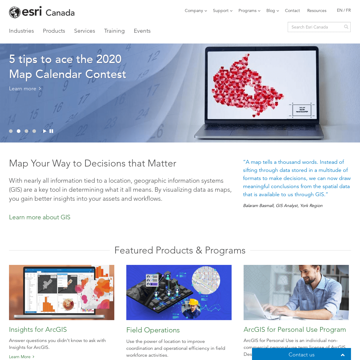
5 TIPS TO ACE THE 2020 MAP CALENDAR CONTESTLearn more
A GROWING COMMUNITY OF CANADIAN OPEN DATA AT YOUR FINGERTIPSLearn more
EXPERIENCE THE ESRI CANADA UCRegister now
APP OF THE MONTH: MAP OF ACCIDENT-PRONE ROAD SEGMENTSLearn more
5 TIPS TO ACE THE 2020 MAP CALENDAR CONTESTLearn more
prev
next
INNER PAGE MENU
HOME
1
* Home
Share AddThis Twitter Facebook Email MAP YOUR WAY TO DECISIONS THAT MATTER With nearly all information tied to a location, geographic information systems (GIS) are a key tool in determining what it all means. By visualizing data as maps, you gain better insights into your assetsand workflows.
LEARN MORE ABOUT GIS A map tells a thousand words. Instead of sifting through data stored in a multitude of formats to make decisions, we can now draw meaningful conclusions from the spatial data that is available to usthrough GIS.
Balaram Basmall, GIS Analyst, York Region Featured Products & ProgramsINSIGHTS FOR ARCGIS
Answer questions you didn’t know to ask with Insights for ArcGIS.Learn More
FIELD OPERATIONS
Use the power of location to improve coordination and operational efficiency in field workforce activities.Learn More
ARCGIS FOR PERSONAL USE PROGRAM ArcGIS for Personal Use is an individual non-commercial personal-use term license of ArcGIS Desktop and extensions.Learn More
Highlights
*
0:00
3 days ago
THE NEW ARCGIS STORYMAPS: EFFORTLESS DIGITAL STORYTELLING FOR ANYAUDIENCE
STORY MAPS HAVE BECOME A NATURAL WAY FOR MANY PEOPLE TO FIND THEIR VOICE AND BRING THEIR CONTENT TOGETHER USING MAPS, NARRATIVES OR PHOTOGRAPHS. THE SIMPLICITY THAT CAME WITH BUILDING STORY MAPS IN THWatch Video
*
10:49
3 days ago
UPLOADING TILE LAYERS AND TILE PACKAGES TO ARCGIS ONLINE HOSTED TILE LAYERS ARE GREAT TO USE FOR FAST MAP VISUALIZATION USING PREDRAWN MAP IMAGES, OR TILES. THIS VIDEO STEPS YOU THROUGH DIFFERENT OPTIONS TO CREATE A TILE LAYER IN ARCGIS ONLINE USING TOOLS FWatch Video
*
4 days ago
EVENTS & TRAINING ROUNDUP — AUGUST 2019 GET A SNAPSHOT OF OUR UPCOMING FALL USER CONFERENCES, WEBINARS,TRAINING AND MORE.
View
*
10 days ago
NEWS ROUNDUP — AUGUST 2019 ESRI CANADA’S NEWS ROUNDUP SUMMARIZES IMPORTANT STORIES, VIDEOS, AWARDS, APPS, STORY MAPS AND MORE IN THE WORLD OF GIS EACH MONTH.View
*
Loading More Items...View more
CONTACT US
CONTACT US
CONTACT US
Need help choosing a product? Have a question about pricing orsupport?
Let’s connect you with the right person. Complete our online form . � 2019 Esri Canada. All Rights Reserved.FOOTER MENU
* Email Preferences
* Legal
* Privacy
* Accessibility
Close
AddThis
Details
2