2
More Annotations


6


3
Favourite Annotations


5


4
Text
BLUE MARBLE NAVIGATOR Night-lights imagery by NOAA's Earth Observation Group | Privacy PolicyPrivacy Policy BLUE MARBLE NAVIGATORBLUE MARBLE NAVIGATORFEATURES OF THIS SITENIGHT
LIGHTS
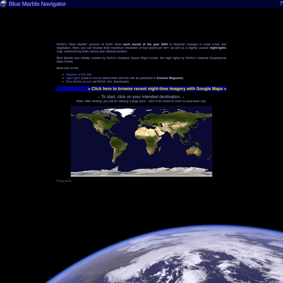
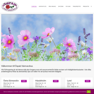
Blue Marble Navigator. NASA's "Blue Marble" pictures of Earth show each month of the year 2004 to illustrate changes in snow cover and vegetation. Here, you can browse their maximum resolution of four pixels per km², as well as a slightly coarser night-lights map, BLUE MARBLE NAVIGATOR Night-lights imagery by NOAA's Earth Observation Group | Privacy PolicyPrivacy Policy BLUE MARBLE NAVIGATOR to move the viewed section: click near the edge • to zoom in/out: click in the middle • to change the picture size: use +/– at the top • Degree Confluence Photos: BLUE MARBLE NAVIGATOR Russia. Turkey. Note that some countries are too small to be included, given the resolution of the source material, or too dark to be discernible. Sources: Night lights (Sep-Dec 2015) based on VIIRS composites by NCEI 's EOG , background image (2004) based on Blue Marble NG by NASA 's EO , borders (2015) generated using GMT . BLUE MARBLE NAVIGATOR Night-lights imagery by NOAA's Earth Observation Group | Privacy PolicyPrivacy Policy BLUE MARBLE NAVIGATORBLUE MARBLE NAVIGATORFEATURES OF THIS SITENIGHTLIGHTS
Blue Marble Navigator. NASA's "Blue Marble" pictures of Earth show each month of the year 2004 to illustrate changes in snow cover and vegetation. Here, you can browse their maximum resolution of four pixels per km², as well as a slightly coarser night-lights map, BLUE MARBLE NAVIGATOR Night-lights imagery by NOAA's Earth Observation Group | Privacy PolicyPrivacy Policy BLUE MARBLE NAVIGATOR to move the viewed section: click near the edge • to zoom in/out: click in the middle • to change the picture size: use +/– at the top • Degree Confluence Photos: BLUE MARBLE NAVIGATOR Russia. Turkey. Note that some countries are too small to be included, given the resolution of the source material, or too dark to be discernible. Sources: Night lights (Sep-Dec 2015) based on VIIRS composites by NCEI 's EOG , background image (2004) based on Blue Marble NG by NASA 's EO , borders (2015) generated using GMT . Blue Marble Navigator?
NASA's "Blue Marble" pictures of Earth show EACH MONTH OF THE YEAR 2004 to illustrate changes in snow cover and vegetation. Here, you can browse their maximum resolution of four pixels per km², as well as a slightly coarser NIGHT-LIGHTS map, enhanced by town names and nationalborders.
Blue Marble was initially created by NASA's Goddard Space Flight Center, the night lights by NOAA's National Geophysical Data Center.More info on the
* features of this site * night lights (read a newsbitabout them
and this site as published in SCIENCE MAGAZINE) * Blue Marble picture(at NASA,
incl. downloads)
� Click here to browse recent night-time imagery with Google Maps « ↓ To start, click on your intended destination: ↓ Note: After clicking, you will be viewing a large area – click in its centre to zoom in (and back out).Privacy Policy
Details
6