5
More Annotations


3


4
Favourite Annotations


6


1
Text
BACKROADSWESTVIRTUAL TOURS WESTBACKROADSWEST CREATIVE TRAVEL GUIDESBACKROADSWEST TRIPS BLOG At BackRoadsWest & Virtual Tours West, we offer virtual tours of stunning places to visit, plus we will create virtual tours to match your specifications. MOJAVE DESERT AVIATION TOUR Mojave Desert Aviation Tour. Cliff Bandringa ⋅ February 15, 2021. A road trip through the Mojave Desert doesn’t have to be all about looking at the scenery. It can also include visiting places where aviation history was made and is still being made today. We’ll take you on this easy road trip that stretches between Victorville and WELCOME | BACKROADSWEST TRIPS BLOG Welcome to the trip blog for BackRoadsWest.com. We love to travel and take lots of trips. When we go, we take our supplies, camera gear and a sense of adventure and head out for the remote areas. This blog is our chance to share some of those trips with you. COW COVE PETROGLPHYS Getting There The only route to Cow Cove that is accessible to all vehicle classes is the one from the north via Interstate 15. This is the route identified in the Difficulty Chart above and can be difficult for non-4WD vehicles because of the soft sand (see map).For those with a 4WD vehicle, you have the option of getting to Cow Cove from the south via Kelbaker Road. SANDSTONE CANYON IN ANZA-BORREGO Sandstone Canyon is one of the only slot canyons in Anza-Borrego that you can drive into. This canyon, as the name implies, is cut through layers of beige-colored sandstones. You can drive into Sandstone Canyon for a couple of miles and, when it becomes too narrow to drive further, get out and hike a short distance through the rest of the
canyon.
SEVEN KEYHOLES SLOT CANYON GOLD BUTTE Seven Keyholes is a unique, small and remote canyon in the middle of Nevada’s Gold Butte National Monument. On some maps, it is referred to as a slot canyon. Other maps simply label it as Seven Keyholes. As the crow flies, Seven Keyholes is located merely one mile from a popular attraction in Gold Butte named Little Finland. NATURAL BRIDGE NEAR ANGELS CAMP If you are visiting the California Gold Country along Hwy 49 near Angels Camp and would like to enjoy a great hiking experience, then try out this hike down to a very unique geological formation. This unique formation is called Natural Bridge. Inside Calaveras County, this site is within a 20 mile radius of the towns of Angels Camp, Vallecito, Sonora, Murphys with its dozens of wineries CATHEDRAL VALLEY ROAD TRIP Our road trip this time takes you into the Cathedral Valley area of Capitol Reef National Park in Utah. The Park itself can be divided into three sections: the southern section that is accessed using the Burr Trail and Notom-Bullfrog Road; the middle section where you’ll find the popular points of interest including Capitol Gorge, the Mormon outpost of Fruita and the Visitor Center; and the SHORTCUT FOR ROUTE 66 IN CAJON PASS Summit Inn RIP: 1952 – 2016. Sadly, on August 16, 2016, the Summit Inn burned down as part of the large Blue Cut fire, which also burnt a major portion of the Cajon Pass. The Summit Inn was a historic icon along Route 66 for 64 years. What’s even more sad is that the Summit Inn was just purchased by a family in June, just 2 months before CACTUS FLATS NEAR BIG BEAR Cactus Flats is an area in the San Bernardino Mountains just east of Big Bear Lake that lives up to its name – it’s a flat area full of cactus. The cactus they refer to, however, is not really a cactus at all. It is the iconic Joshua tree which is, technically, a member of the yucca family and not a BACKROADSWESTVIRTUAL TOURS WESTBACKROADSWEST CREATIVE TRAVEL GUIDESBACKROADSWEST TRIPS BLOG At BackRoadsWest & Virtual Tours West, we offer virtual tours of stunning places to visit, plus we will create virtual tours to match your specifications. MOJAVE DESERT AVIATION TOUR Mojave Desert Aviation Tour. Cliff Bandringa ⋅ February 15, 2021. A road trip through the Mojave Desert doesn’t have to be all about looking at the scenery. It can also include visiting places where aviation history was made and is still being made today. We’ll take you on this easy road trip that stretches between Victorville and WELCOME | BACKROADSWEST TRIPS BLOG Welcome to the trip blog for BackRoadsWest.com. We love to travel and take lots of trips. When we go, we take our supplies, camera gear and a sense of adventure and head out for the remote areas. This blog is our chance to share some of those trips with you. COW COVE PETROGLPHYS Getting There The only route to Cow Cove that is accessible to all vehicle classes is the one from the north via Interstate 15. This is the route identified in the Difficulty Chart above and can be difficult for non-4WD vehicles because of the soft sand (see map).For those with a 4WD vehicle, you have the option of getting to Cow Cove from the south via Kelbaker Road. SANDSTONE CANYON IN ANZA-BORREGO Sandstone Canyon is one of the only slot canyons in Anza-Borrego that you can drive into. This canyon, as the name implies, is cut through layers of beige-colored sandstones. You can drive into Sandstone Canyon for a couple of miles and, when it becomes too narrow to drive further, get out and hike a short distance through the rest of thecanyon.
SEVEN KEYHOLES SLOT CANYON GOLD BUTTE Seven Keyholes is a unique, small and remote canyon in the middle of Nevada’s Gold Butte National Monument. On some maps, it is referred to as a slot canyon. Other maps simply label it as Seven Keyholes. As the crow flies, Seven Keyholes is located merely one mile from a popular attraction in Gold Butte named Little Finland. NATURAL BRIDGE NEAR ANGELS CAMP If you are visiting the California Gold Country along Hwy 49 near Angels Camp and would like to enjoy a great hiking experience, then try out this hike down to a very unique geological formation. This unique formation is called Natural Bridge. Inside Calaveras County, this site is within a 20 mile radius of the towns of Angels Camp, Vallecito, Sonora, Murphys with its dozens of wineries CATHEDRAL VALLEY ROAD TRIP Our road trip this time takes you into the Cathedral Valley area of Capitol Reef National Park in Utah. The Park itself can be divided into three sections: the southern section that is accessed using the Burr Trail and Notom-Bullfrog Road; the middle section where you’ll find the popular points of interest including Capitol Gorge, the Mormon outpost of Fruita and the Visitor Center; and the SHORTCUT FOR ROUTE 66 IN CAJON PASS Summit Inn RIP: 1952 – 2016. Sadly, on August 16, 2016, the Summit Inn burned down as part of the large Blue Cut fire, which also burnt a major portion of the Cajon Pass. The Summit Inn was a historic icon along Route 66 for 64 years. What’s even more sad is that the Summit Inn was just purchased by a family in June, just 2 months before CACTUS FLATS NEAR BIG BEAR Cactus Flats is an area in the San Bernardino Mountains just east of Big Bear Lake that lives up to its name – it’s a flat area full of cactus. The cactus they refer to, however, is not really a cactus at all. It is the iconic Joshua tree which is, technically, a member of the yucca family and not a WELCOME | ANZA-BORREGO TRAVEL GUIDE Welcome to the Anza-Borrego region and welcome to a new way to learn about a place you will soon be visiting by using our Virtual Tour Guide. Within a one to three hour drive from nearly any point in Southern California is a forgotten frontier of desert discovery. It is a diverse land of beautiful landscapes with views that stretch to thehorizon.
ANZA-BORREGO TRAVEL GUIDE AND BLOG The Anza-Borrego region is located in eastern San Diego County, south of Palm Springs and just west of the Salton Sea. This desert covers a large area and includes the state park of the same name, a small resort town at its center and a large off-road park called Ocotillo Wells State Vehicular Recreation Area. CATHEDRAL VALLEY ROAD TRIP Our road trip this time takes you into the Cathedral Valley area of Capitol Reef National Park in Utah. The Park itself can be divided into three sections: the southern section that is accessed using the Burr Trail and Notom-Bullfrog Road; the middle section where you’ll find the popular points of interest including Capitol Gorge, the Mormon outpost of Fruita and the Visitor Center; and the WILLIS CREEK SLOT CANYON Willis Canyon is located 9 miles south of Cannonville, Utah. To reach Cannonville from Bryce Canyon (at the junction of Hwy 12 and the road into Bryce), drive east 12 miles (19 km) on Hwy 12, through the town of Tropic, to Cannonville (which is located on the right or south of the highway). If you are coming from the town of Escalante in the GHOST TOWN TRAIL NEAR LONE PINE Ghost Town Trail Near Lone Pine. In the Owen’s Valley, about a two hour drive north of Los Angeles near the town of Lone Pine, is a string of “almost” ghost towns that are fun to visit and explore. You’ll also get to experience the views and vastness of Owens (Dry) Lake, the Sierra Nevada and Inyo Mountains – each can take yourbreath
NATURAL BRIDGE NEAR ANGELS CAMP If you are visiting the California Gold Country along Hwy 49 near Angels Camp and would like to enjoy a great hiking experience, then try out this hike down to a very unique geological formation. This unique formation is called Natural Bridge. Inside Calaveras County, this site is within a 20 mile radius of the towns of Angels Camp, Vallecito, Sonora, Murphys with its dozens of wineries FISH CREEK ROUTE & AREA Fish Creek Route. There’s a lot to see in the Carrizo Badlands area of southern Anza-Borrego and that’s why this Road Trip is called the Fish Creek Area. It is also unusual for a Road Trip to have three different route options but this one does. Two of those options include one-way “drop offs” that require some above averageoff-road
CACTUS FLATS NEAR BIG BEAR Cactus Flats is an area in the San Bernardino Mountains just east of Big Bear Lake that lives up to its name – it’s a flat area full of cactus. The cactus they refer to, however, is not really a cactus at all. It is the iconic Joshua tree which is, technically, a member of the yucca family and not a HENDERSON CANYON ROAD WILDFLOWERS Henderson Canyon Road. When the wildflowers are blooming in Anza-Borrego, a drive along Henderson Canyon Road is one of the best places to see them. Just north of Borrego Springs, Henderson Canyon Road is a paved road that provides easy access to several fields of wildflowers that almost always have flowers during the bloomingmonths.
PIPES CANYON IN THE NEW SAND TO SNOW NATIONAL MONUMENT The Sand to Snow National Monument encompasses an eastern chunk of the San Bernardino Mountains and includes Southern California’s highest peak, San Gorgonio Mountain, at 11,503 feet. Looking west to east on a map, it runs from the border of Joshua Tree National Park, all the way to the towns of Angeles Oaks and Forrest Falls near Yucaipa. BACKROADSWESTBACKROADSWEST CREATIVE TRAVEL GUIDESBACKROADSWEST TRIPS BLOGVIRTUAL TOURS WEST At BackRoadsWest & Virtual Tours West, we offer virtual tours of stunning places to visit, plus we will create virtual tours to match your specifications. MOJAVE DESERT AVIATION TOUR Mojave Desert Aviation Tour. Cliff Bandringa ⋅ February 15, 2021. A road trip through the Mojave Desert doesn’t have to be all about looking at the scenery. It can also include visiting places where aviation history was made and is still being made today. We’ll take you on this easy road trip that stretches between Victorville and WILLIS CREEK SLOT CANYON Willis Canyon is located 9 miles south of Cannonville, Utah. To reach Cannonville from Bryce Canyon (at the junction of Hwy 12 and the road into Bryce), drive east 12 miles (19 km) on Hwy 12, through the town of Tropic, to Cannonville (which is located on the right or south of the highway). If you are coming from the town of Escalante in the CATHEDRAL VALLEY ROAD TRIP From the Visitor Center, head east on Hwy 24. Reset your odometer. The turnoff for the road into Cathedral Valley is found at 11.7 miles. Look for mile-marker 91. If coming from the other direction, the turnoff is 25 miles from the town of Hanksville (junction ANZA-BORREGO TRAVEL GUIDE AND BLOG The Anza-Borrego region is located in eastern San Diego County, south of Palm Springs and just west of the Salton Sea. This desert covers a large area and includes the state park of the same name, a small resort town at its center and a large off-road park called Ocotillo Wells State Vehicular Recreation Area. GHOST TOWN TRAIL NEAR LONE PINE Ghost Town Trail Near Lone Pine. In the Owen’s Valley, about a two hour drive north of Los Angeles near the town of Lone Pine, is a string of “almost” ghost towns that are fun to visit and explore. You’ll also get to experience the views and vastness of Owens (Dry) Lake, the Sierra Nevada and Inyo Mountains – each can take yourbreath
NATURAL BRIDGE NEAR ANGELS CAMP If you are visiting the California Gold Country along Hwy 49 near Angels Camp and would like to enjoy a great hiking experience, then try out this hike down to a very unique geological formation. This unique formation is called Natural Bridge. Inside Calaveras County, this site is within a 20 mile radius of the towns of Angels Camp, Vallecito, Sonora, Murphys with its dozens of wineries SEVEN KEYHOLES SLOT CANYON GOLD BUTTE Seven Keyholes is a unique, small and remote canyon in the middle of Nevada’s Gold Butte National Monument. On some maps, it is referred to as a slot canyon. Other maps simply label it as Seven Keyholes. As the crow flies, Seven Keyholes is located merely one mile from a popular attraction in Gold Butte named Little Finland. SANDSTONE CANYON IN ANZA-BORREGO Sandstone Canyon is one of the only slot canyons in Anza-Borrego that you can drive into. This canyon, as the name implies, is cut through layers of beige-colored sandstones. You can drive into Sandstone Canyon for a couple of miles and, when it becomes too narrow to drive further, get out and hike a short distance through the rest of thecanyon.
SHORTCUT FOR ROUTE 66 IN CAJON PASS Summit Inn RIP: 1952 – 2016. Sadly, on August 16, 2016, the Summit Inn burned down as part of the large Blue Cut fire, which also burnt a major portion of the Cajon Pass. The Summit Inn was a historic icon along Route 66 for 64 years. What’s even more sad is that the Summit Inn was just purchased by a family in June, just 2 months before BACKROADSWESTBACKROADSWEST CREATIVE TRAVEL GUIDESBACKROADSWEST TRIPS BLOGVIRTUAL TOURS WEST At BackRoadsWest & Virtual Tours West, we offer virtual tours of stunning places to visit, plus we will create virtual tours to match your specifications. MOJAVE DESERT AVIATION TOUR Mojave Desert Aviation Tour. Cliff Bandringa ⋅ February 15, 2021. A road trip through the Mojave Desert doesn’t have to be all about looking at the scenery. It can also include visiting places where aviation history was made and is still being made today. We’ll take you on this easy road trip that stretches between Victorville and WILLIS CREEK SLOT CANYON Willis Canyon is located 9 miles south of Cannonville, Utah. To reach Cannonville from Bryce Canyon (at the junction of Hwy 12 and the road into Bryce), drive east 12 miles (19 km) on Hwy 12, through the town of Tropic, to Cannonville (which is located on the right or south of the highway). If you are coming from the town of Escalante in the CATHEDRAL VALLEY ROAD TRIP From the Visitor Center, head east on Hwy 24. Reset your odometer. The turnoff for the road into Cathedral Valley is found at 11.7 miles. Look for mile-marker 91. If coming from the other direction, the turnoff is 25 miles from the town of Hanksville (junction ANZA-BORREGO TRAVEL GUIDE AND BLOG The Anza-Borrego region is located in eastern San Diego County, south of Palm Springs and just west of the Salton Sea. This desert covers a large area and includes the state park of the same name, a small resort town at its center and a large off-road park called Ocotillo Wells State Vehicular Recreation Area. GHOST TOWN TRAIL NEAR LONE PINE Ghost Town Trail Near Lone Pine. In the Owen’s Valley, about a two hour drive north of Los Angeles near the town of Lone Pine, is a string of “almost” ghost towns that are fun to visit and explore. You’ll also get to experience the views and vastness of Owens (Dry) Lake, the Sierra Nevada and Inyo Mountains – each can take yourbreath
NATURAL BRIDGE NEAR ANGELS CAMP If you are visiting the California Gold Country along Hwy 49 near Angels Camp and would like to enjoy a great hiking experience, then try out this hike down to a very unique geological formation. This unique formation is called Natural Bridge. Inside Calaveras County, this site is within a 20 mile radius of the towns of Angels Camp, Vallecito, Sonora, Murphys with its dozens of wineries SEVEN KEYHOLES SLOT CANYON GOLD BUTTE Seven Keyholes is a unique, small and remote canyon in the middle of Nevada’s Gold Butte National Monument. On some maps, it is referred to as a slot canyon. Other maps simply label it as Seven Keyholes. As the crow flies, Seven Keyholes is located merely one mile from a popular attraction in Gold Butte named Little Finland. SANDSTONE CANYON IN ANZA-BORREGO Sandstone Canyon is one of the only slot canyons in Anza-Borrego that you can drive into. This canyon, as the name implies, is cut through layers of beige-colored sandstones. You can drive into Sandstone Canyon for a couple of miles and, when it becomes too narrow to drive further, get out and hike a short distance through the rest of thecanyon.
SHORTCUT FOR ROUTE 66 IN CAJON PASS Summit Inn RIP: 1952 – 2016. Sadly, on August 16, 2016, the Summit Inn burned down as part of the large Blue Cut fire, which also burnt a major portion of the Cajon Pass. The Summit Inn was a historic icon along Route 66 for 64 years. What’s even more sad is that the Summit Inn was just purchased by a family in June, just 2 months before CATHEDRAL VALLEY ROAD TRIP Our road trip this time takes you into the Cathedral Valley area of Capitol Reef National Park in Utah. The Park itself can be divided into three sections: the southern section that is accessed using the Burr Trail and Notom-Bullfrog Road; the middle section where you’ll find the popular points of interest including Capitol Gorge, the Mormon outpost of Fruita and the Visitor Center; and the ANZA-BORREGO TRAVEL GUIDE AND BLOG The Anza-Borrego region is located in eastern San Diego County, south of Palm Springs and just west of the Salton Sea. This desert covers a large area and includes the state park of the same name, a small resort town at its center and a large off-road park called Ocotillo Wells State Vehicular Recreation Area. HISTORIC TRAIN TRIP FEATHER RIVER CANYON On this trip, we are trading in our usual dirt-road travel for something on two iron rails. Join us as we take this unique train trip on a seldom-traveled route through remote Northern California and Oregon aboard a collection of historic railcars. Our three-day excursion starts in Sacramento and goes through the Feather River Canyon, onto the BNSF Inside Gateway, past Klamath Falls to Chemult BACK ROAD APPLE VALLEY TO BIG BEAR The road between Apple Valley and Big Bear has a long history. In 1855, gold was discovered in Holcomb Valley, which is just north of Big Bear (which was known as Bear Valley back then). Slowly, an increased flow of miners and settlers began traveling to the area and they were hindered by the steep and treacherous roads up the southside of the
CIMA ROAD IN THE MOJAVE NATIONAL PRESERVE Cima Road. The Mojave National Preserve only has a handful of paved roads into its interior and Cima Road is one of them. There are lots of things to see and do along this road and, for those who travel the I-15 between Las Vegas and Los Angeles, it can provide a nice break from what is often a monotonous and traffic-congested drive. SALT CREEK TRAIL DEATH VALLEY The aptly named Salt Creek is a small, briny, meandering stream that drains portions of northern Death Valley. Just east of the parking area, its waters used to drain into a large, ancient inland lake known as Lake Manly that once filled most of Death Valley. The brininess of this creek (like other small streams and ponds found in Death Valley RIDING THE CALIFORNIA ZEPHYR DOME CAR Below are some pictures of what you will see along the way. Our California Zephyr Dome Car at a stop in Salinas. Passing by the lush farmland of Salinas Valley. Descending the Cuesta Grade. Descending the Cuesta Grade. Another stop in San Luis Obispo. BLACK MOUNTAINS AND INSCRIPTION CANYON PETROGLYPHS Black Mountains and Inscription Canyon Petroglyphs. Cliff Bandringa ⋅ December 26, 2015. The Black Mountains cover a very remote portion of the Mojave Desert northwest of Barstow and make a great one-day exploring trip. Our road trip starts on Harper Dry Lake (where Howard Hughes once tested aircraft), takes you into Black Canyon to look for SHORTCUT FOR ROUTE 66 IN CAJON PASS Summit Inn RIP: 1952 – 2016. Sadly, on August 16, 2016, the Summit Inn burned down as part of the large Blue Cut fire, which also burnt a major portion of the Cajon Pass. The Summit Inn was a historic icon along Route 66 for 64 years. What’s even more sad is that the Summit Inn was just purchased by a family in June, just 2 months before HENDERSON CANYON ROAD WILDFLOWERS Henderson Canyon Road. When the wildflowers are blooming in Anza-Borrego, a drive along Henderson Canyon Road is one of the best places to see them. Just north of Borrego Springs, Henderson Canyon Road is a paved road that provides easy access to several fields of wildflowers that almost always have flowers during the bloomingmonths.
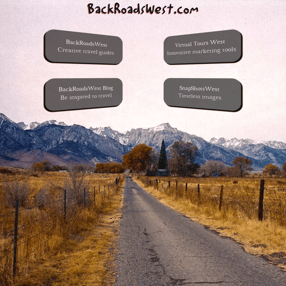
BACKROADSWEST.COM
BACKROADSWEST
CREATIVE TRAVEL GUIDESVIRTUAL TOURS WEST
INNOVATIVE MARKETING TOOLSBACKROADSWEST BLOG
BE INSPIRED TO TRAVELSNAPSHOTSWEST
TIMELESS IMAGES
Details
3